International
- Maps
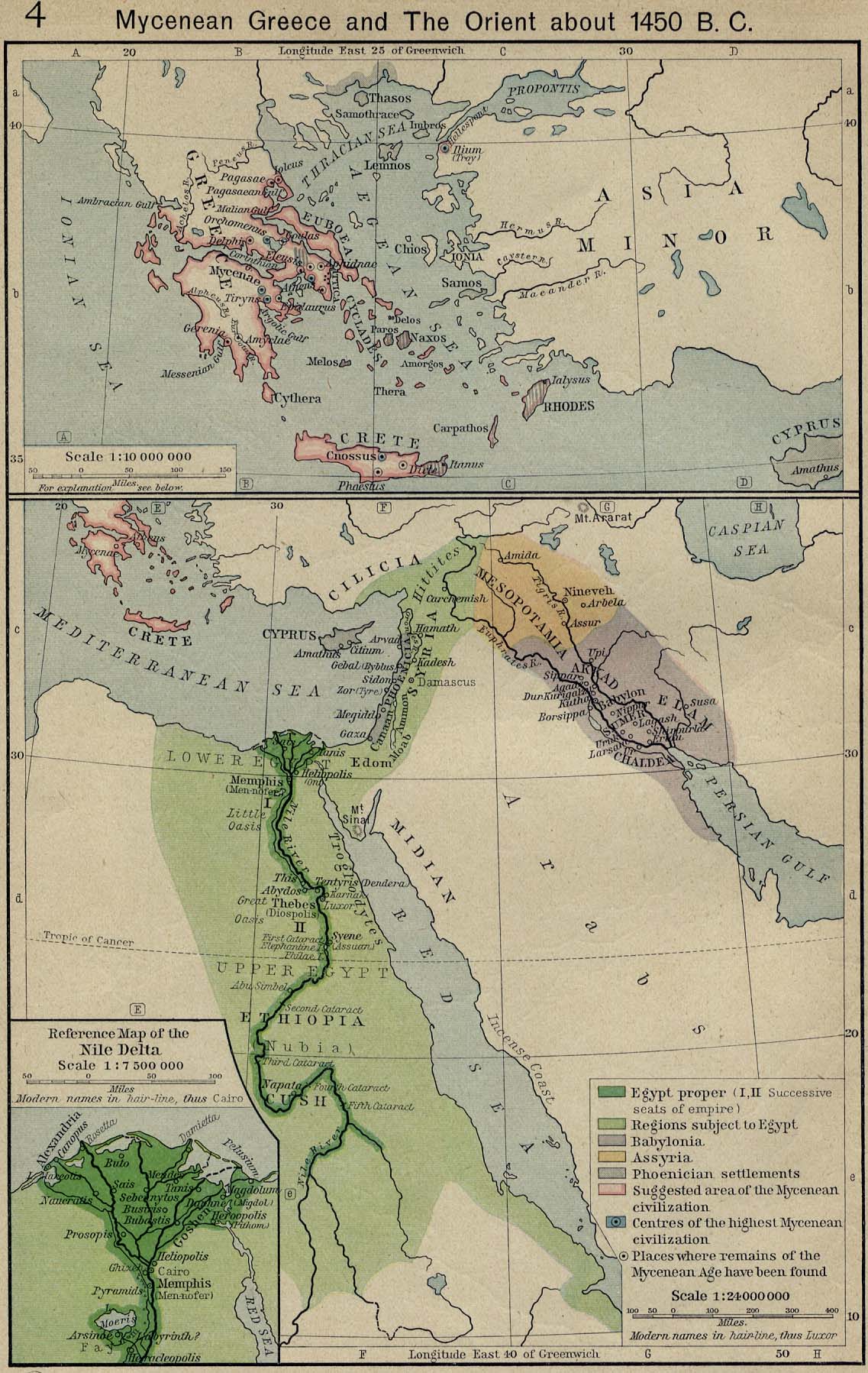
- Political map of Greece, Egypt and the Eastern Mediterranean, c.1450 BC
- Political map of the Middle East, c.600 BC
- Map of the Persian Empire, c.500 BC
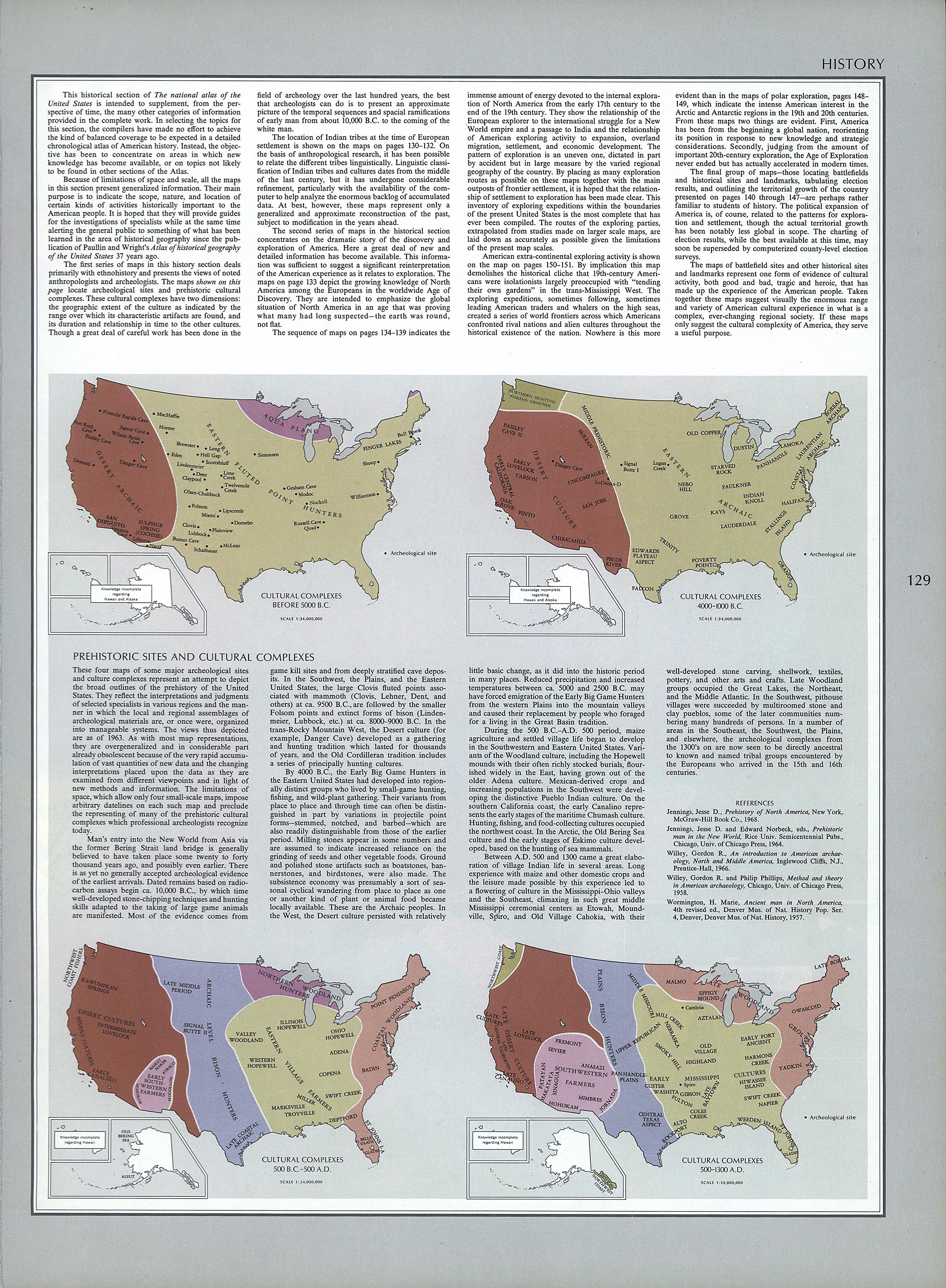
- Cultural maps of North America to 1300
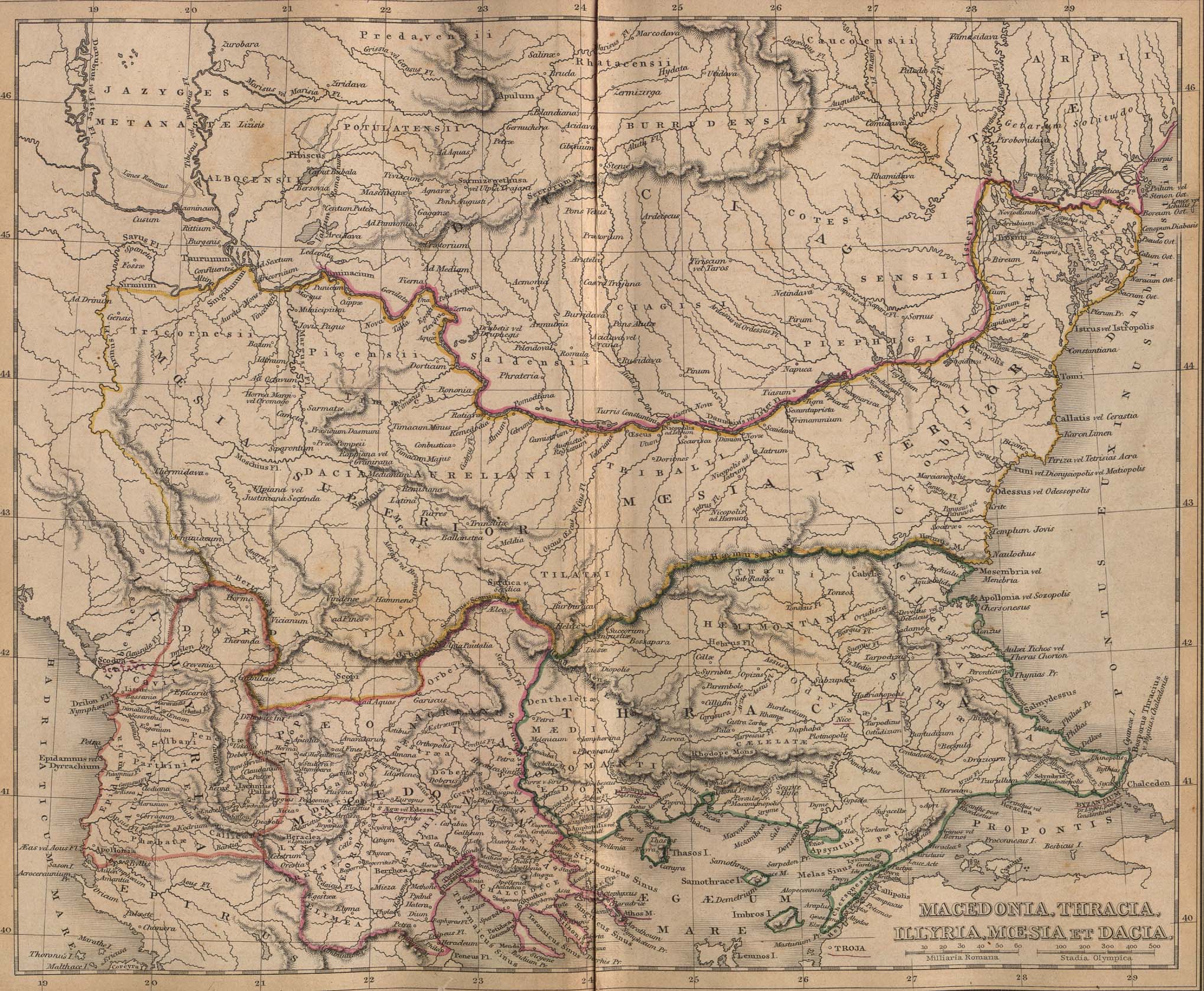
- Map of Ancient Macedonia, Thracia, Illyria, Moesia and Dacia
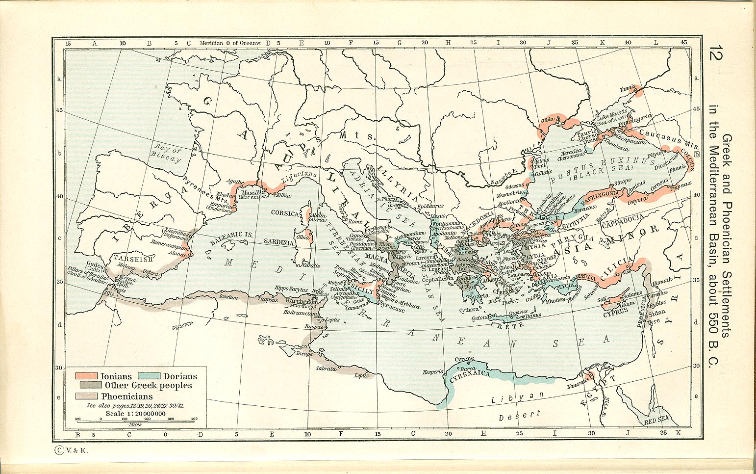
- Map of Greek and Phoenician settlements around the Mediterranean, c.550 BC
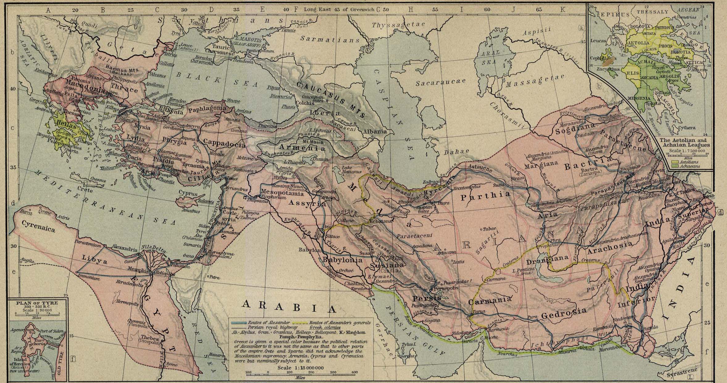
- Map of the Macedonian Empire, 336–323 BC
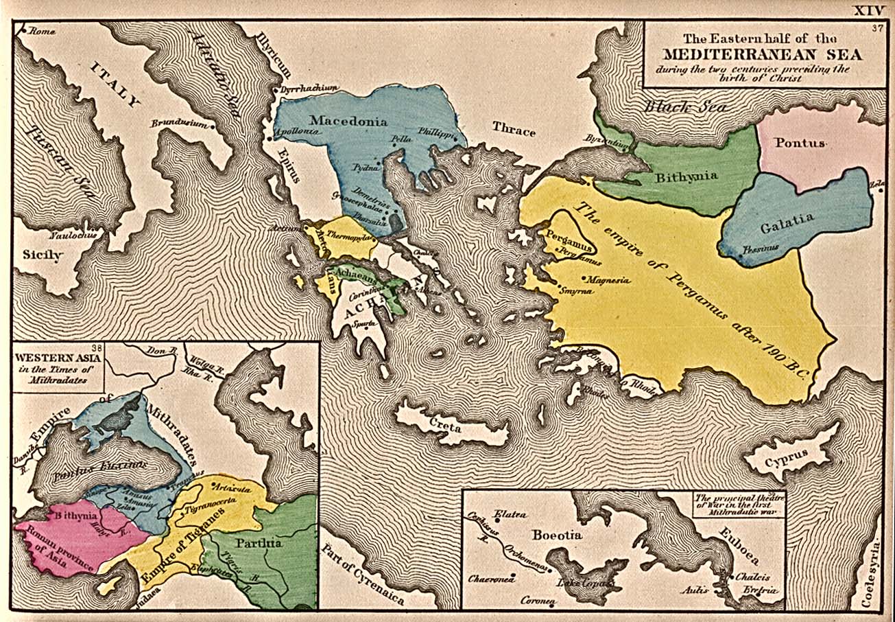
- Map of the Eastern Mediterranean and Asia Minor, 200–1 BC
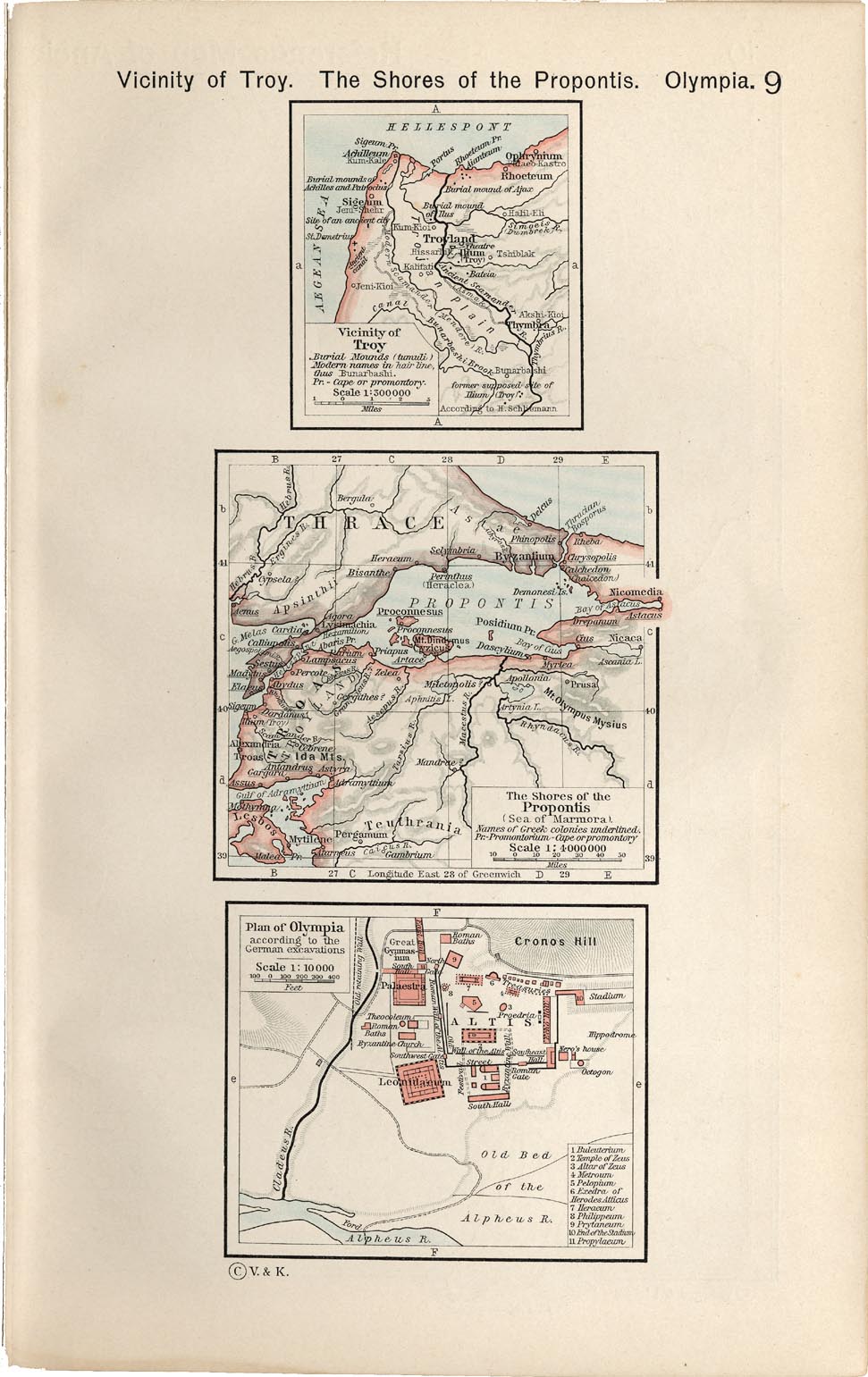
- Map of the shores of the Propontis (Sea of Marmora) showing Greek colonies
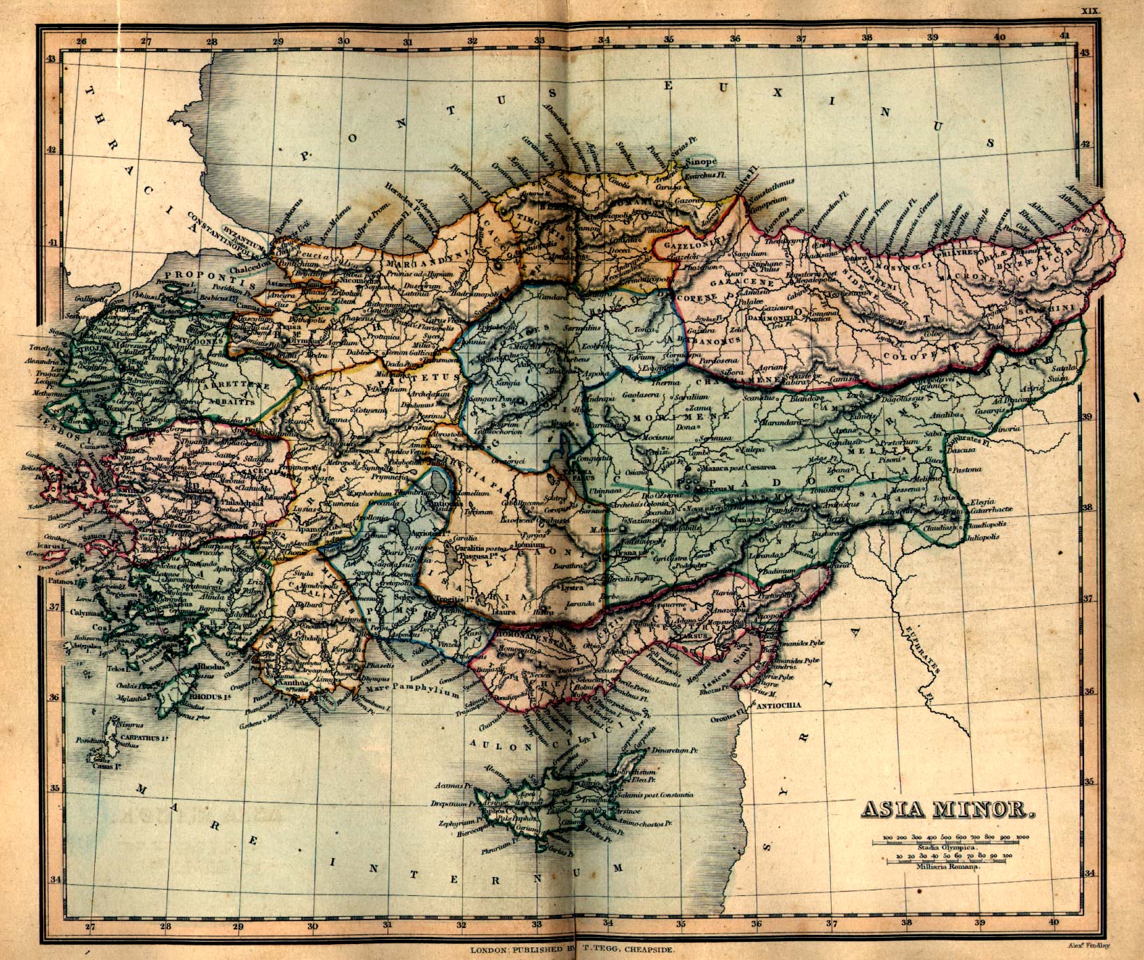
- Map of Ancient Asia Minor
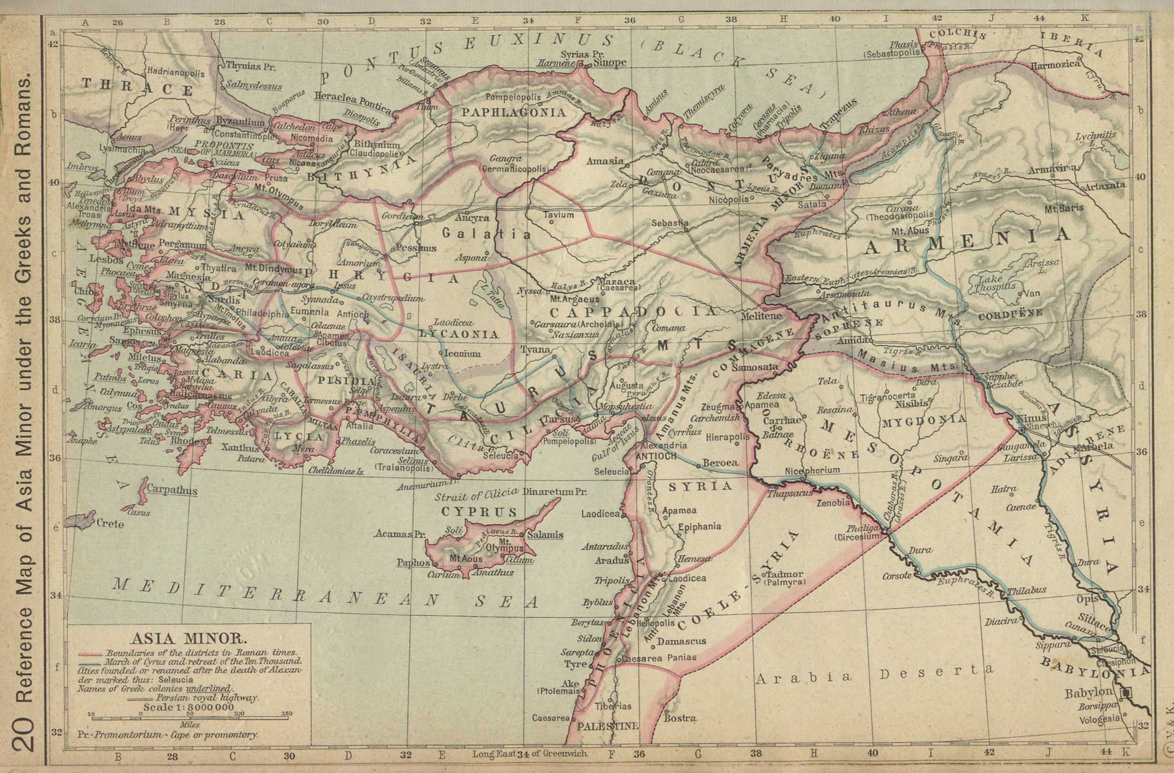
- Map of Asia Minor under the Greeks and Romans
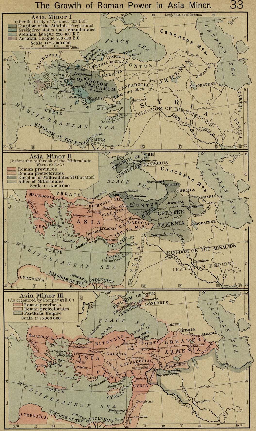
- Maps of Asia Minor, 188, 90 and 63 BC
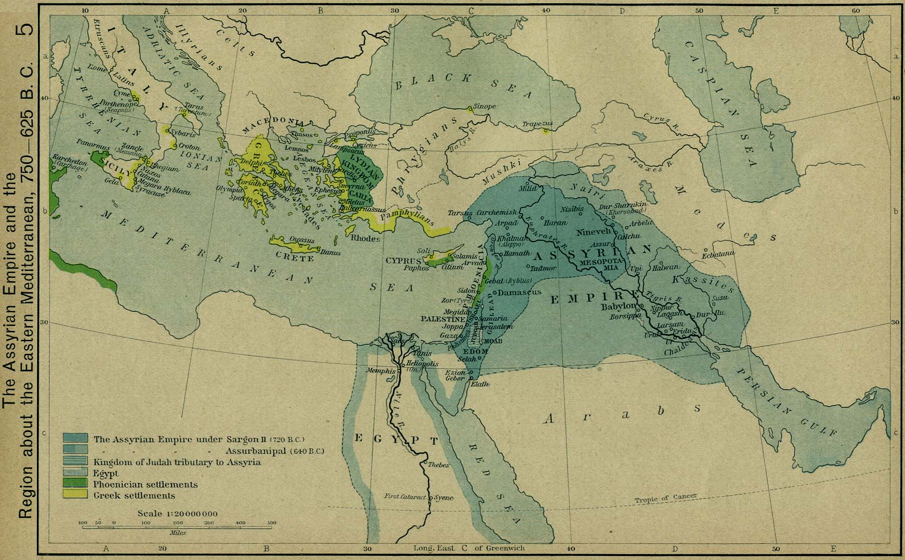
- Map of the Assyrian Empire and the Eastern Mediterranean, 750–625 BC
- Map of the Lydian, Medean, Chaldaean and Egyptian Empires, c.600 BC
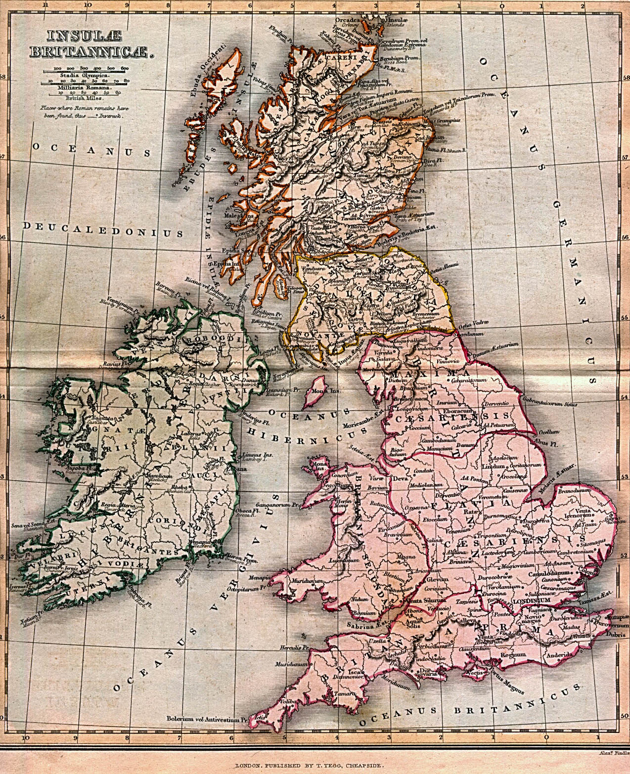
Britain
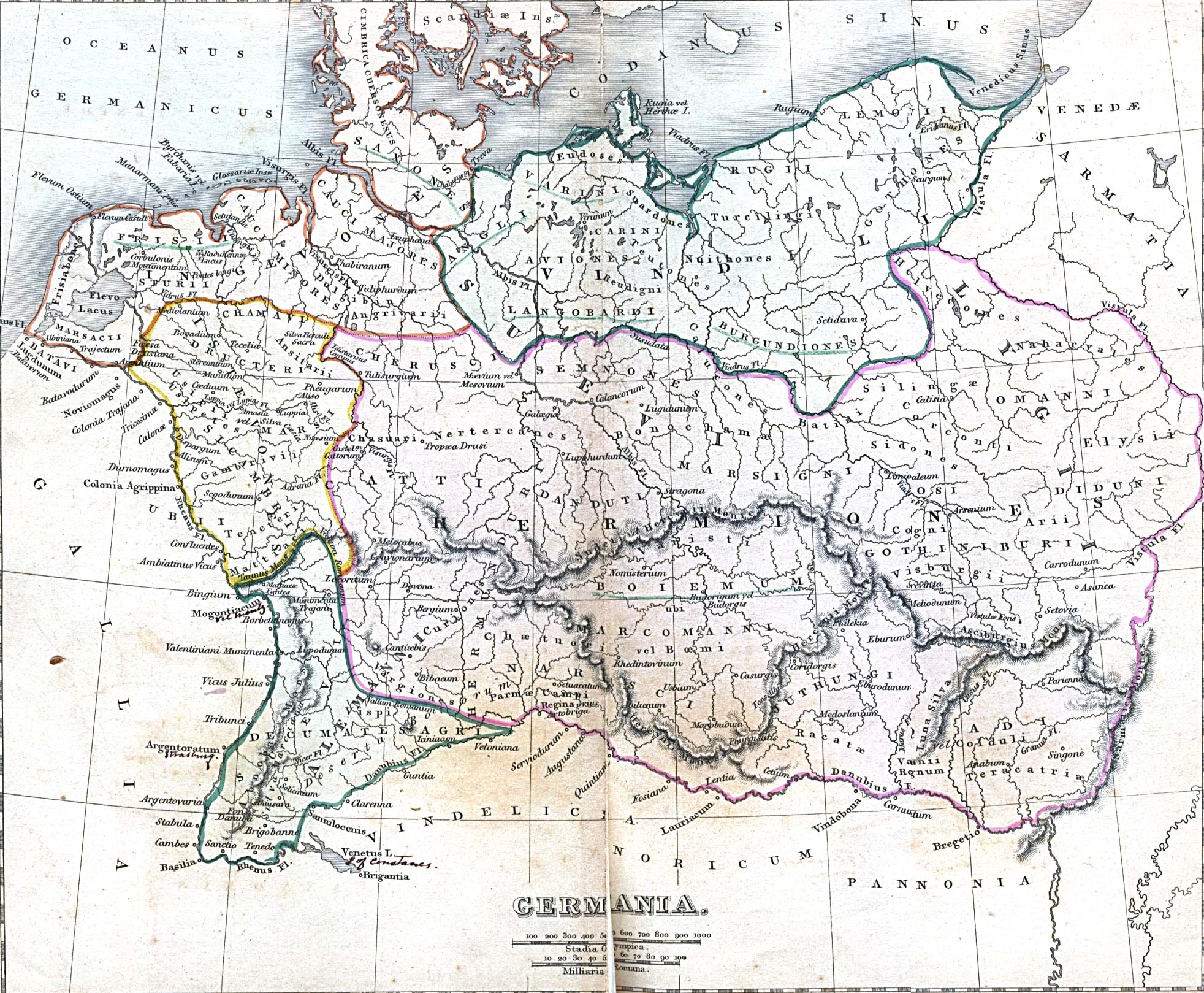
Germania
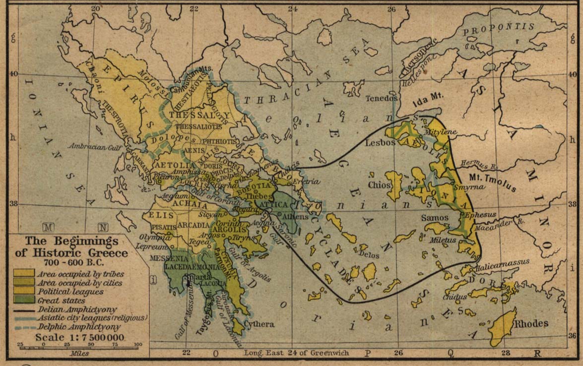
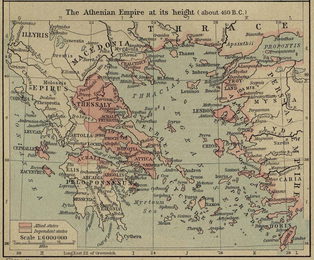
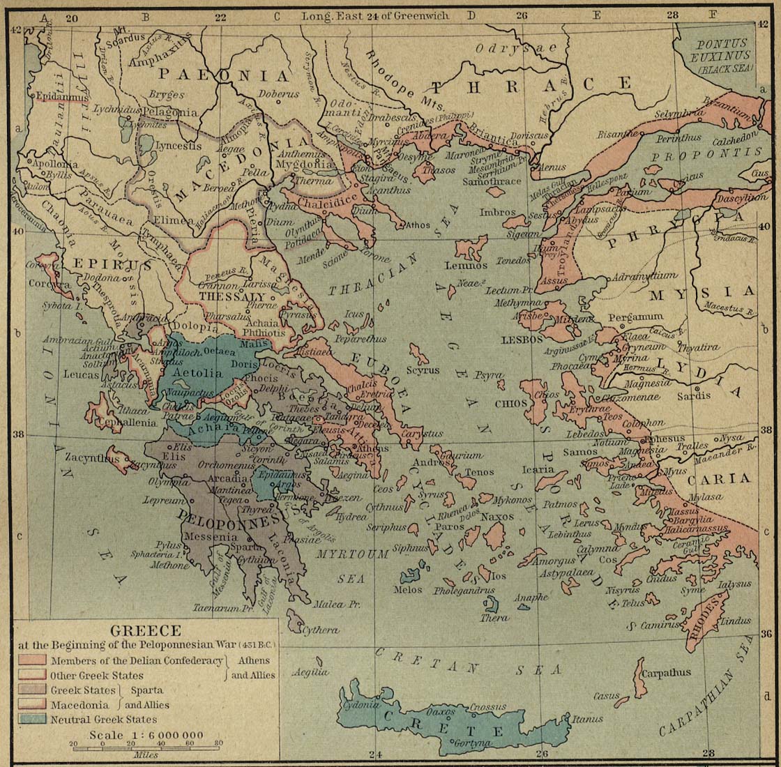
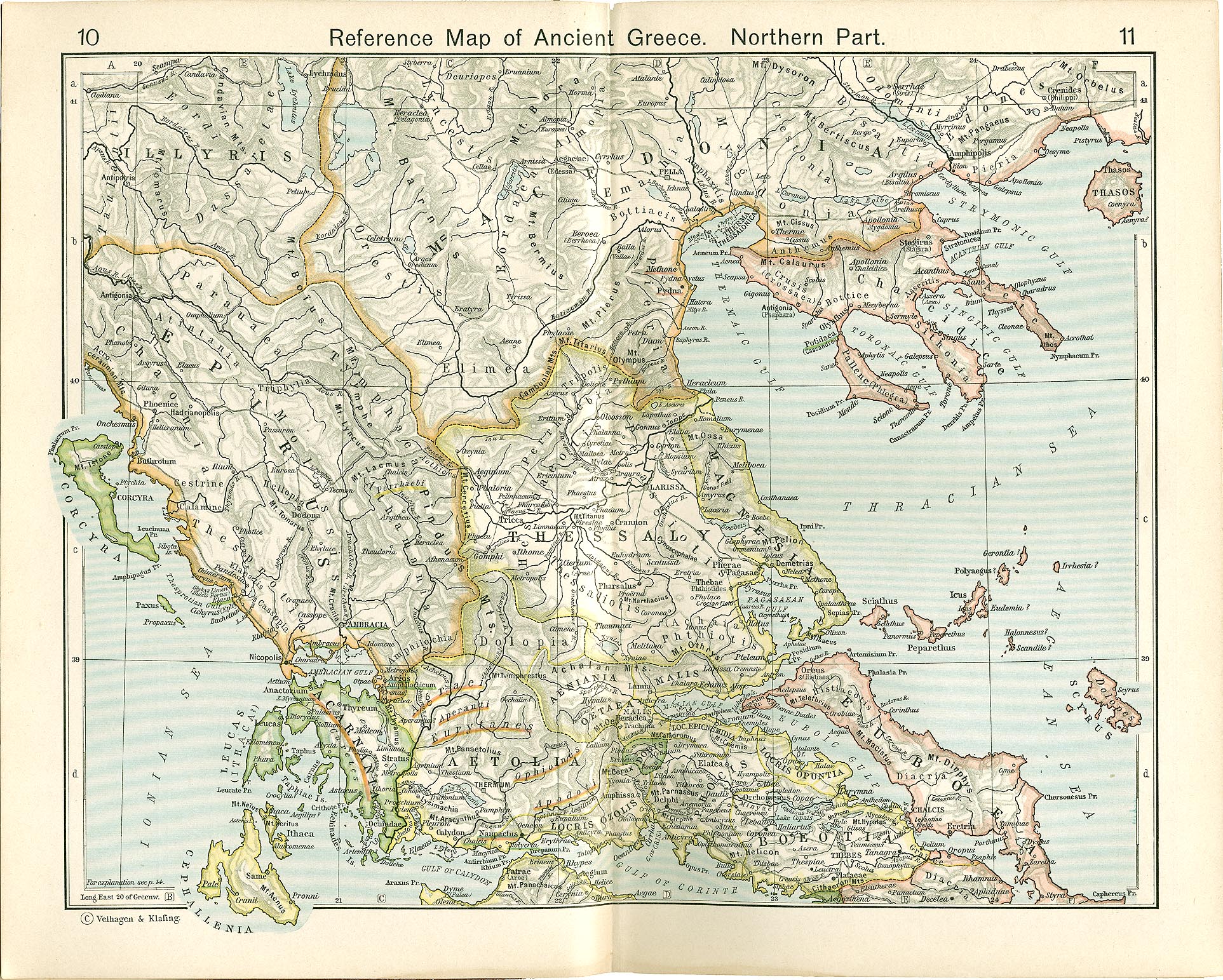
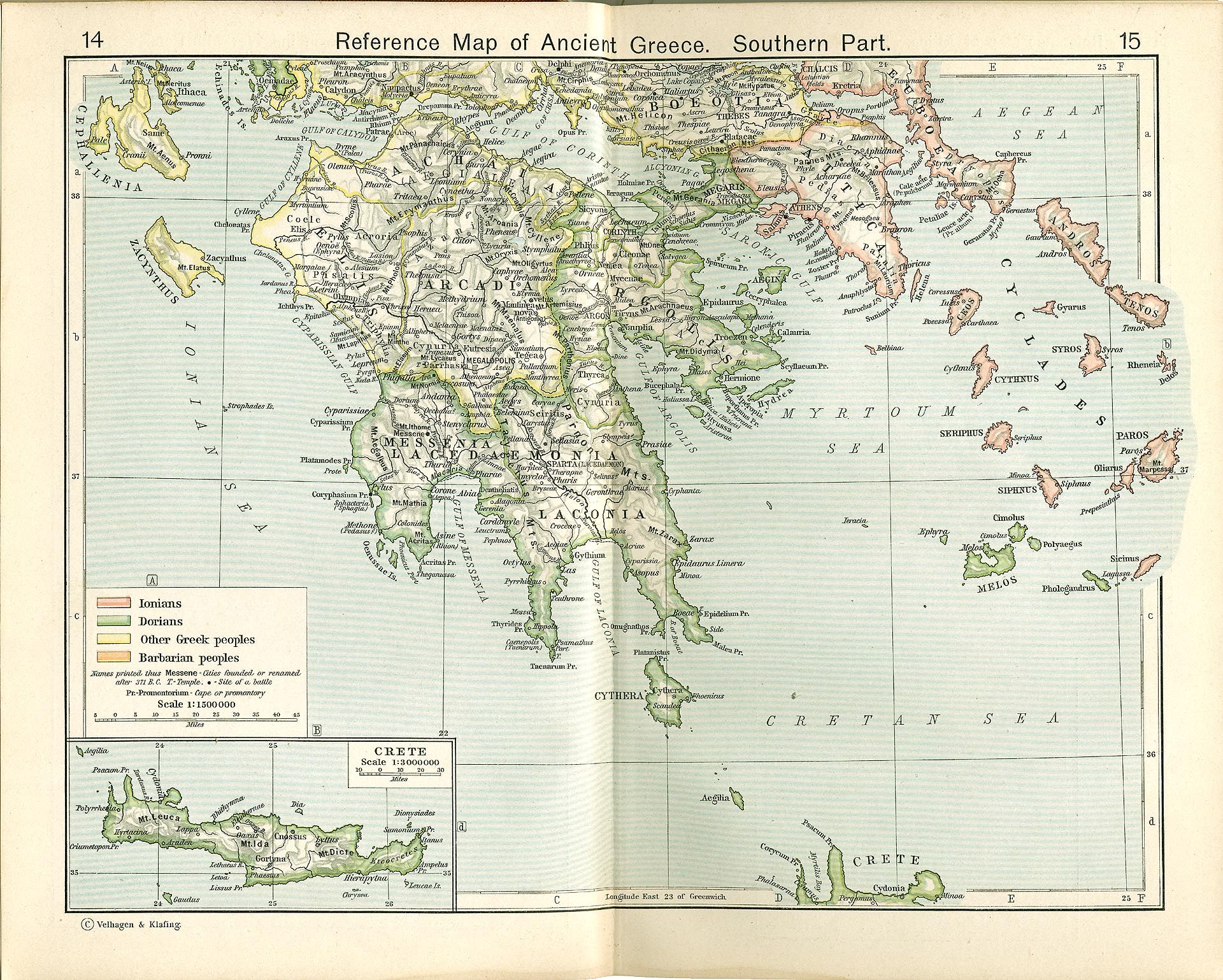
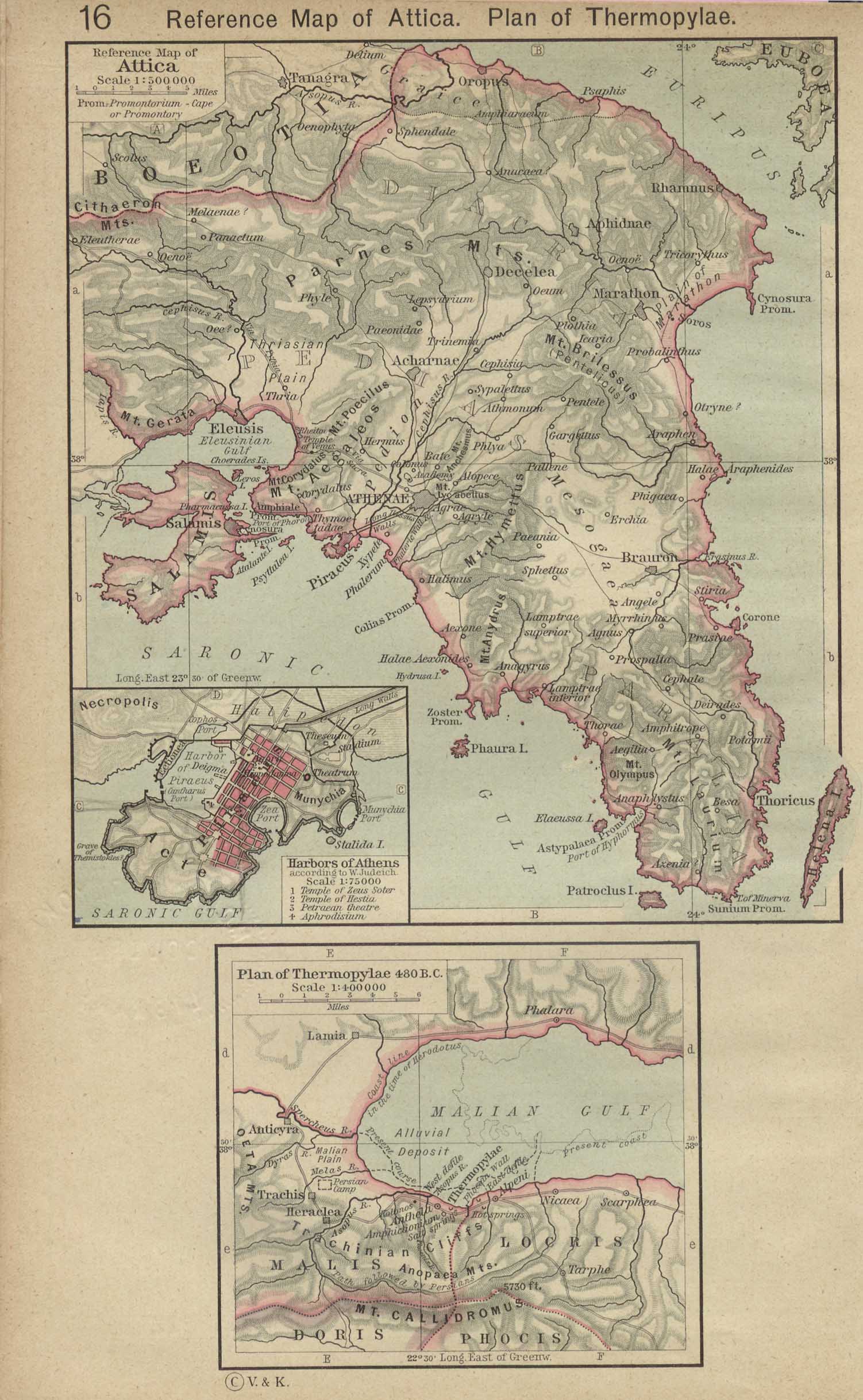
Greece
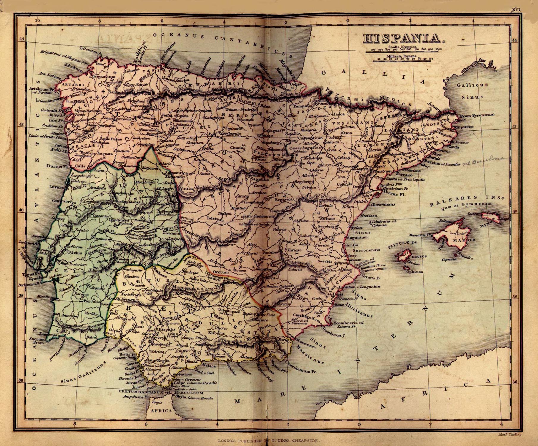
Hispania
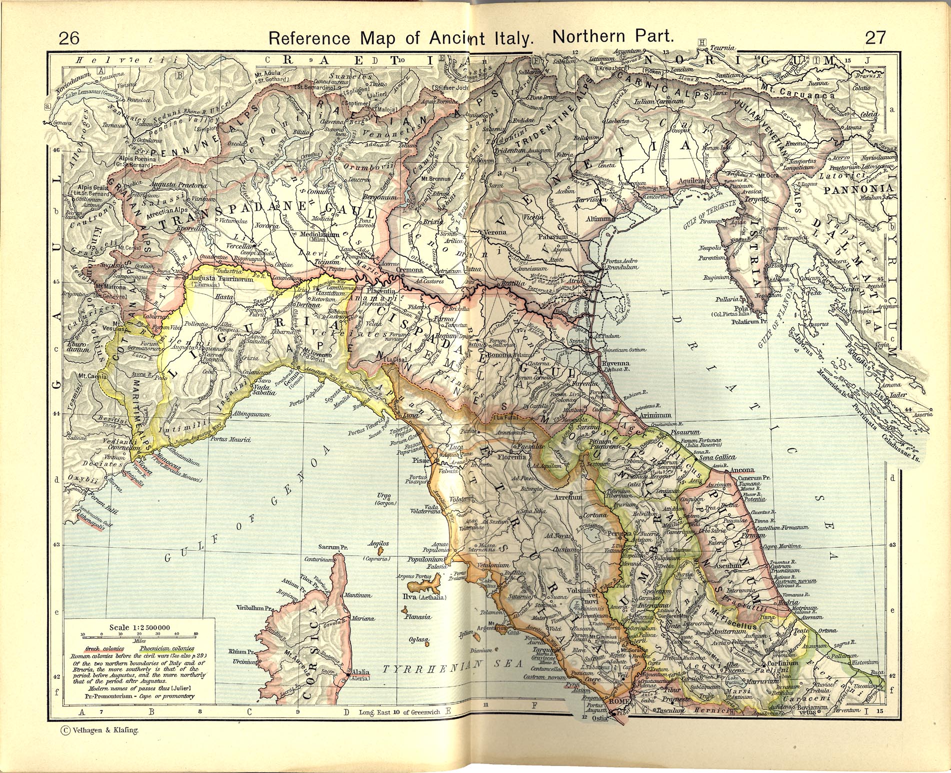
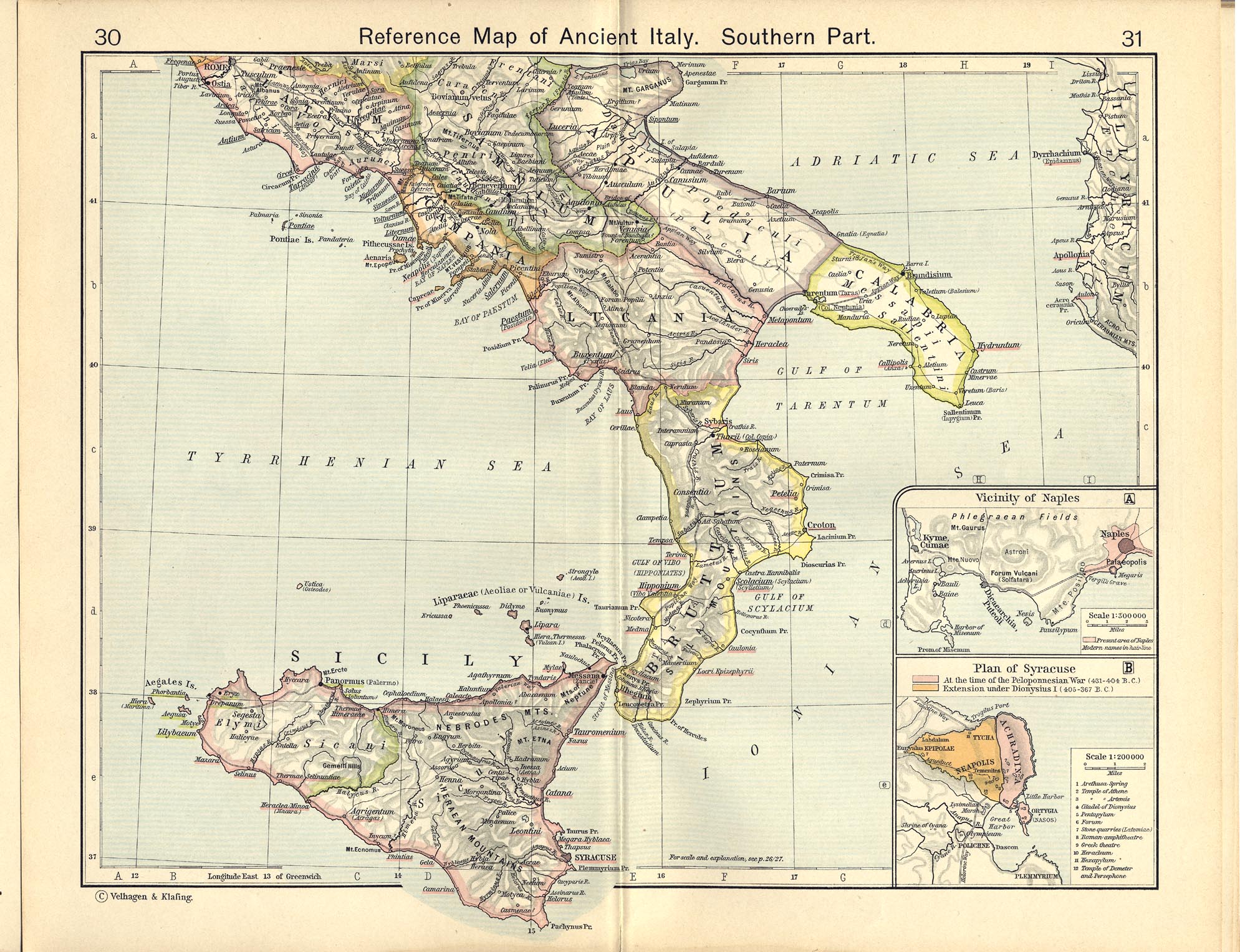
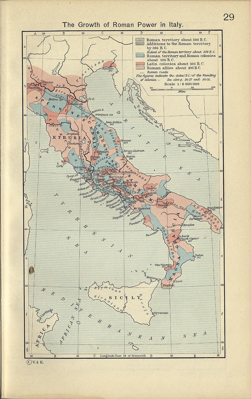
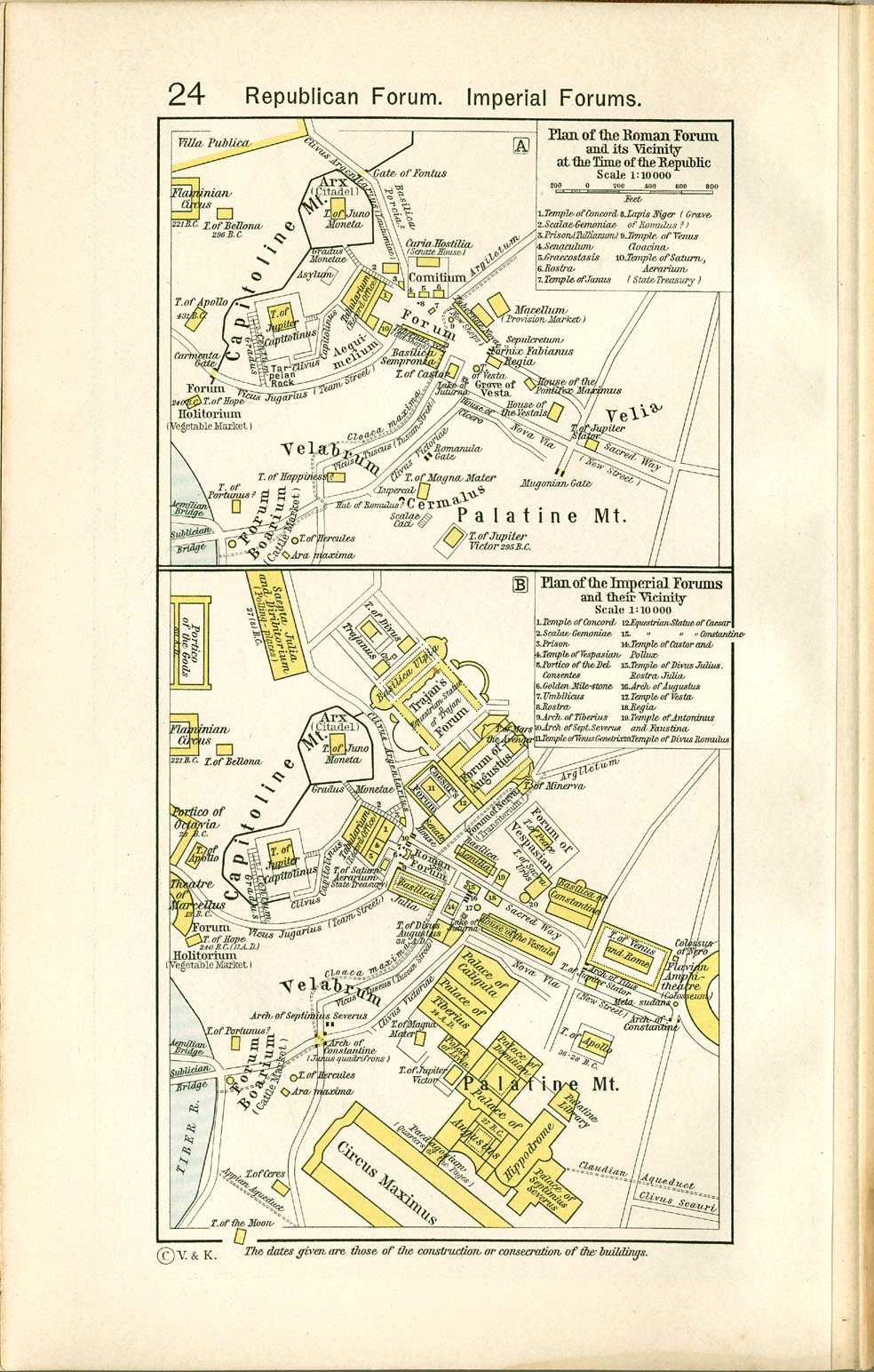
Italy
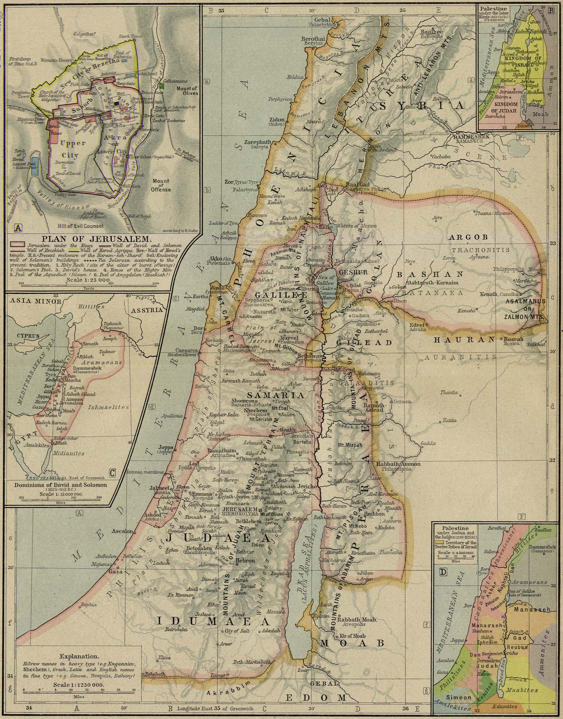
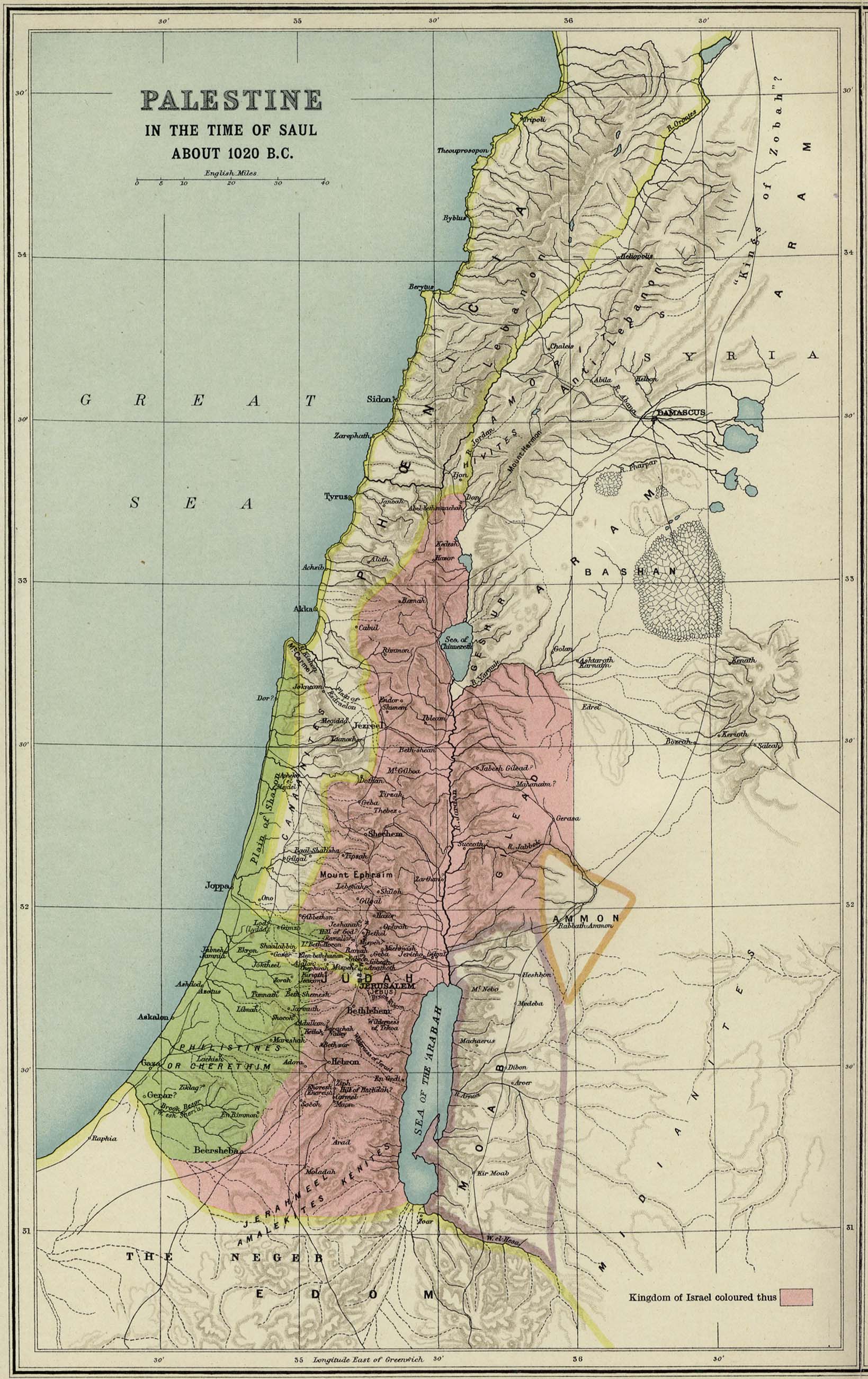
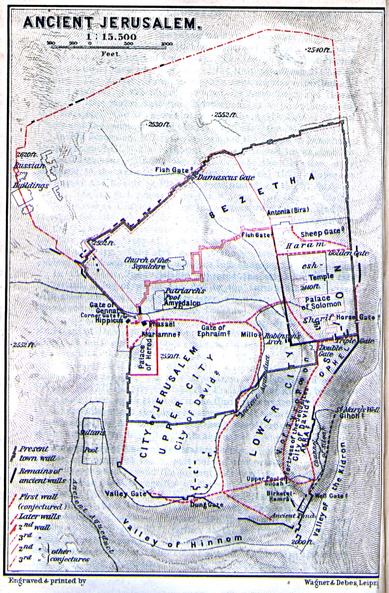
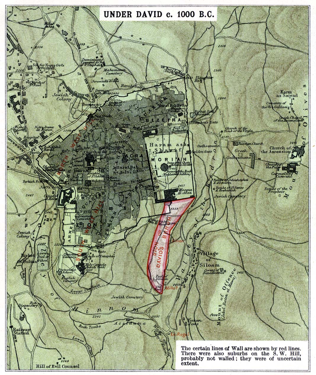
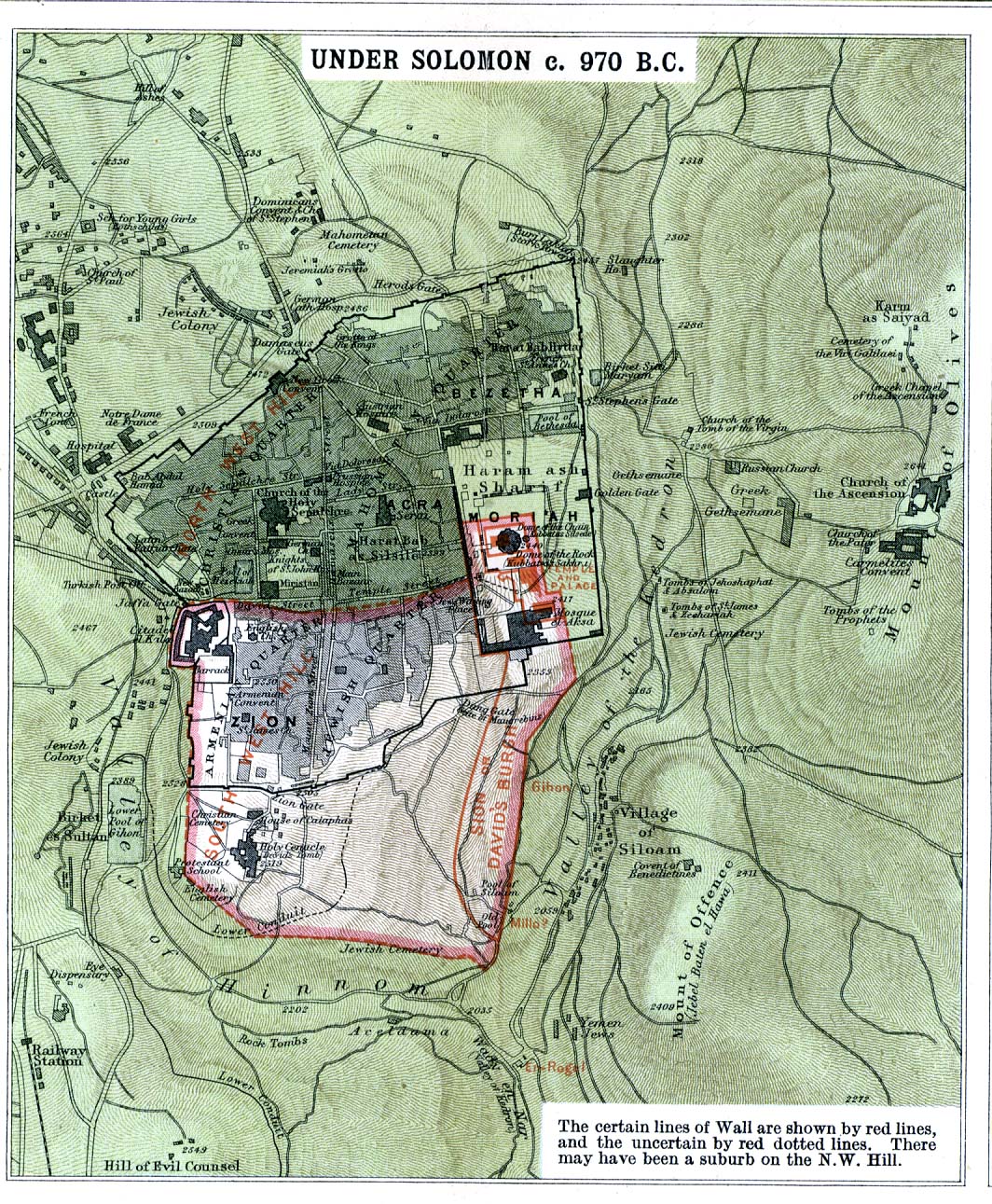
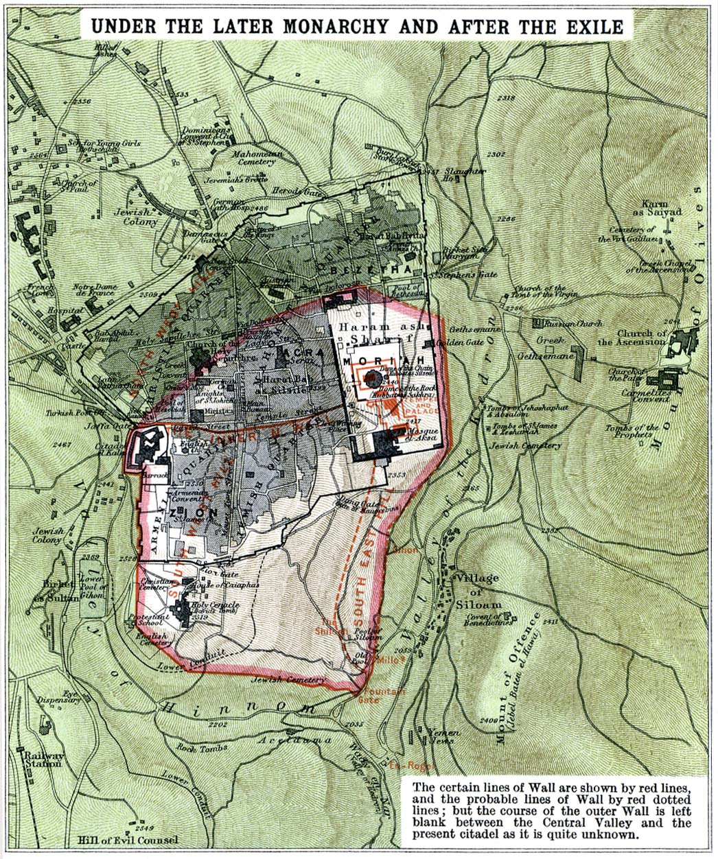
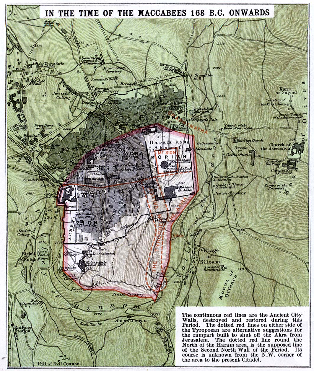
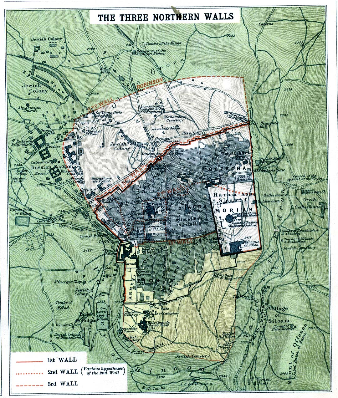
Palestine
Persia
Troy
