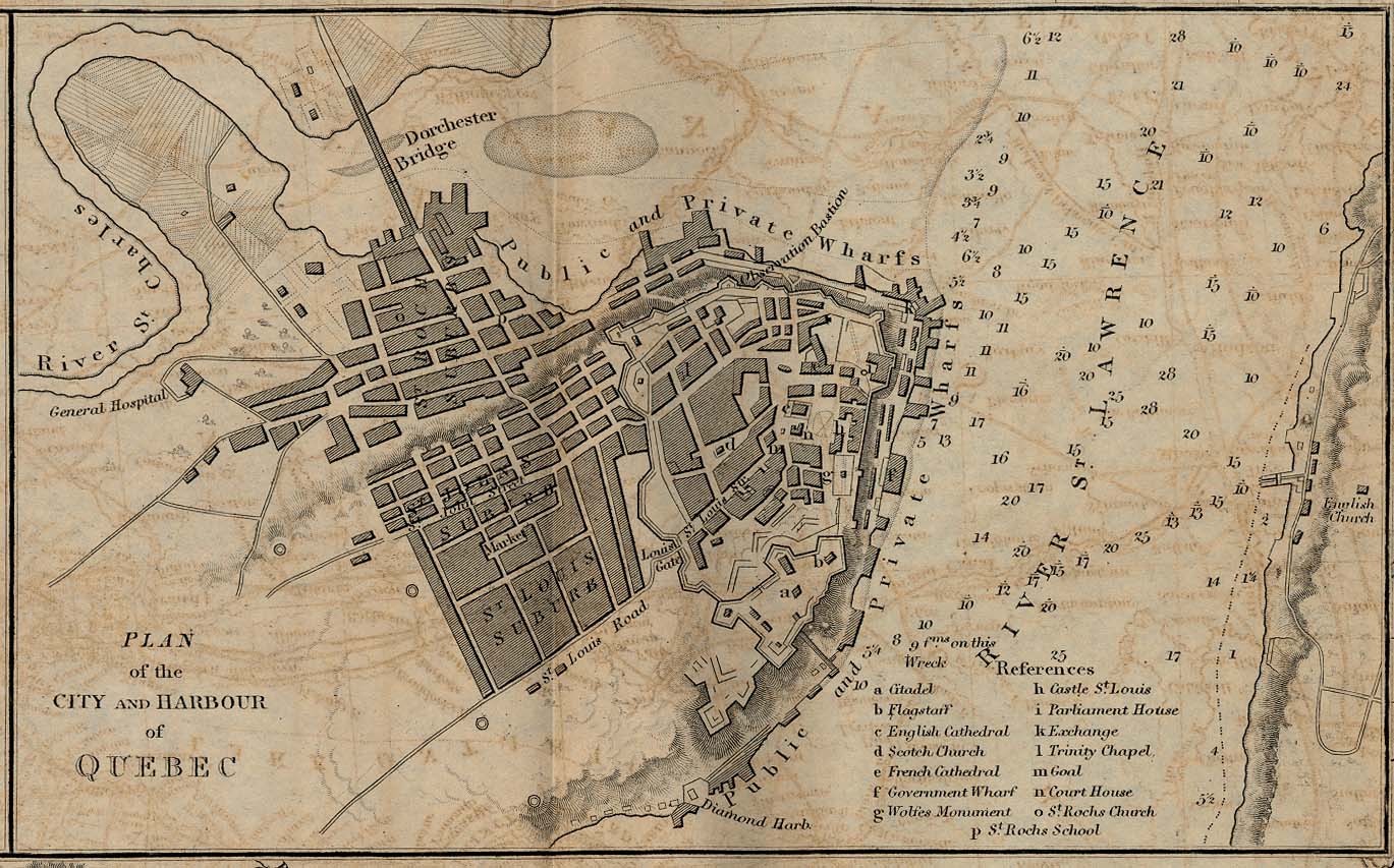
International
- Maps
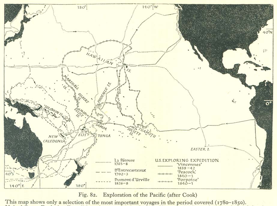
- Map of explorations of the Pacific, 1785–1842
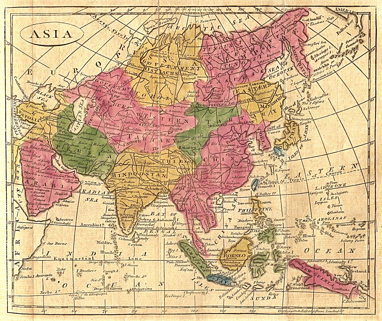
- Map of Asia, 1808
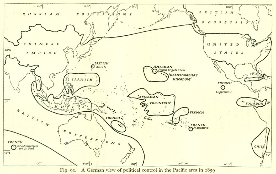
- Political map of the Pacific, 1859
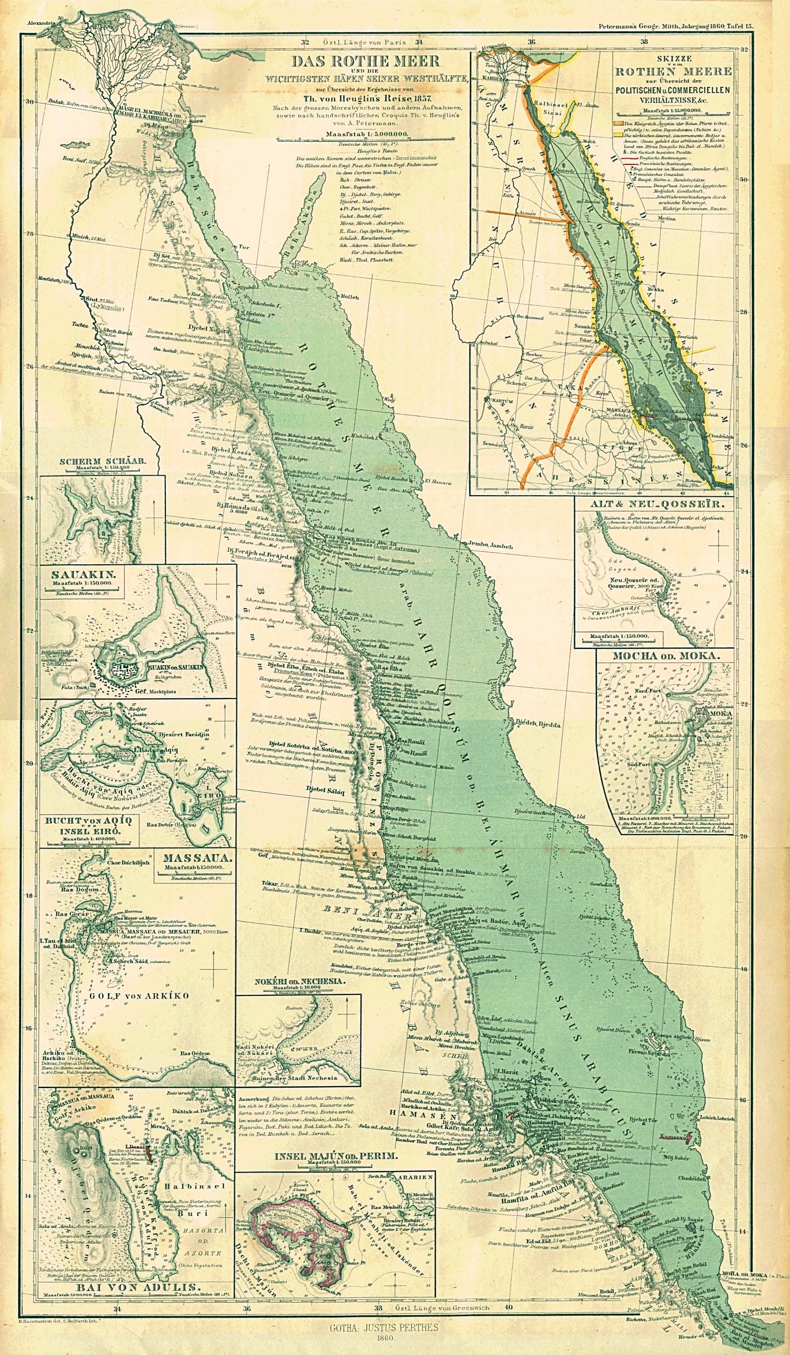
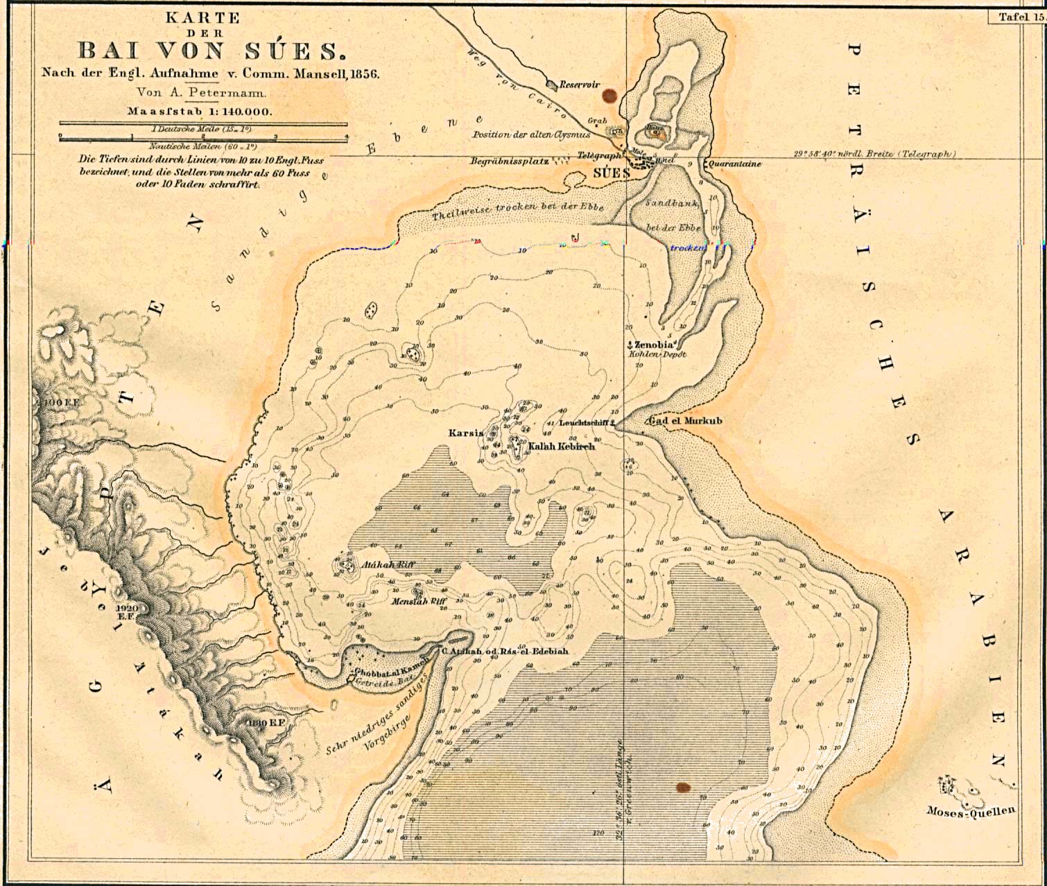
- Map of the Red Sea coast, 1860
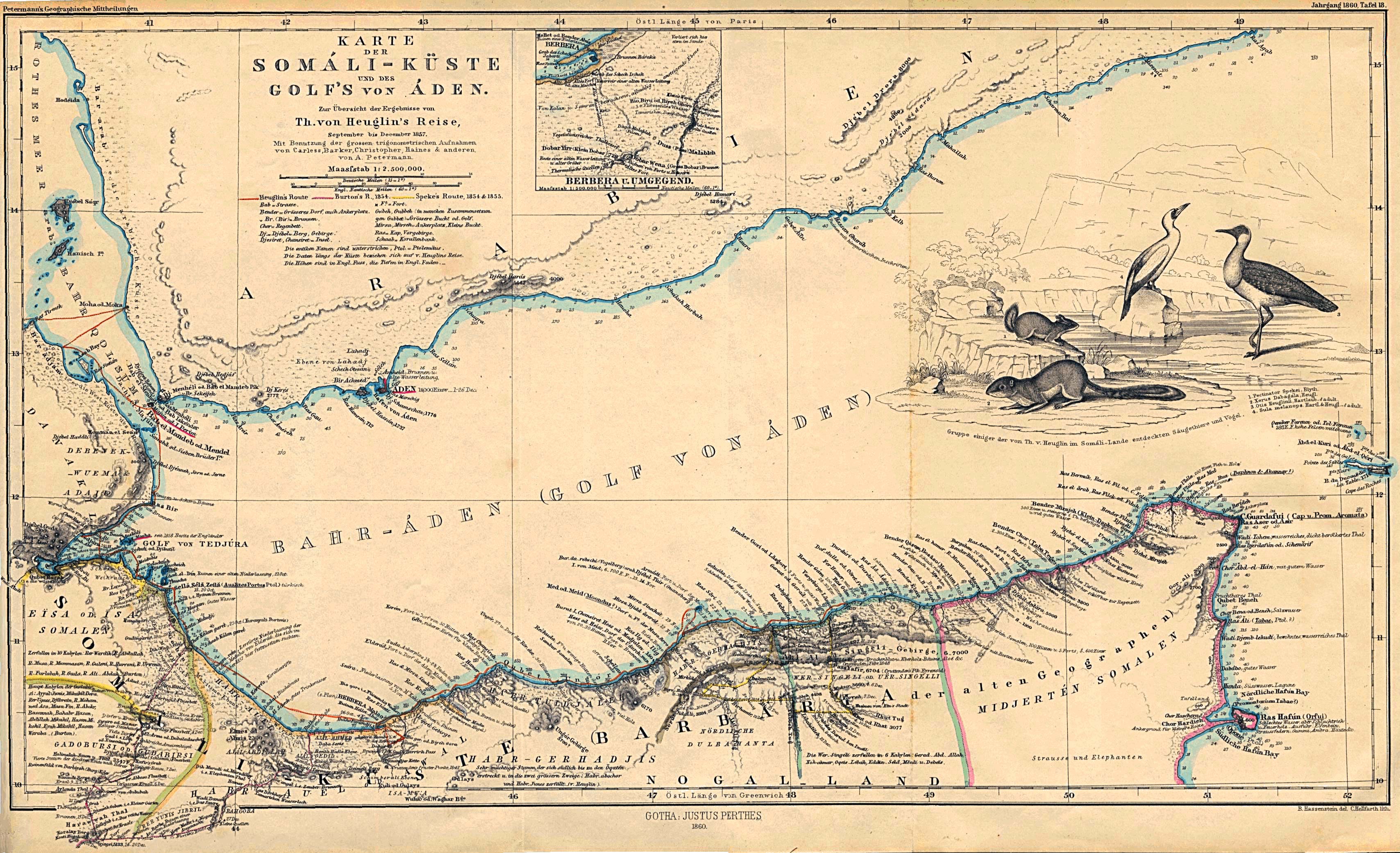
- Map of the Somali Coast and the Gulf of Aden, 1860
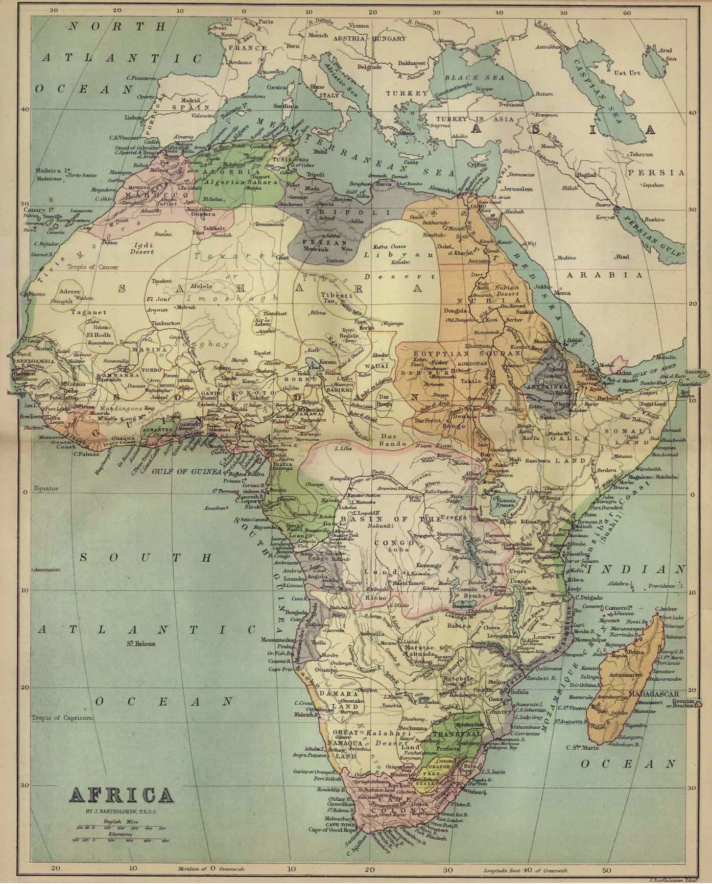
- Political map of Africa, 1885
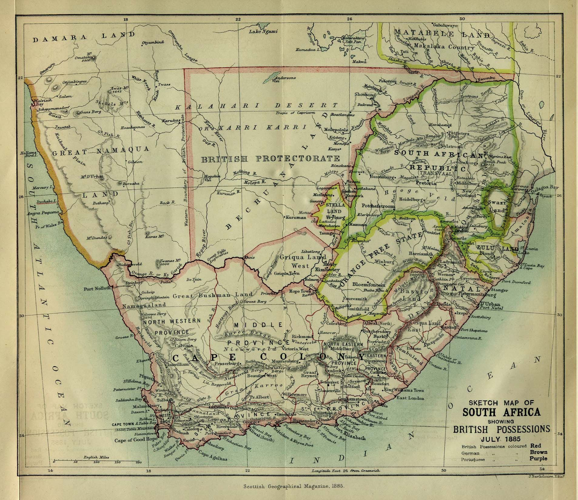
- Political map of Southern Africa, 1885
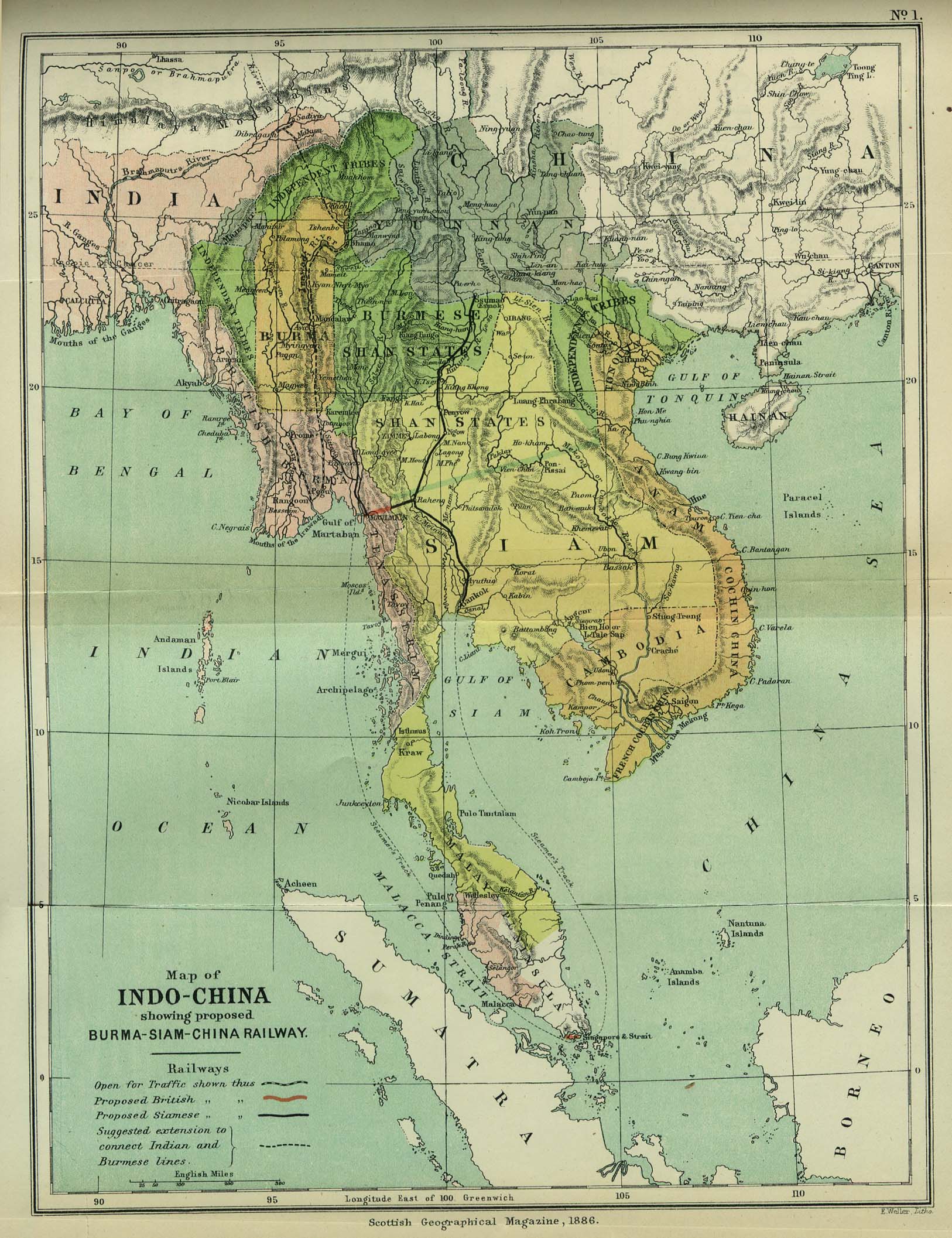
- Map of Indo-China, 1886
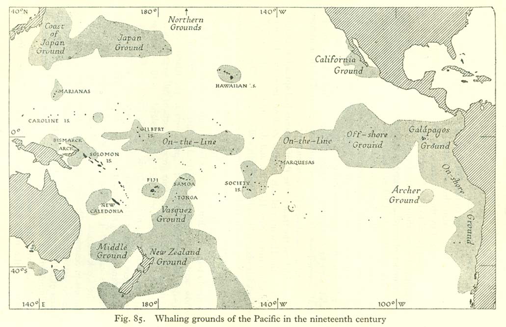
- Map of whaling grounds in the Pacific
- Map of nationality of discovery of the Central Equatorial Islands
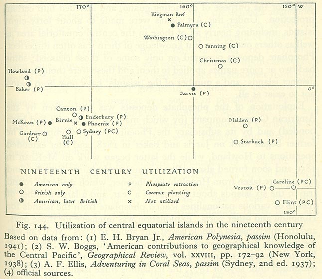
- Map of utilisation of the Central Equatorial Islands in the 19th century
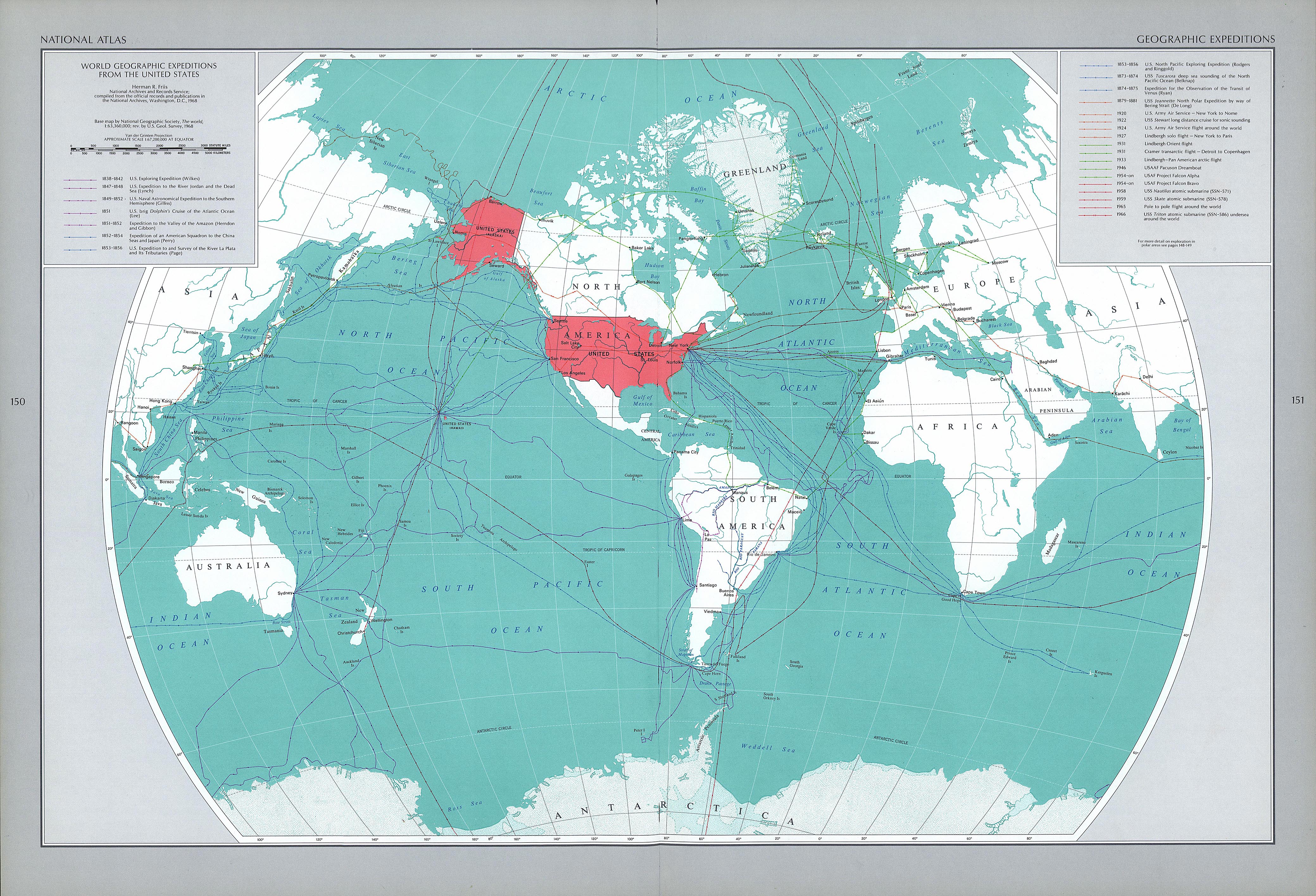
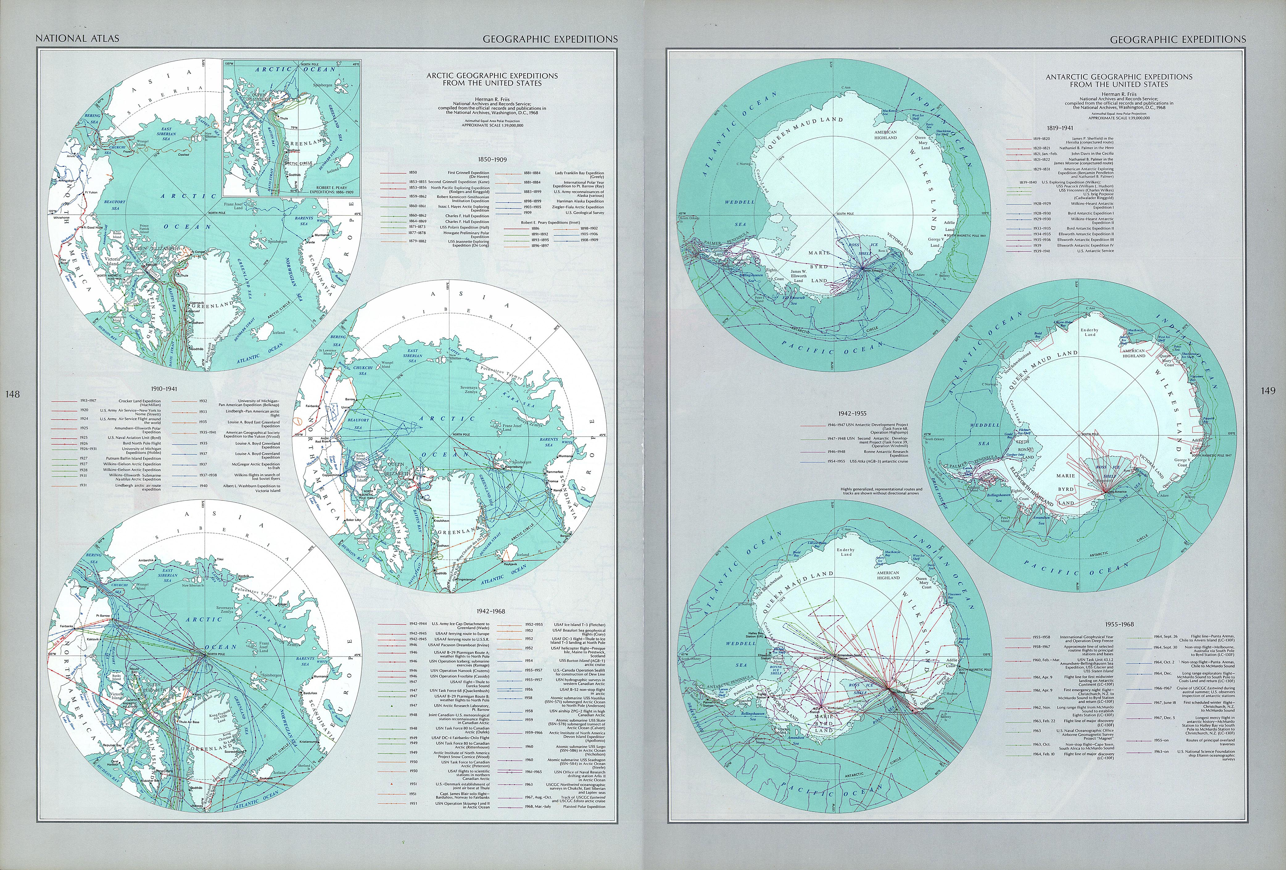
- Map of principal American geographic expeditions, 1838–1966
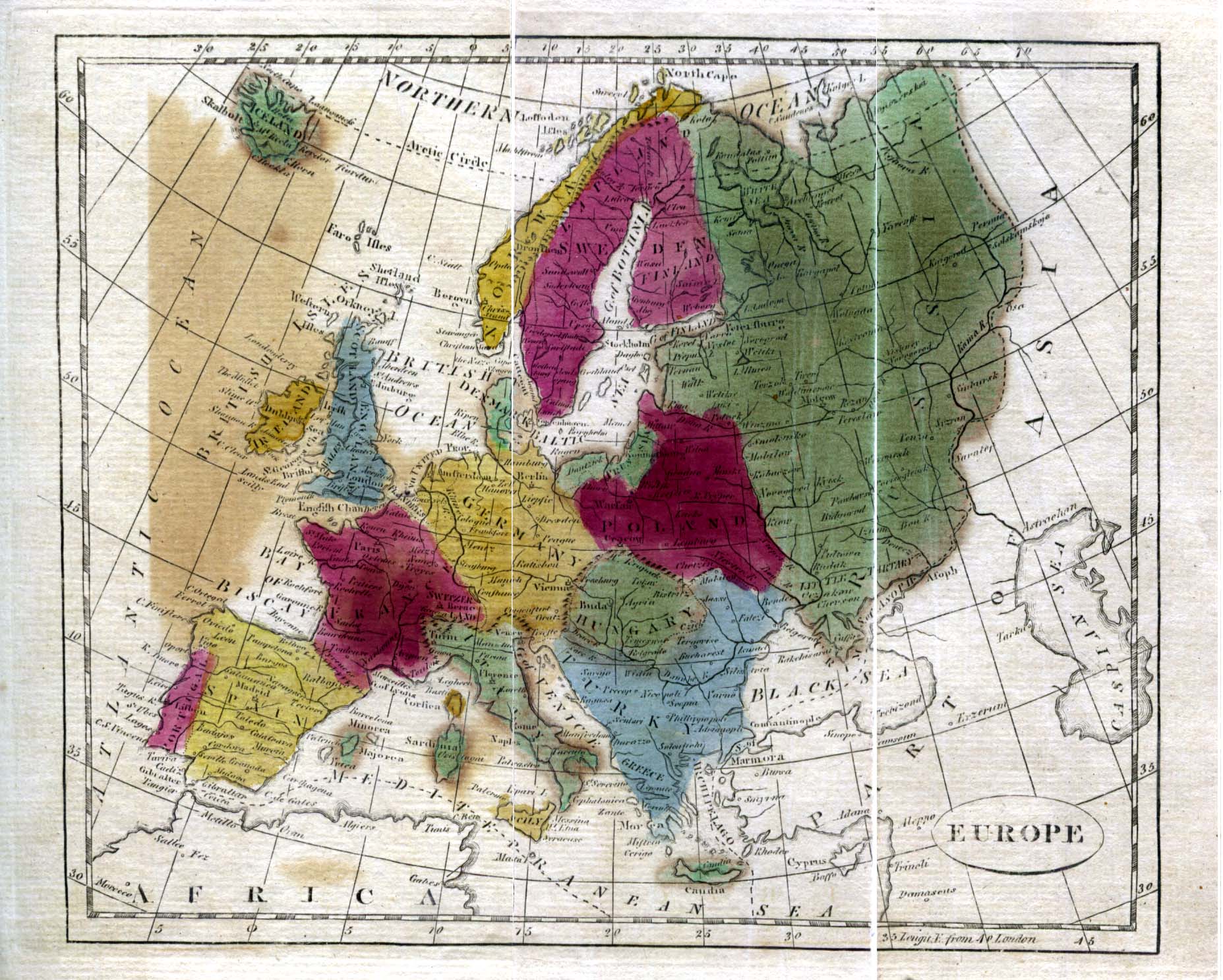
- Political map of Europe, 1808
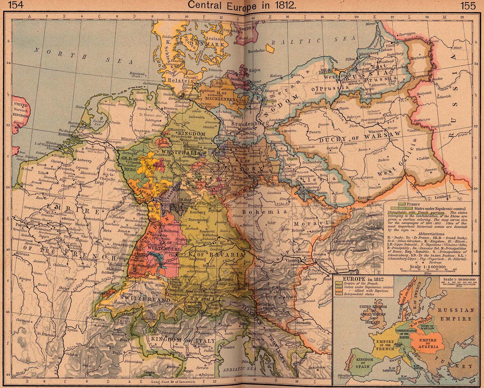
- Political map of Central Europe, 1812
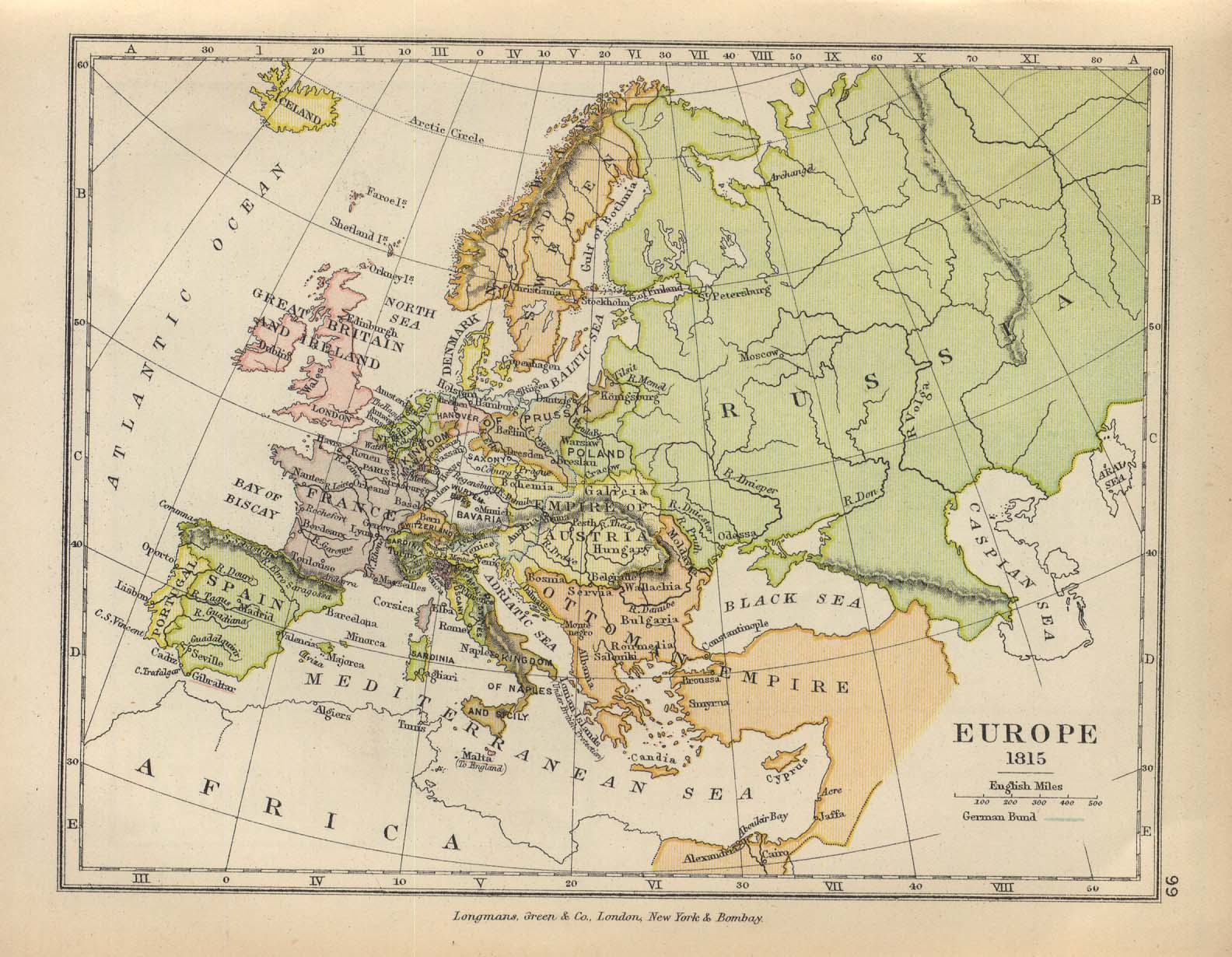
- Political map of Europe, 1815
- Map of treaty adjustments in Europe, 1814–1815
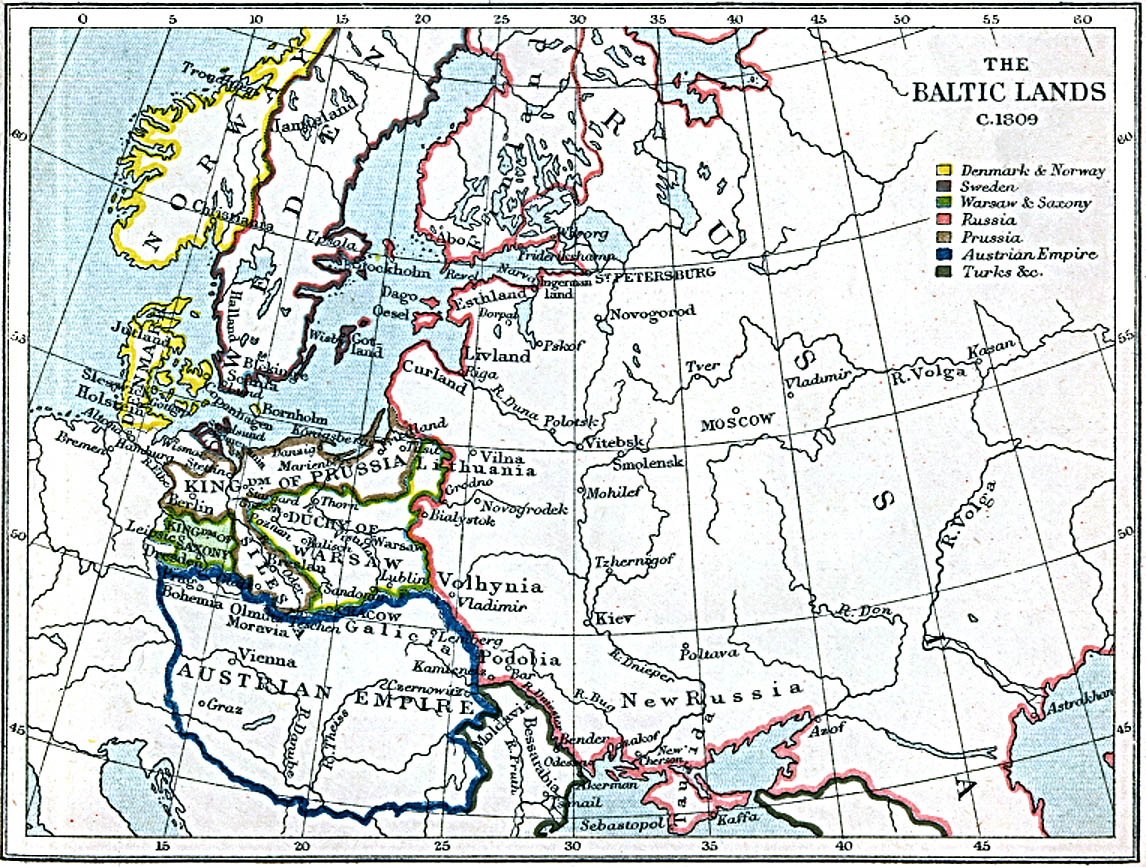
- Map of the lands surrounding the Baltic, 1809
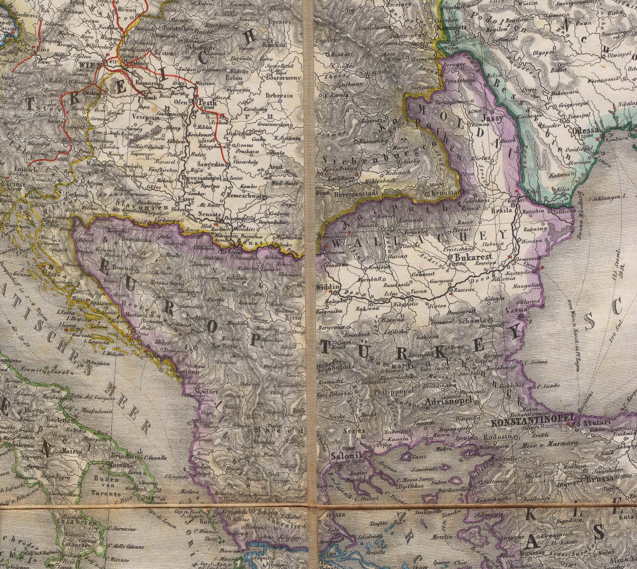
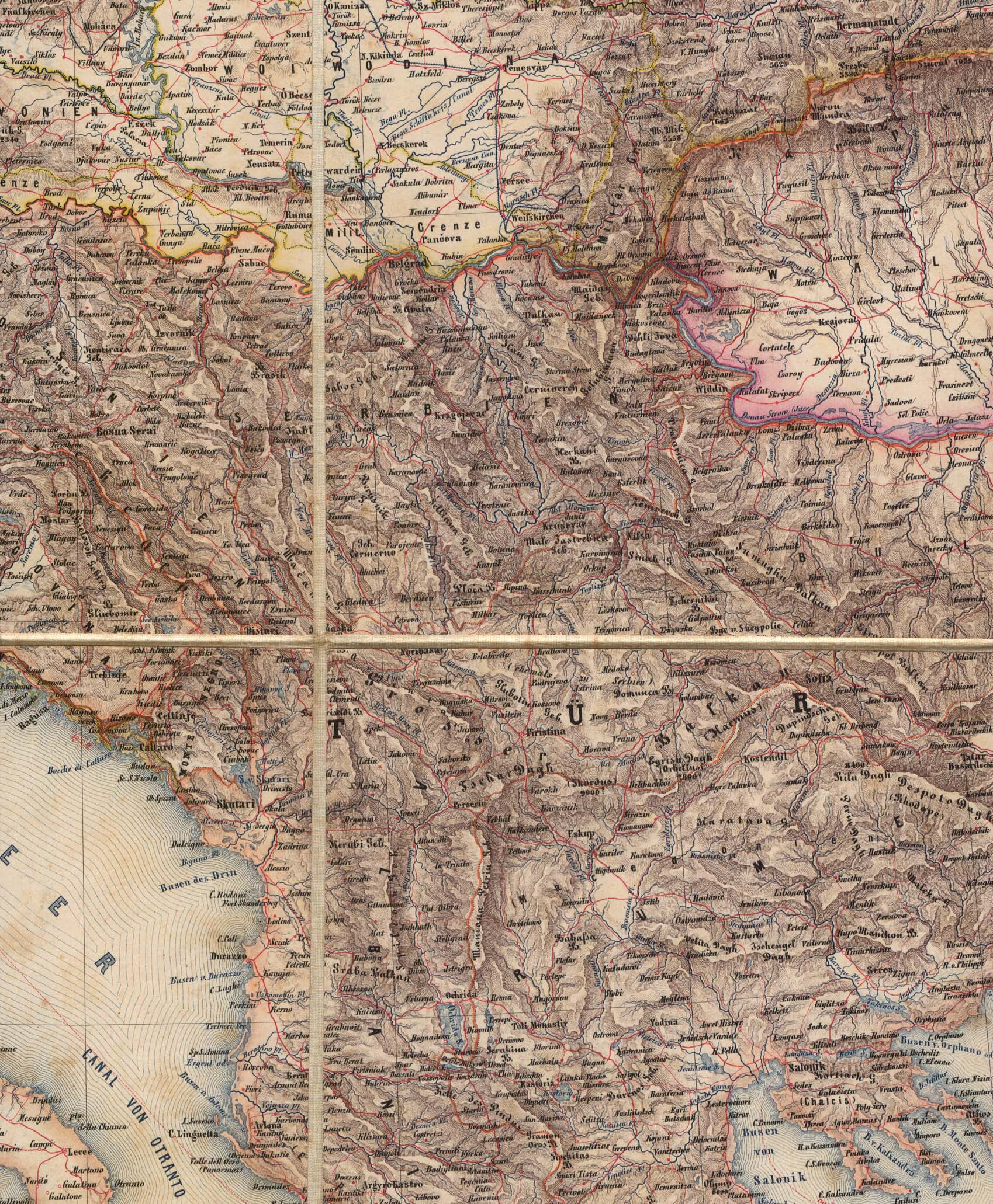
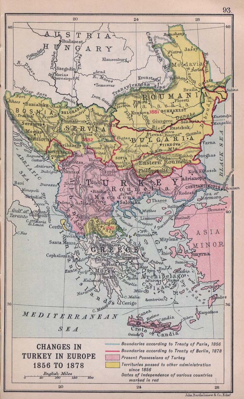
- Map of the Balkans, 1856
- Map of the Balkans, 1859
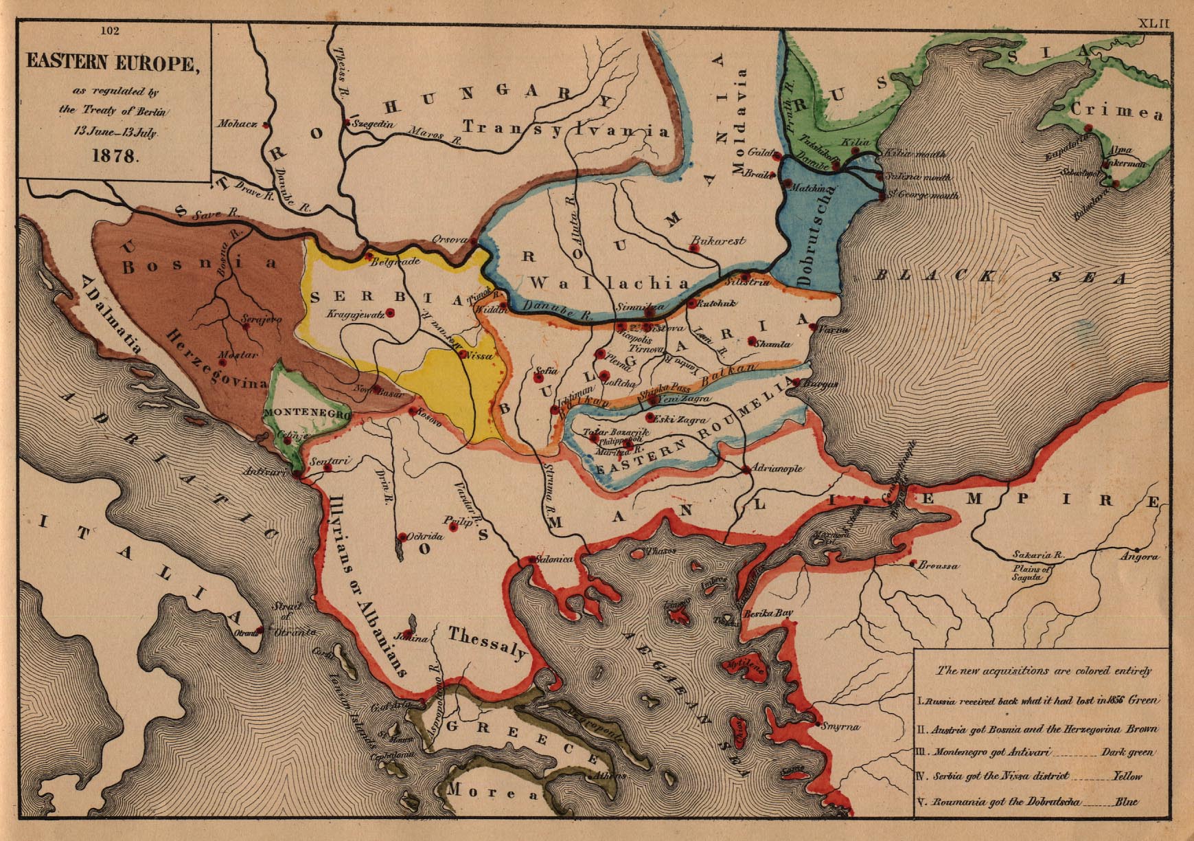
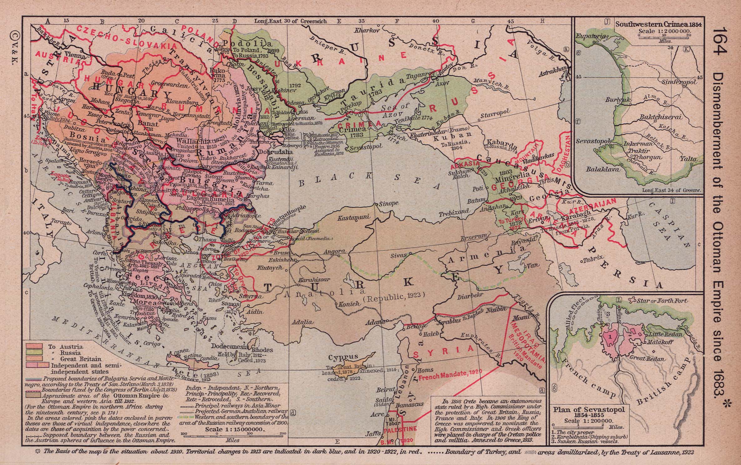
- Map of Eastern Europe, 1878
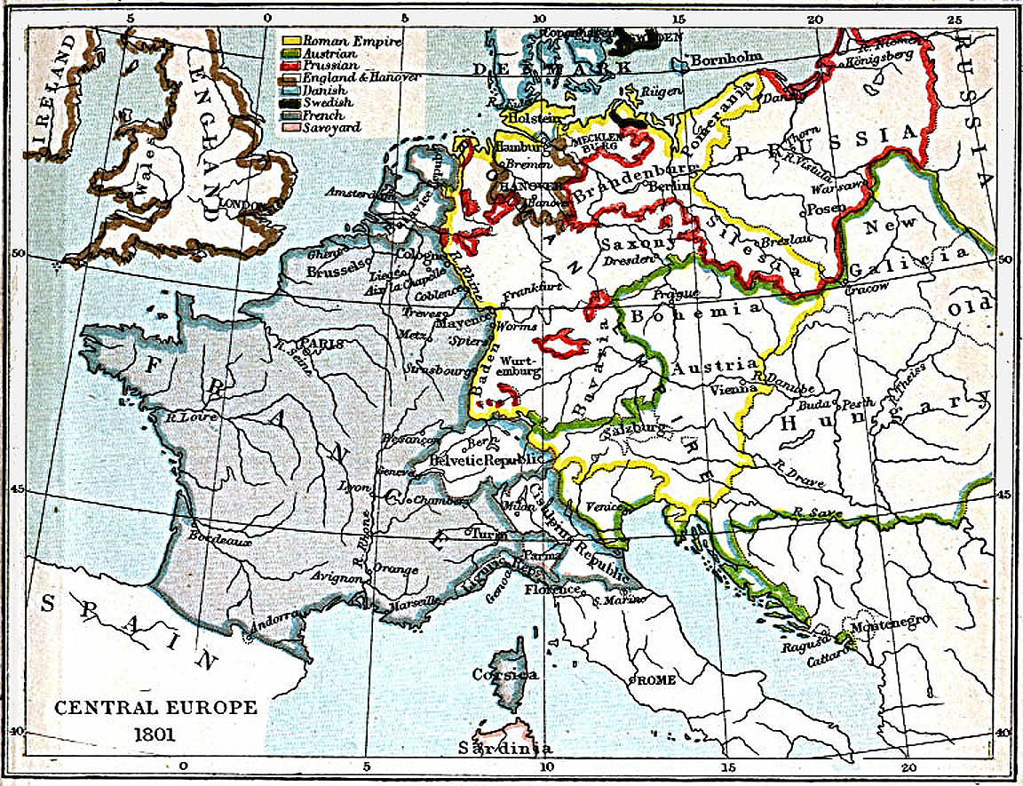
- Map of Central Europe, 1801
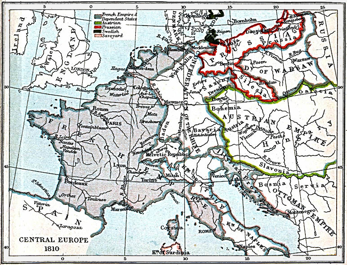
- Map of Central Europe, 1810
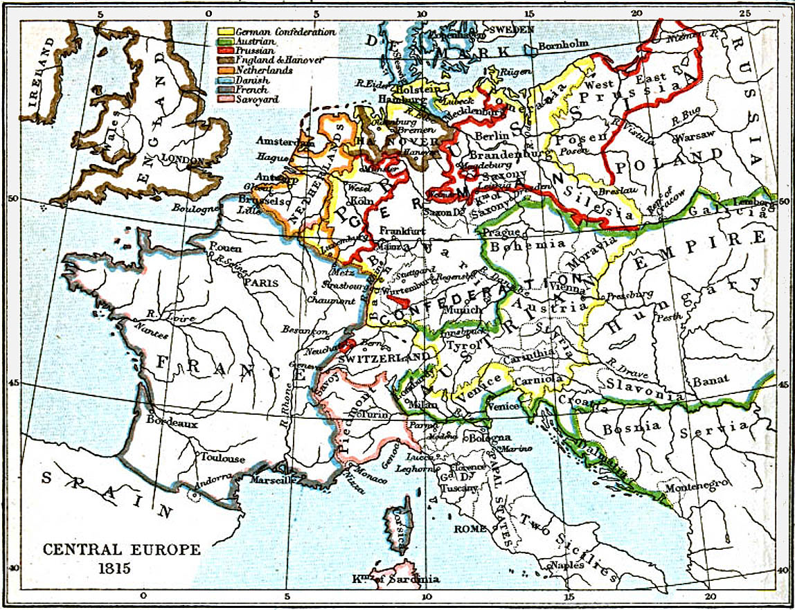
- Map of Central Europe, 1815
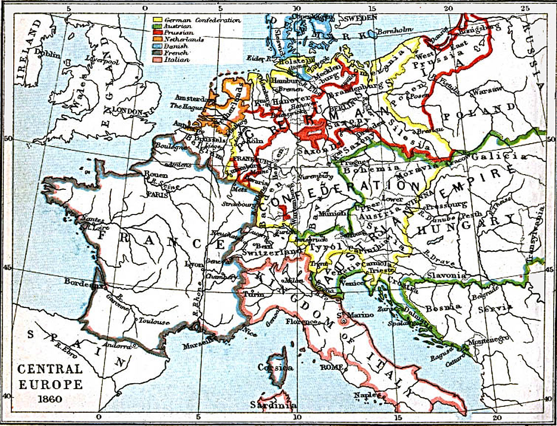
- Map of Central Europe, 1860
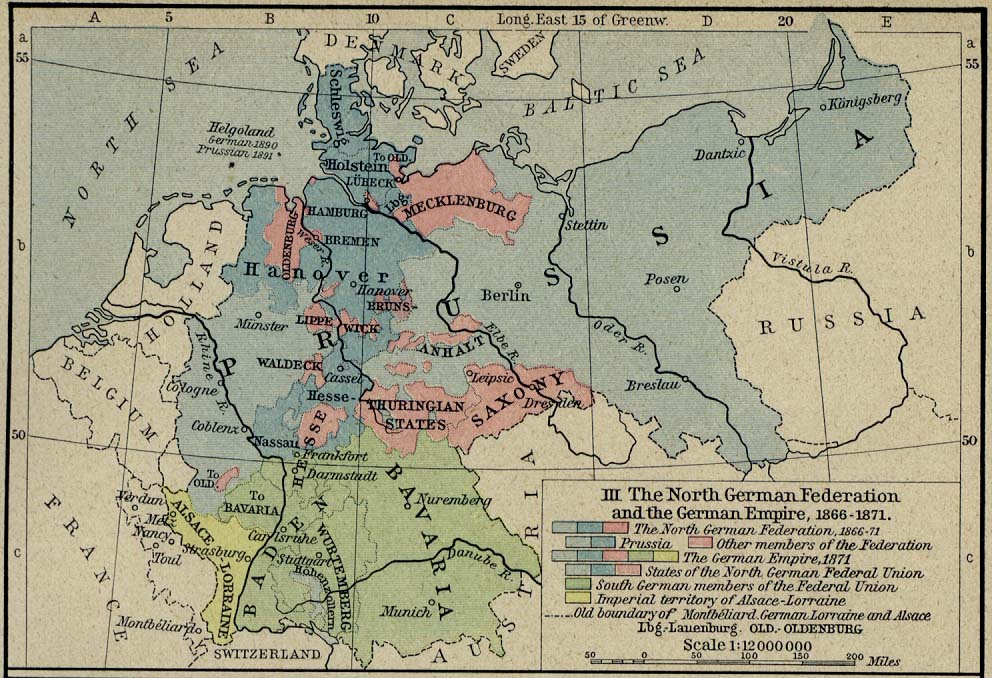
- Map of Central Europe, 1871
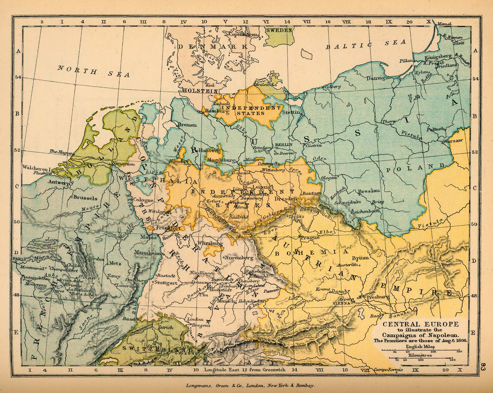
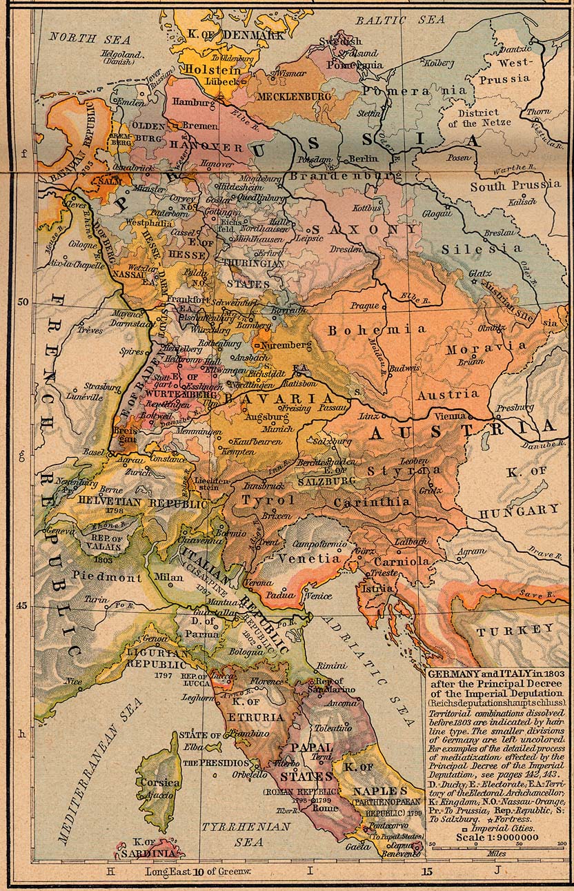
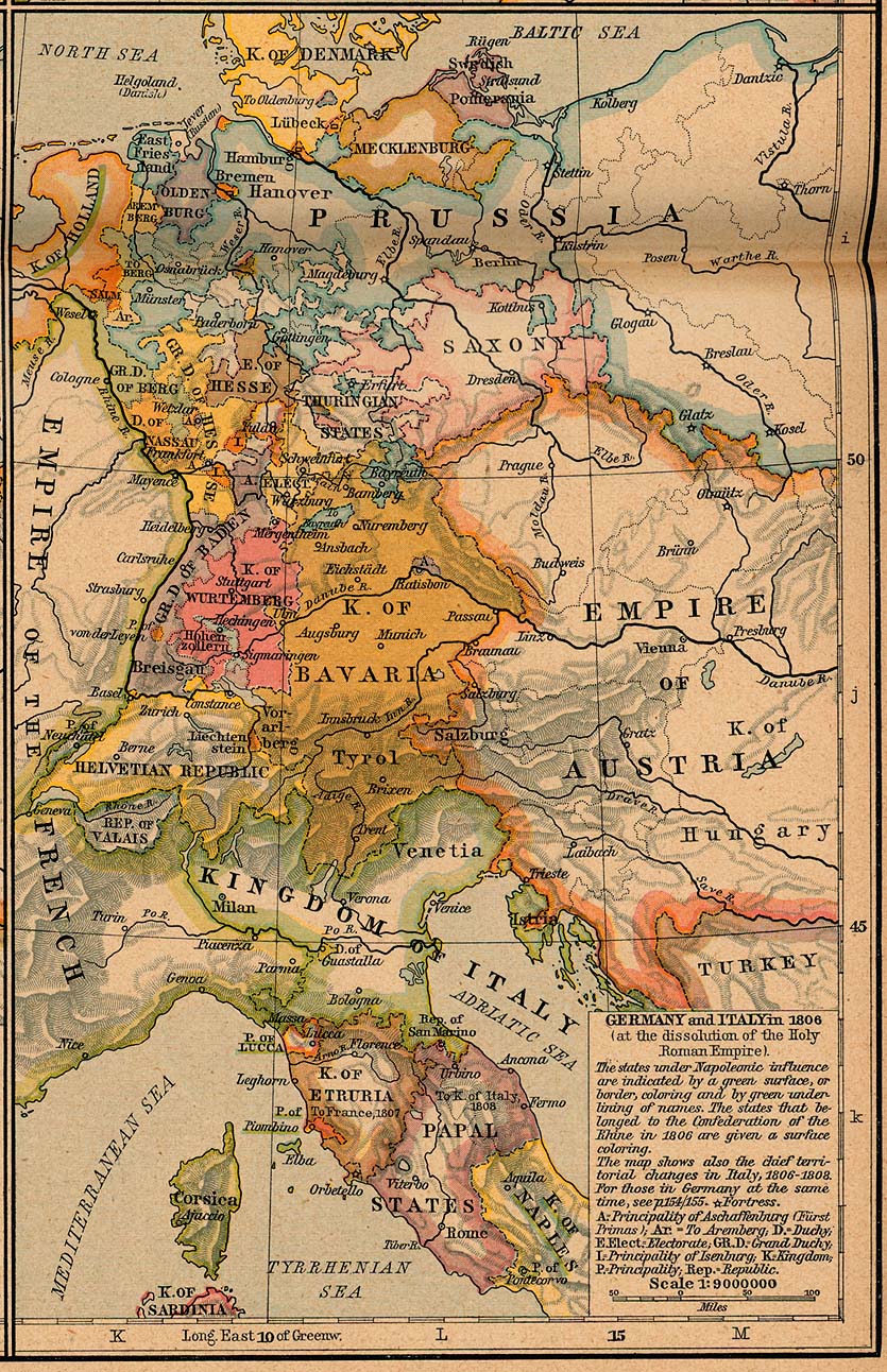
- Map of Central Europe, 1806
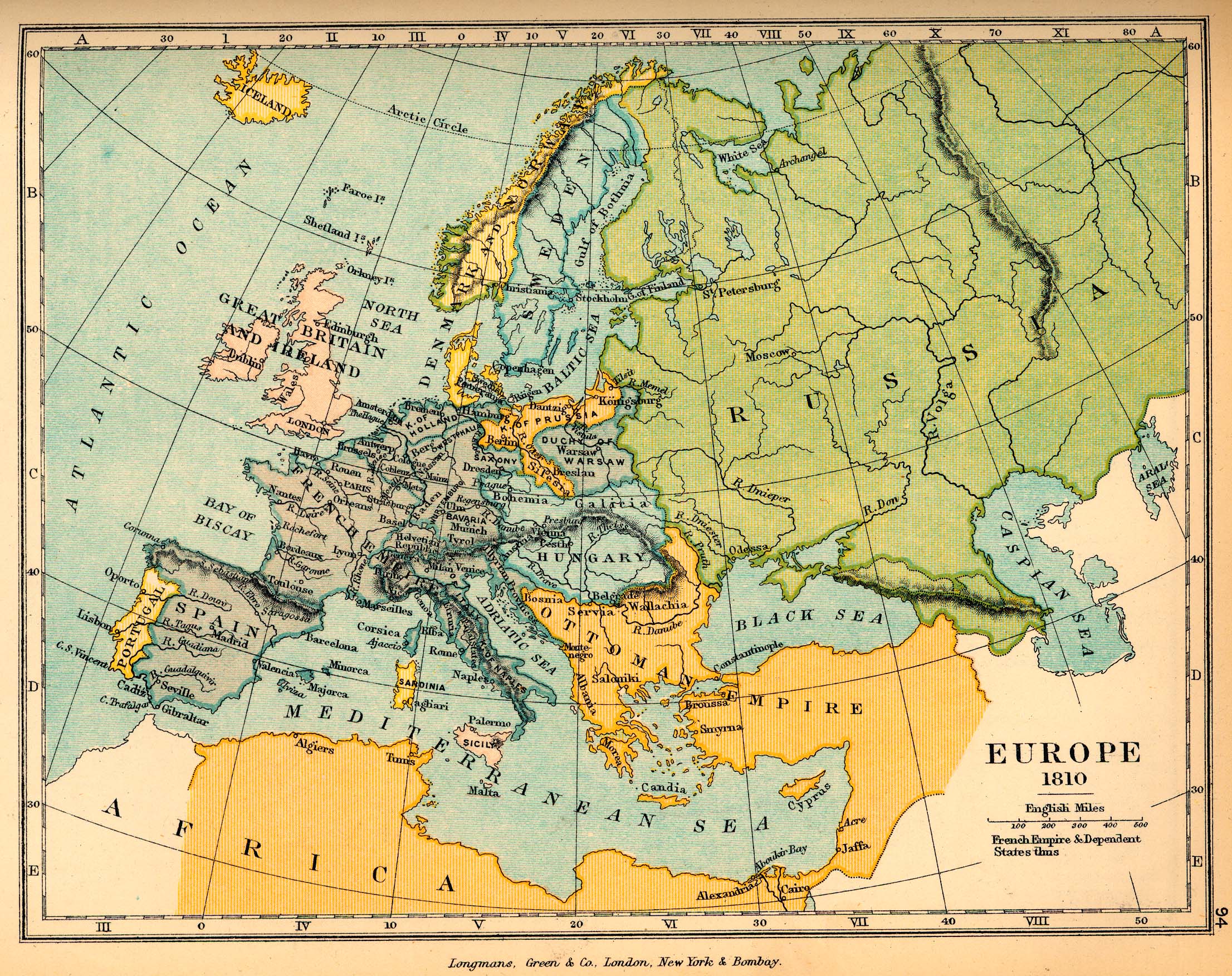
- Map of Europe, 1810
- Map of Europe, 1815
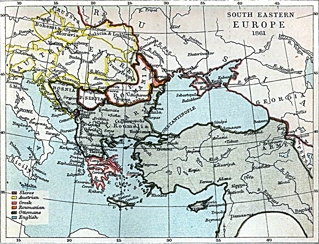
- Map of South-Eastern Europe and Asia Minor, 1861
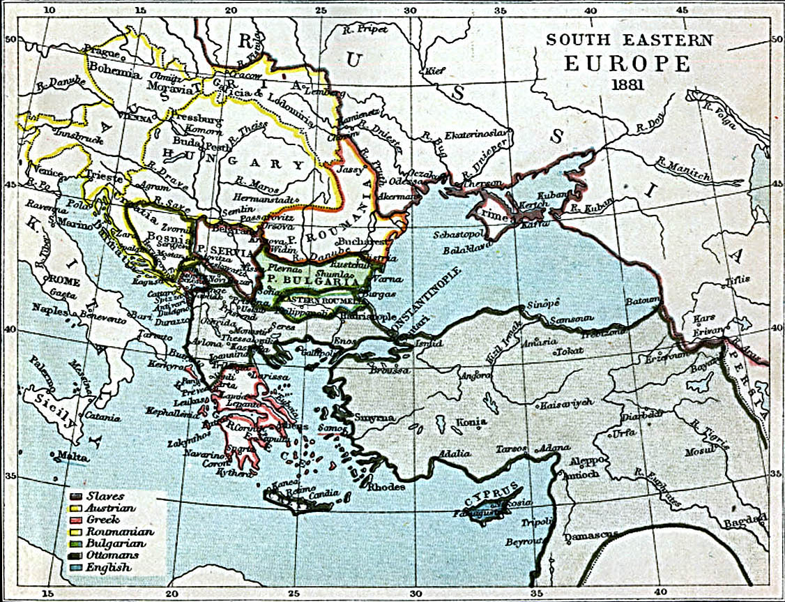
- Map of South-Eastern Europe and Asia Minor, 1881
- Map of the Red Sea, 1860
- Map of the Somali Coast and the Gulf of Aden, 1860
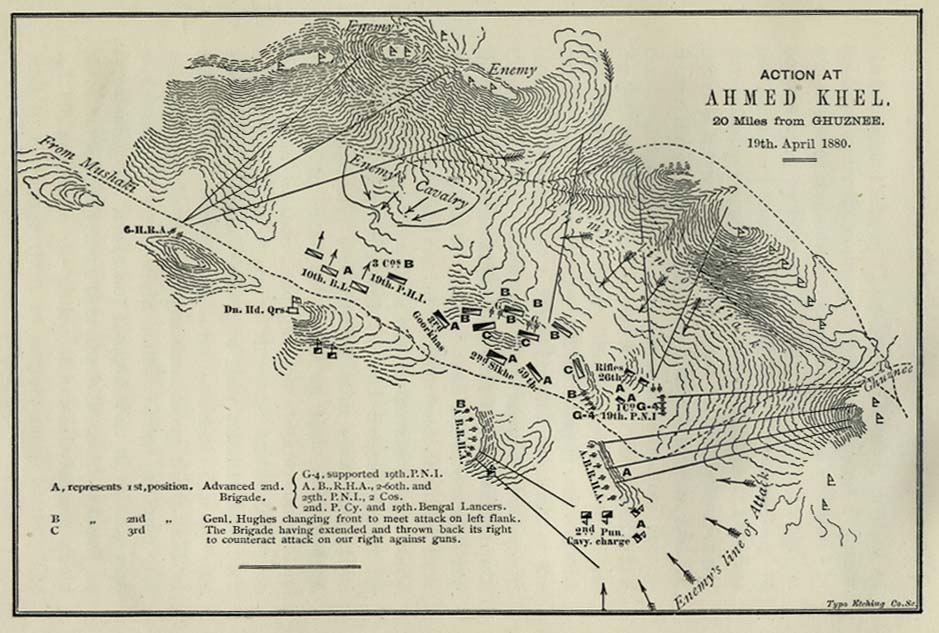
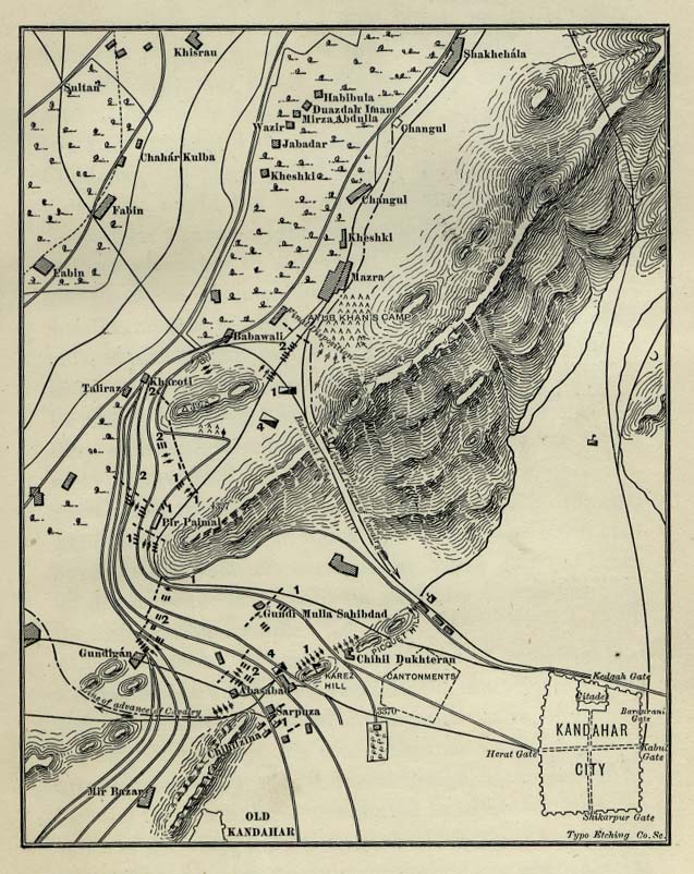
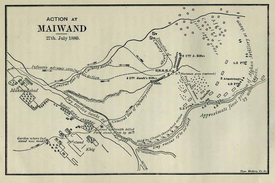
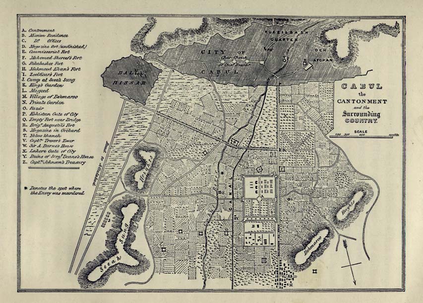
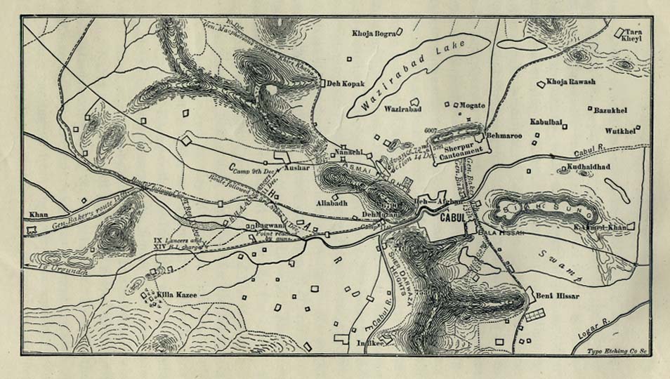
Afghanistan
Antarctica
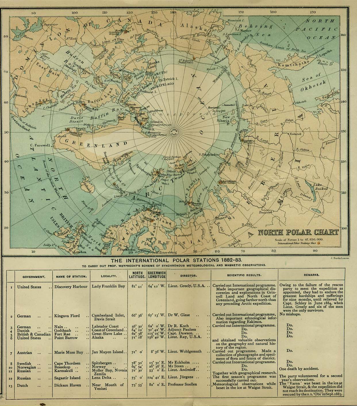
Arctic
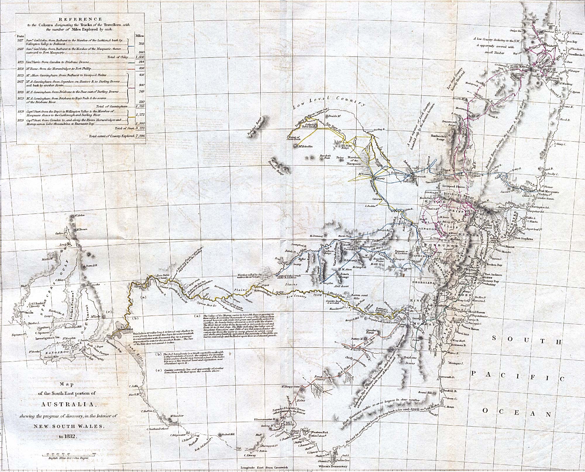
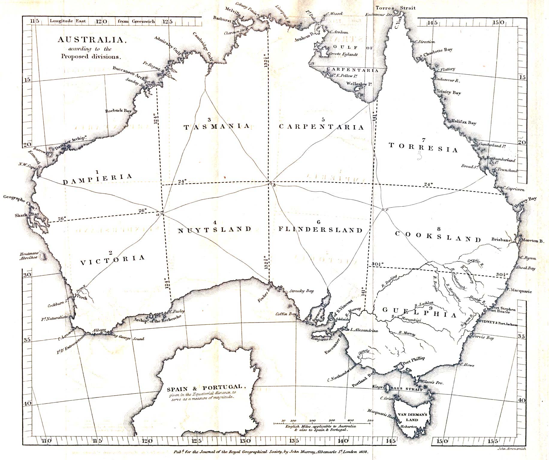
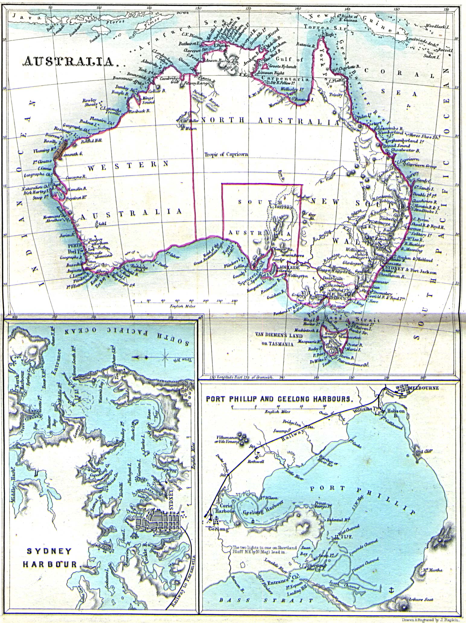
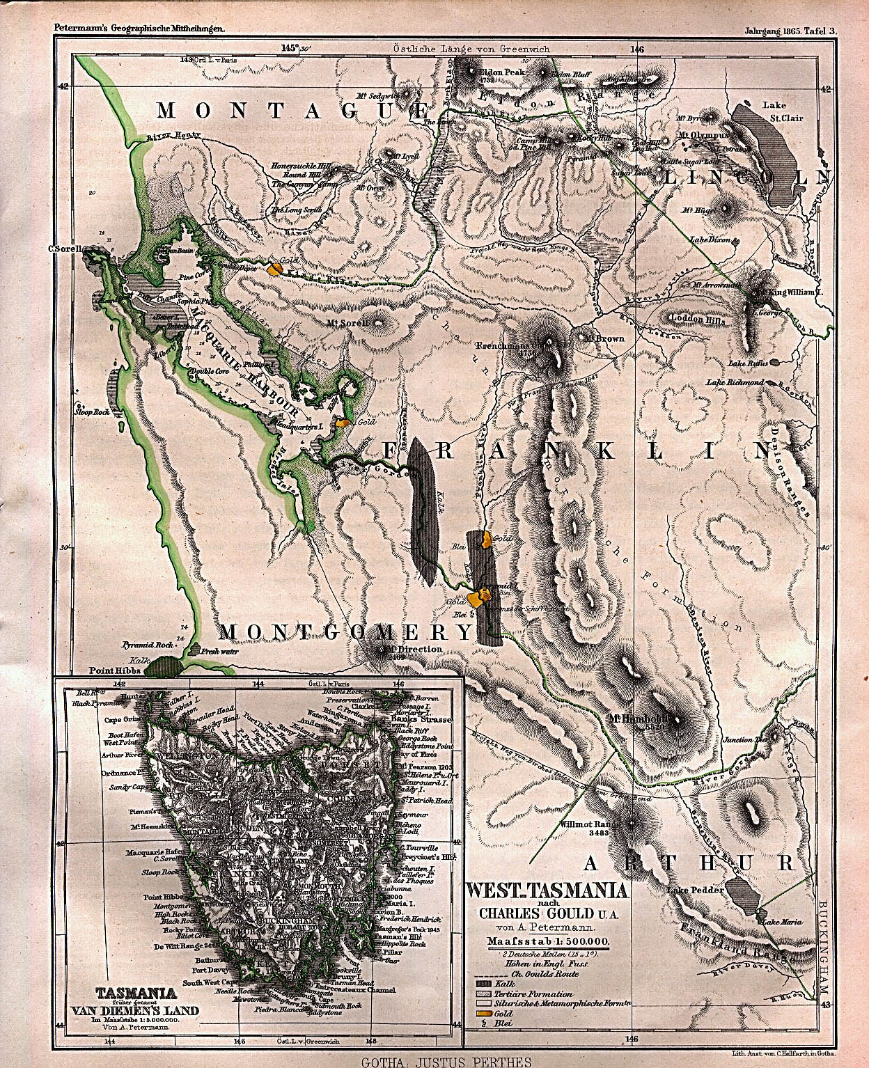
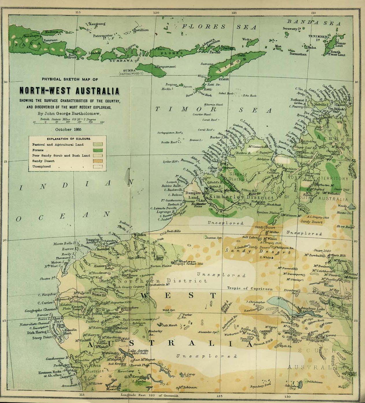
Australia
Austrian/Austro-Hungarian Empire
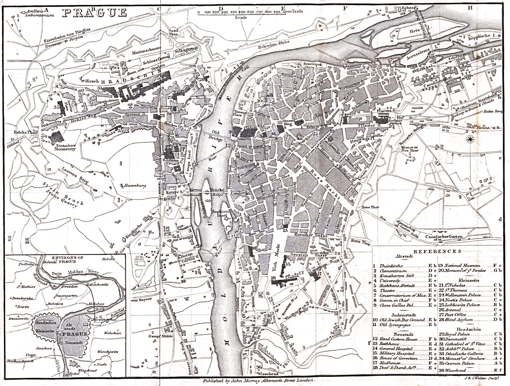
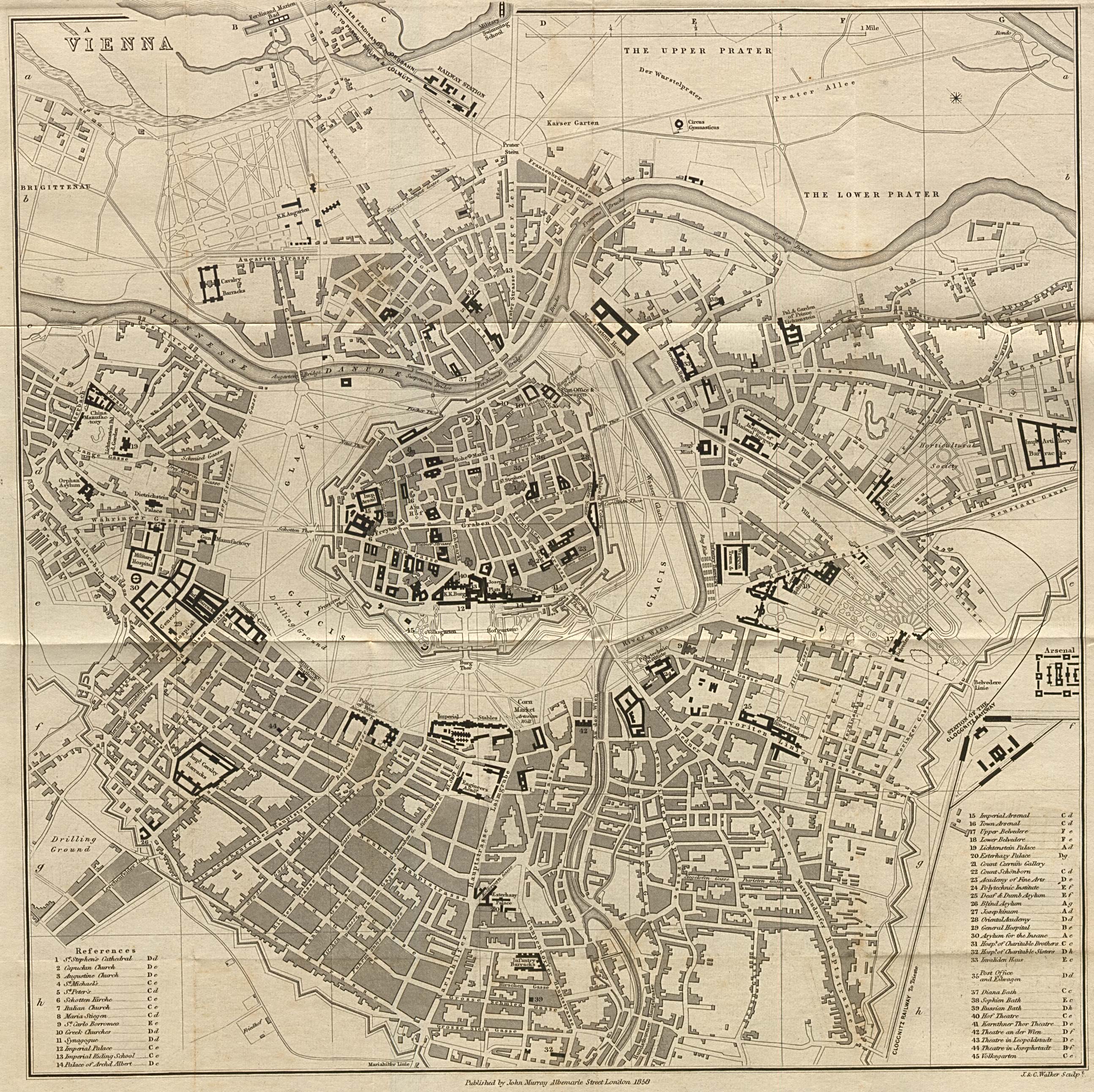
- General reference
- Cities
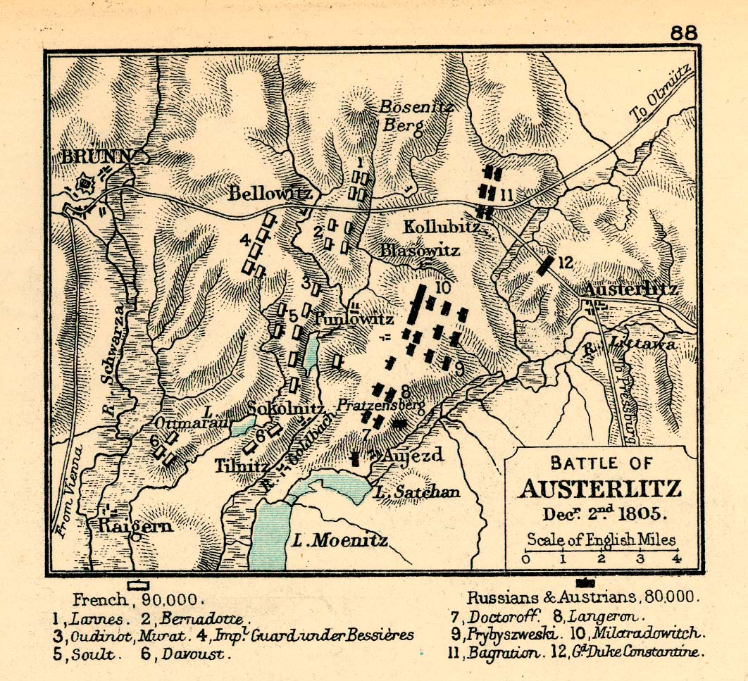
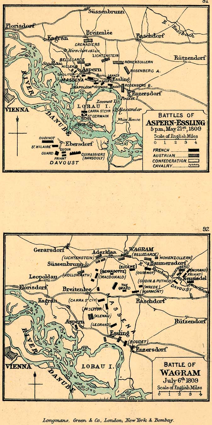
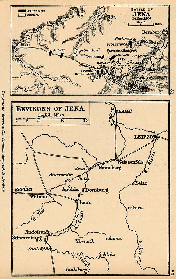
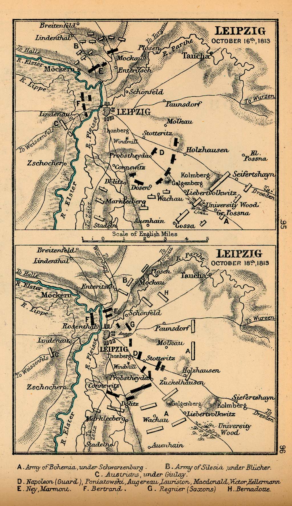
- Napoleonic Wars
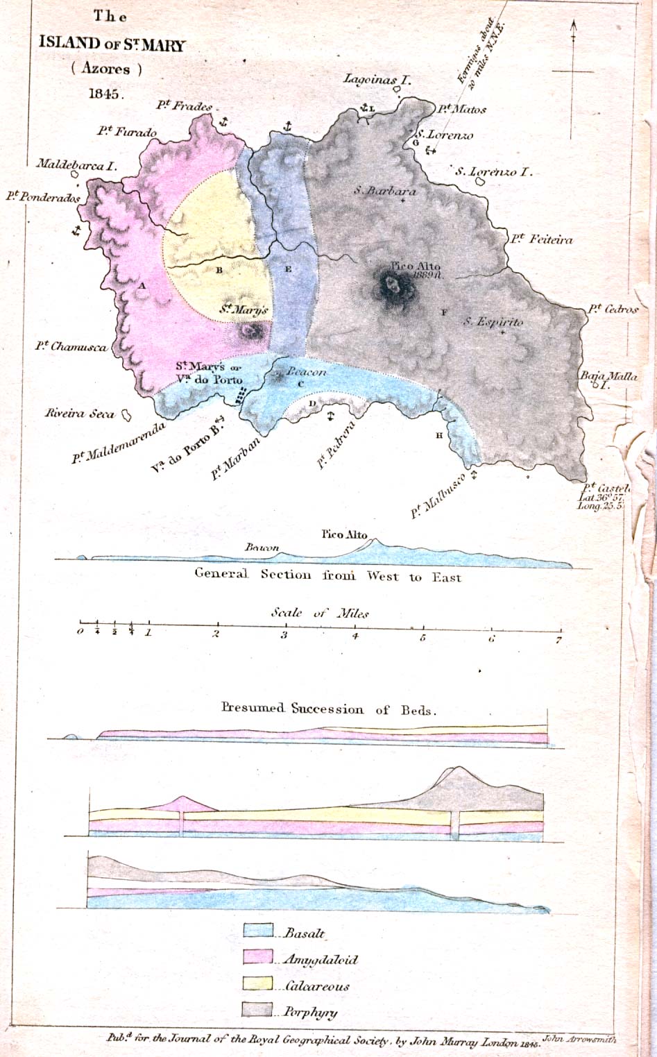
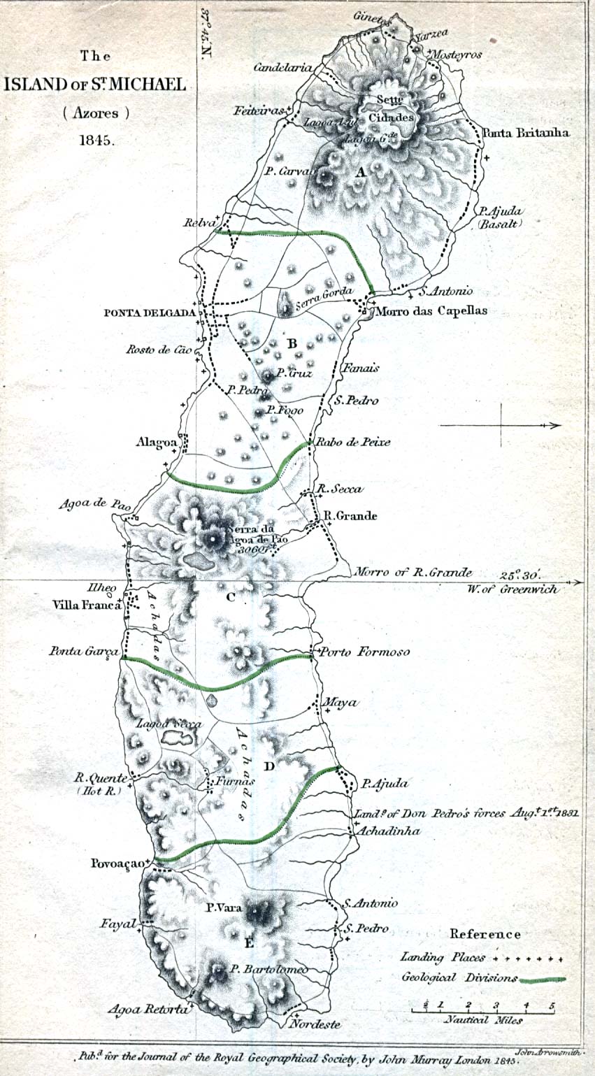
Azores
Baluchistan
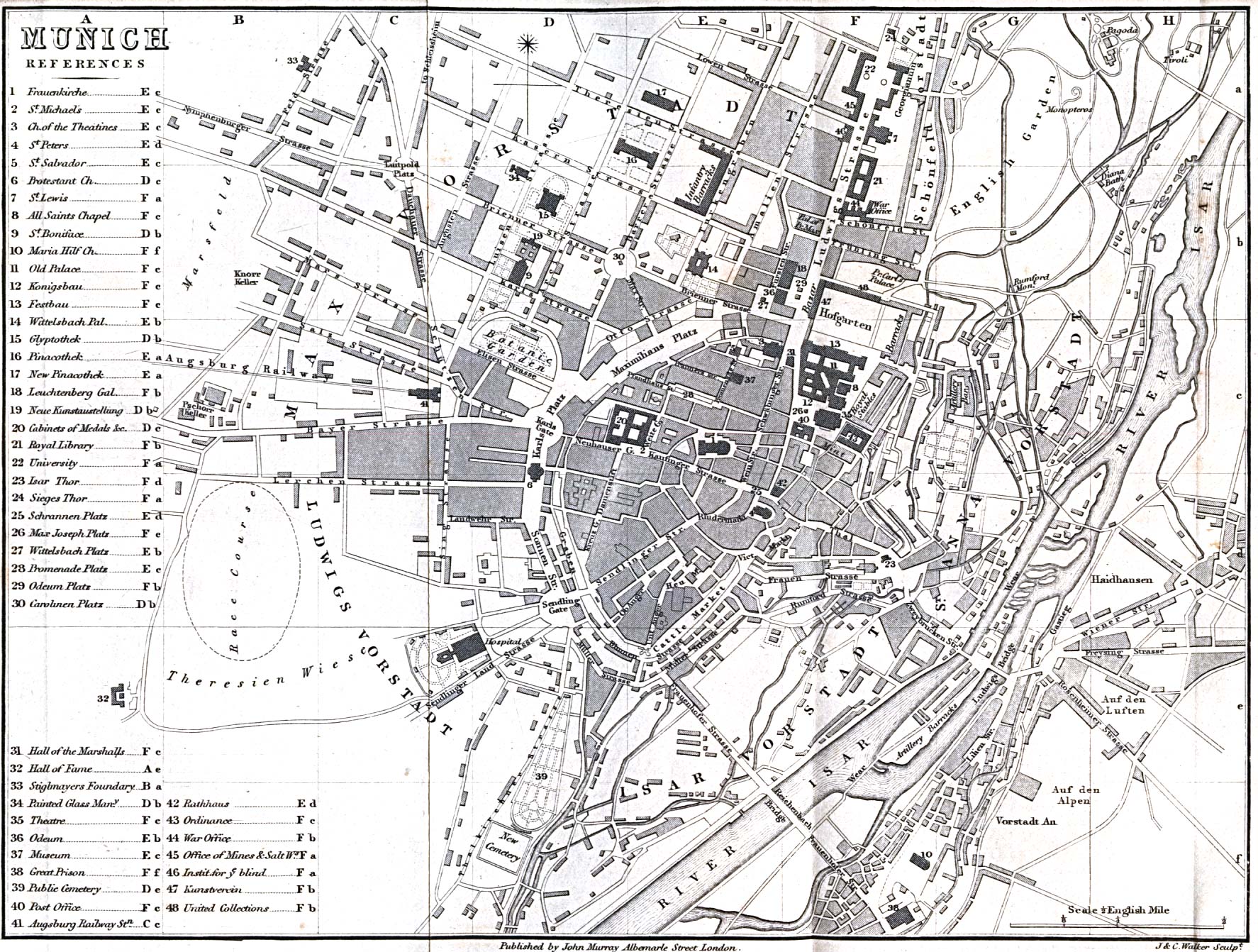
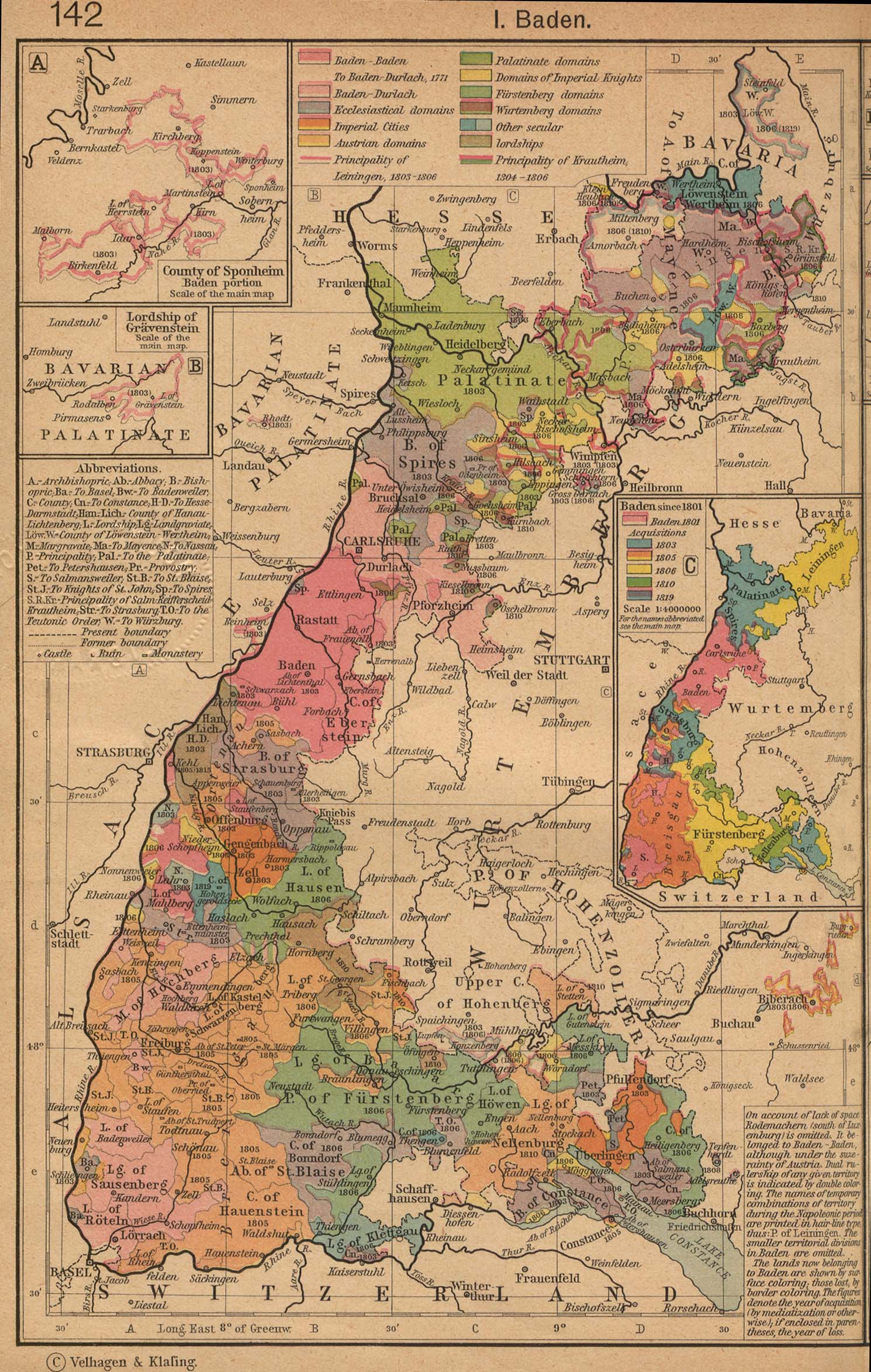
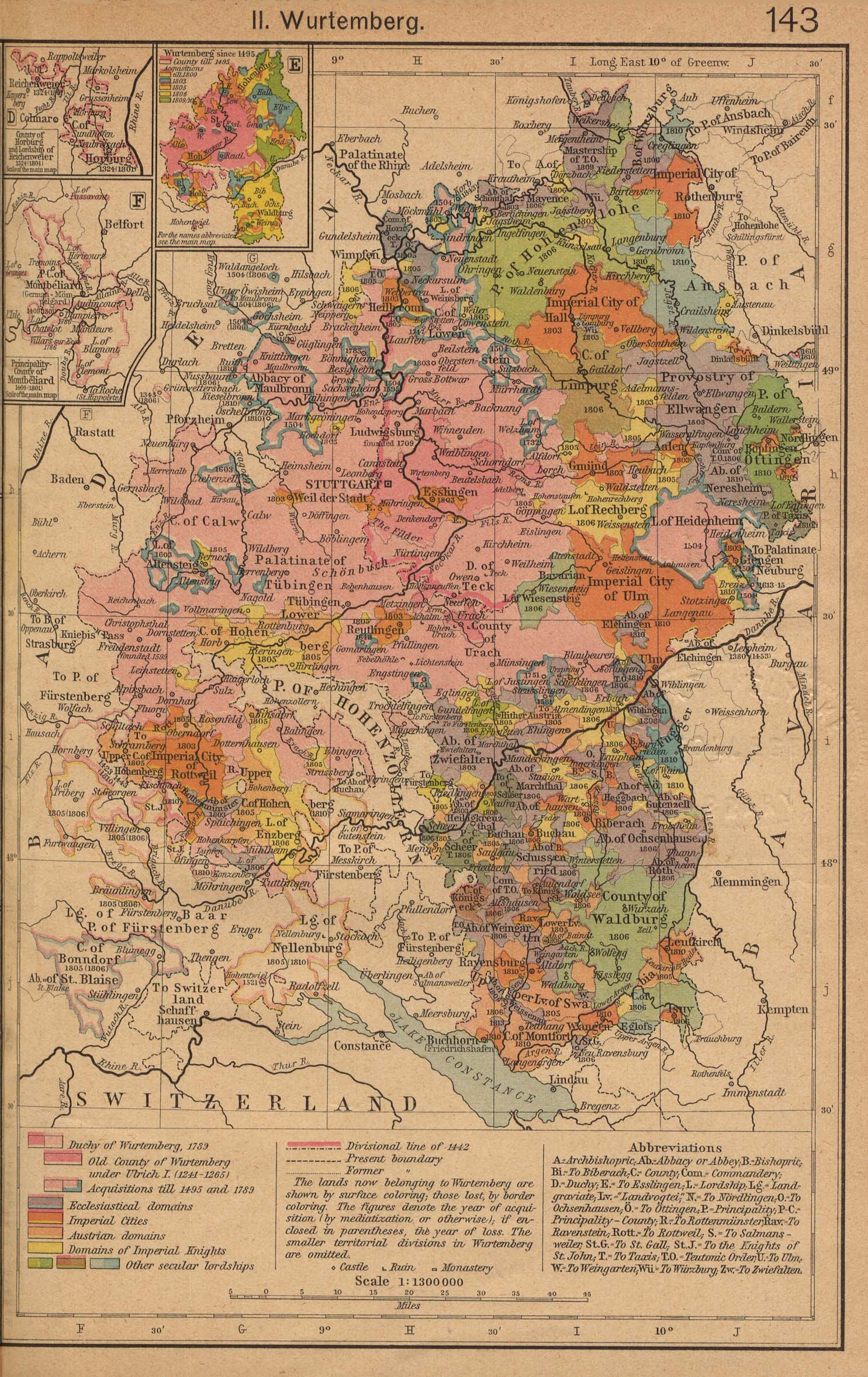
Bavaria
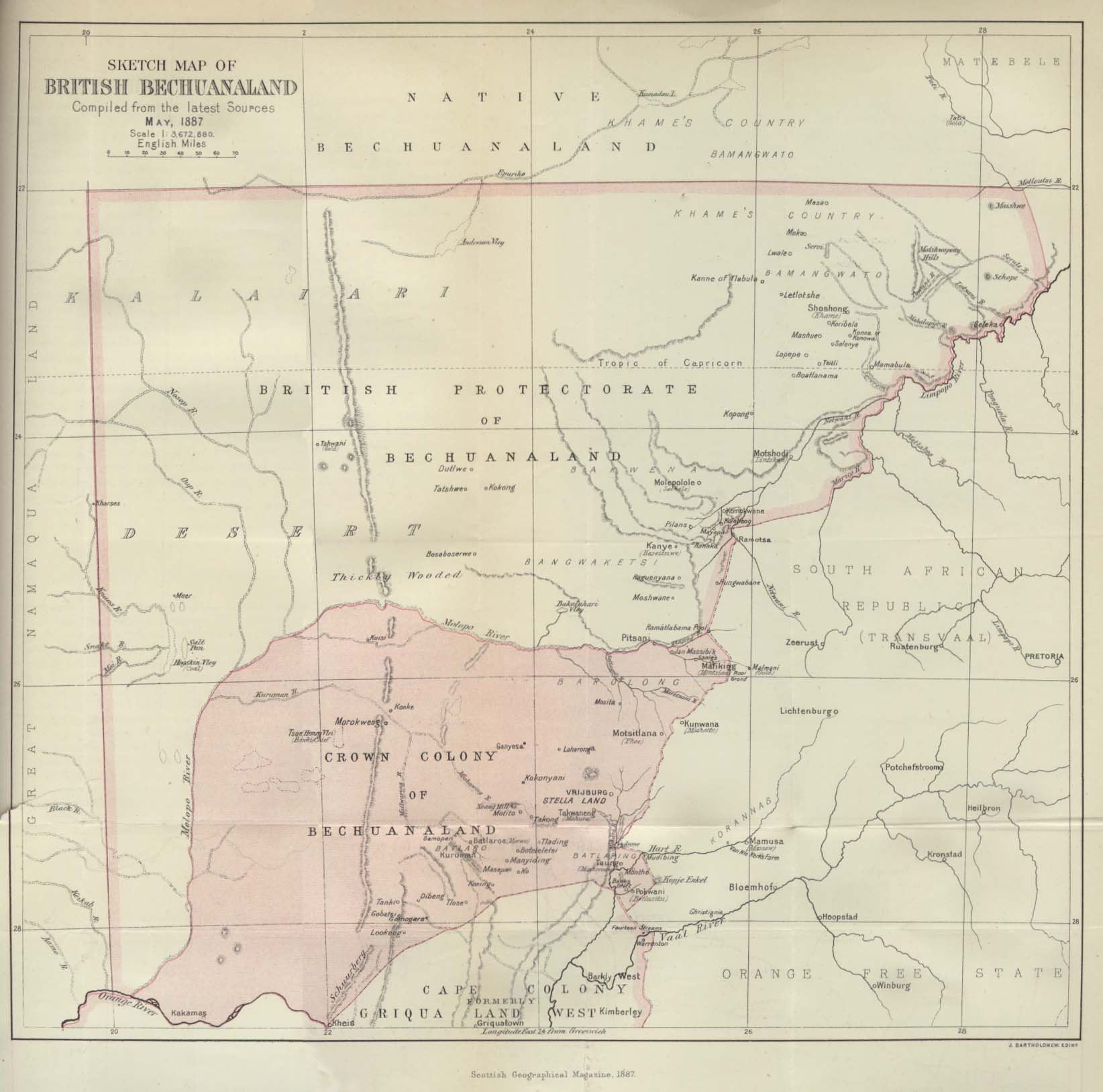
Bechuanaland
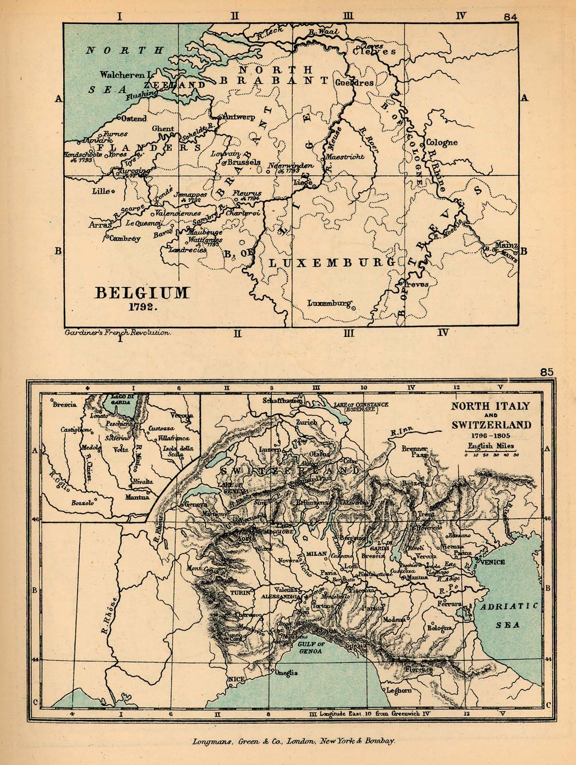
Belgium
- Guides
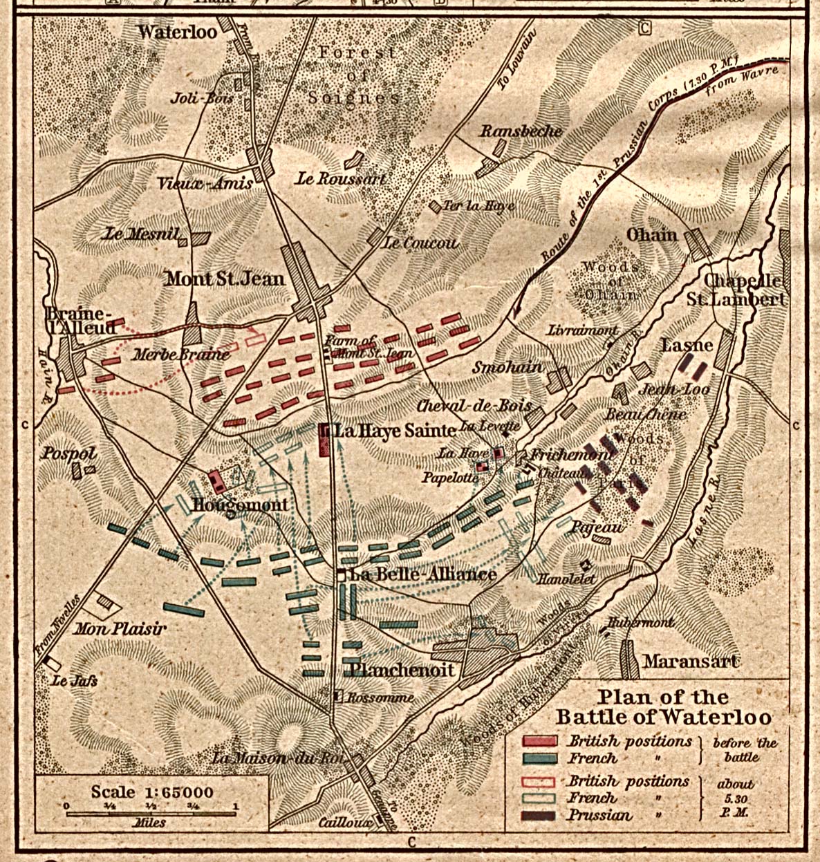
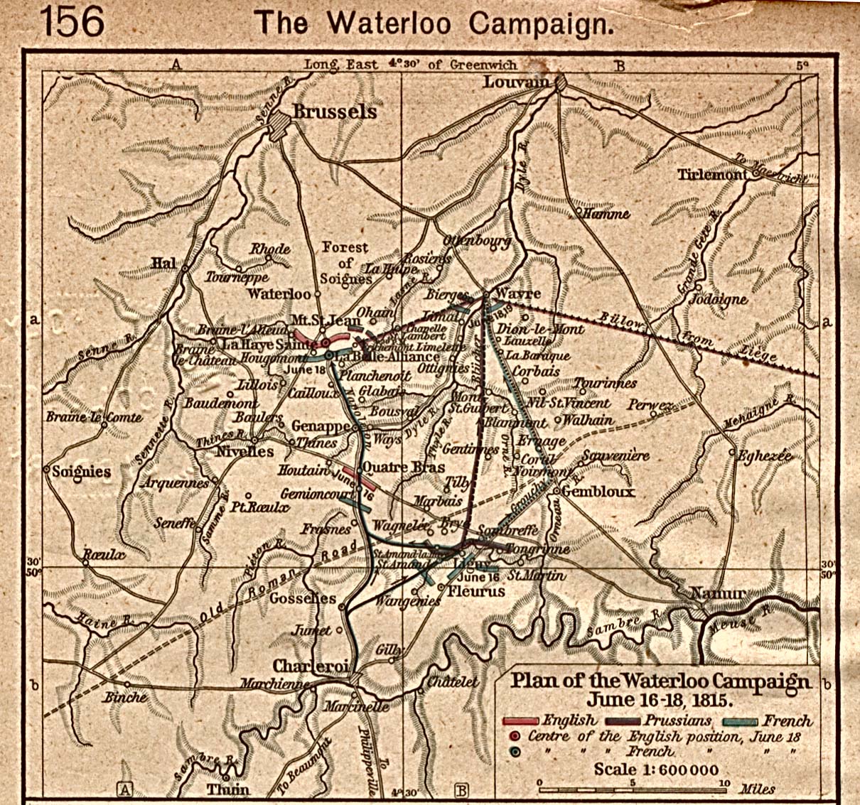
- Battle of Waterloo, 1815
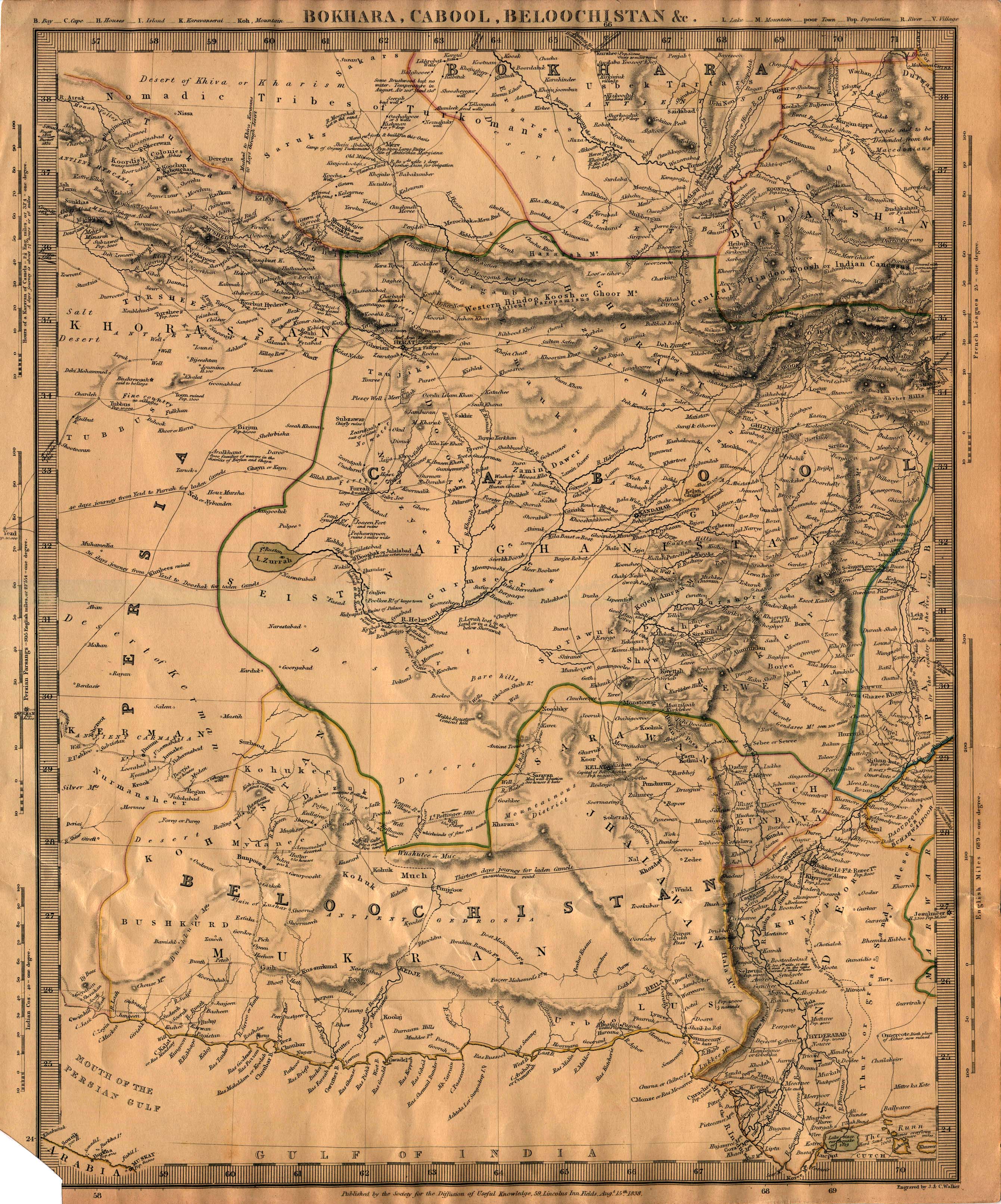
Bokhara
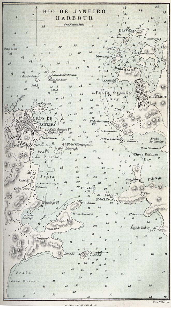
Brazil
Bulgaria
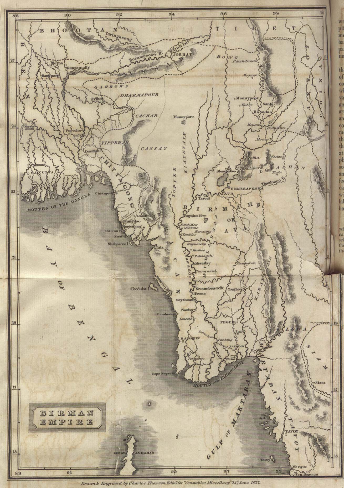
Burma
Canada
- Guides
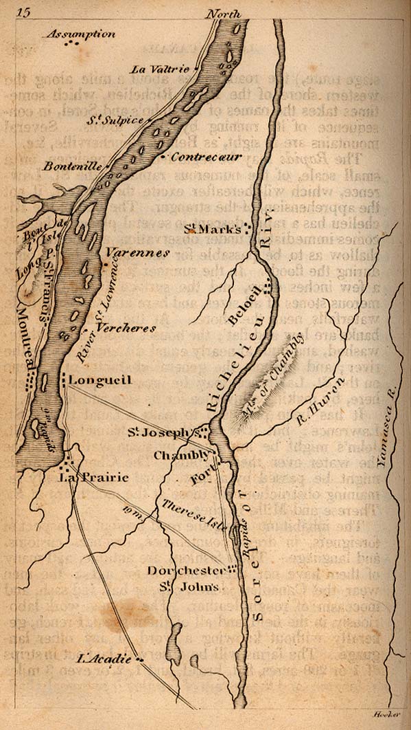
- Maps
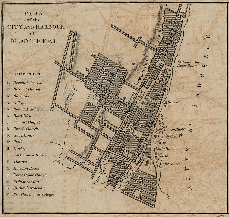
- Montreal
- Other cities
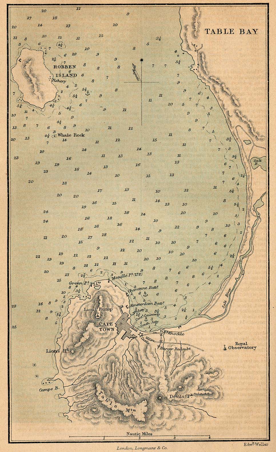
Cape Colony
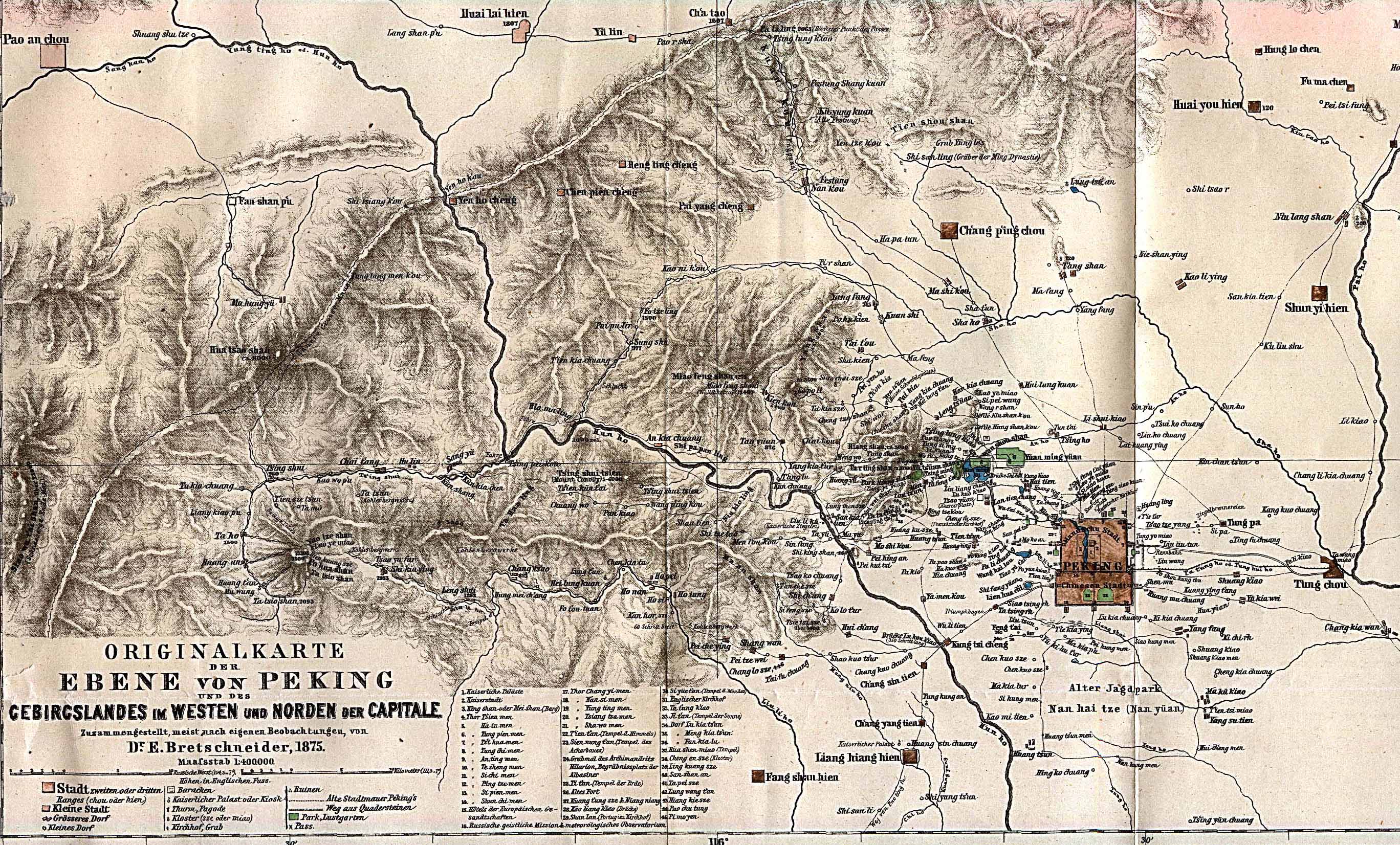
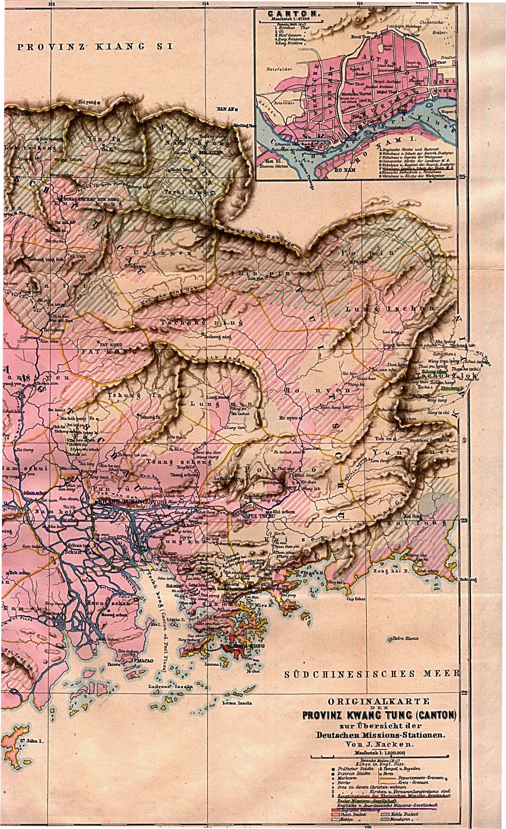
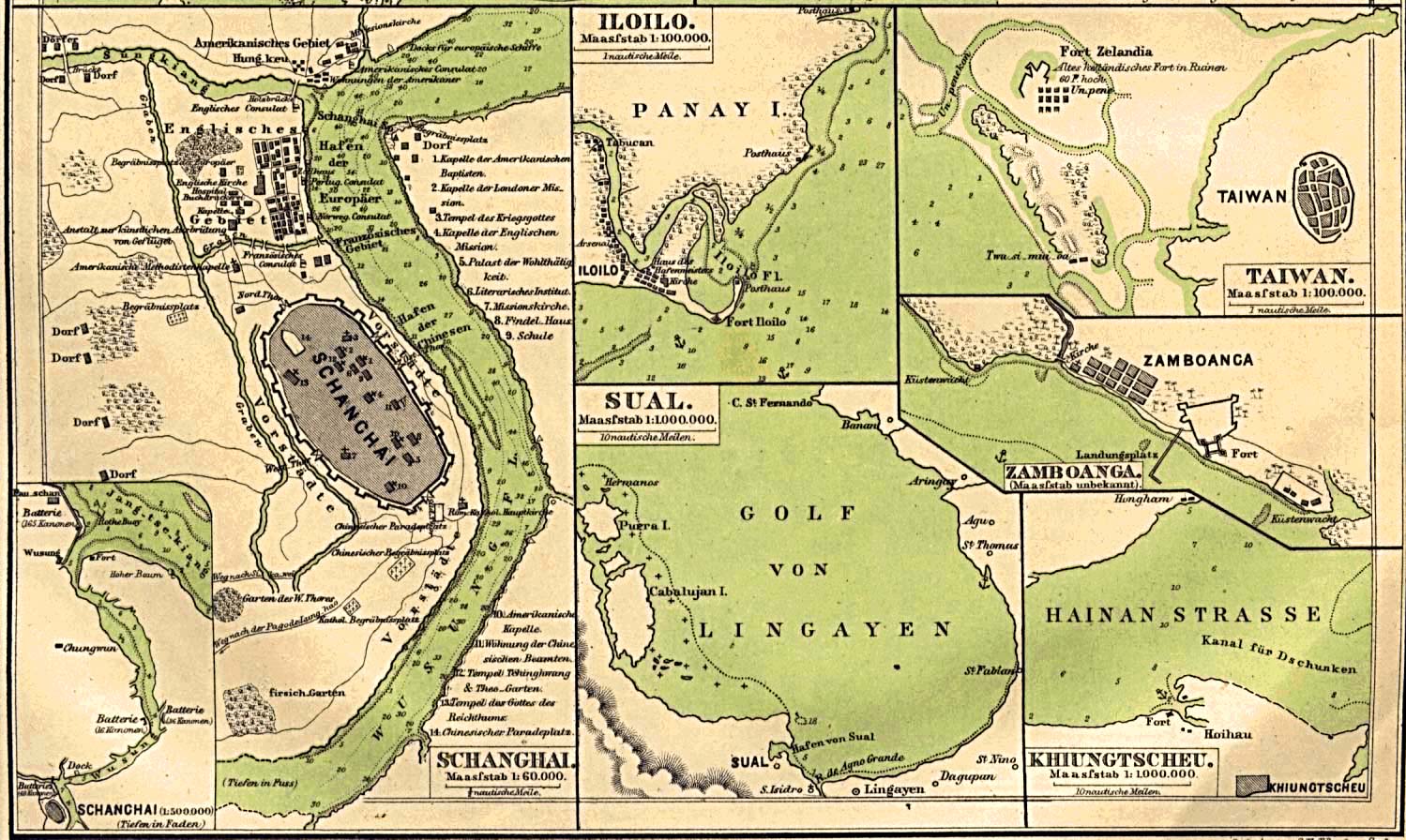
China
- Maps
- Shanghai
- Other cities
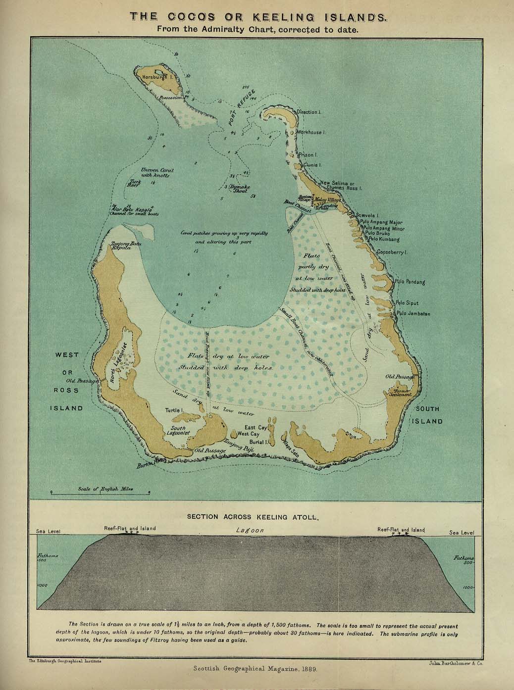
Cocos or Keeling Islands
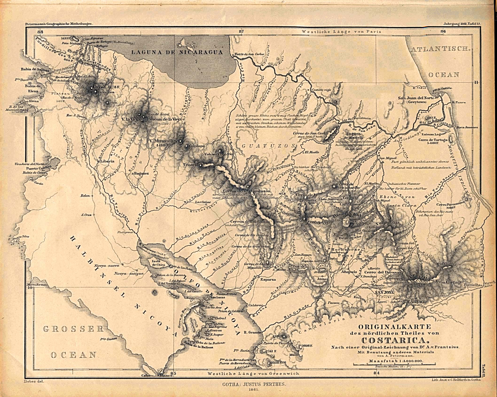
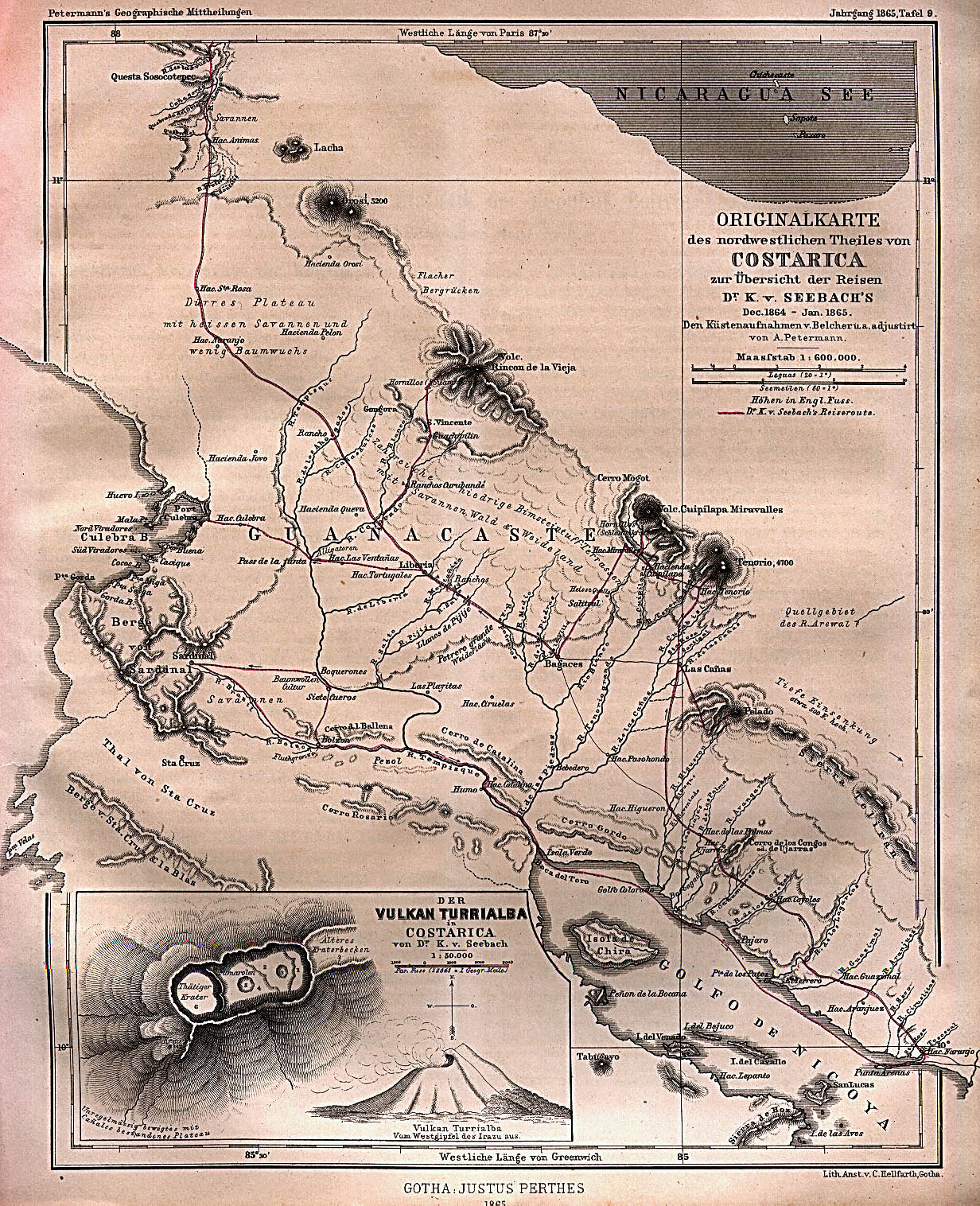
Costa Rica
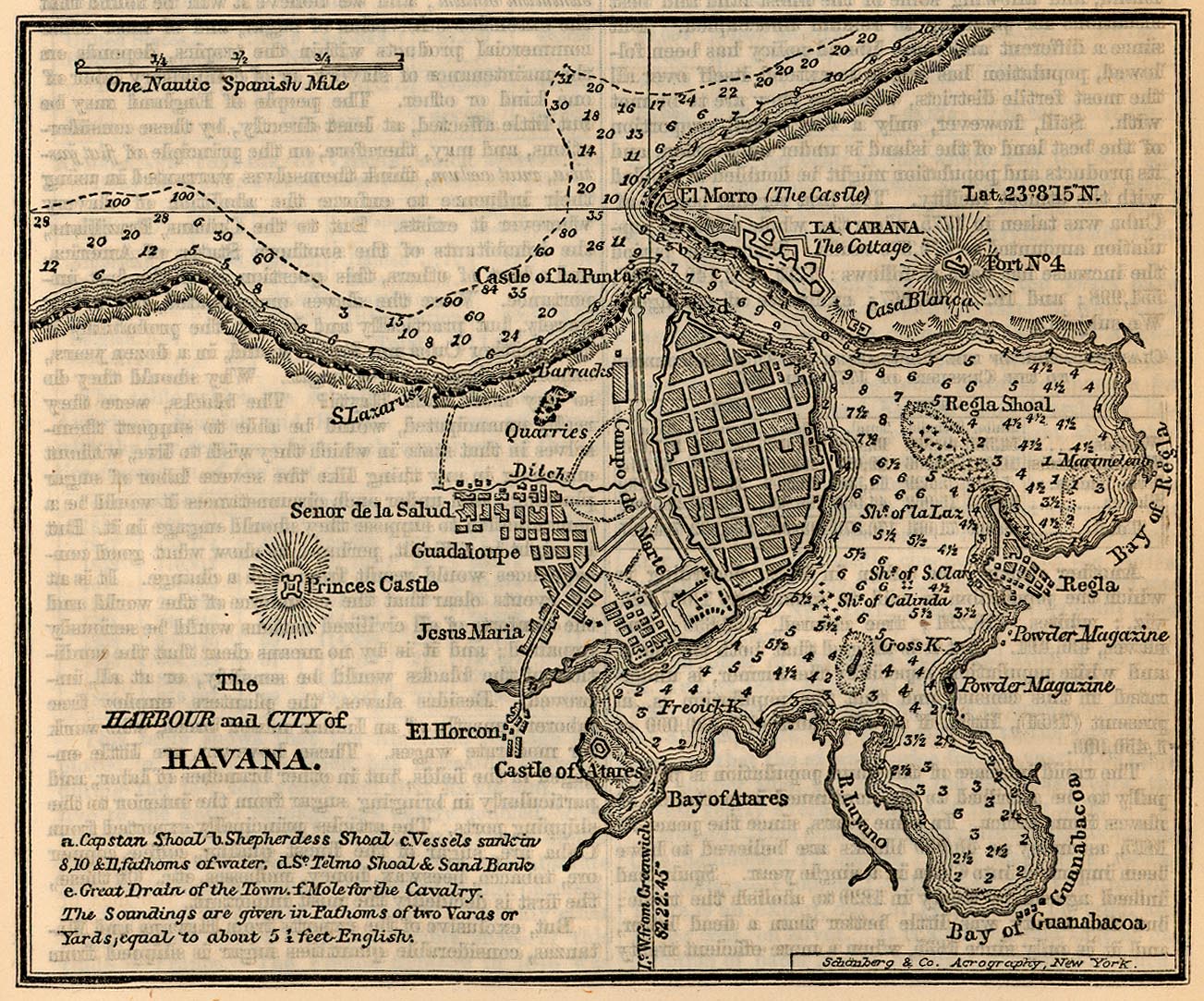
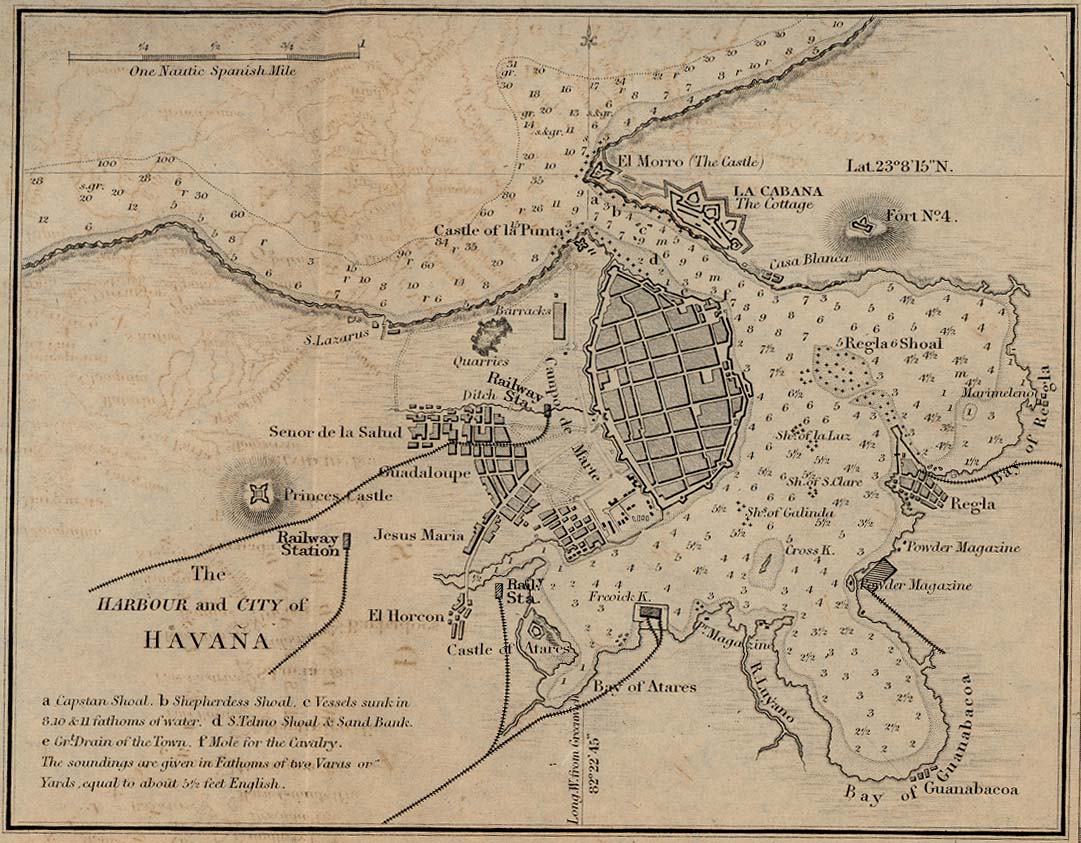
Cuba
Egypt
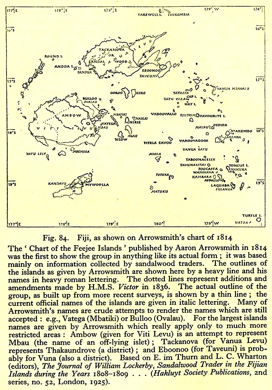
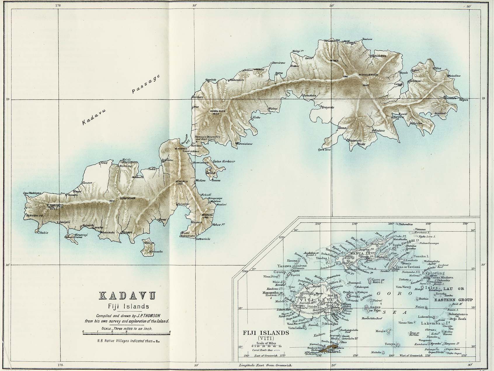
Fiji
Formosa
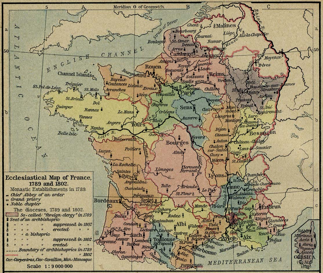
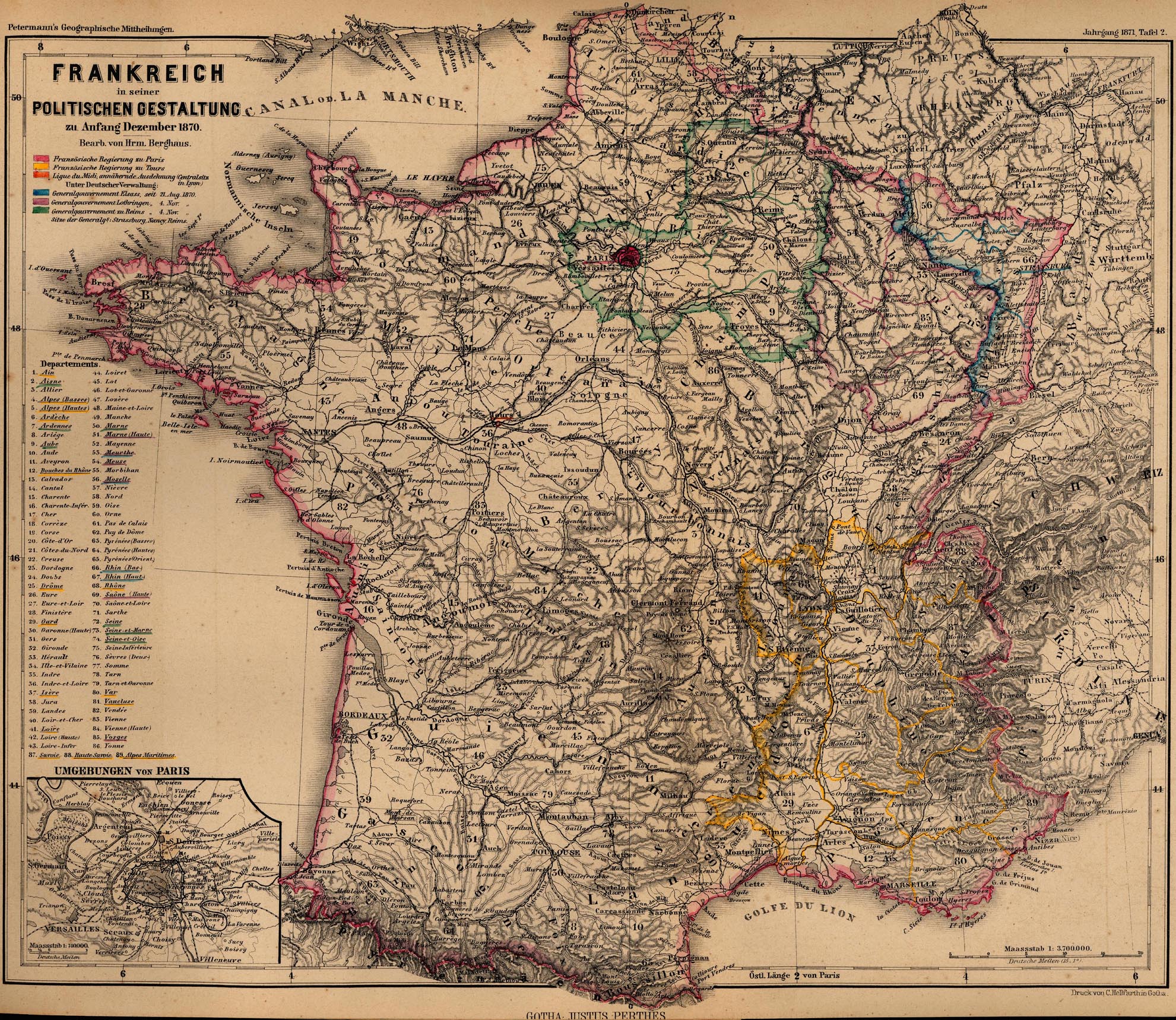
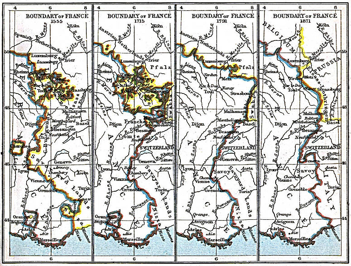
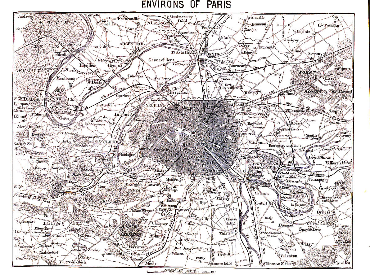
France
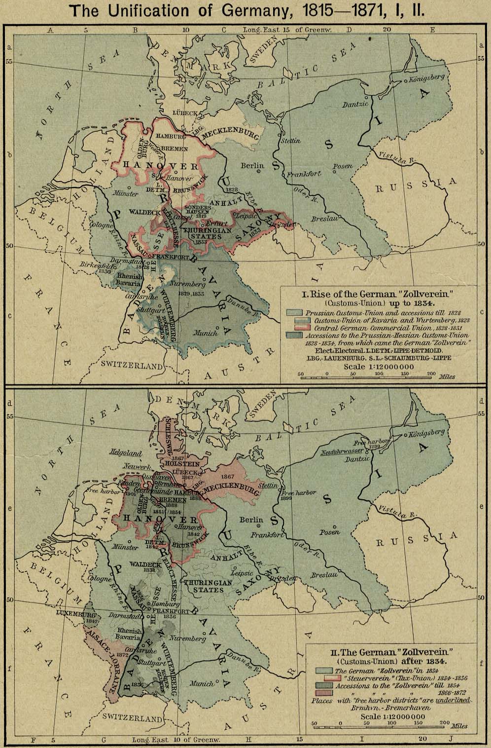
Germany (General)
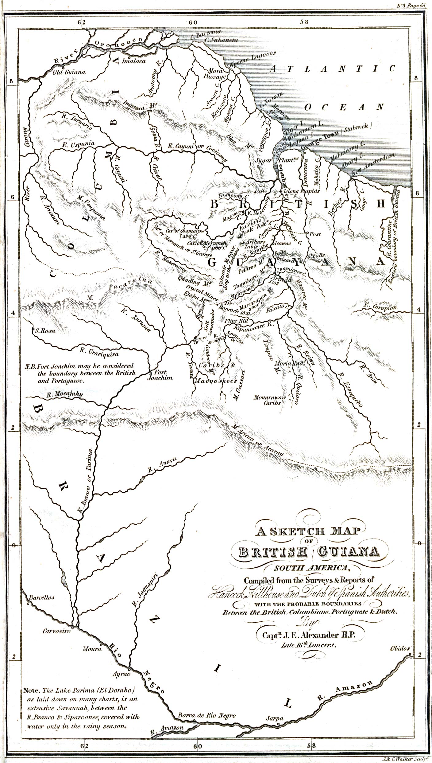
British Guiana
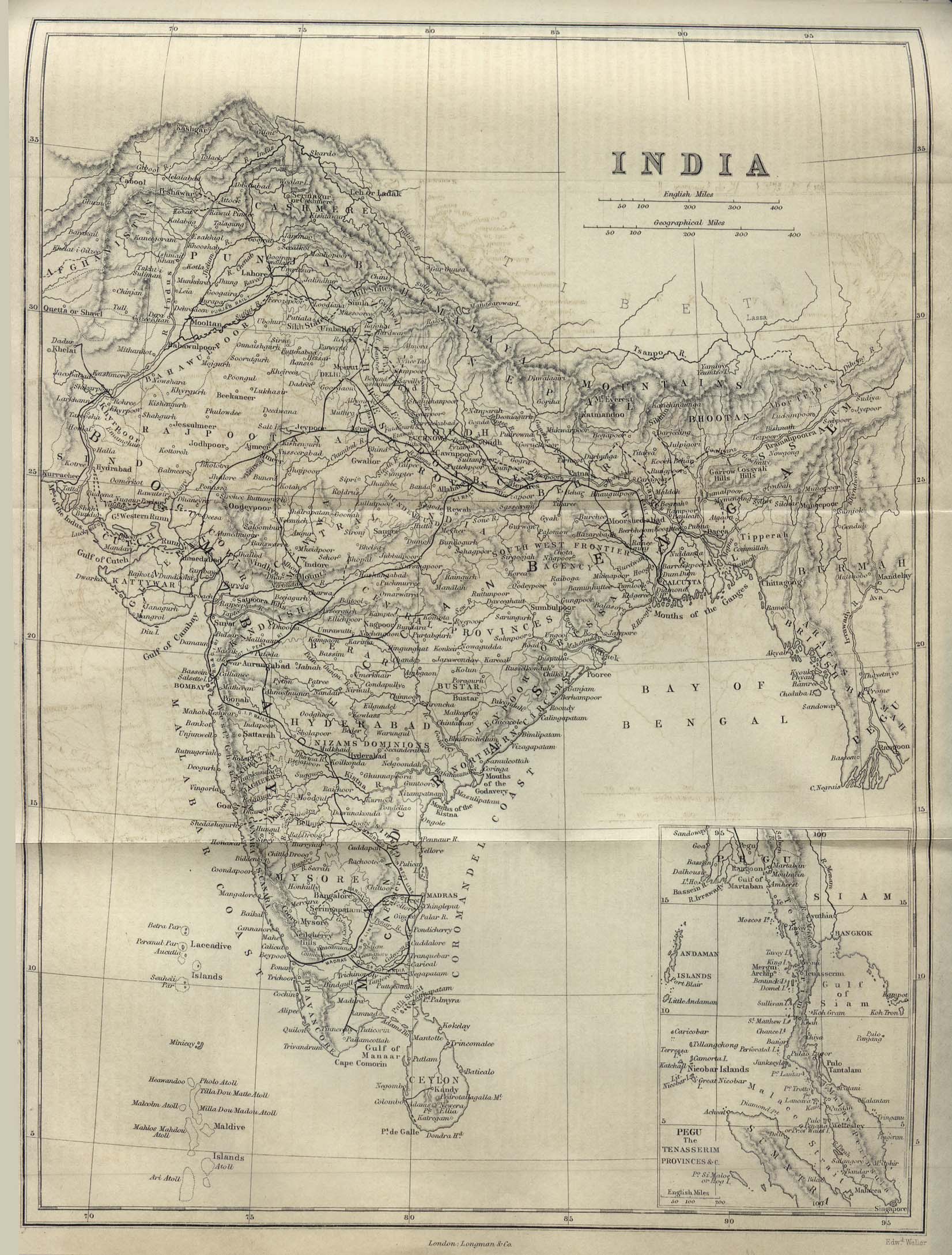
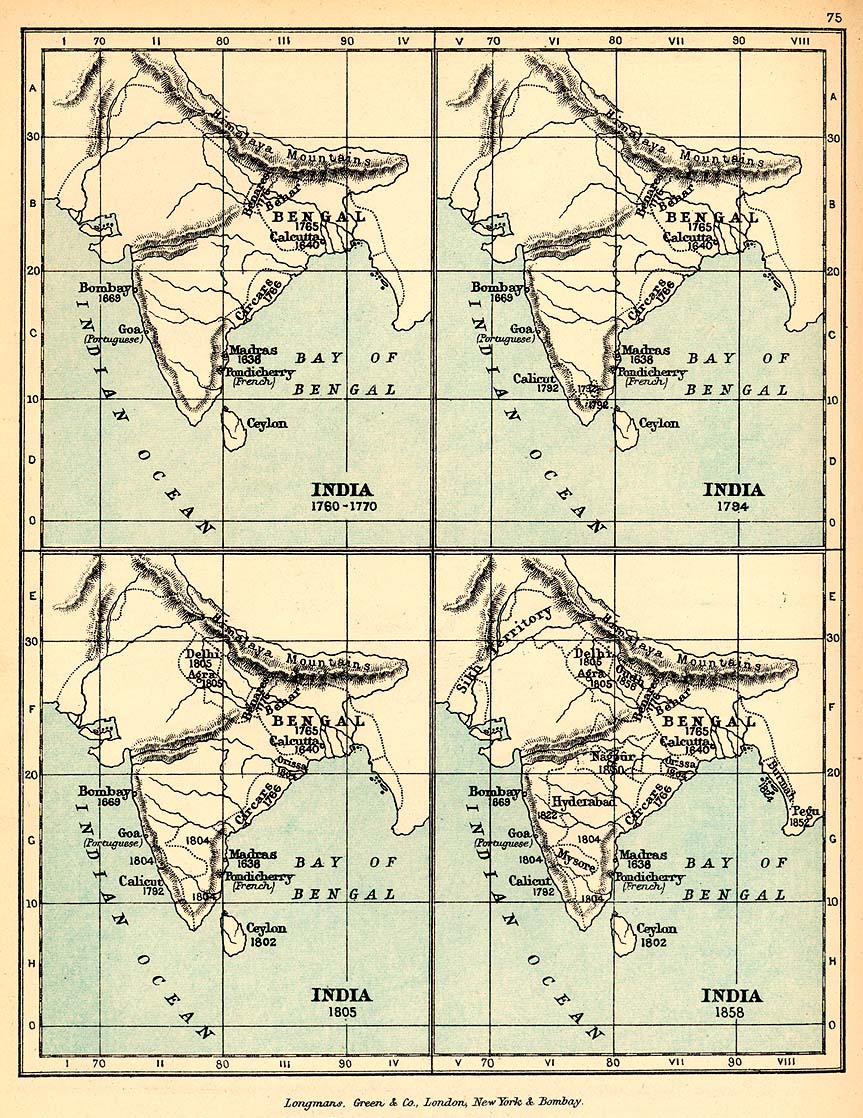
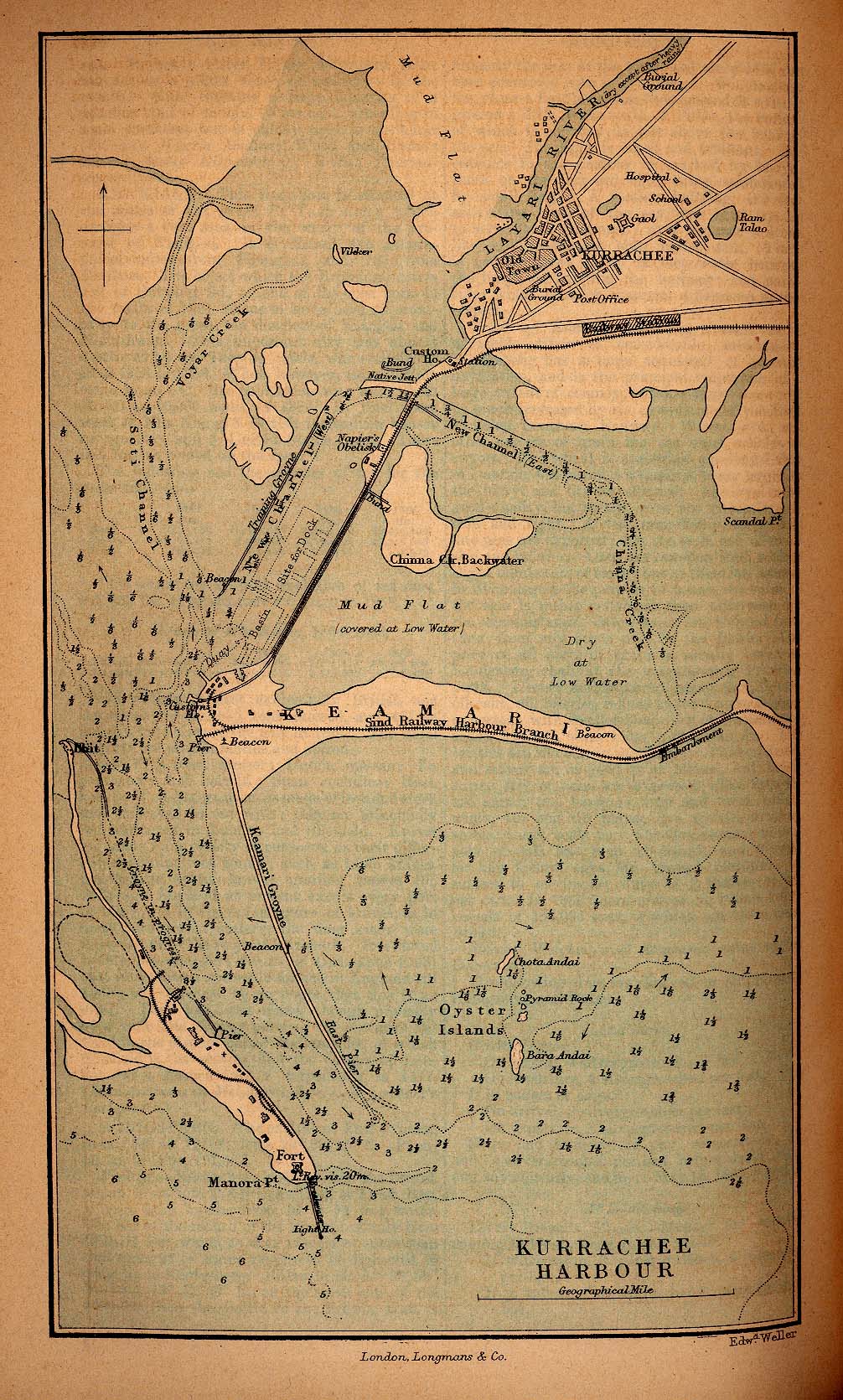
India
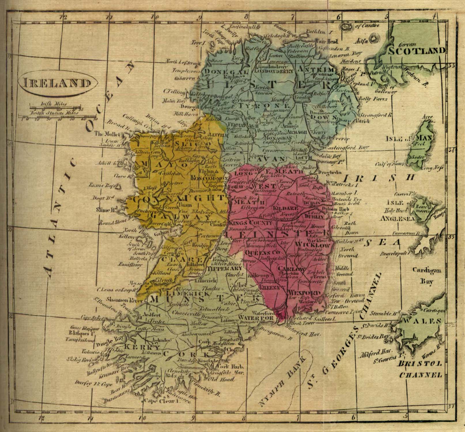
Ireland
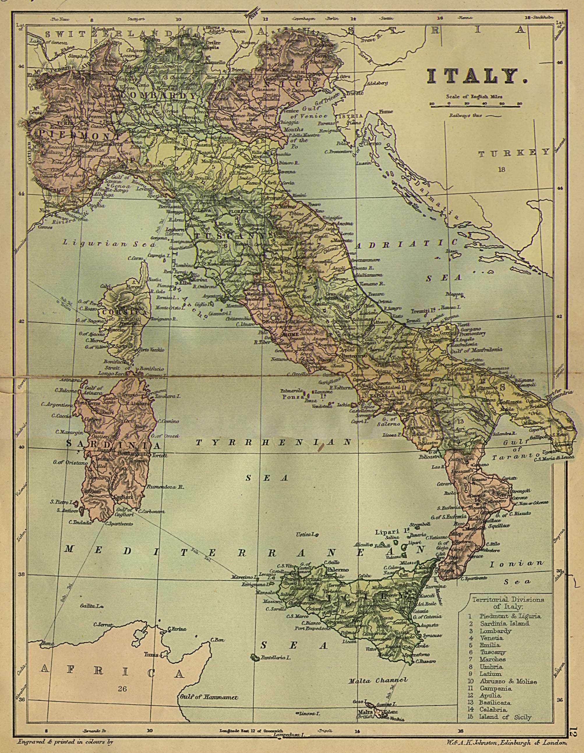
Italy
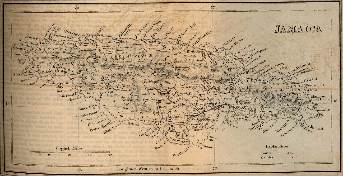
Jamaica
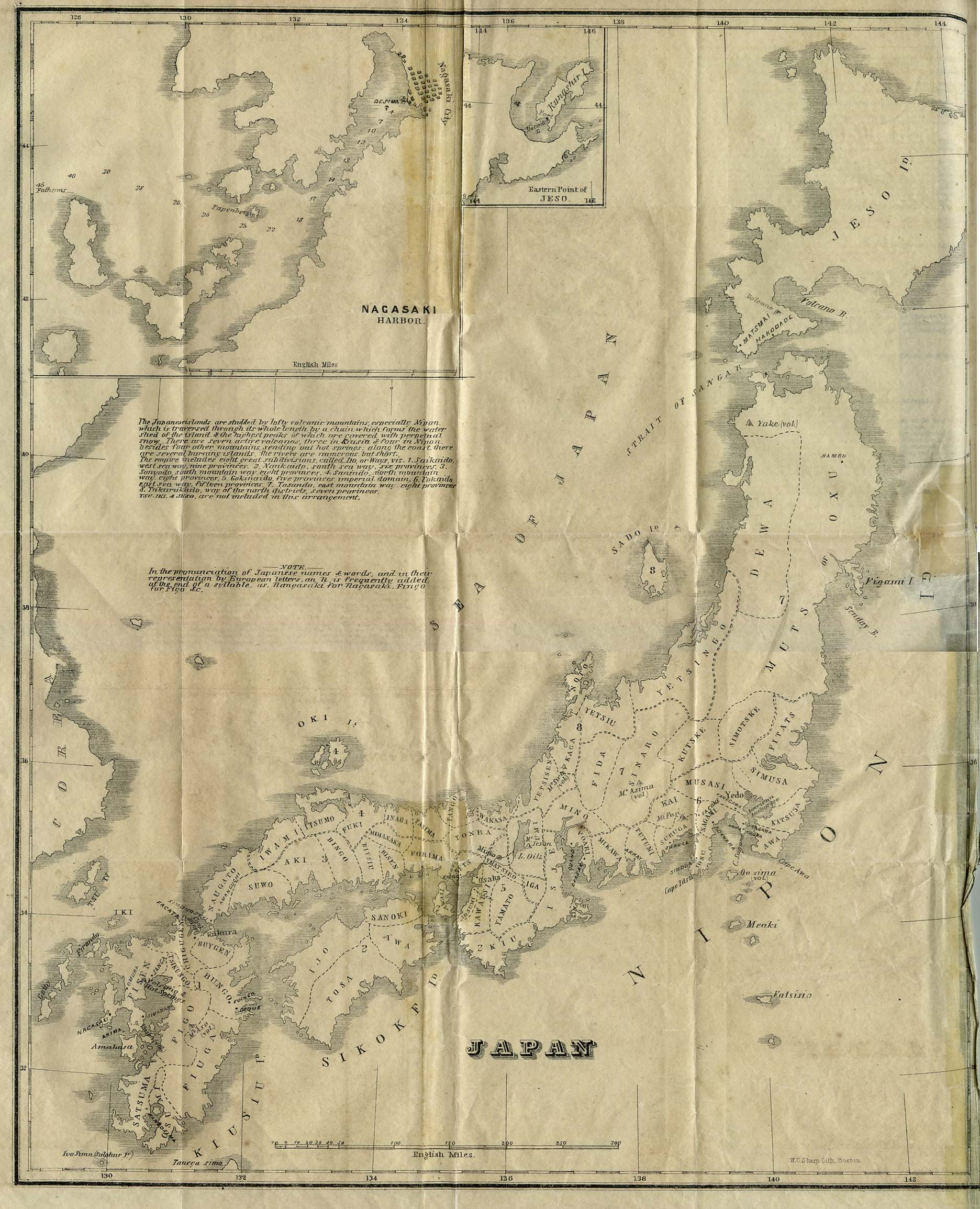
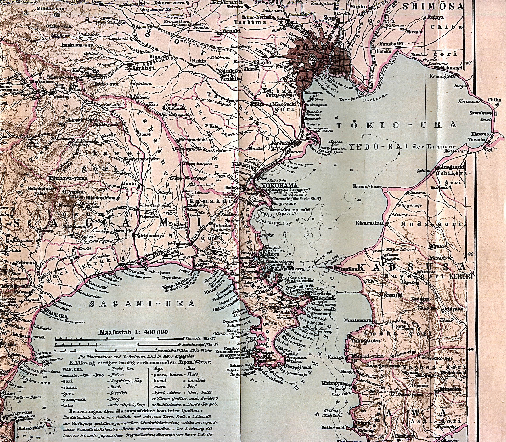
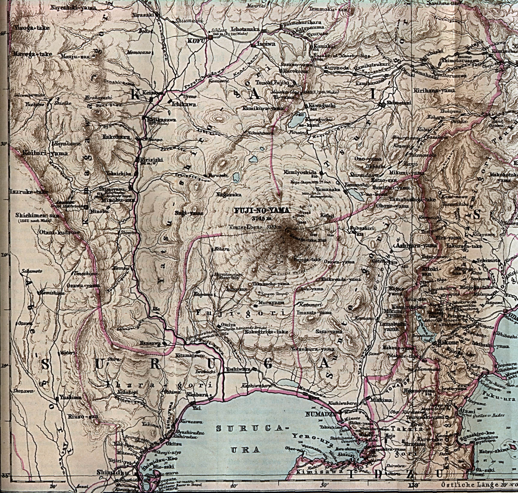
Japan
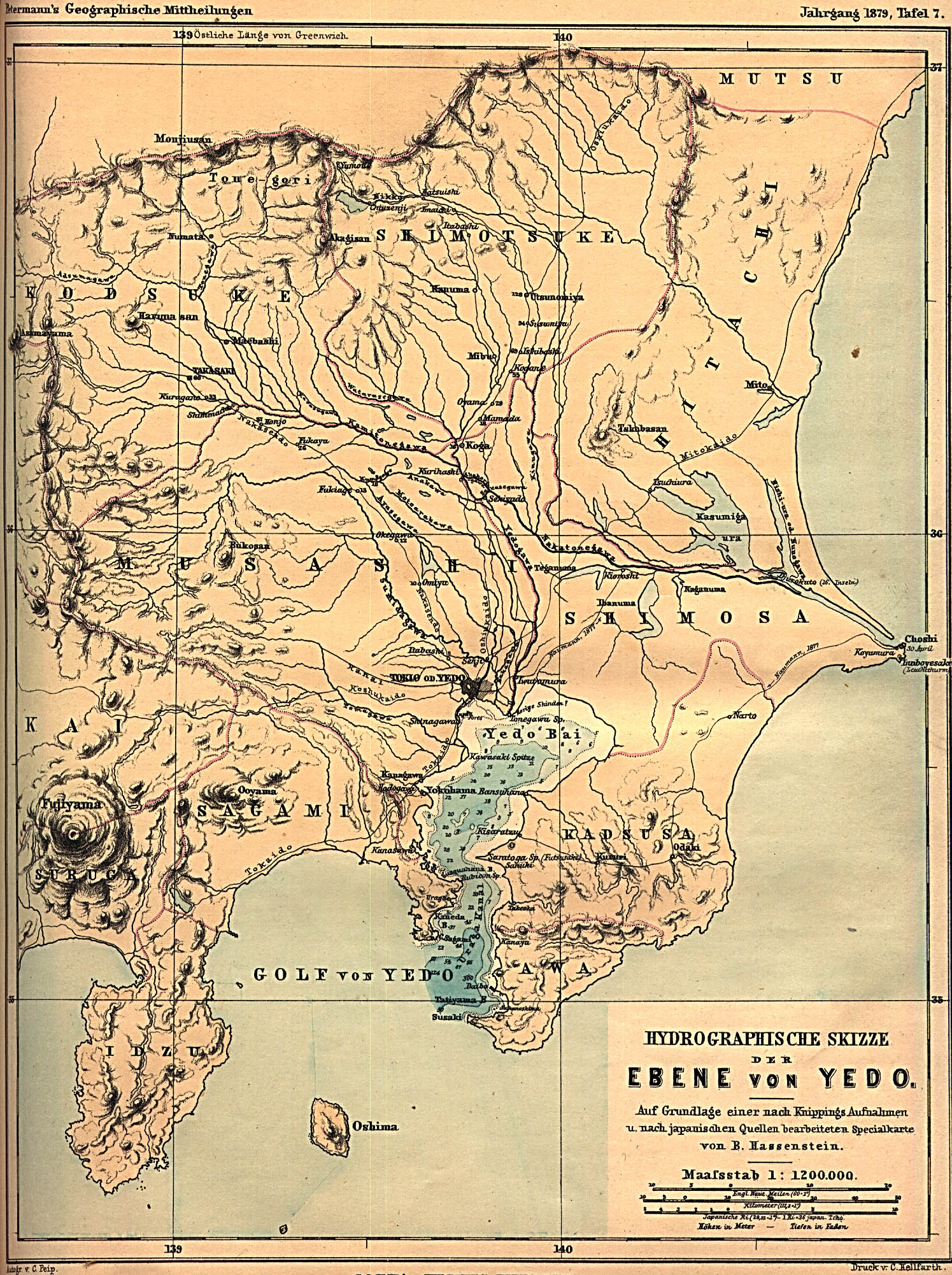
- Maps
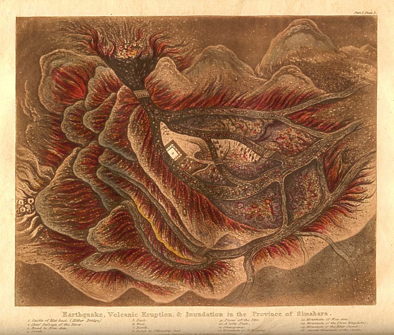
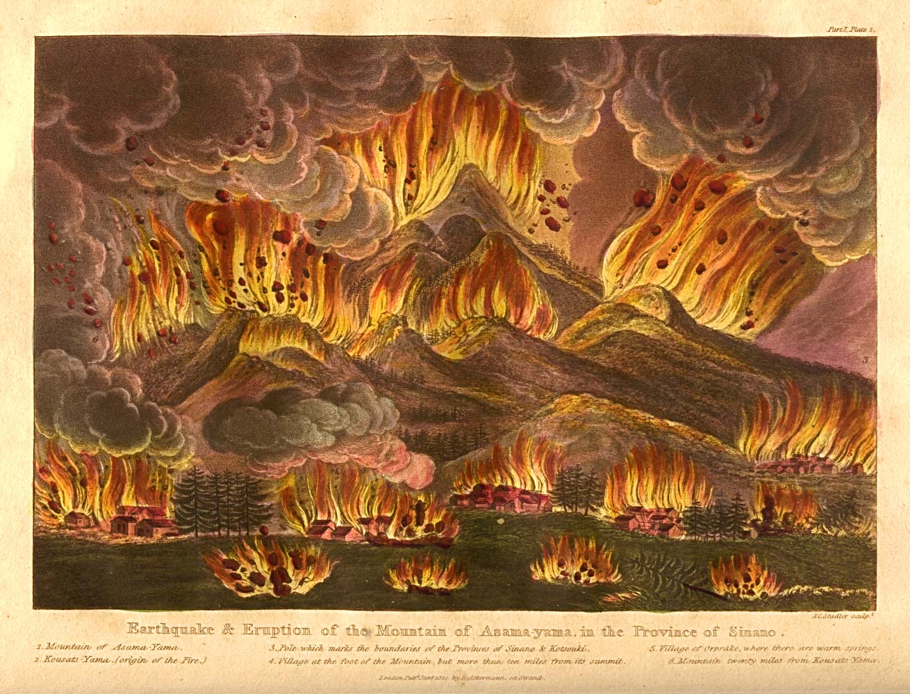
- Disasters
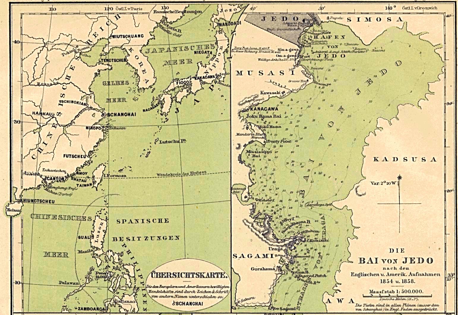
- Edo (Tokyo)
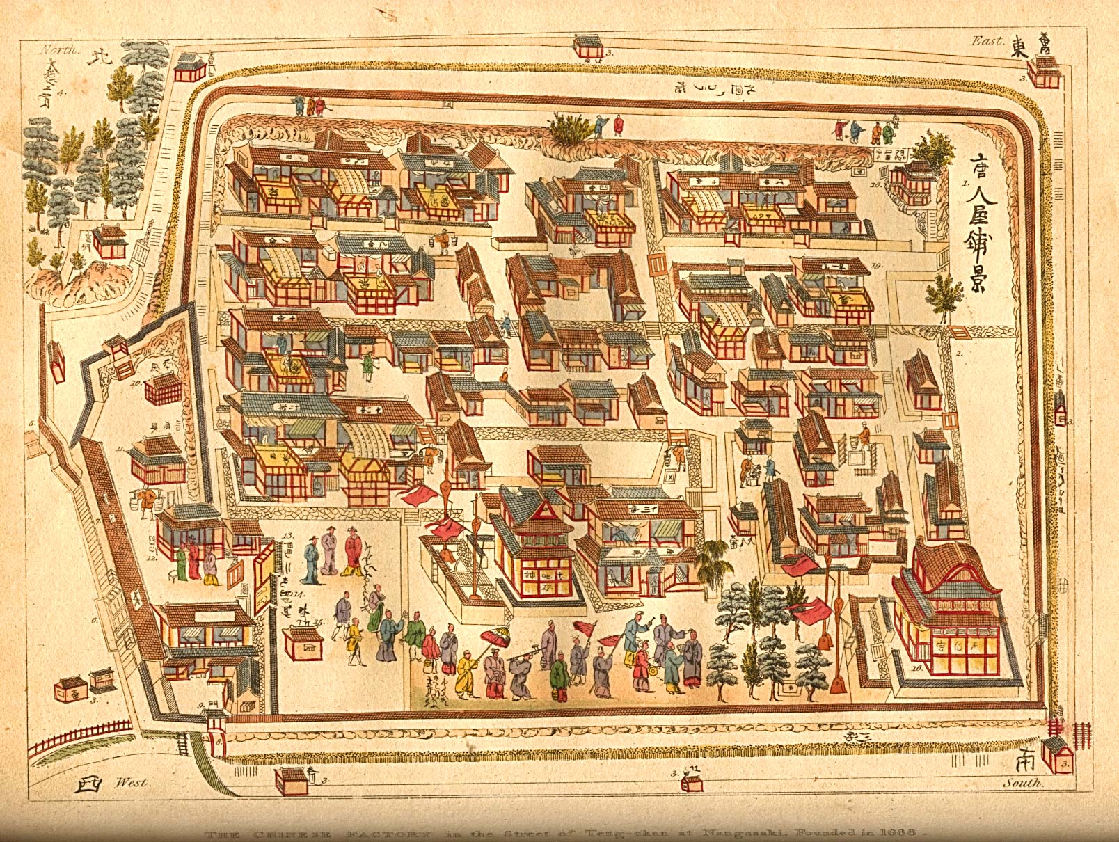
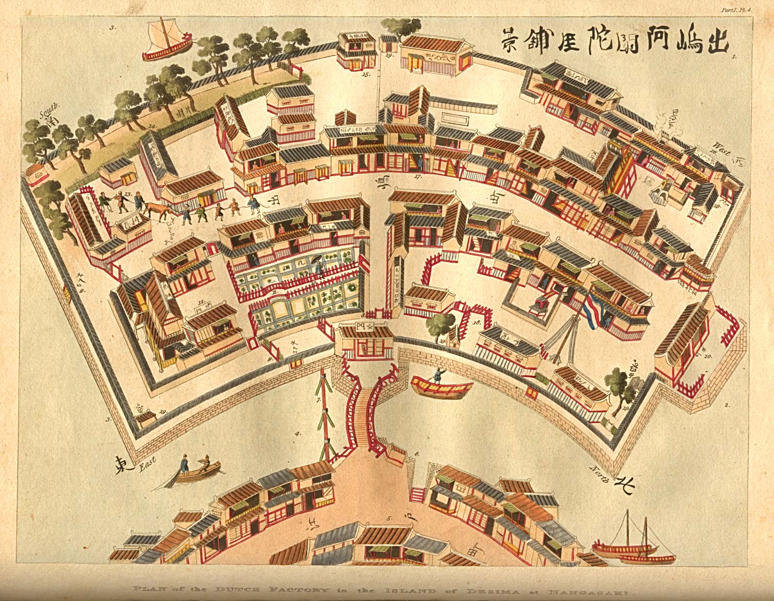
- Nagasaki
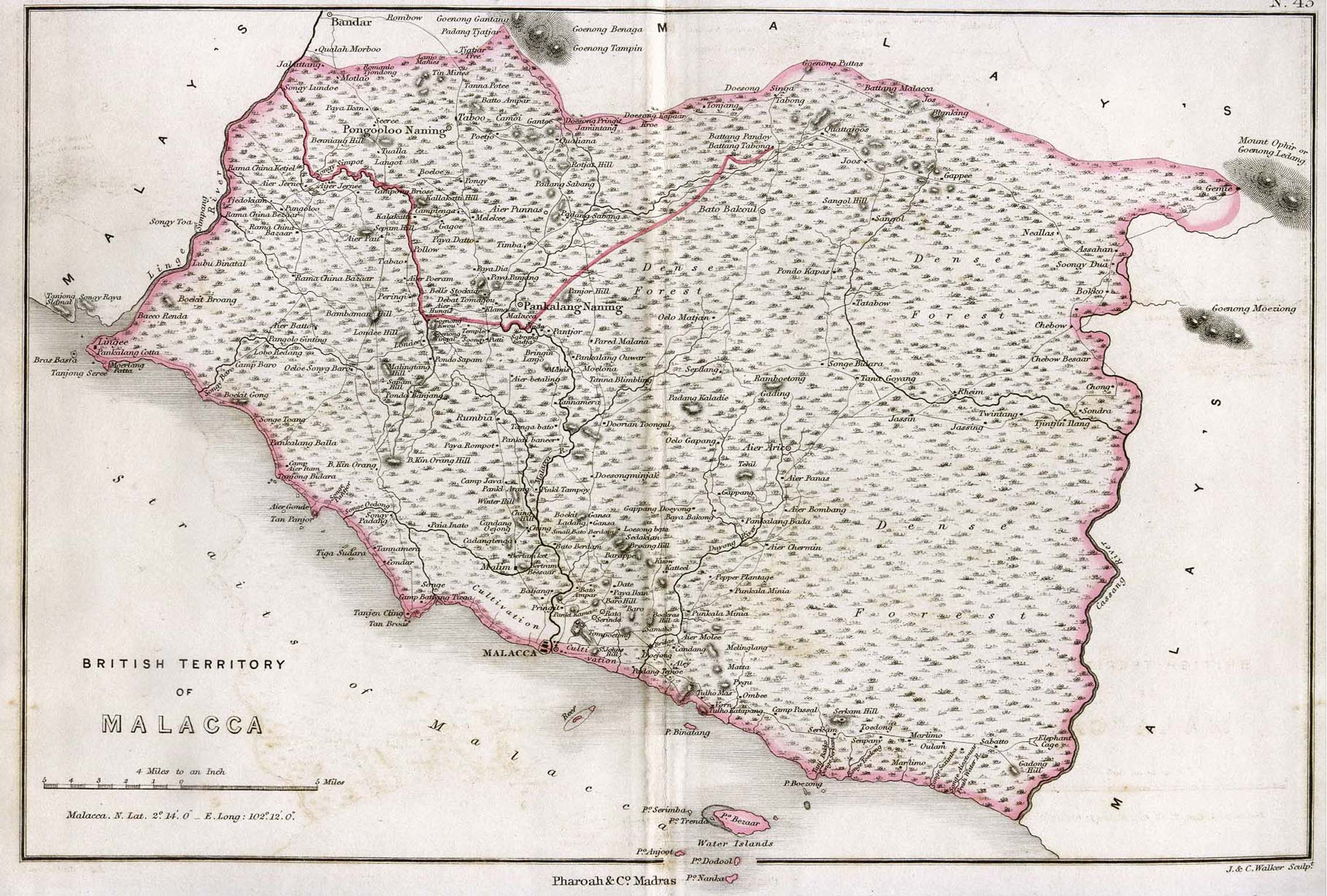
Malacca
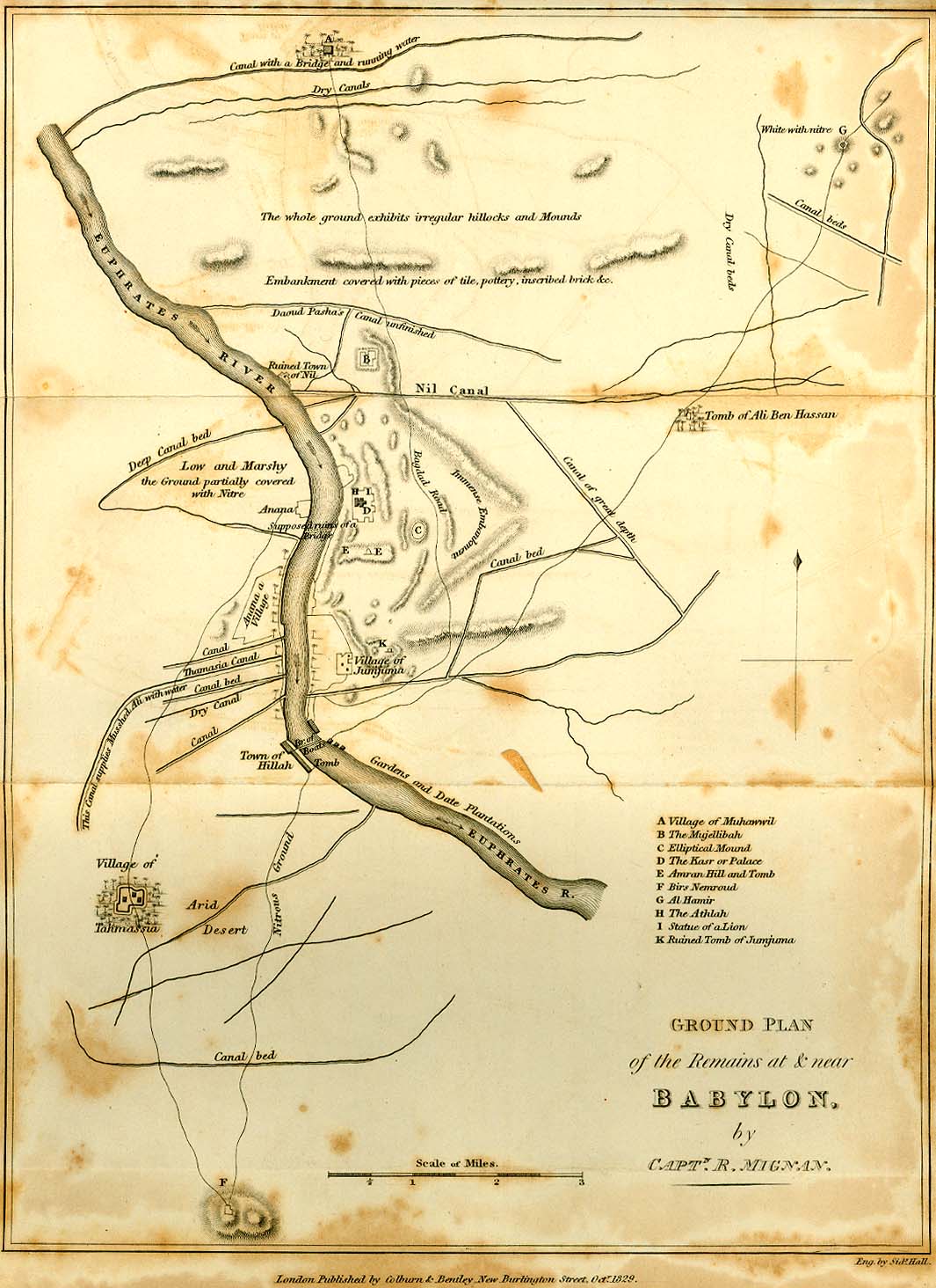
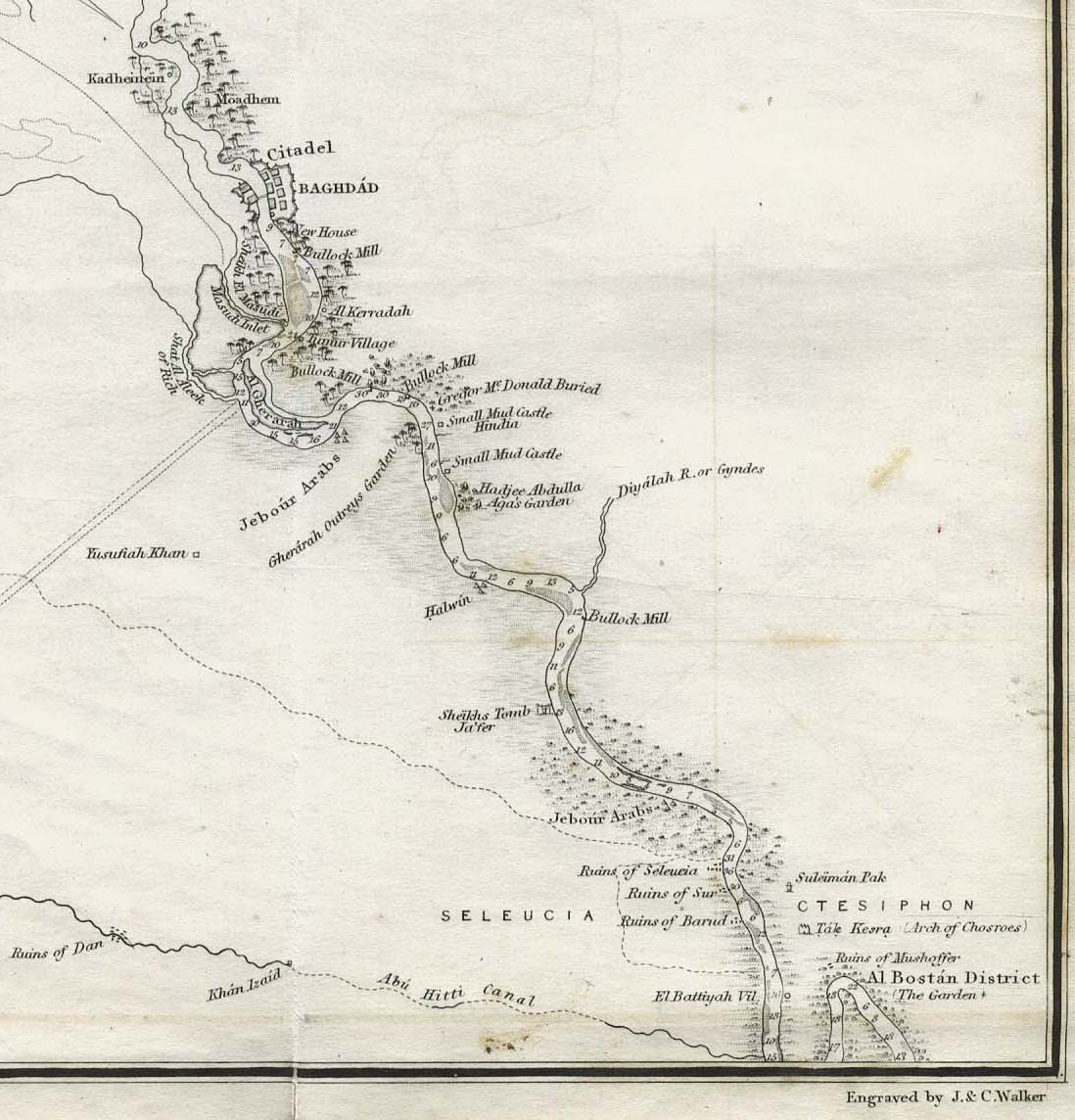
Mesopotamia
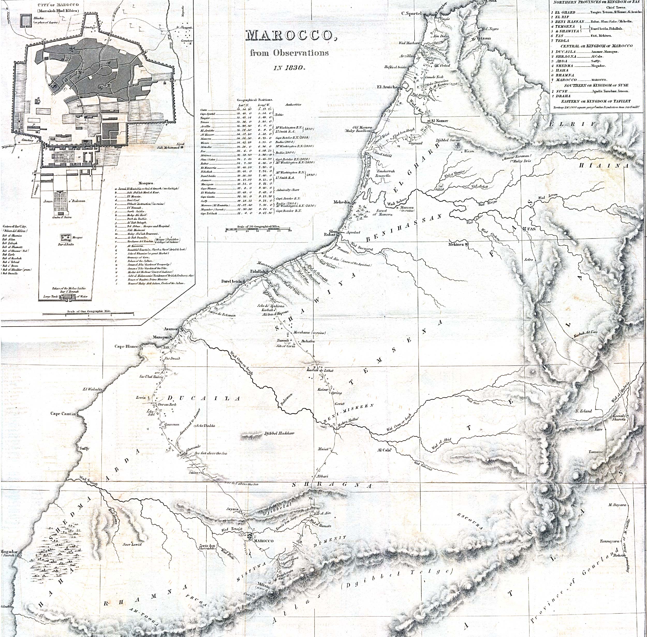
Morocco
Netherlands
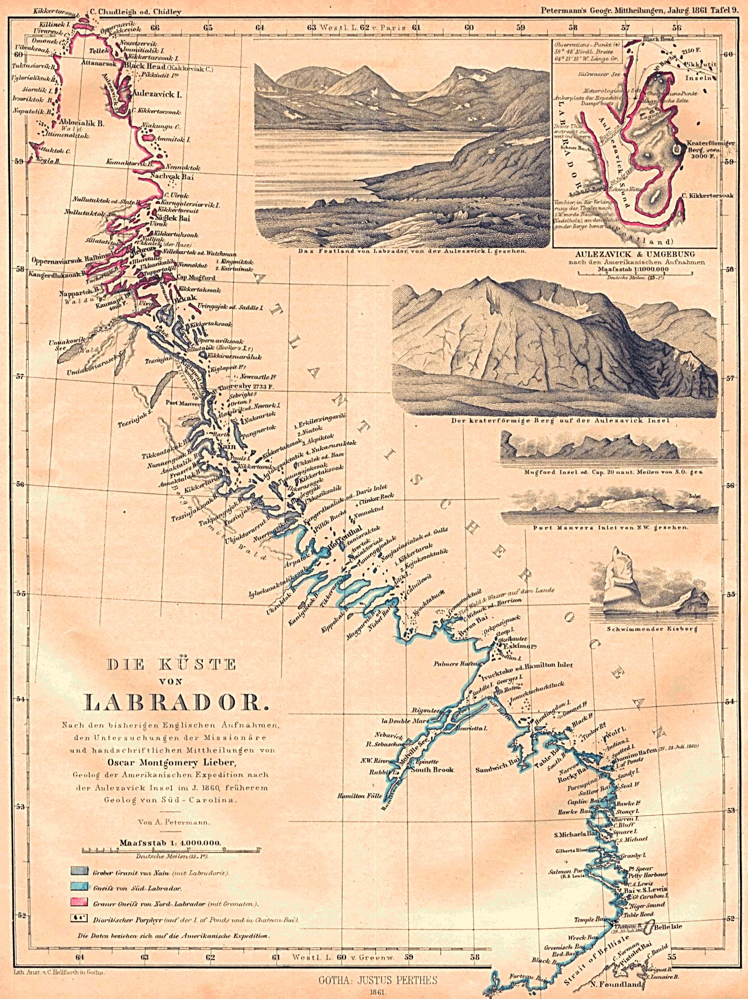
Newfoundland
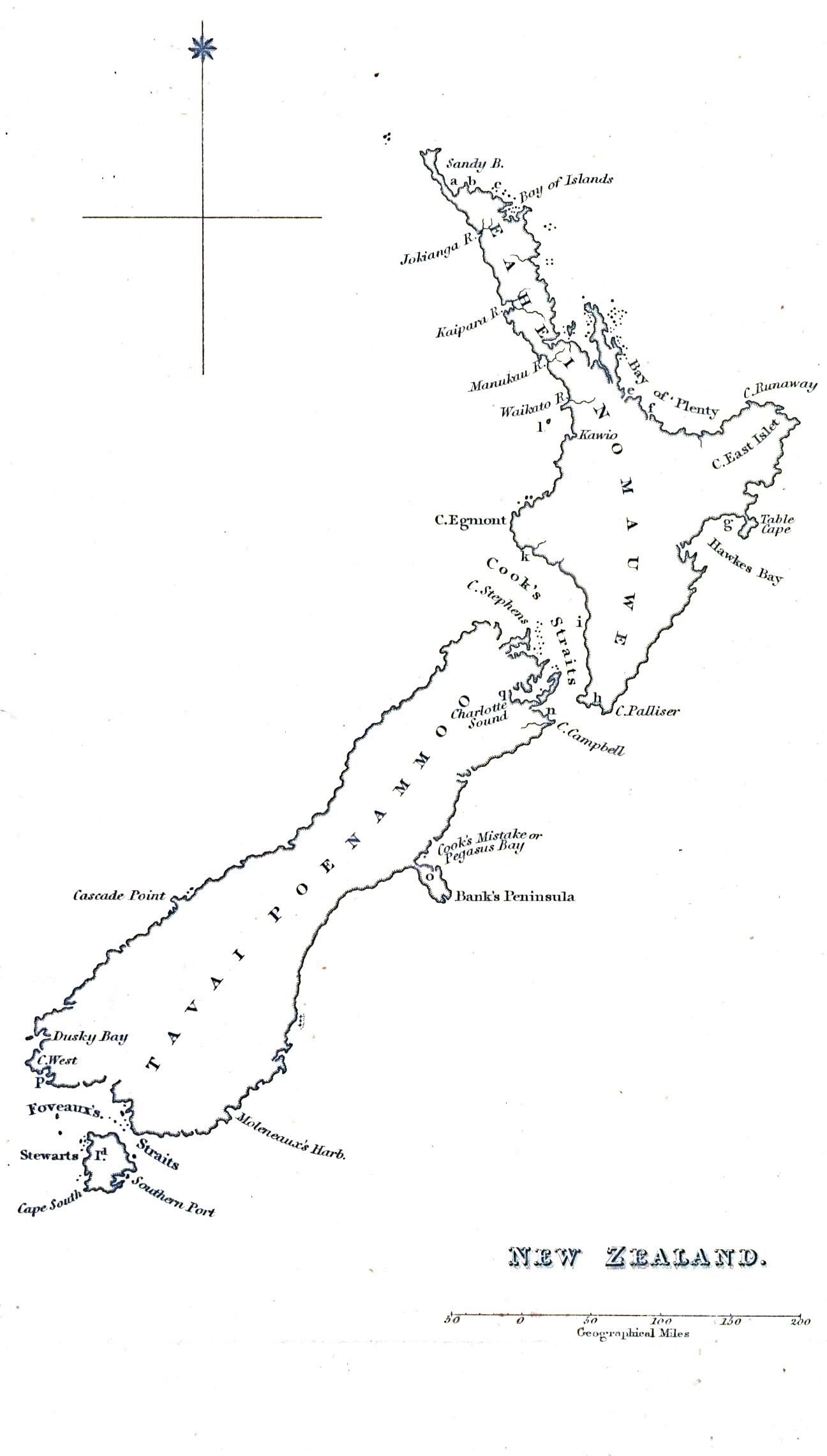
New Zealand
Norway
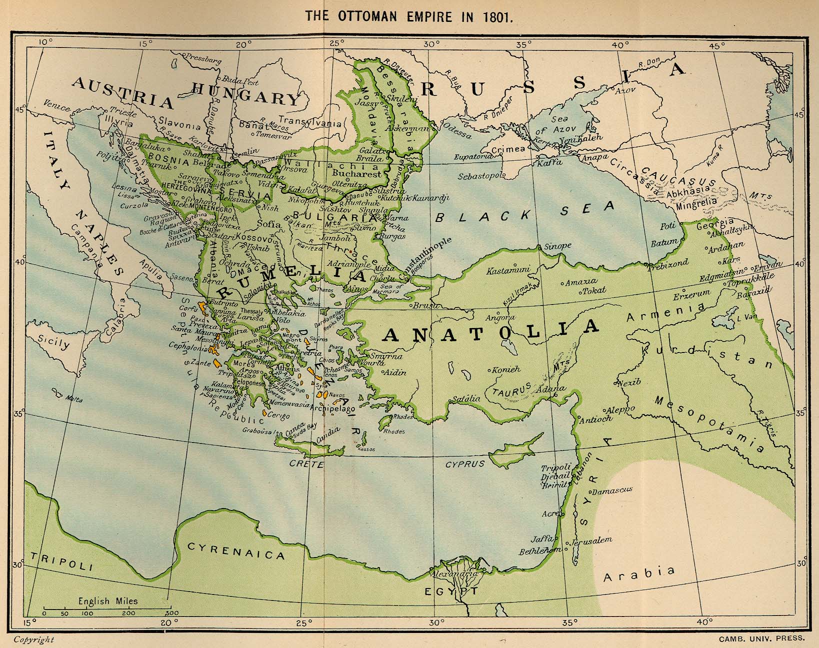
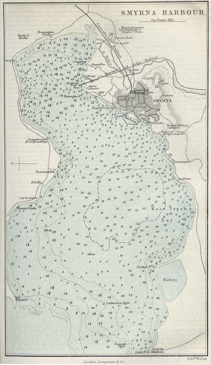
Ottoman Empire
Palestine
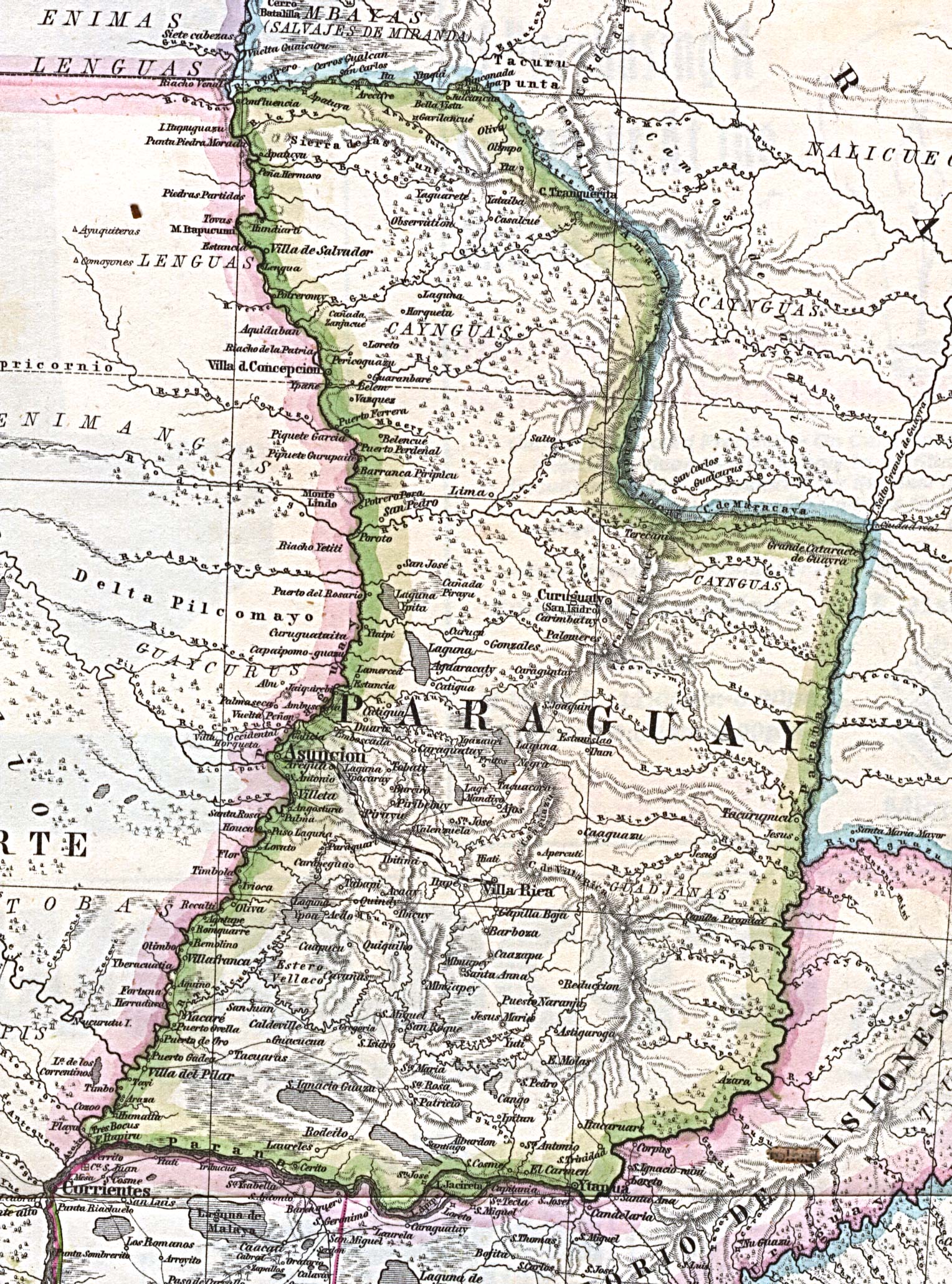
Paraguay
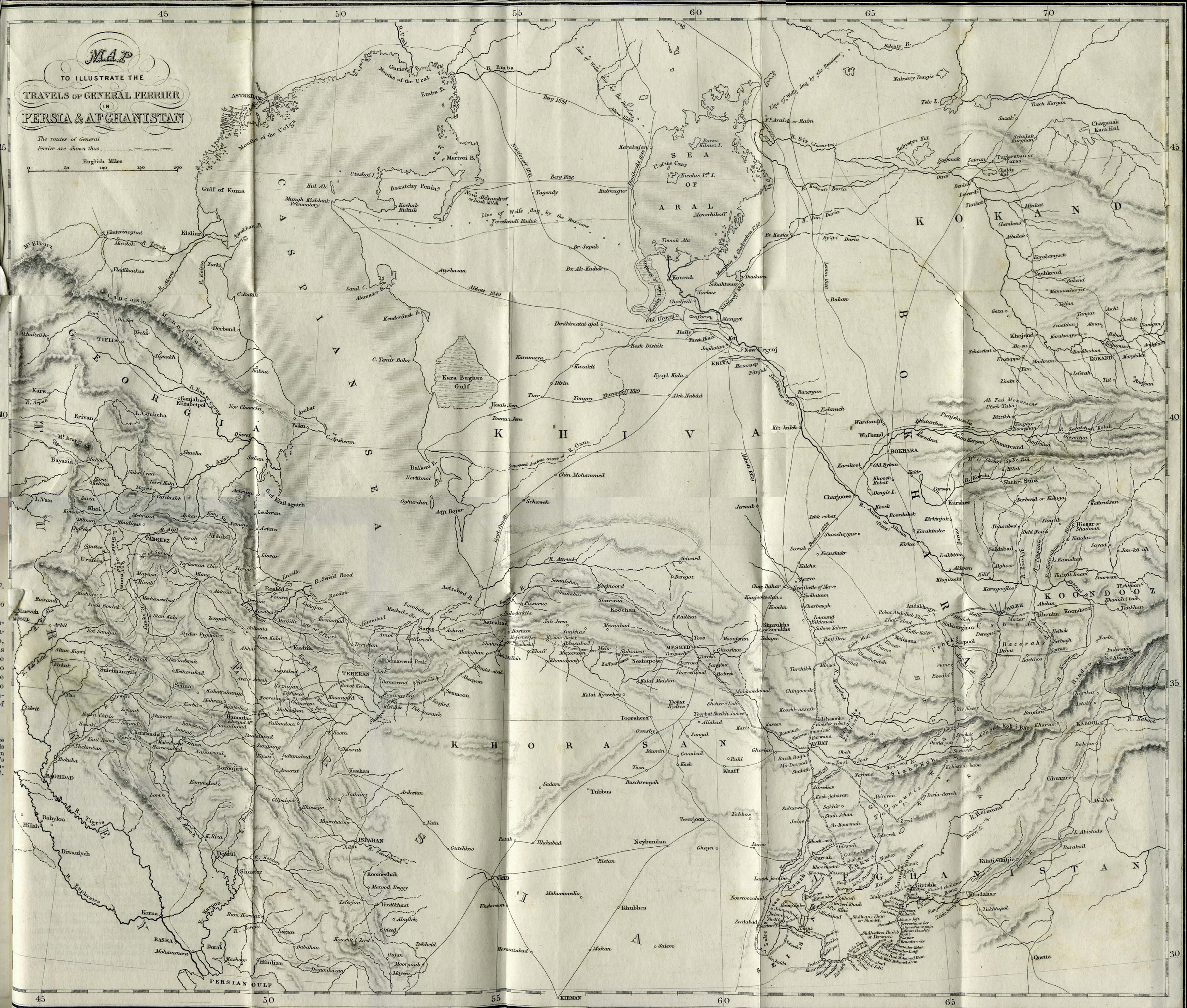
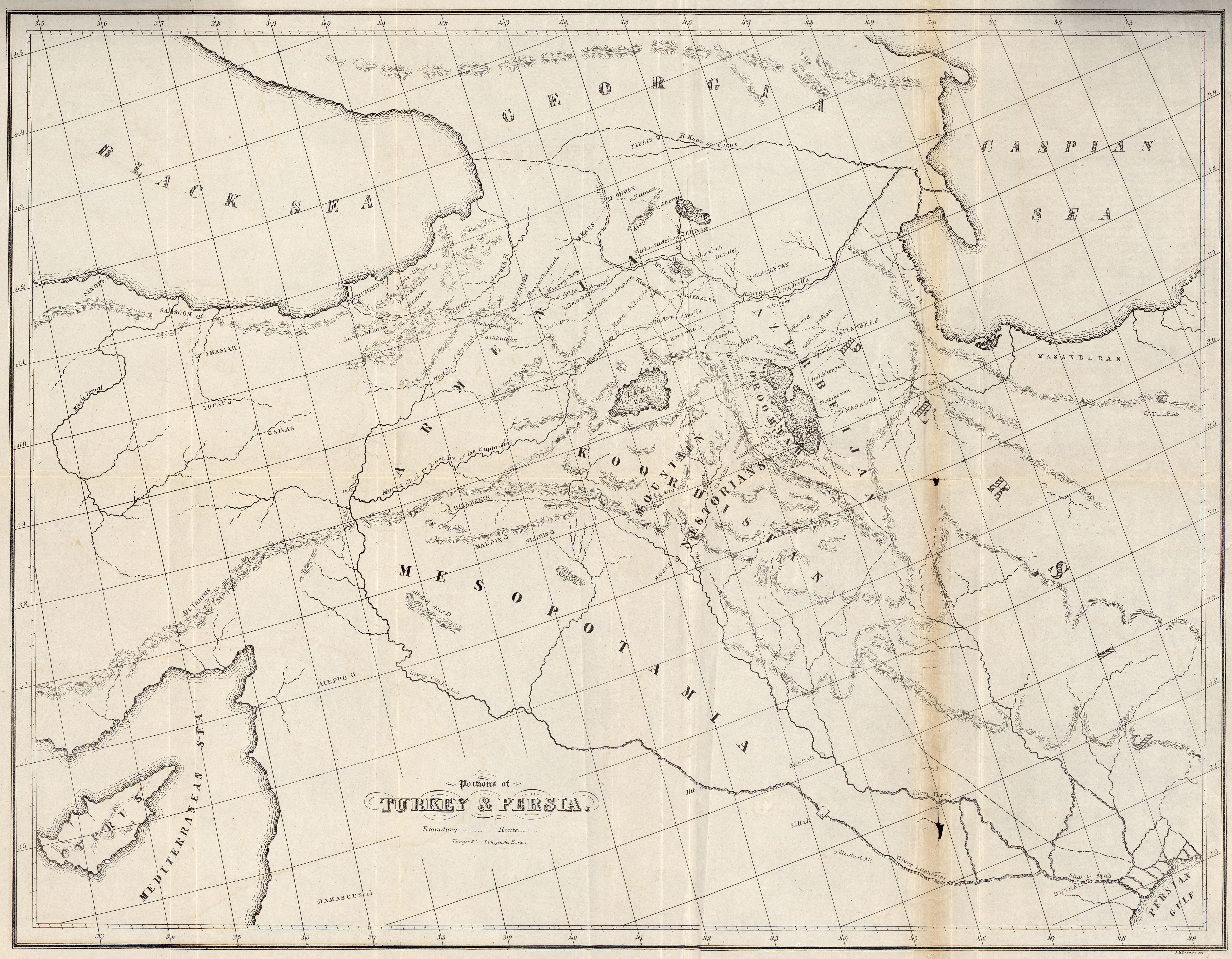
Persia
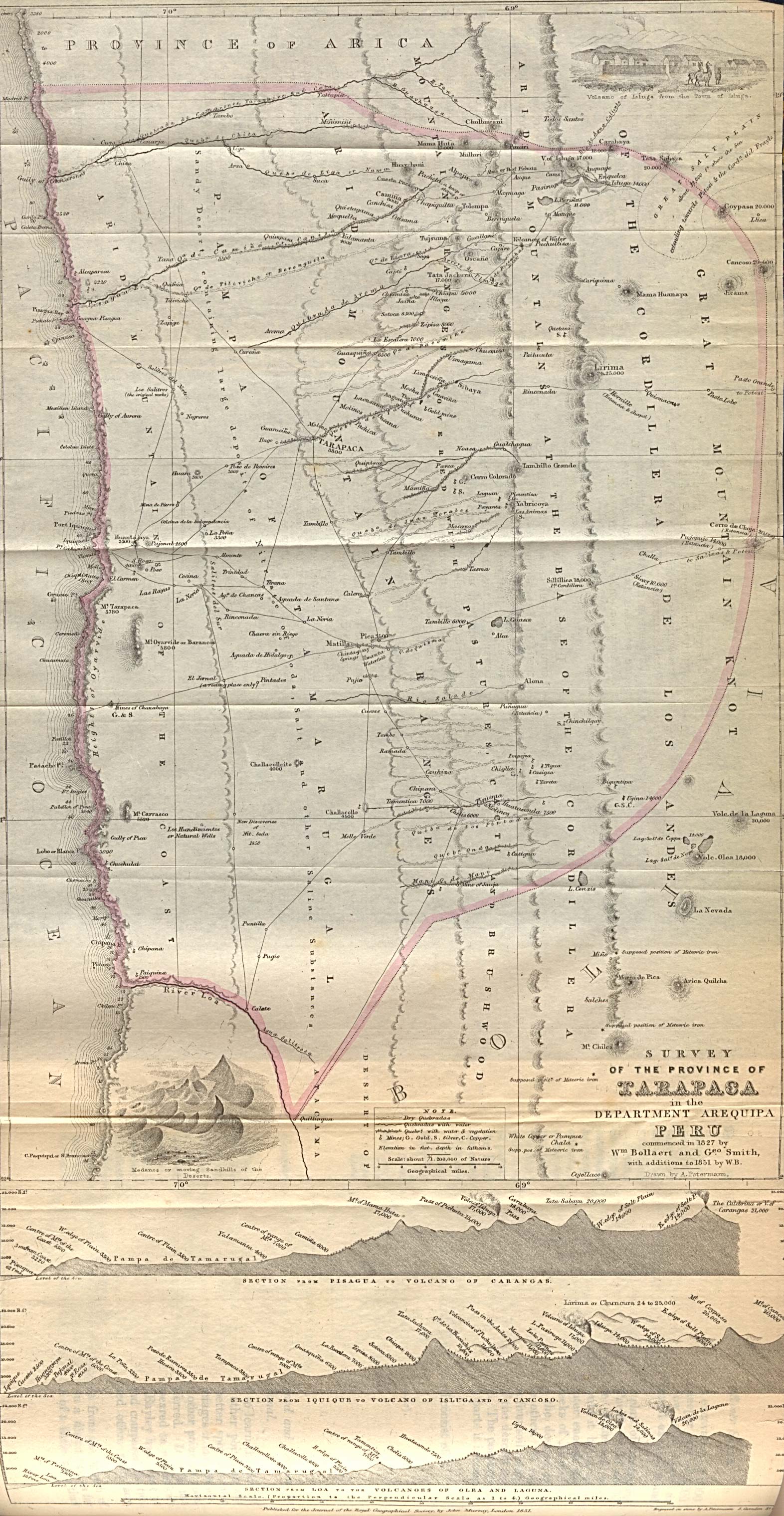
Peru
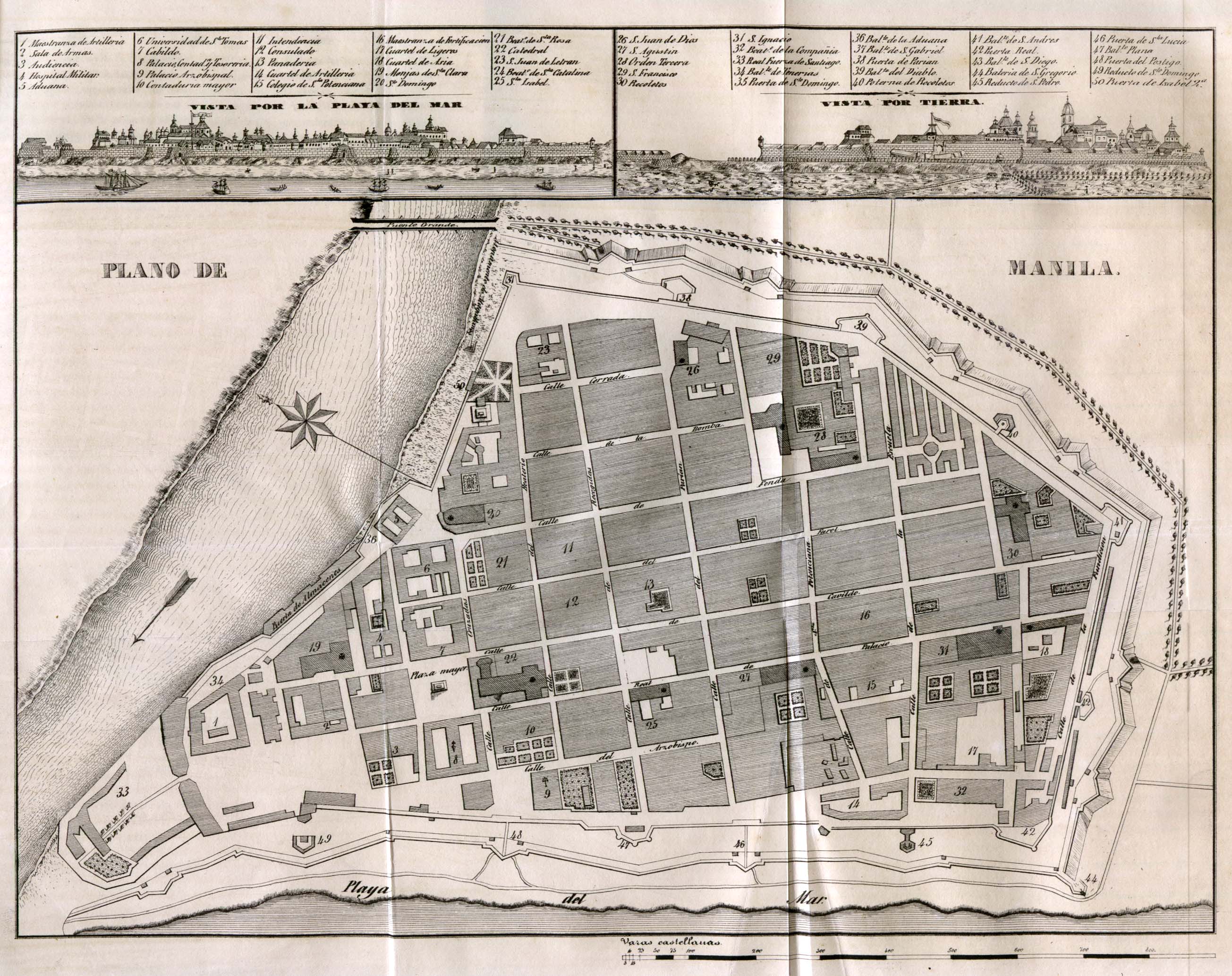
Philippines
American Polynesia
Portugal
Romania
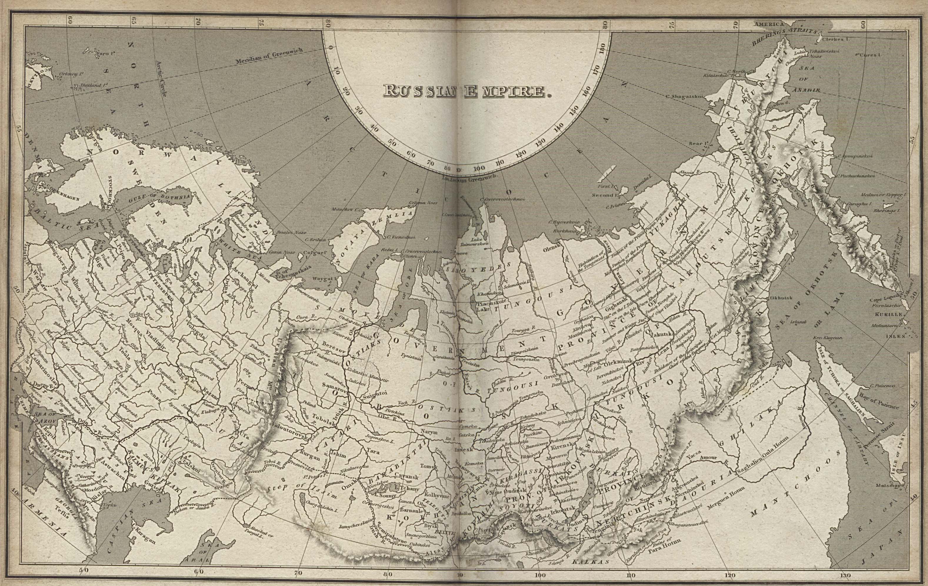
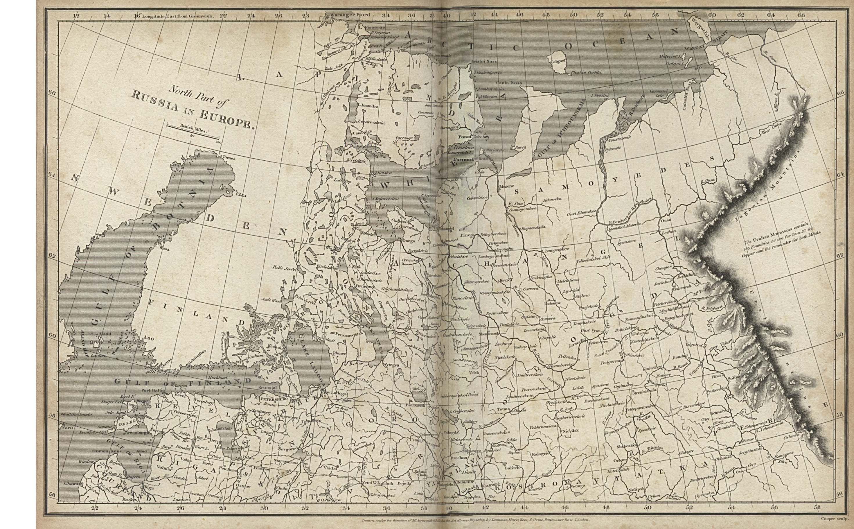
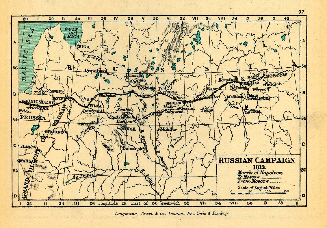
Russian Empire
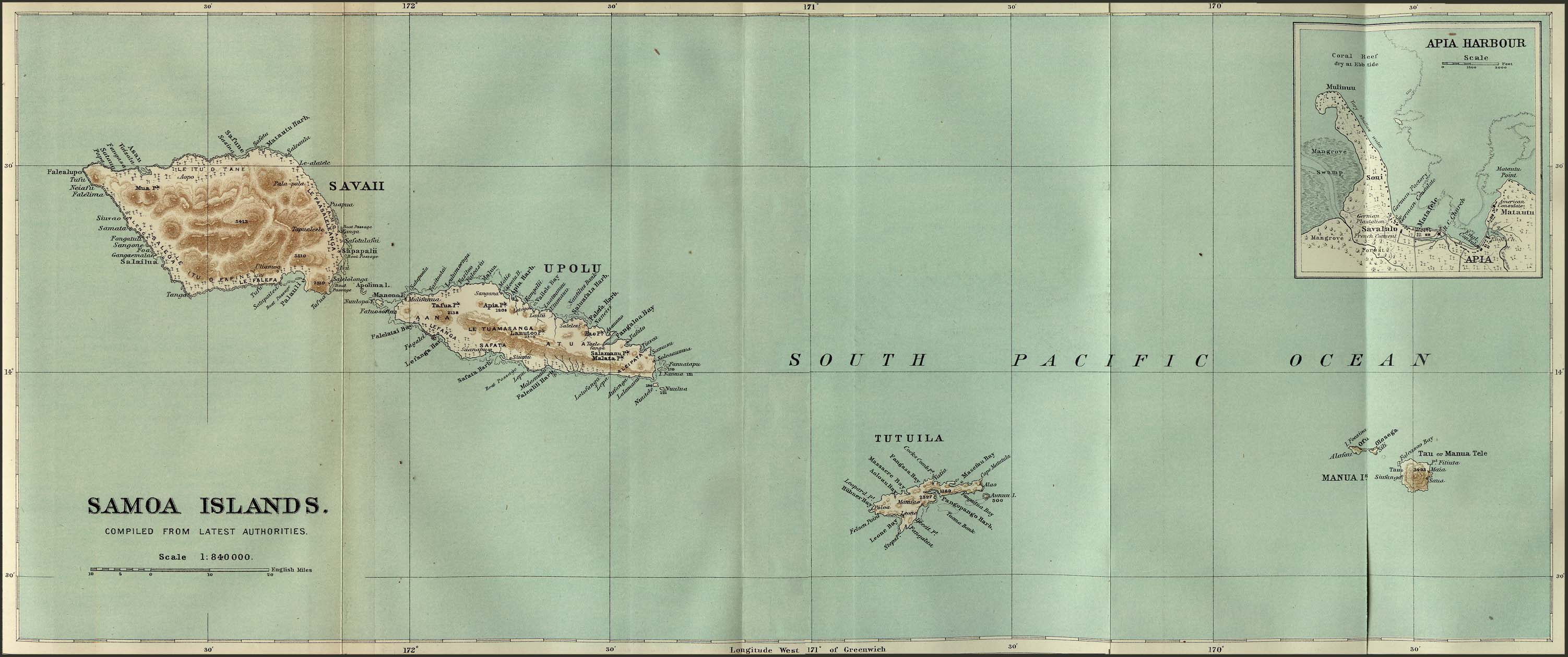
Samoa
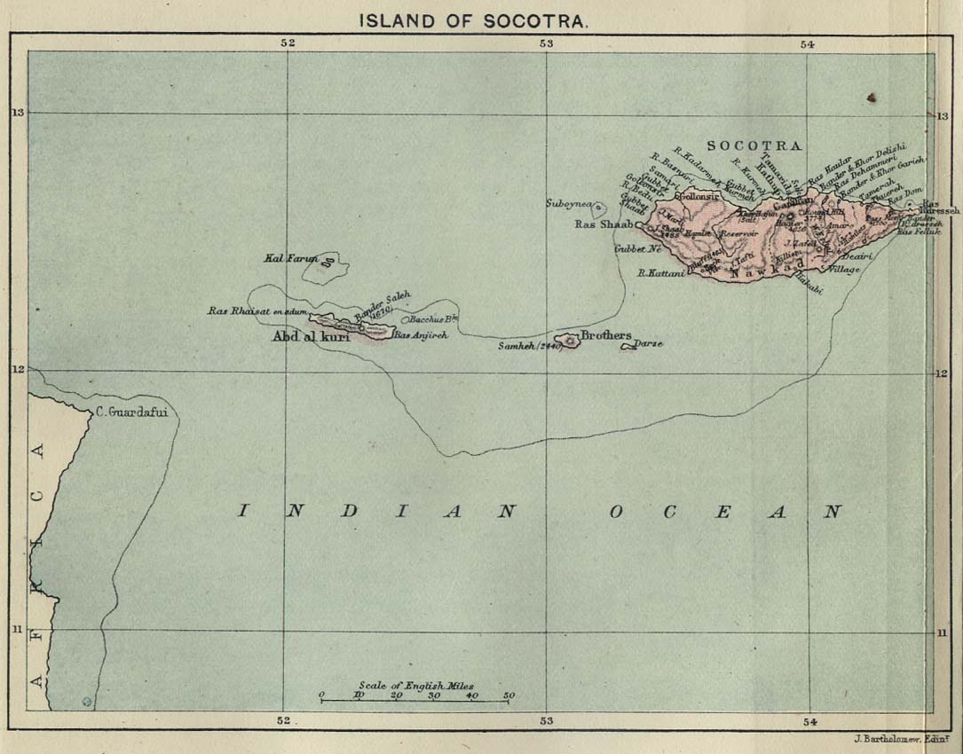
Socotra
Somaliland
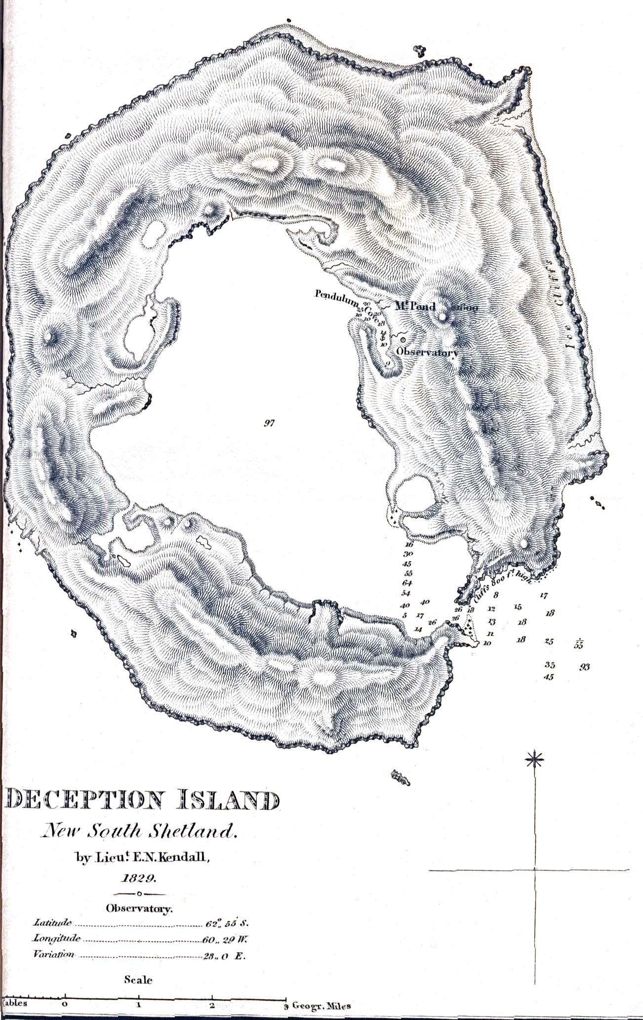
South Shetland Islands
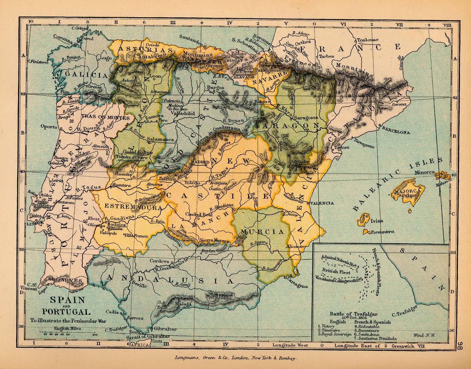
Spain
Switzerland
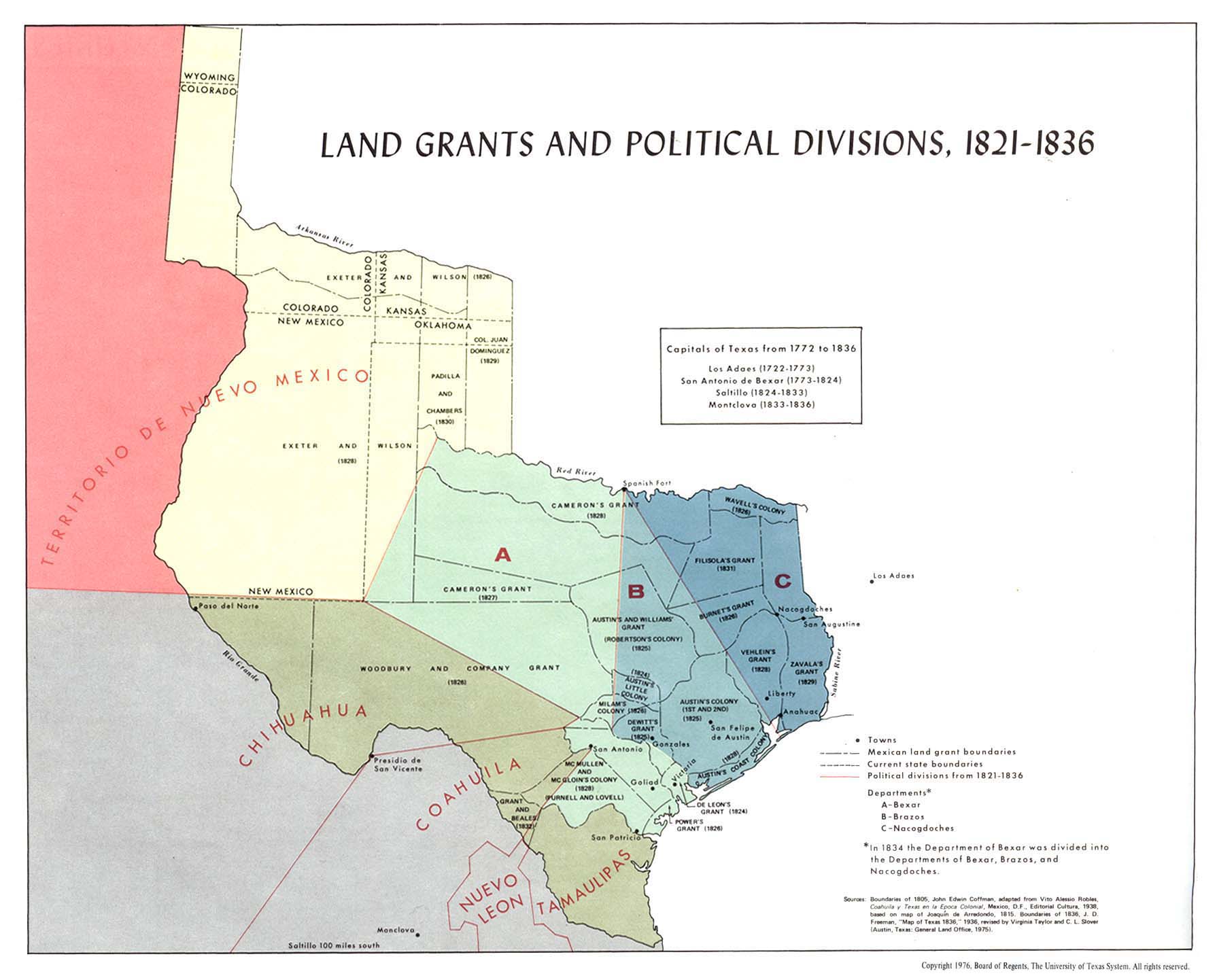
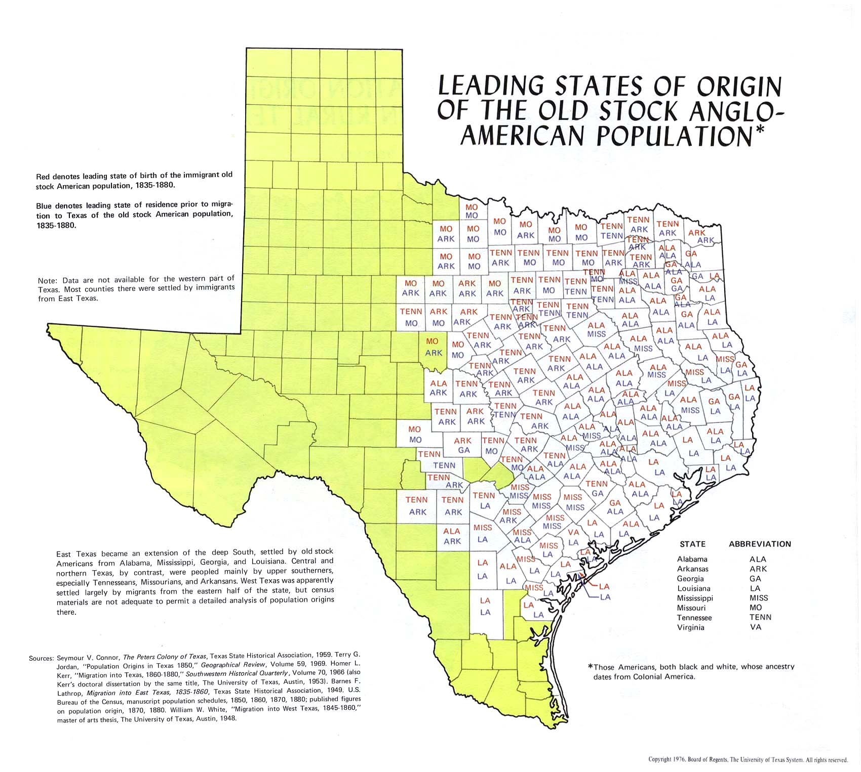
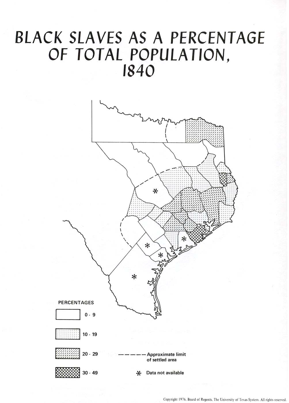
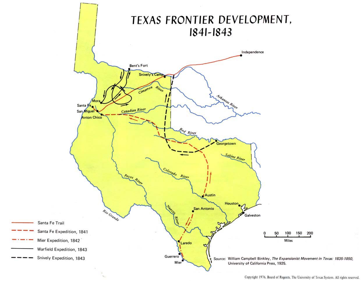
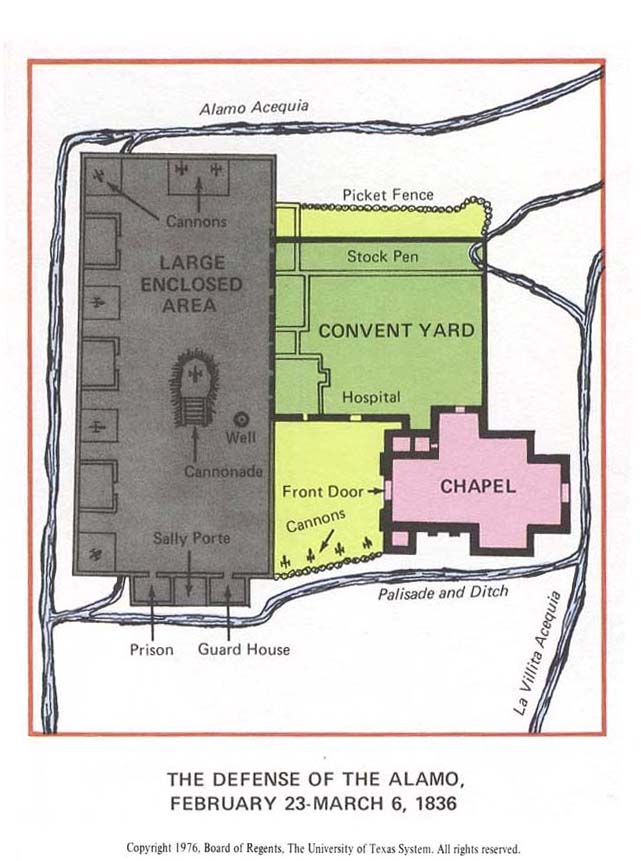
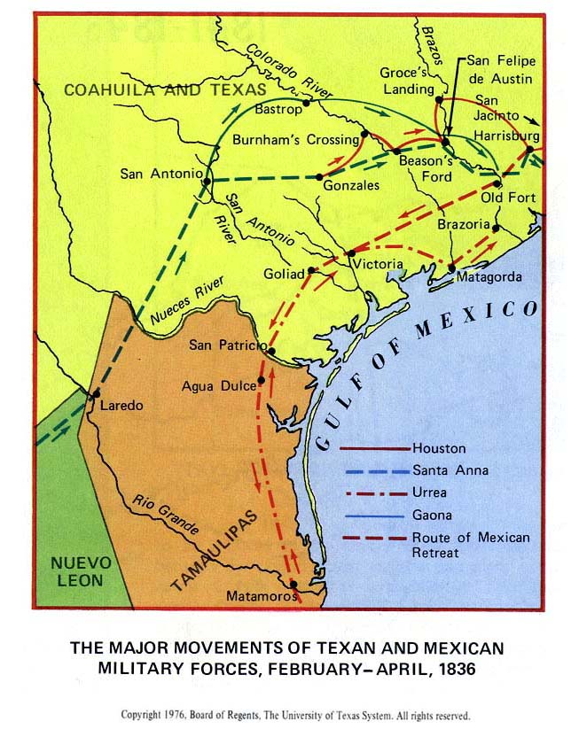
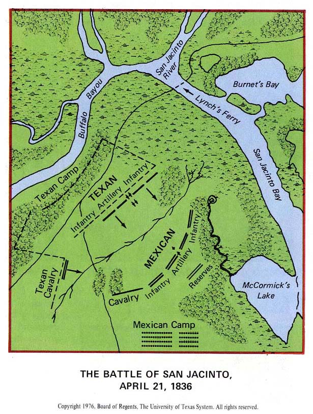
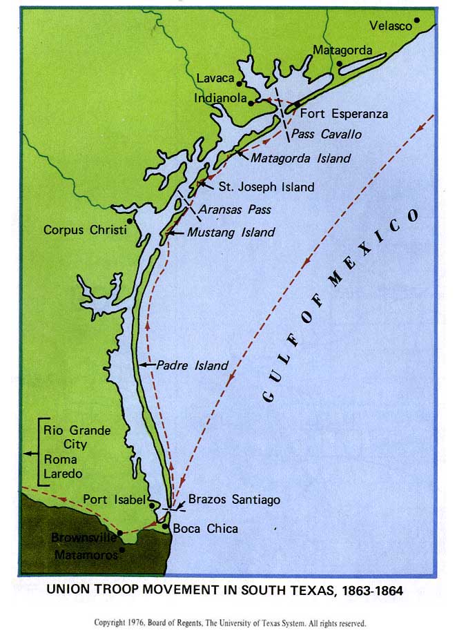
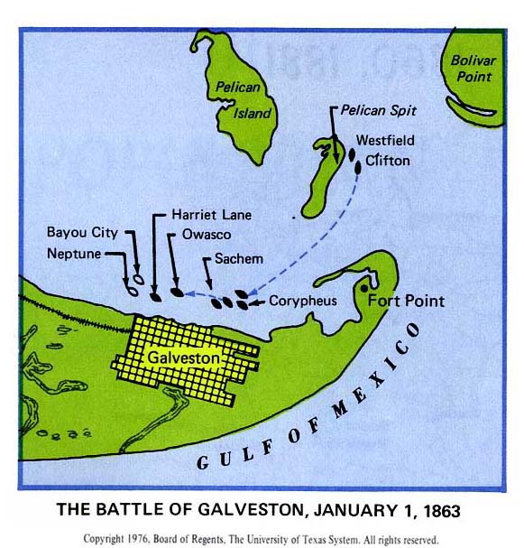
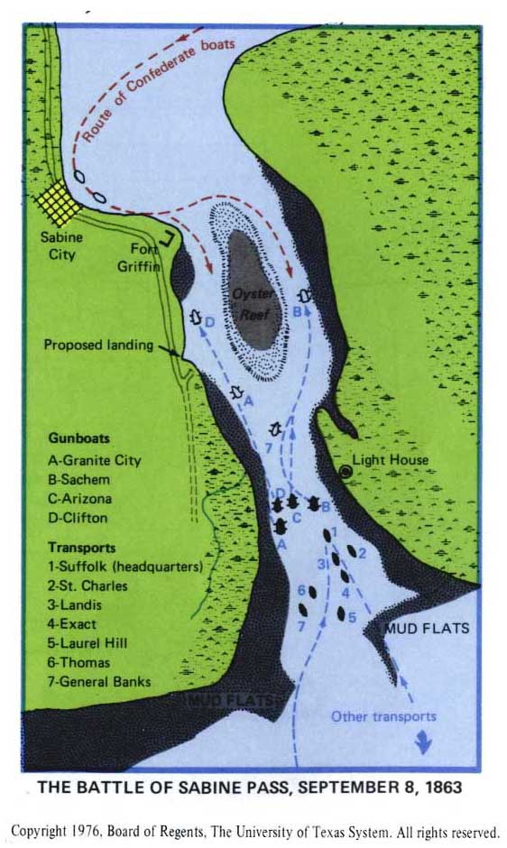
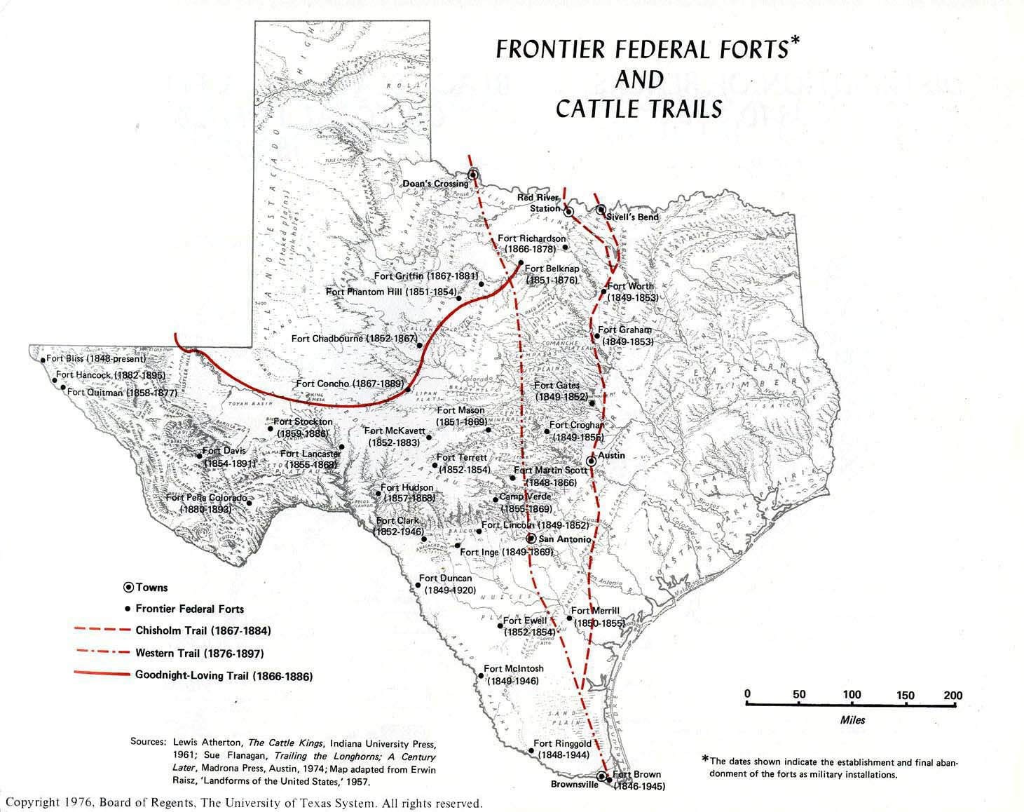
Texas
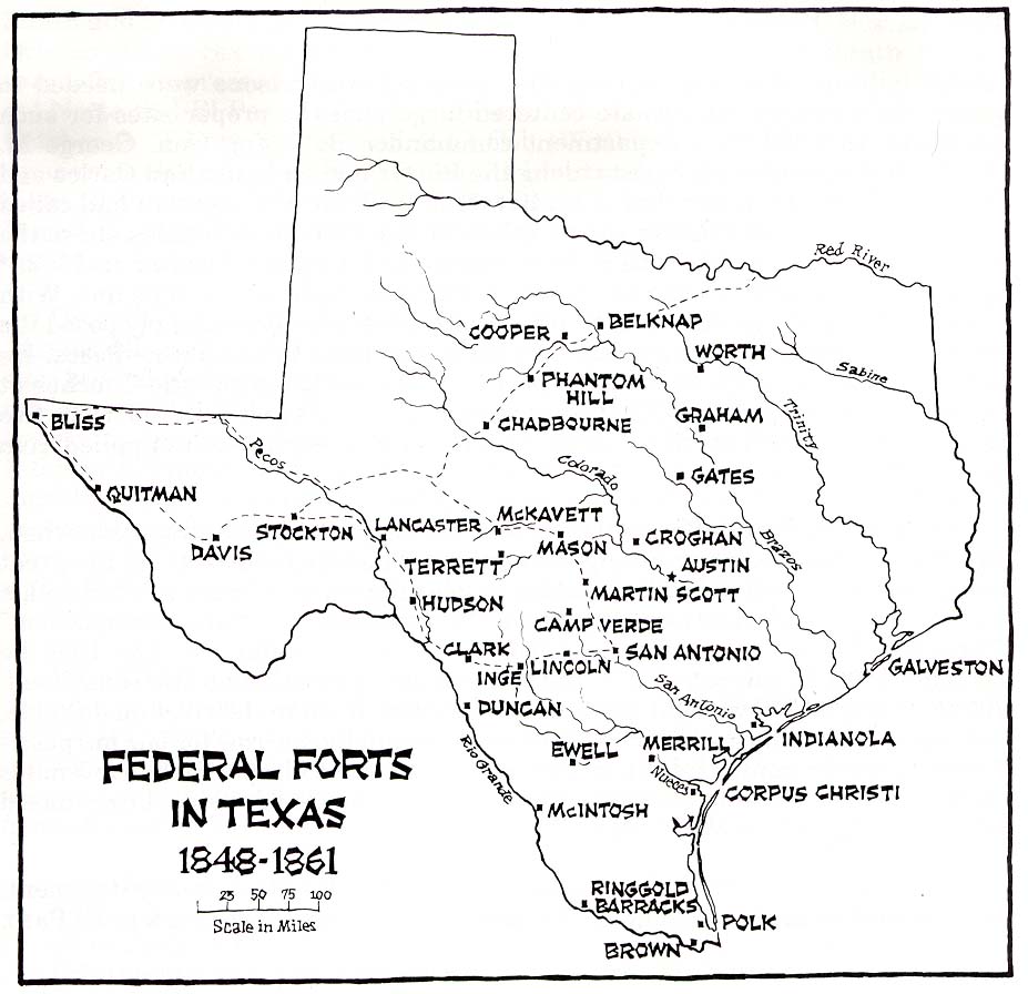
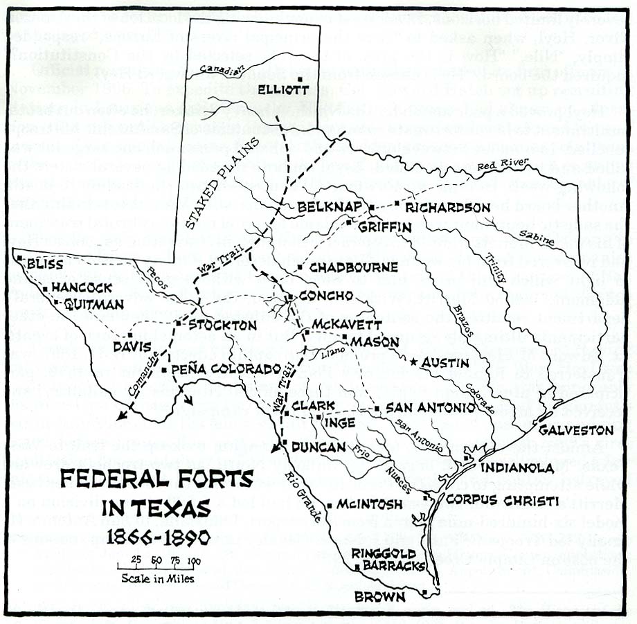
- Maps
- Texan Revolution, 1836
- Austin
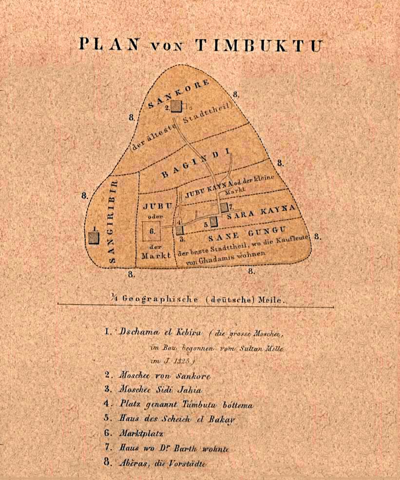
Timbuktu
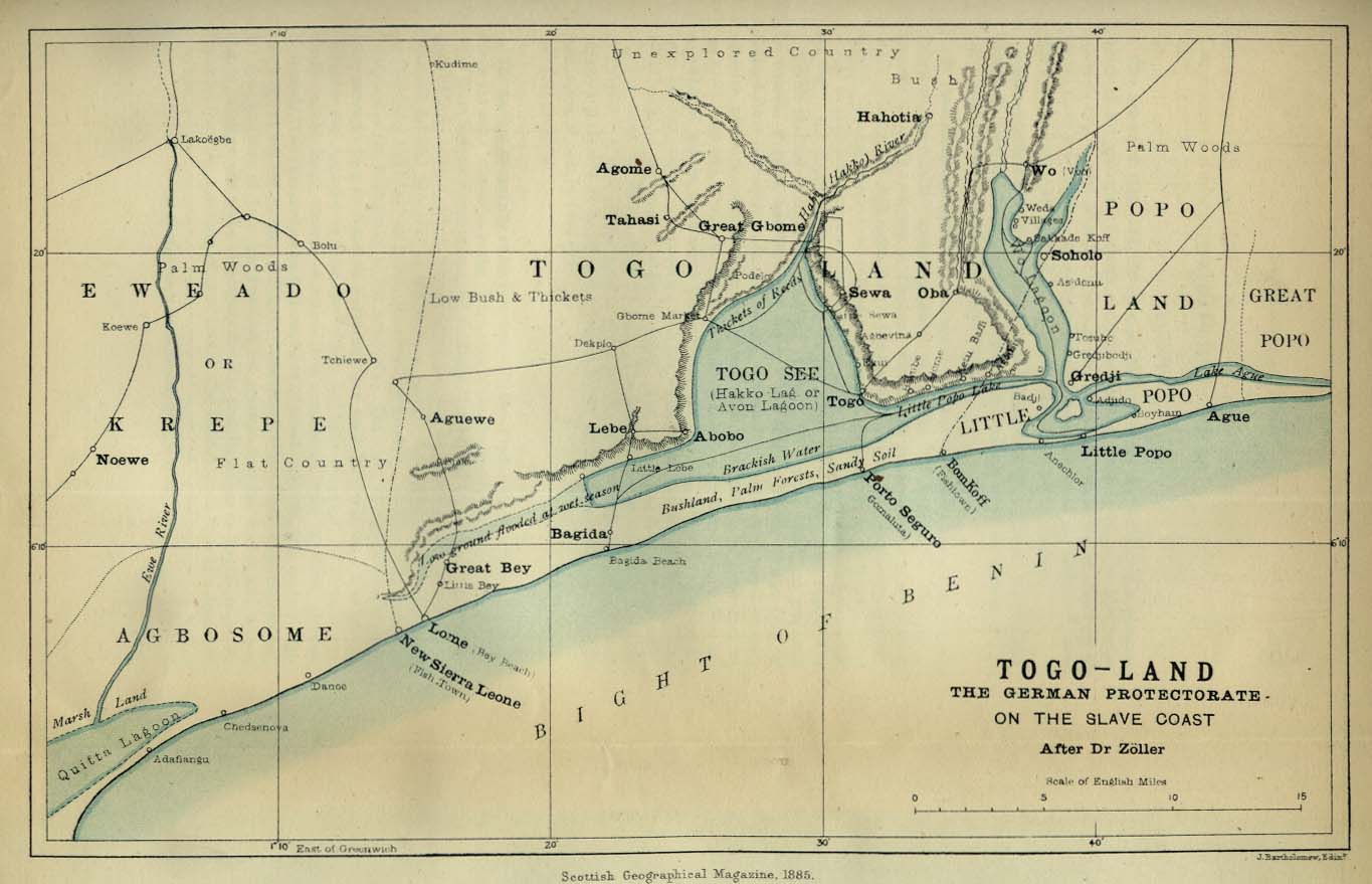
Togoland
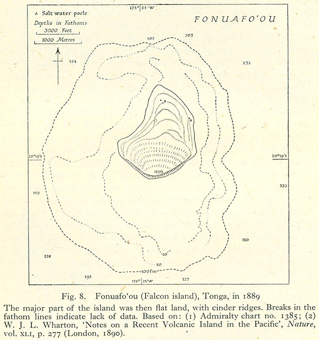
Tonga
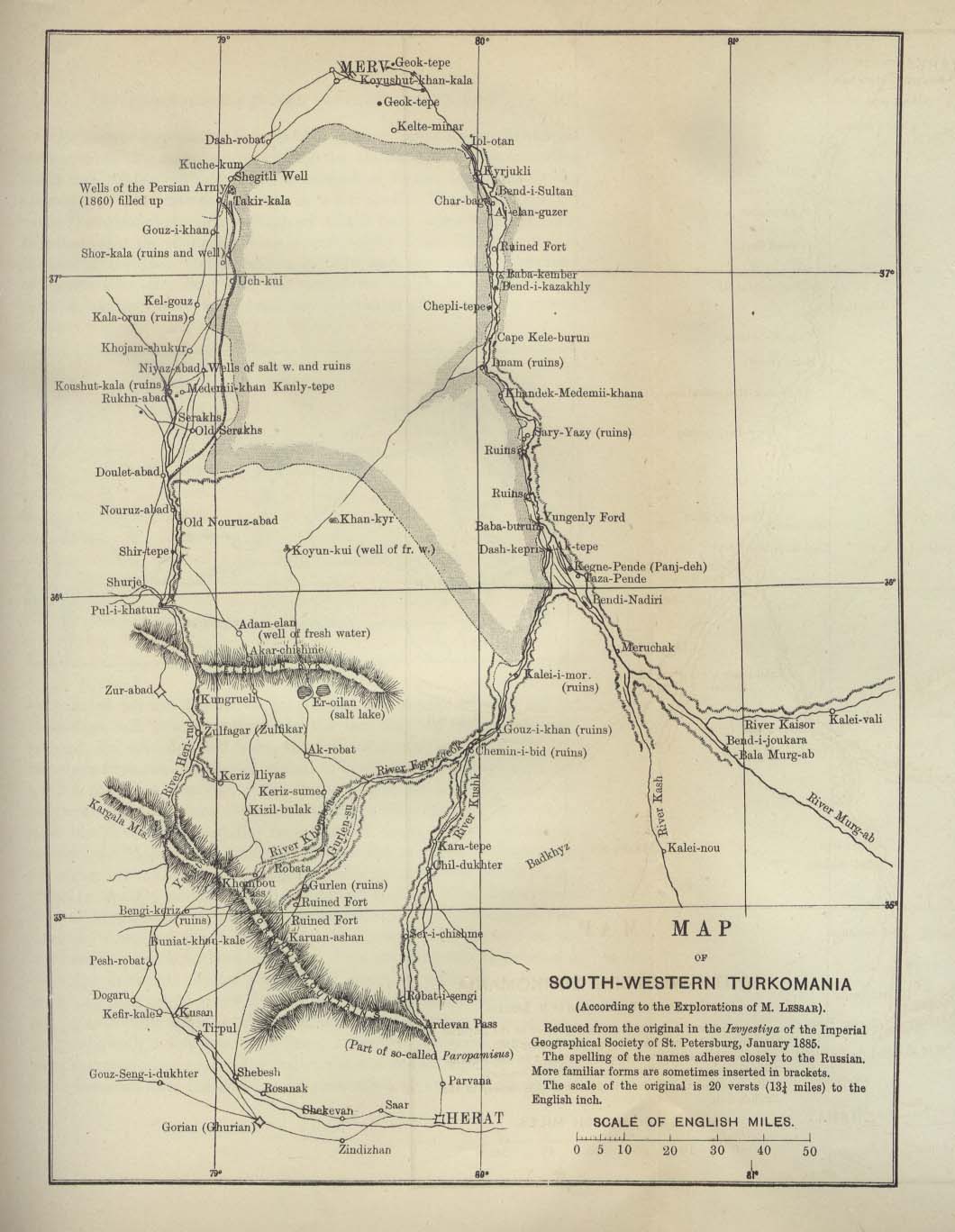
Turkmania (Turkmenistan)
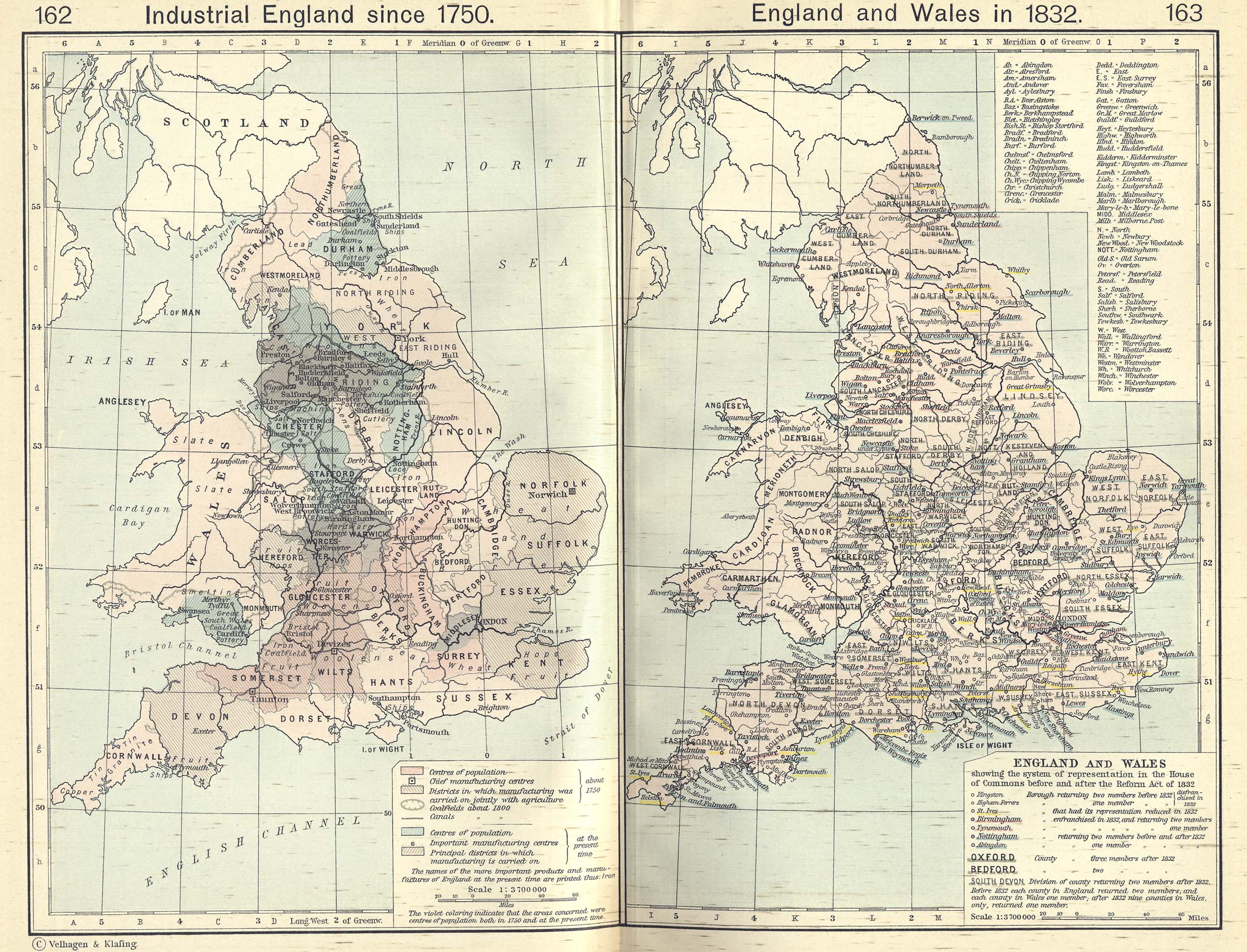
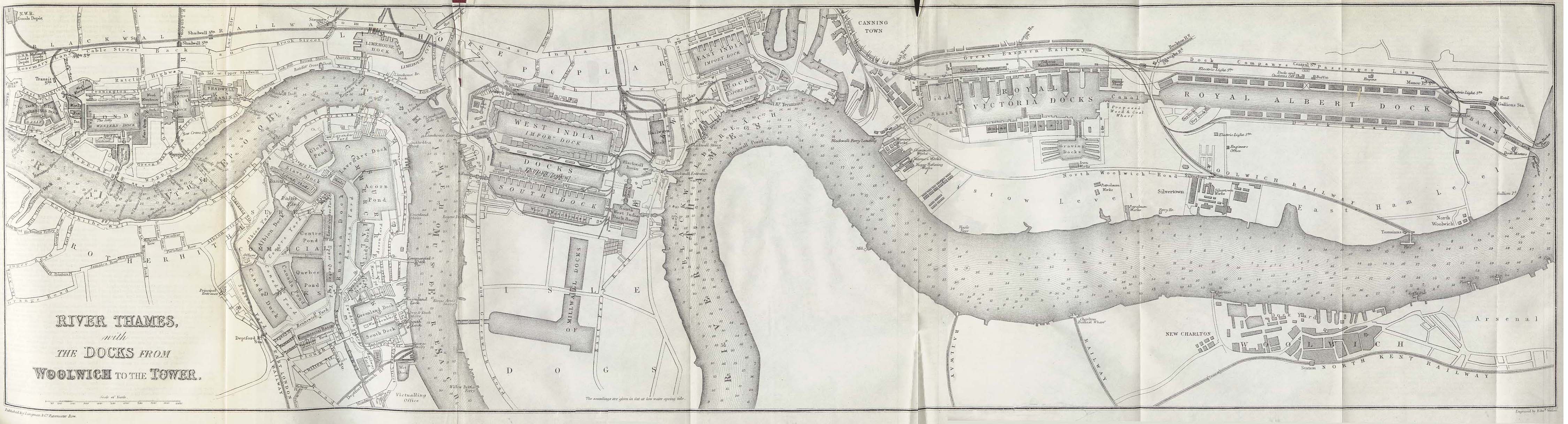
United Kingdom
United States of America
- Guides
- Maps
- Map of the United States, 1783–1803
- Political maps of the United States, 1803–1912
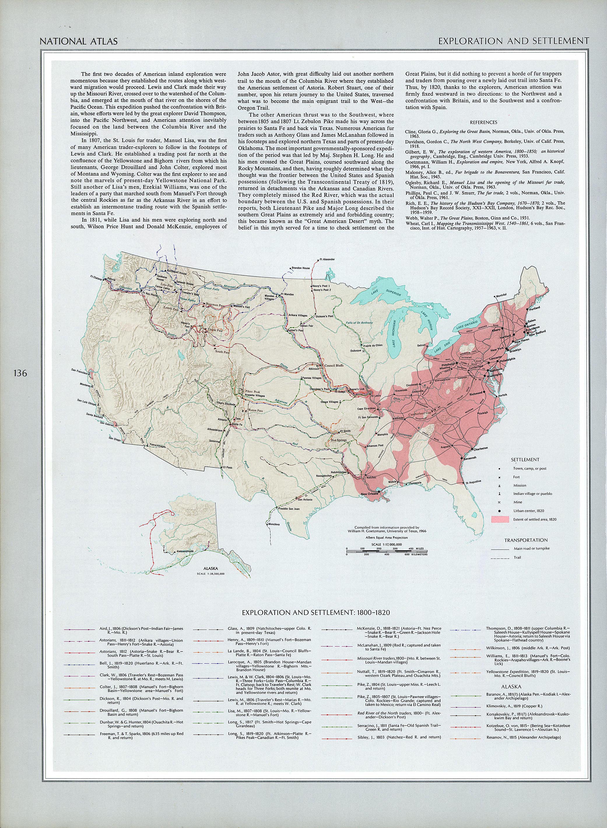
- Map of European settlement of the United States and territories, 1800–1820
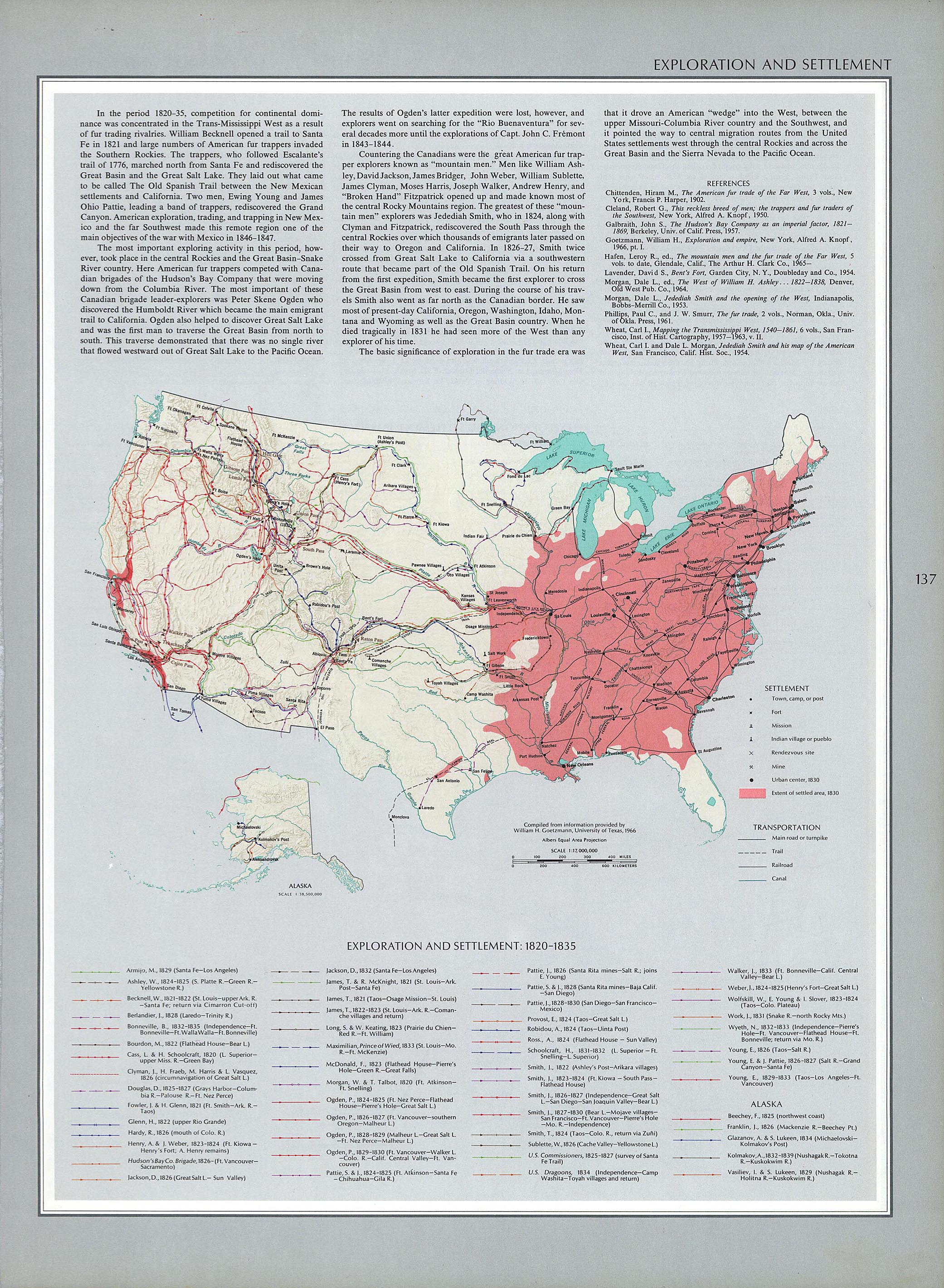
- Map of European settlement of the United States and territories, 1820–1835
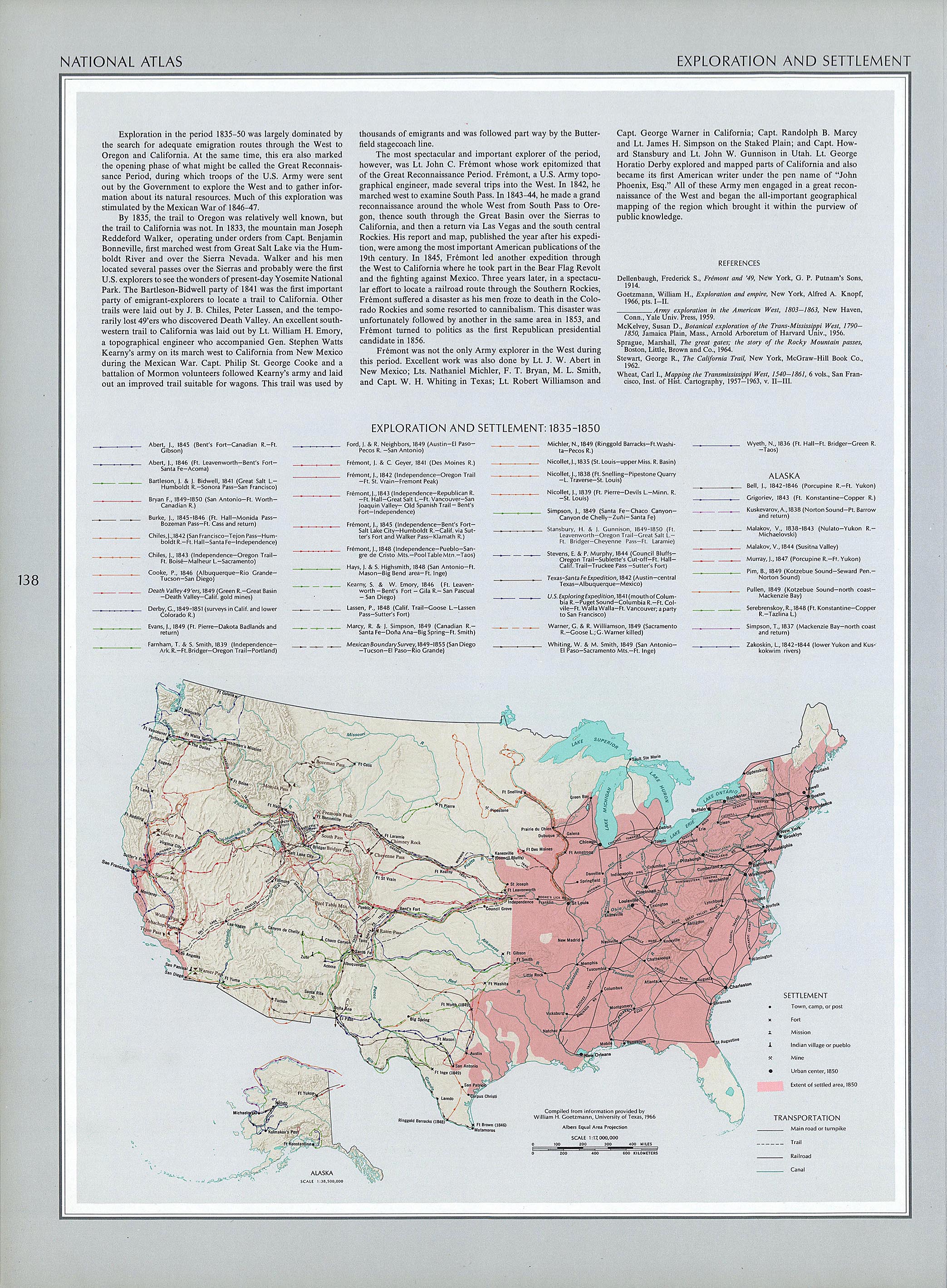
- Map of European settlement of the United States and territories, 1835–1850
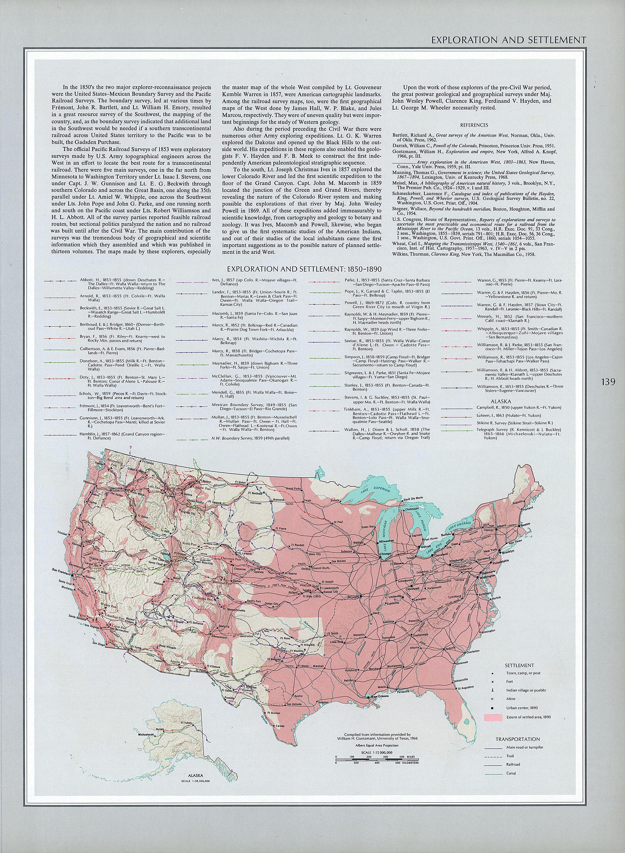
- Map of European settlement of the United States and territories, 1850–1890
- Map of territorial growth of the United States, 1775–1920
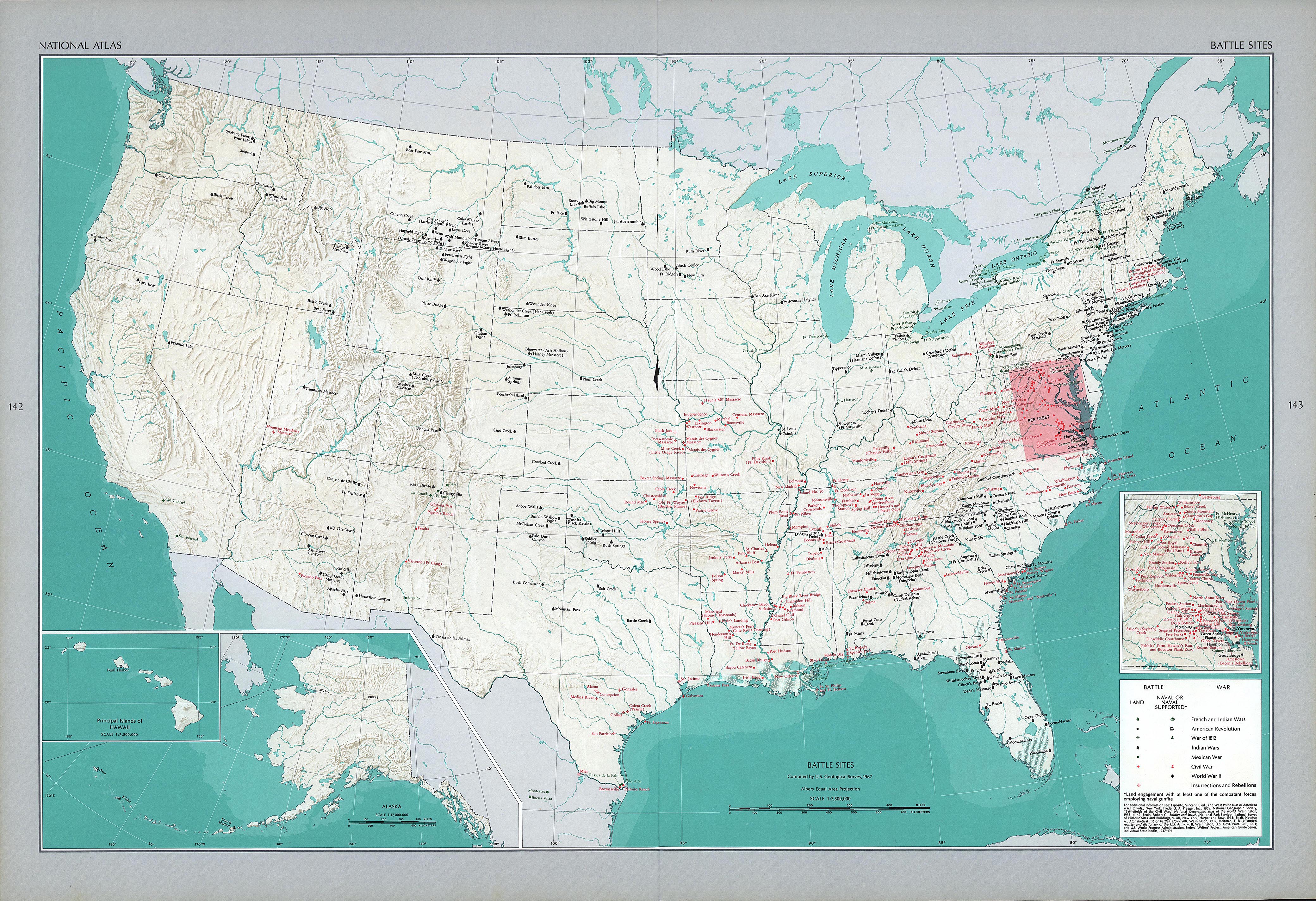
- Map of battles in the United States
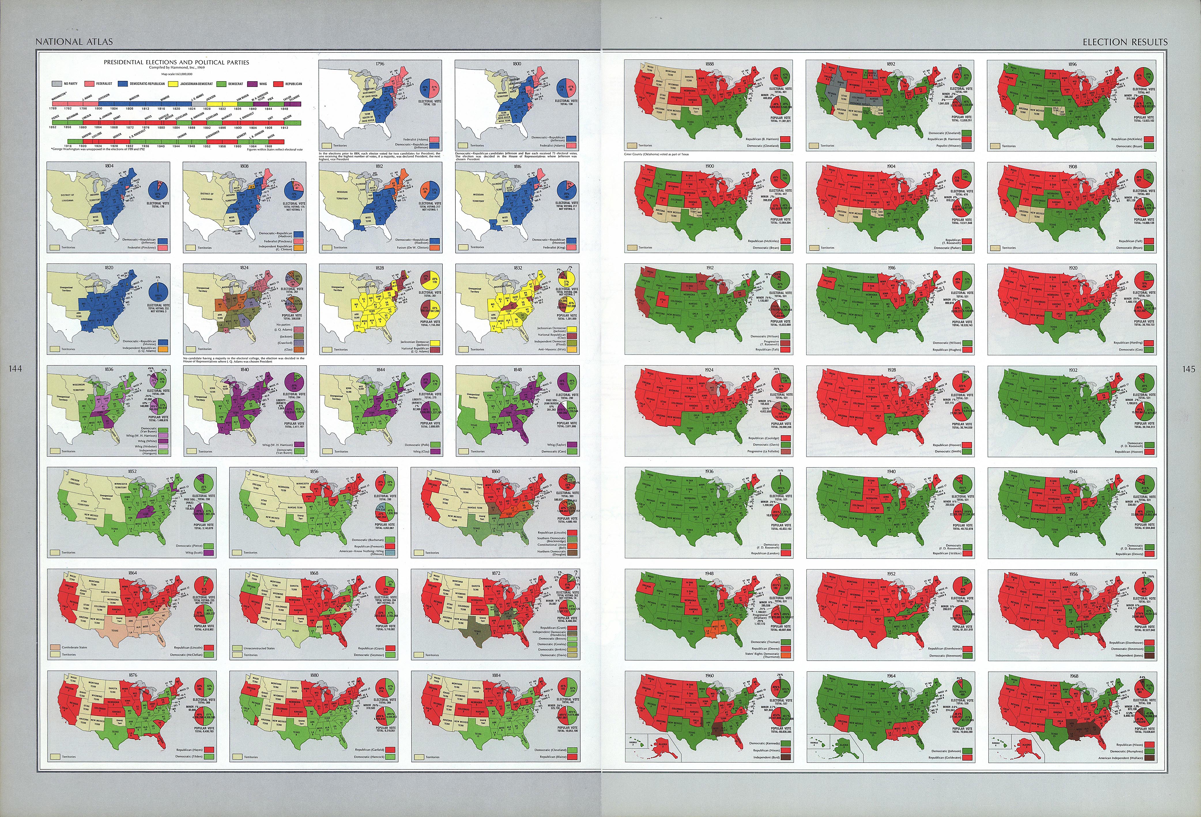
- Election map of the United States, 1796–1960
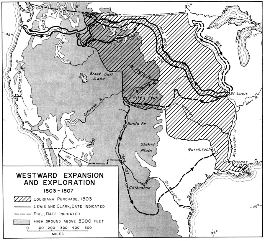
- Map of westward expansion and exploration, 1803–1807
- Map of the Lewis and Clark Expedition, 1804–1806
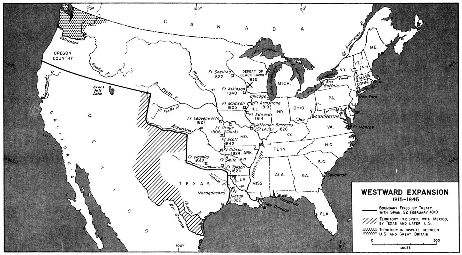
- Map of westward expansion, 1815–1845
- Distribution map of British-born people in the United States, 1872
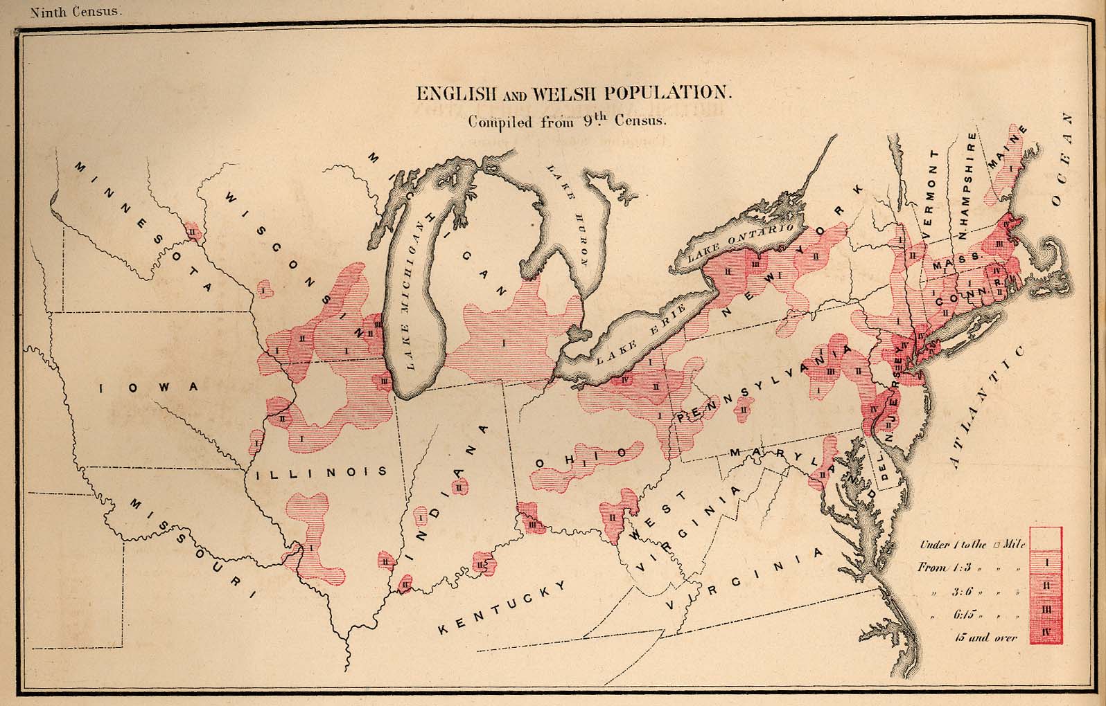
- Distribution map of English- and Welsh-born people in the United States, 1872
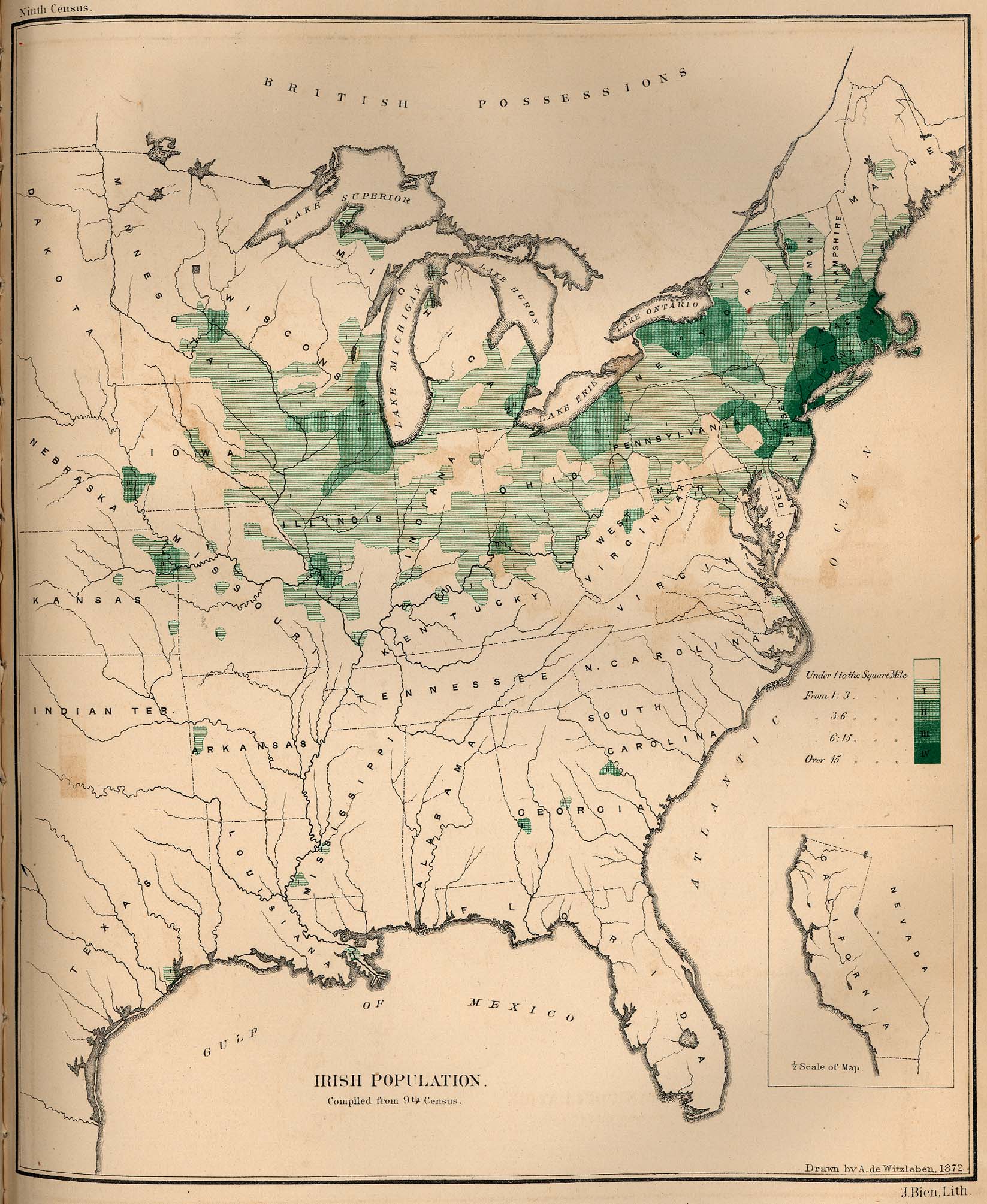
- Distribution map of Irish-born people in the United States, 1872
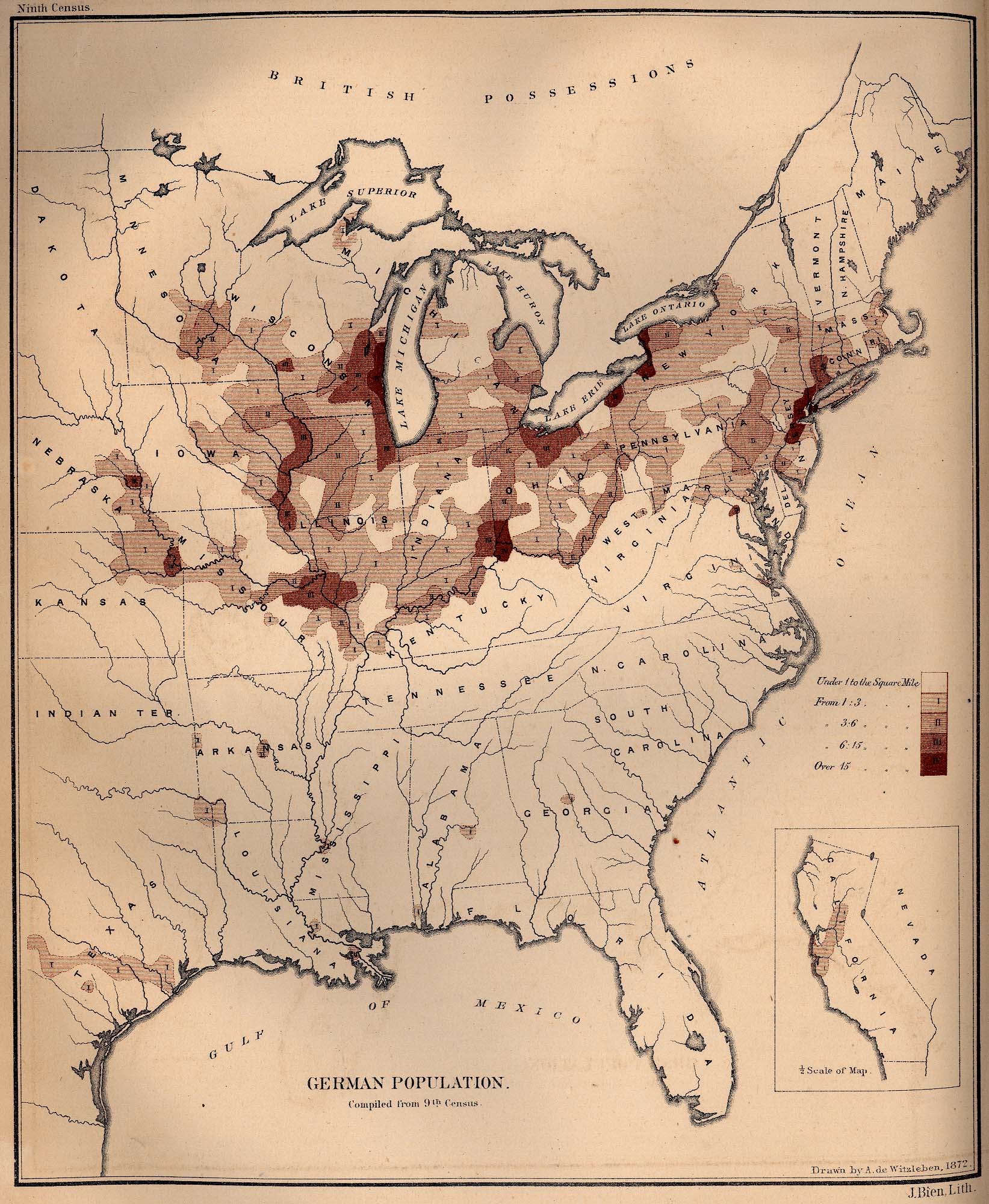
- Distribution map of German-born people in the United States, 1872
- Distribution map of Swedish- and Norwegian-born people in the United States, 1872
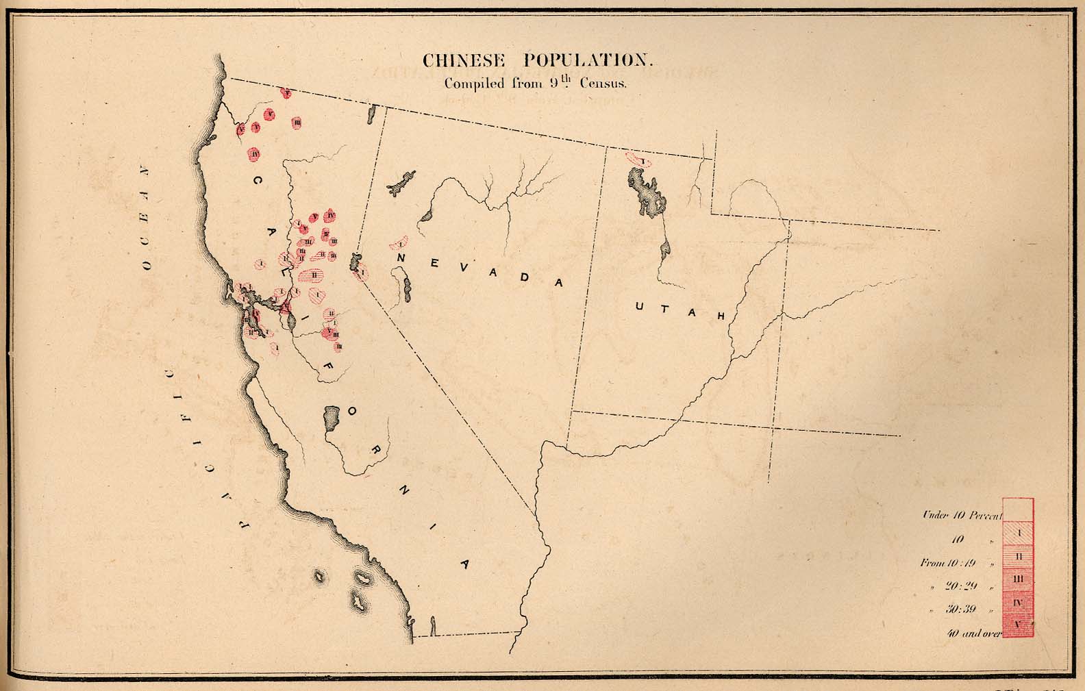
- Distribution map of Chinese-born people in the United States, 1872
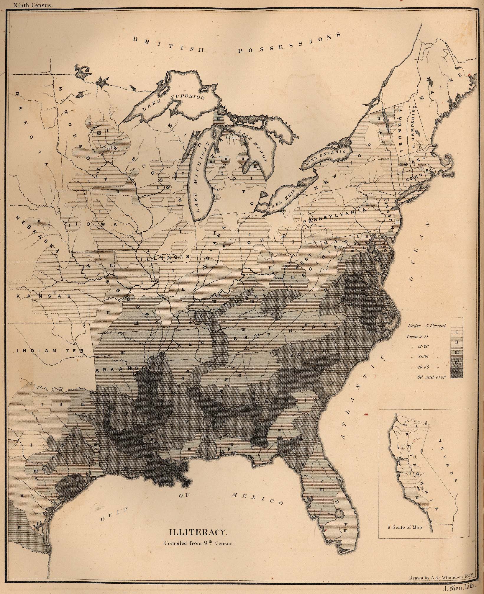
- Distribution map of illiterate people in the United States, 1872
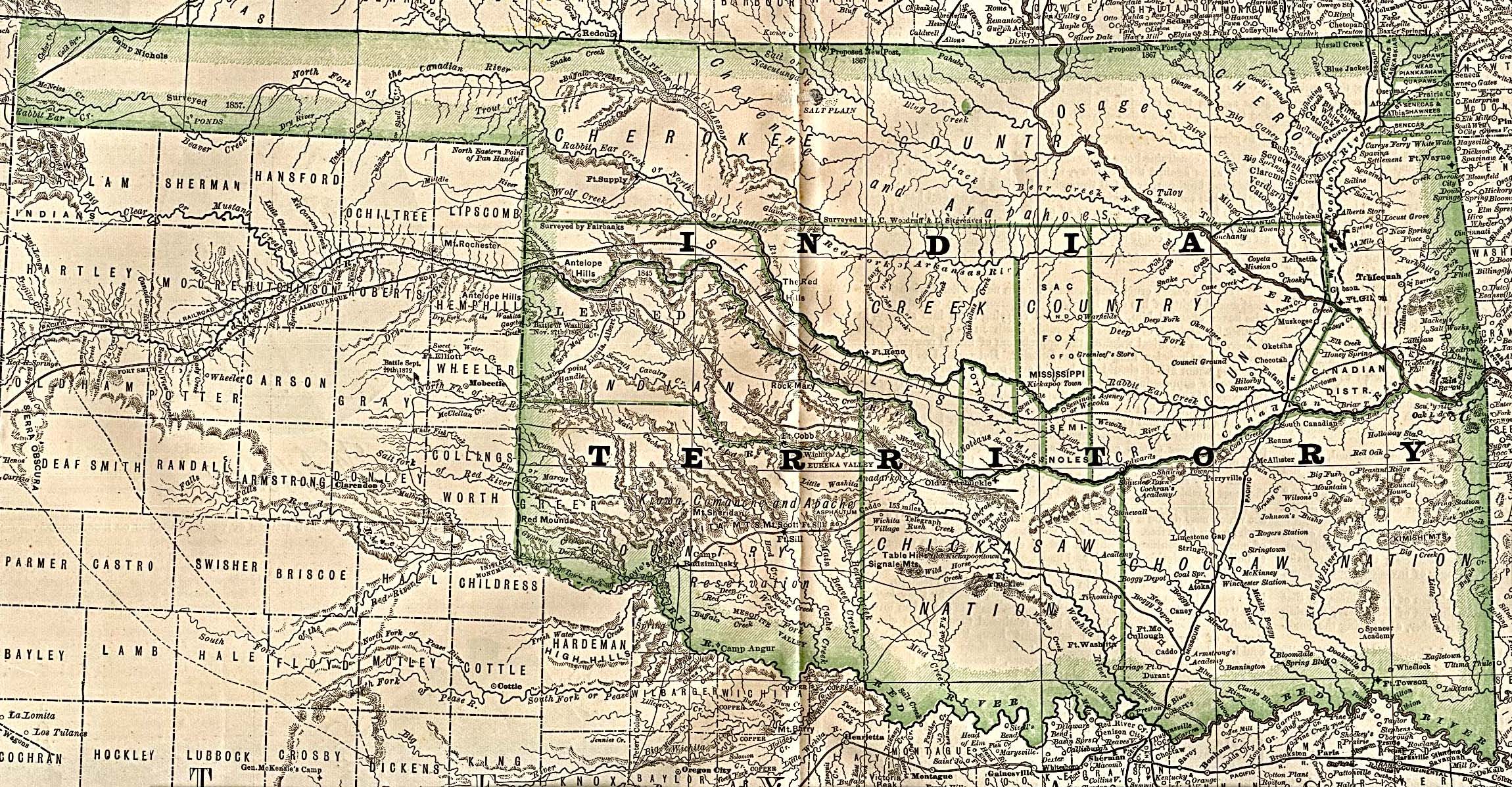
- Map of Indian Territory (Oklahoma), 1884
- Distribution map of Indian tribes
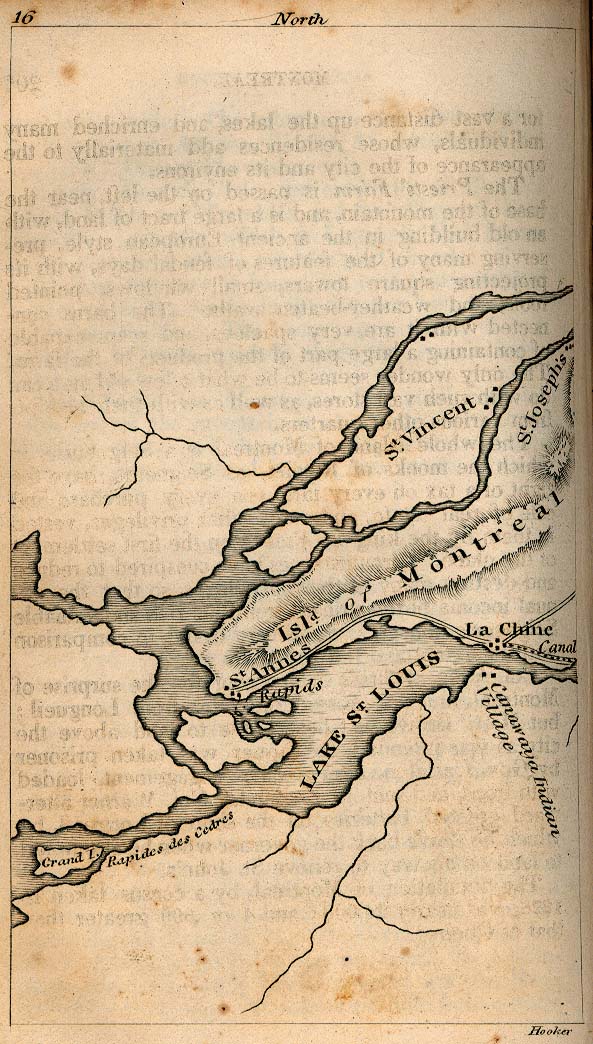
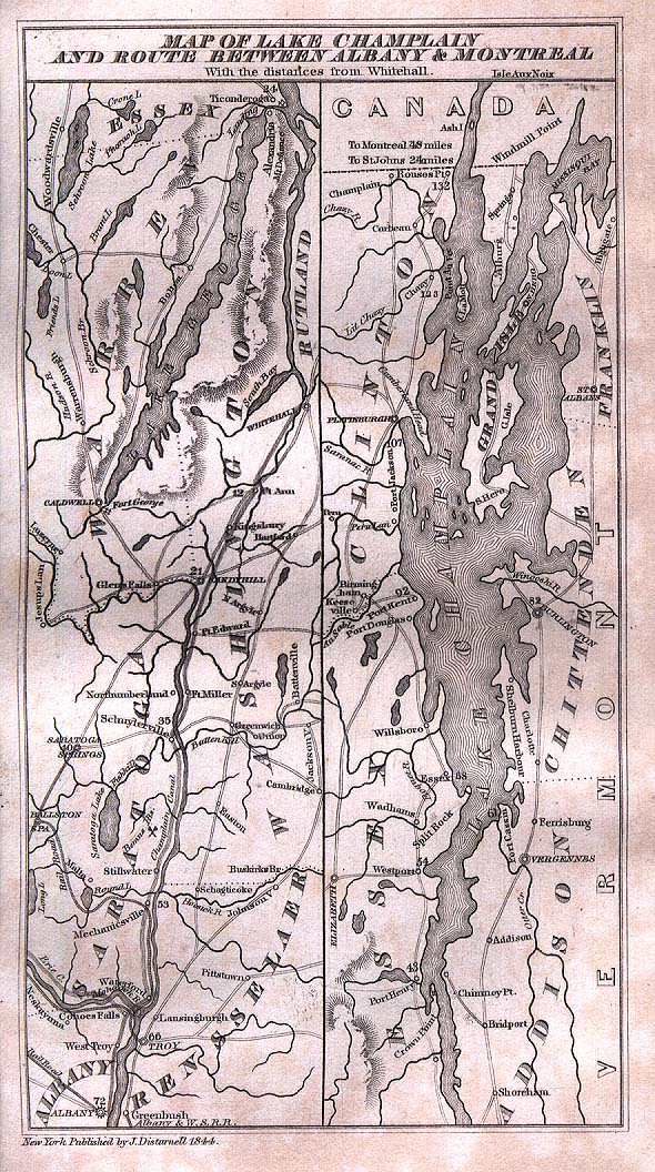
- Map of Lake Champlain and the route between Albany and Montreal, 1844
- Map of old trails and roads in Minnesota
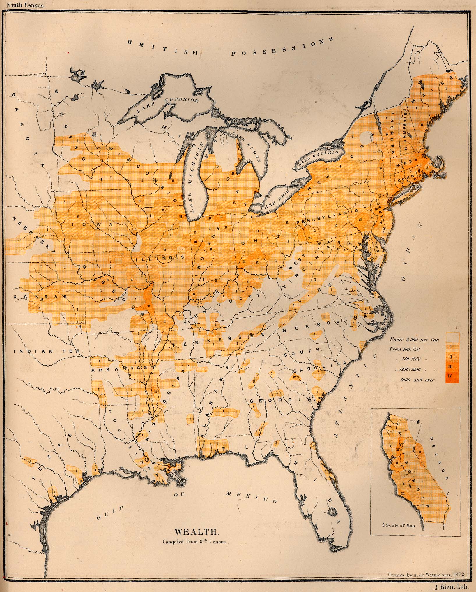
- Distribution map of wealth in the United States, 1872
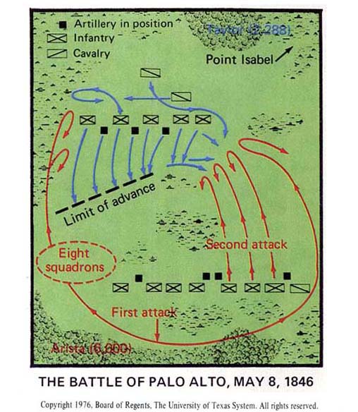
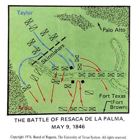
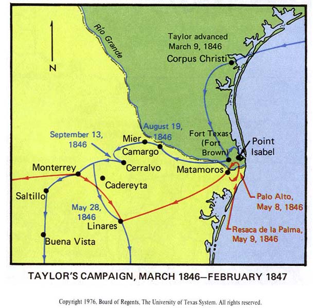
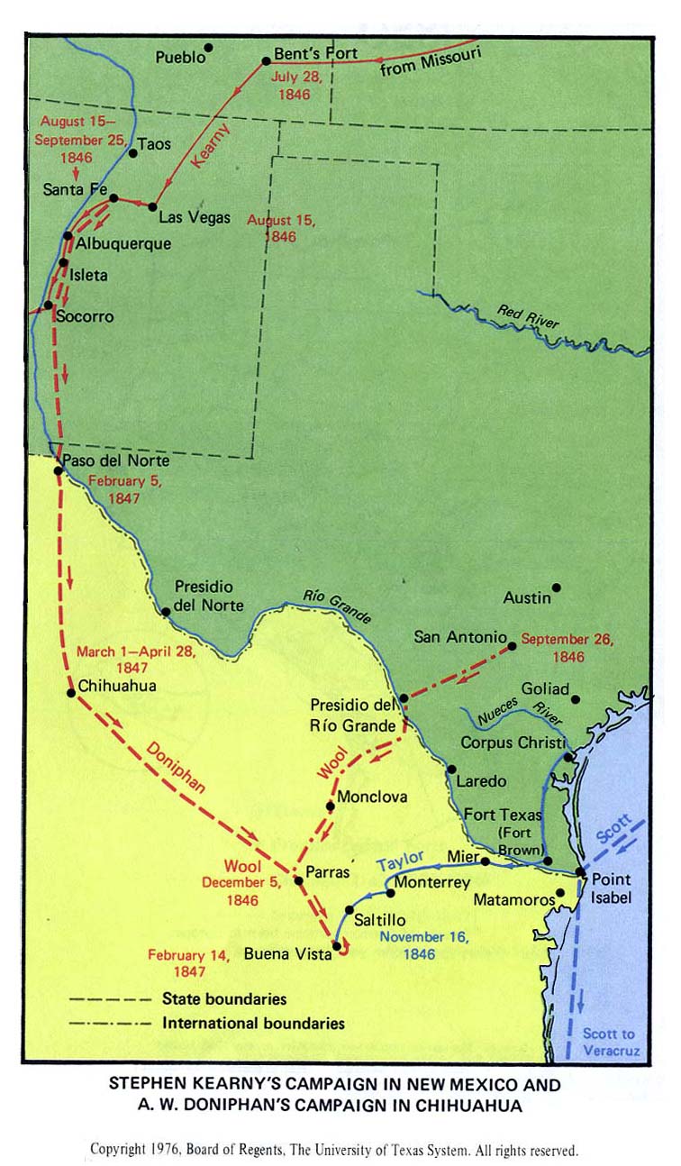
- Mexican-American War, 1846–1847
- American Civil War
- Austin, Texas
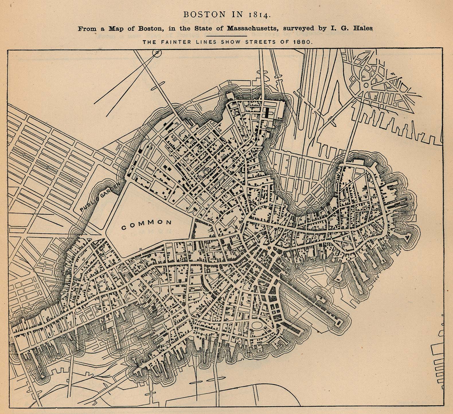
- Boston
- Plan of Boston, 1814
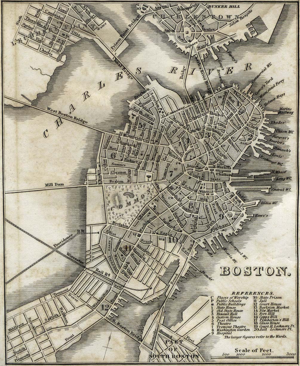
- Plan of Boston, 1842
- Plan of Boston, 1880
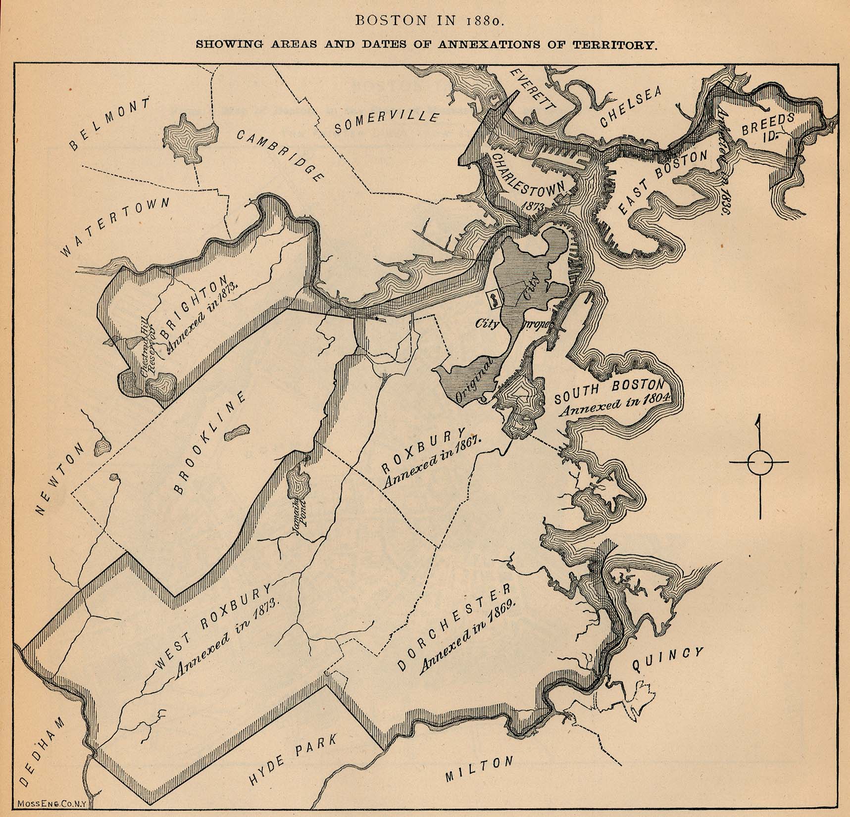
- Map of Boston 1880, showing dates of annexation of other communities
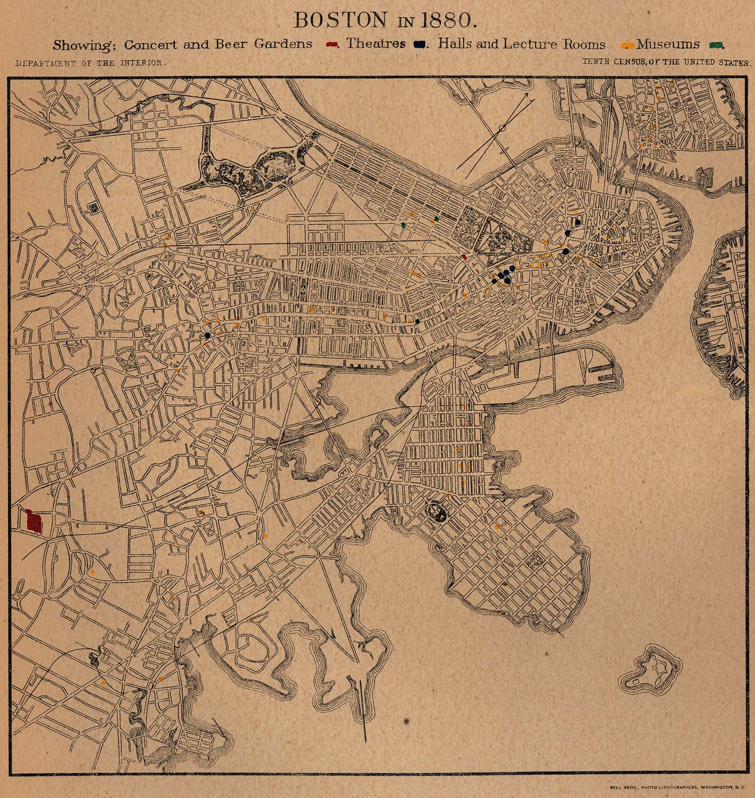
- Plan of Boston 1880, showing locations of concert and beer gardens, theatres, halls, lecture rooms and museums
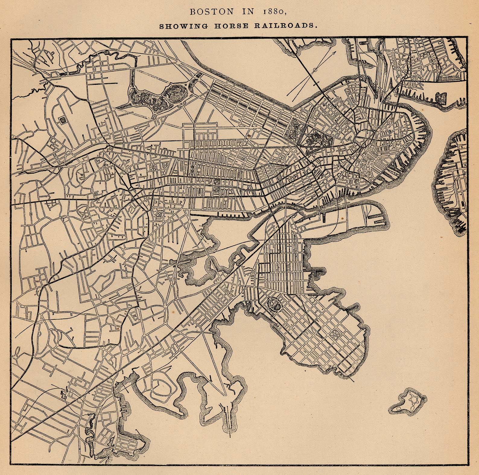
- Plan of Boston, 1880, showing horse railroads
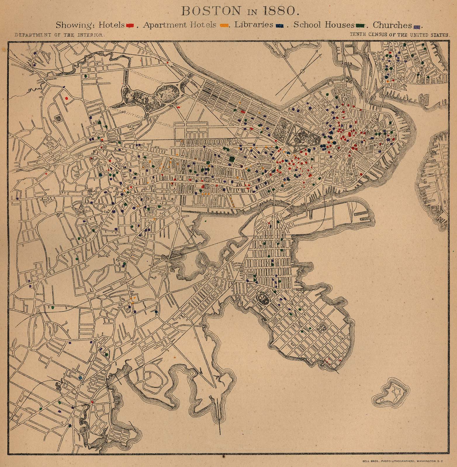
- Plan of Boston, 1880, showing locations of hotels, libraries, schools and churches
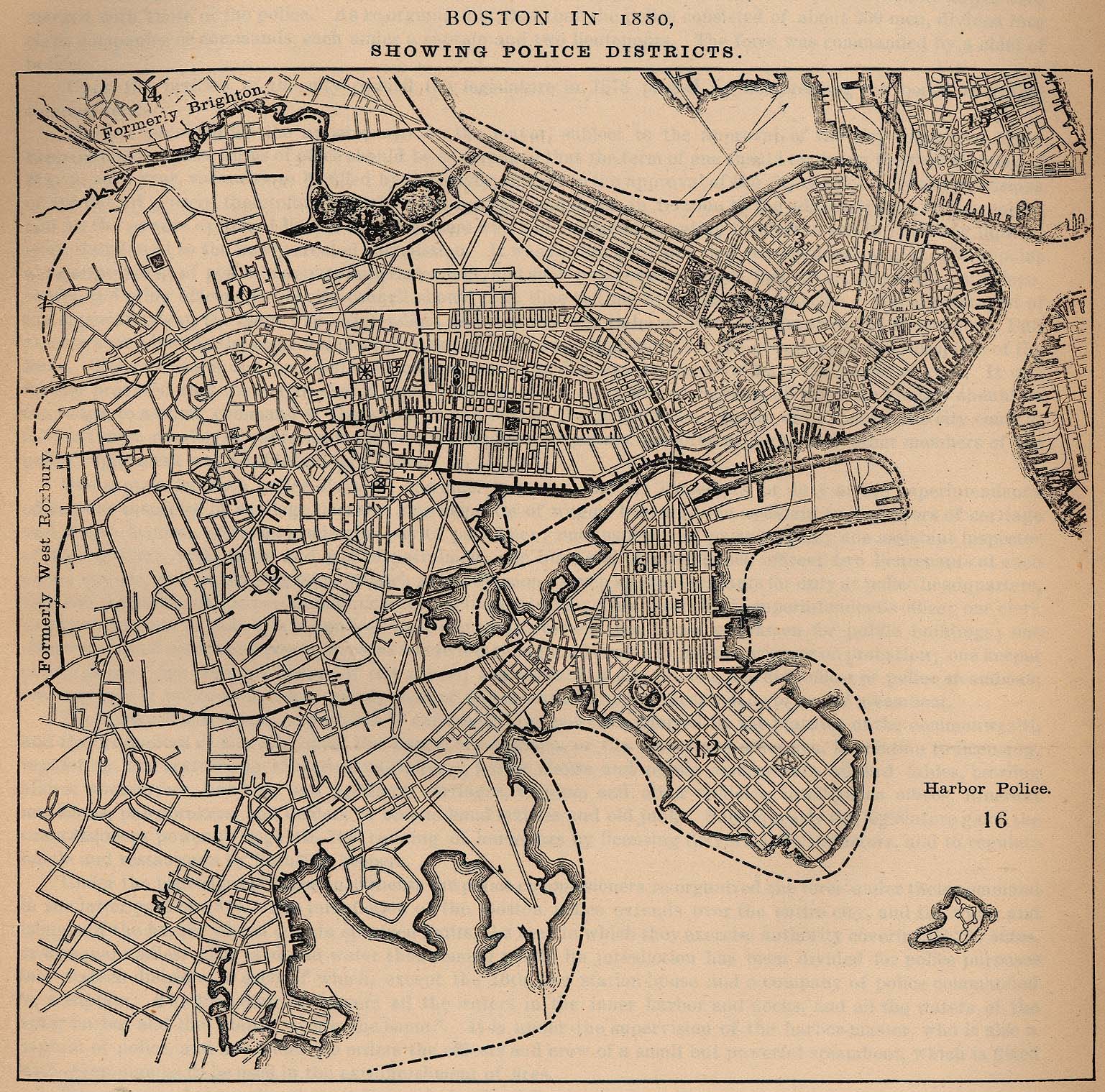
- Plan of Boston, 1880, showing police districts
- Plan of Boston, 1880, showing locations of societies, hospitals, asylums and homes
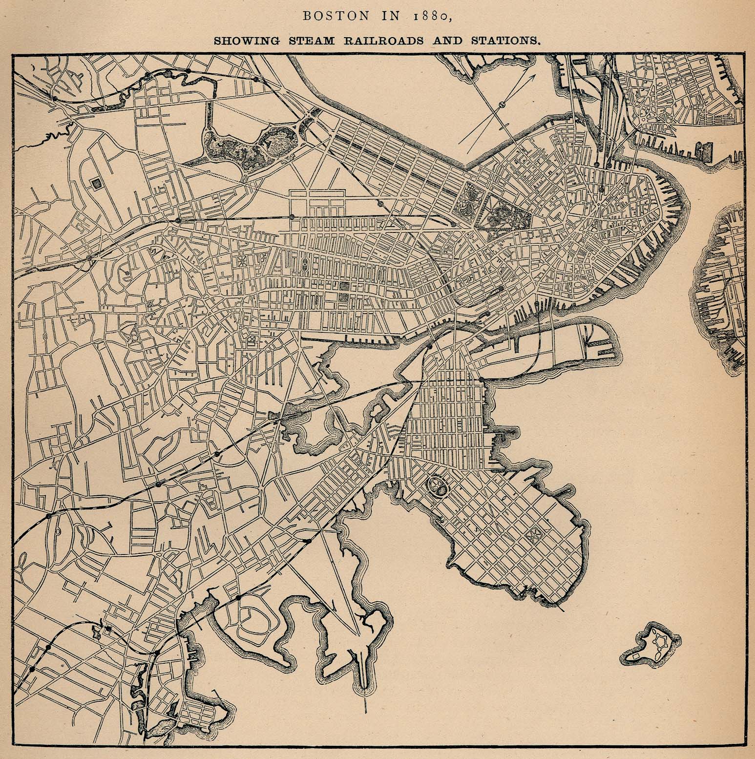
- Plan of Boston, 1880, showing steam railroads and stations
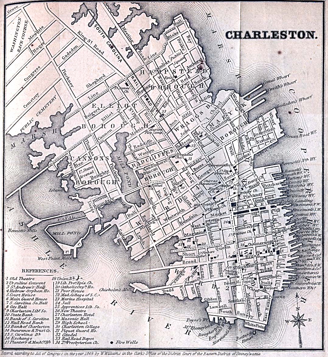
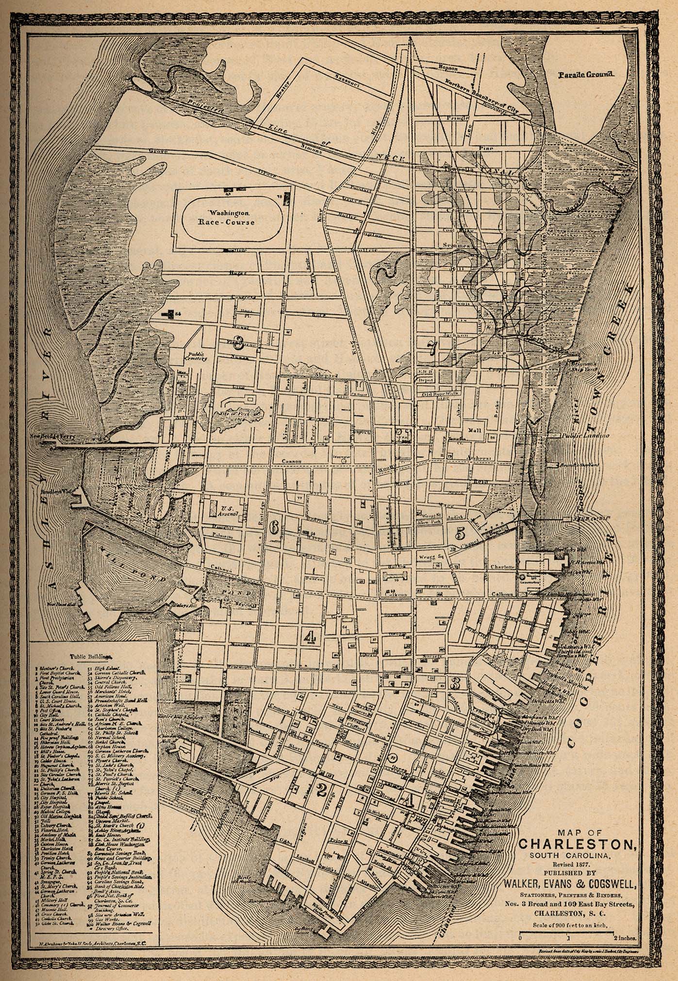
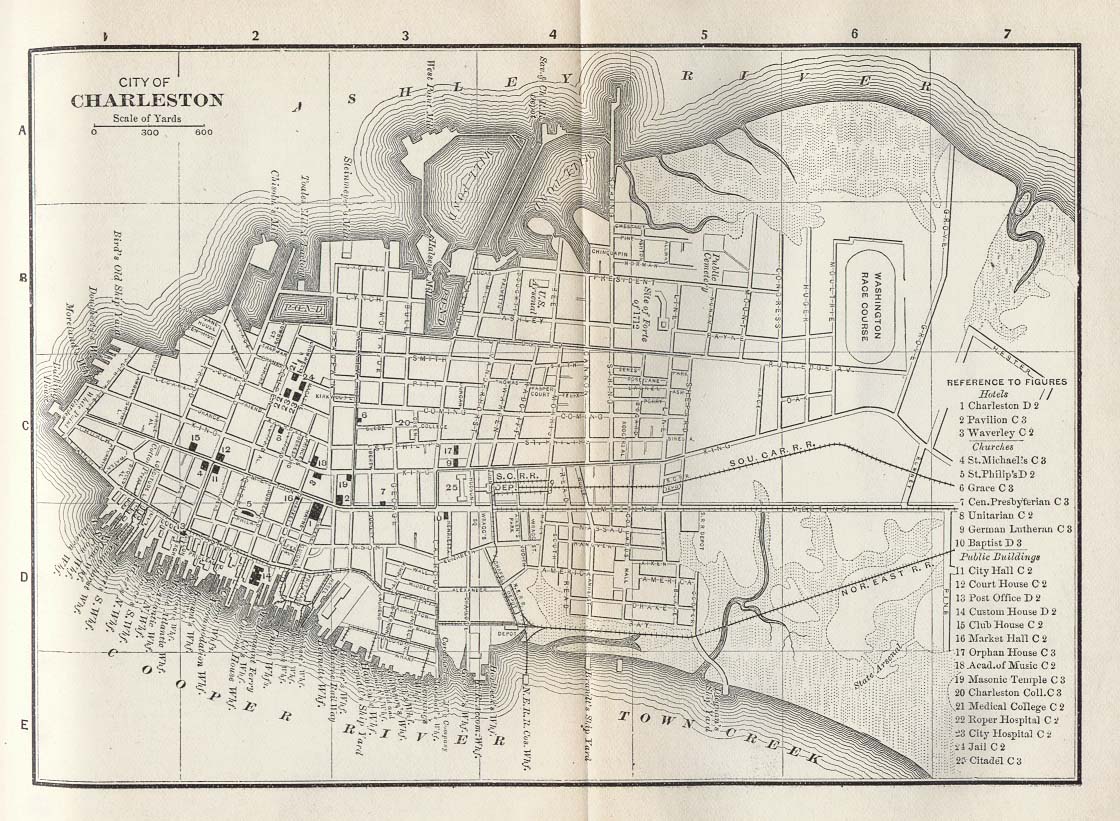
- Charleston
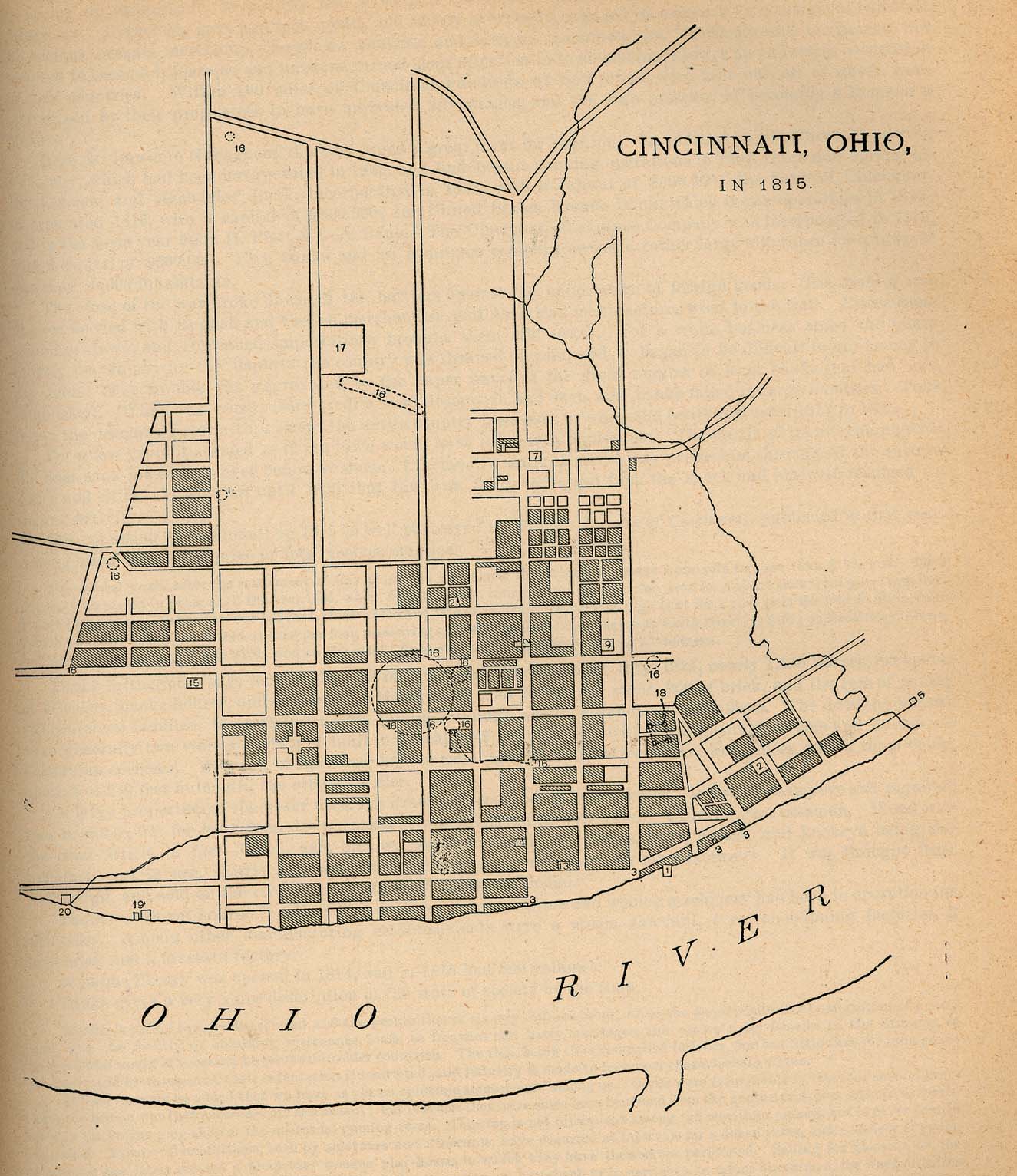
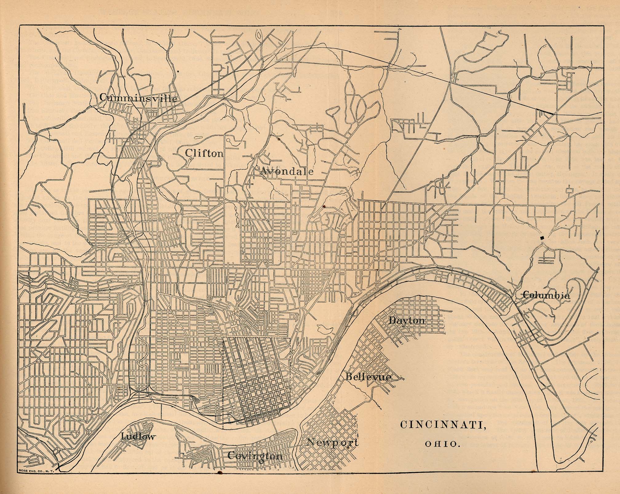
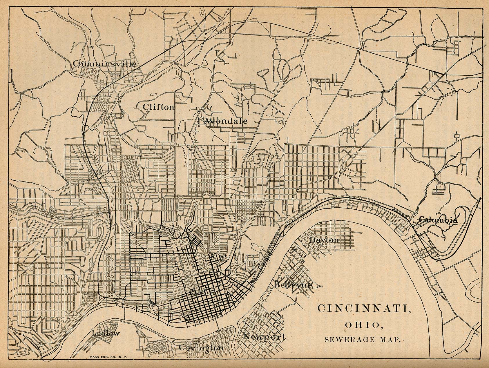
- Cincinnati
- Fort Worth
- Galveston
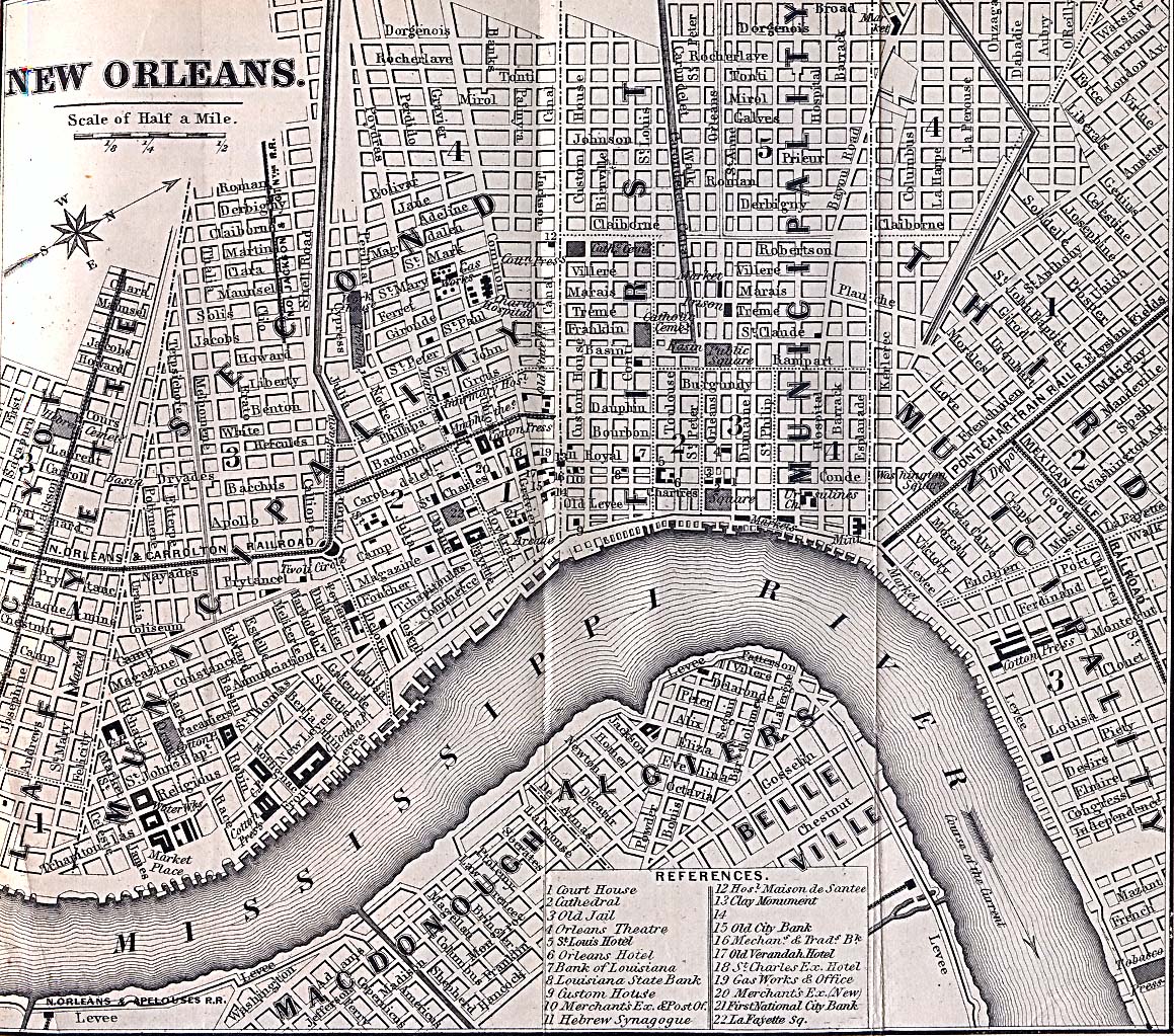
- New Orleans
- Plan of New Orleans, 1816
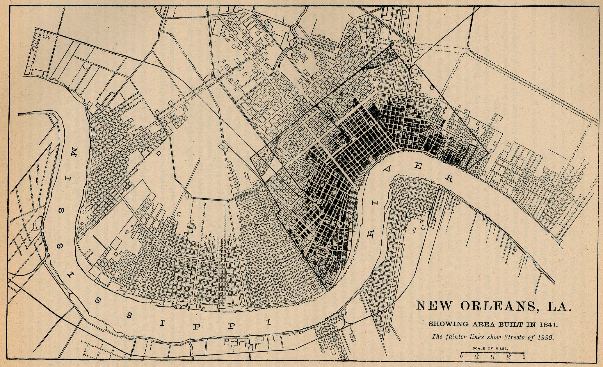
- Plan of New Orleans, 1841
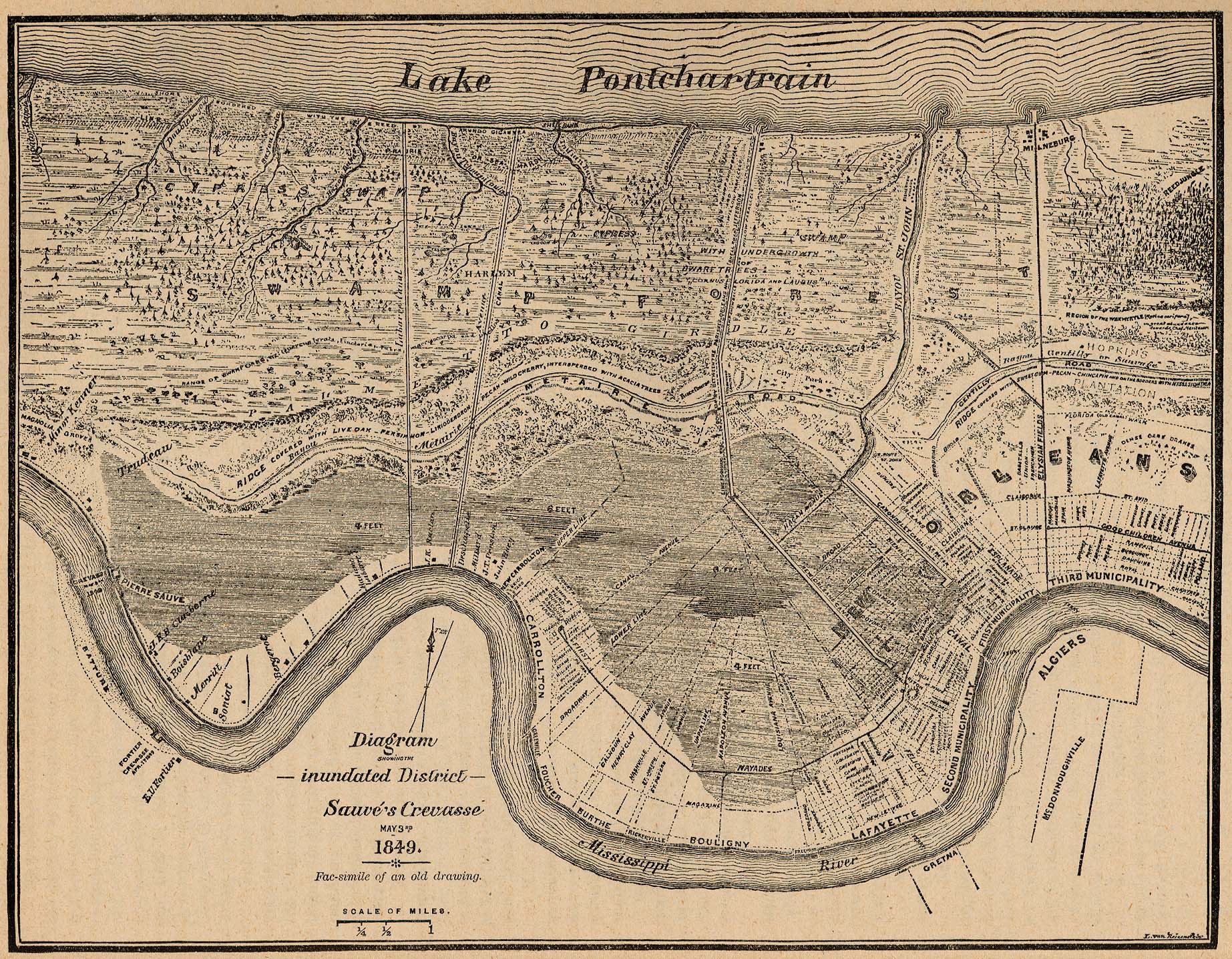
- Plan of New Orleans, 1849
- Plan of New Orleans, 1869
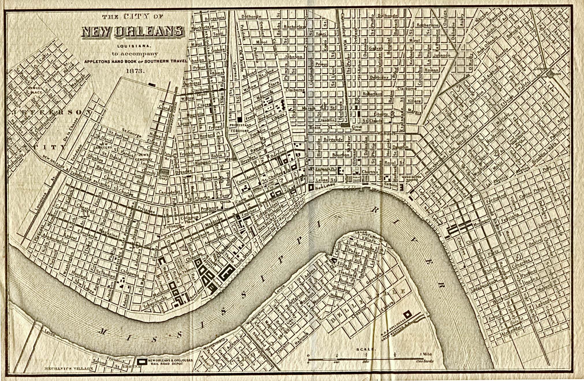
- Plan of New Orleans, 1873
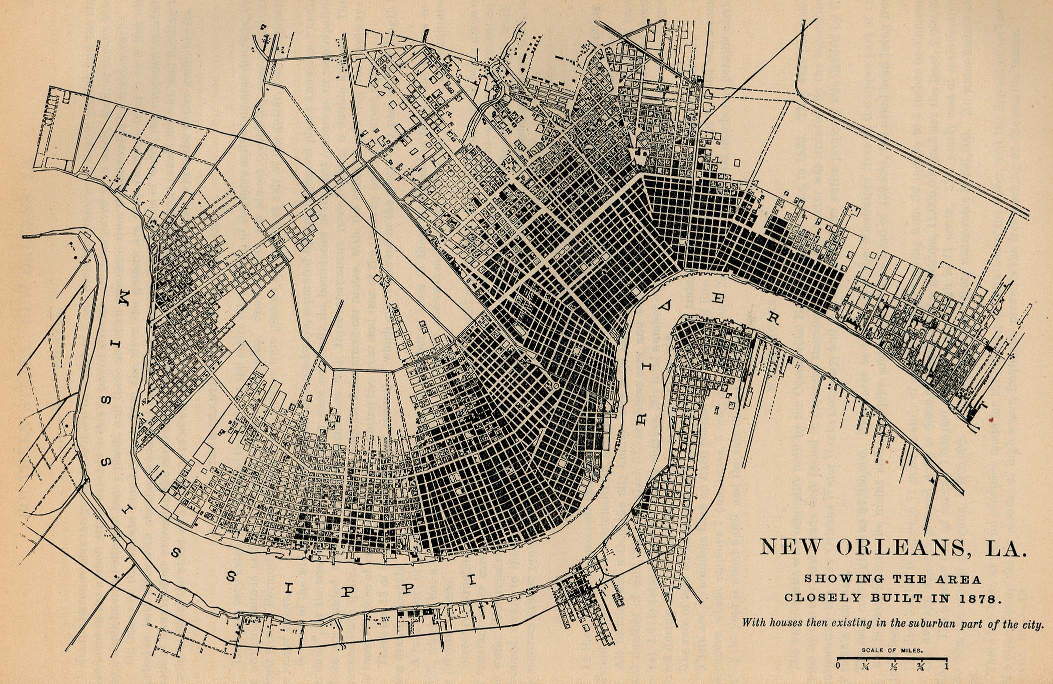
- Plan of New Orleans, 1878
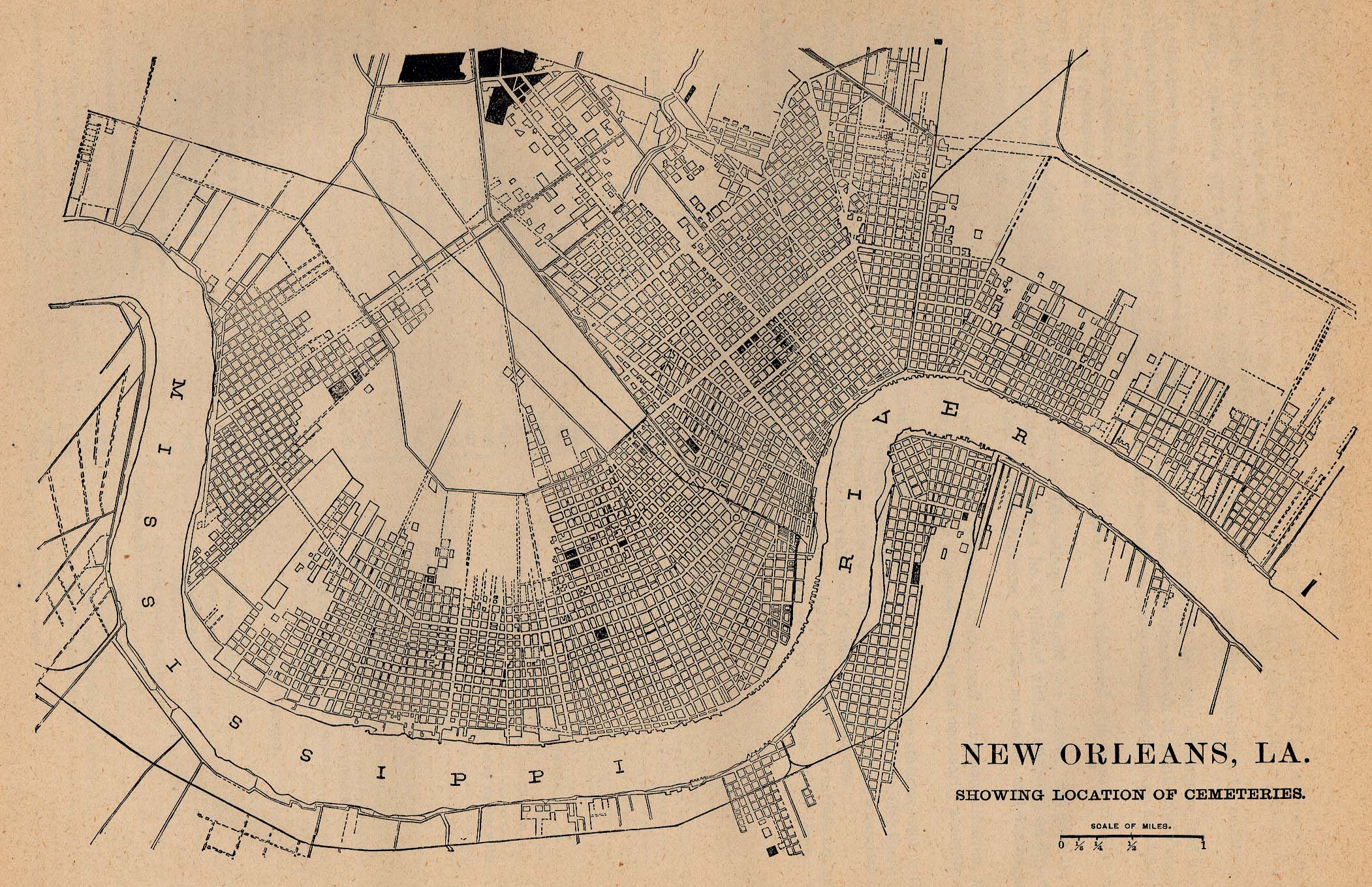
- Plan of New Orleans, 1880, showing locations of cemeteries
- Plan of New Orleans, 1880, showing locations of markets
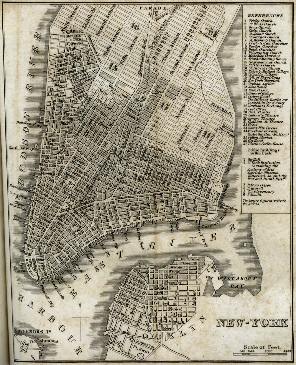
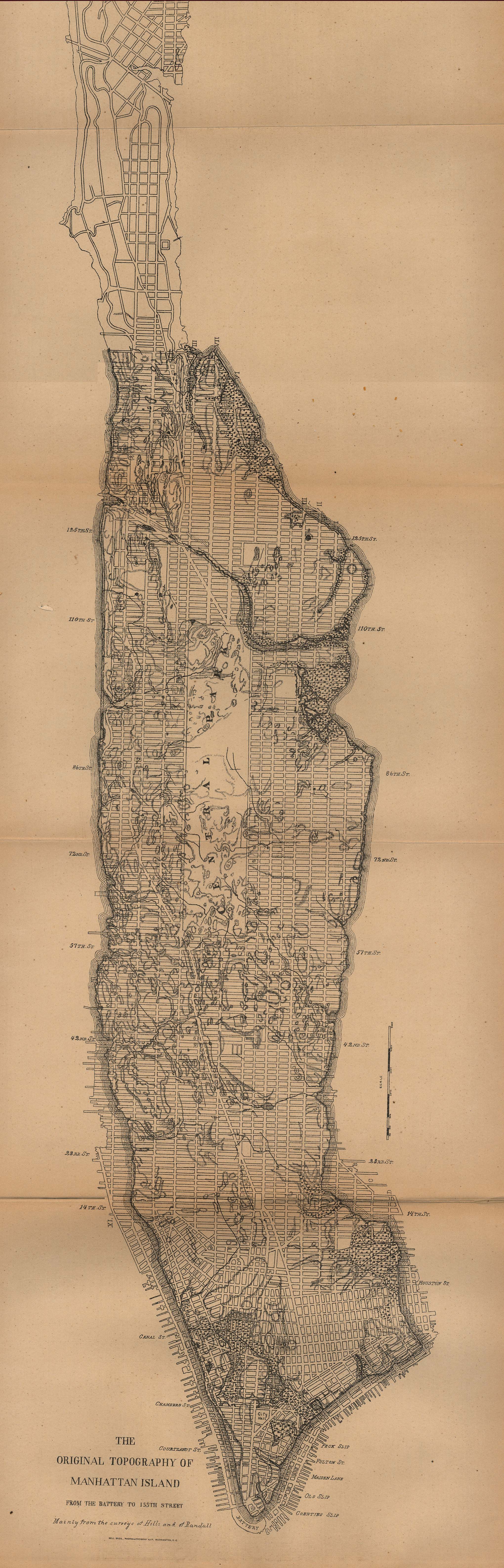
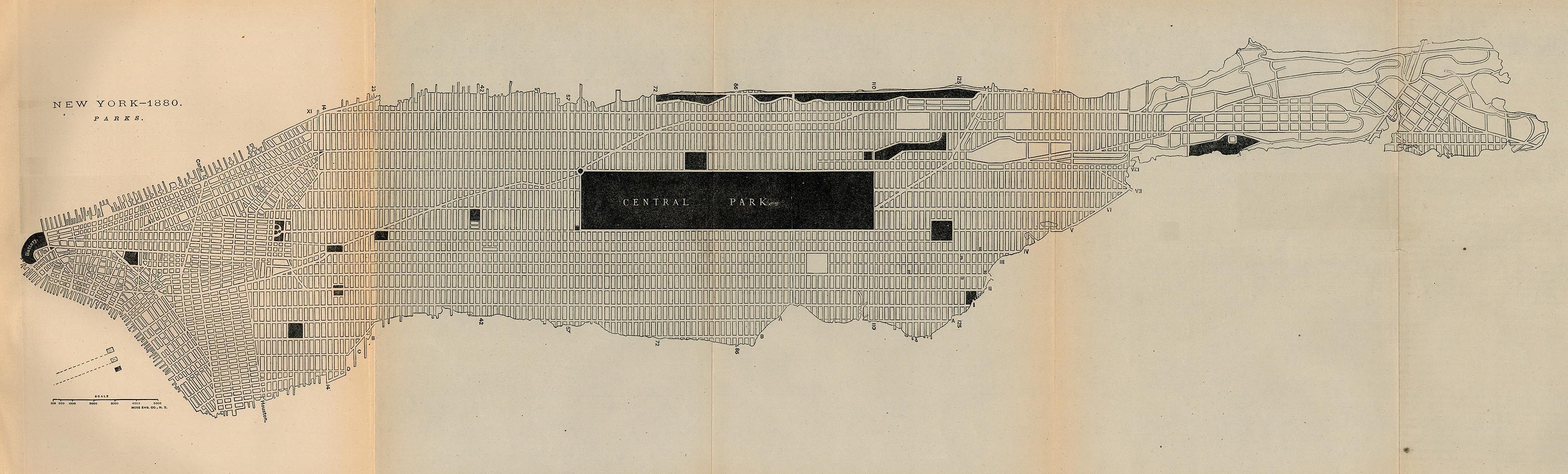
- New York City
- San Antonio, Texas
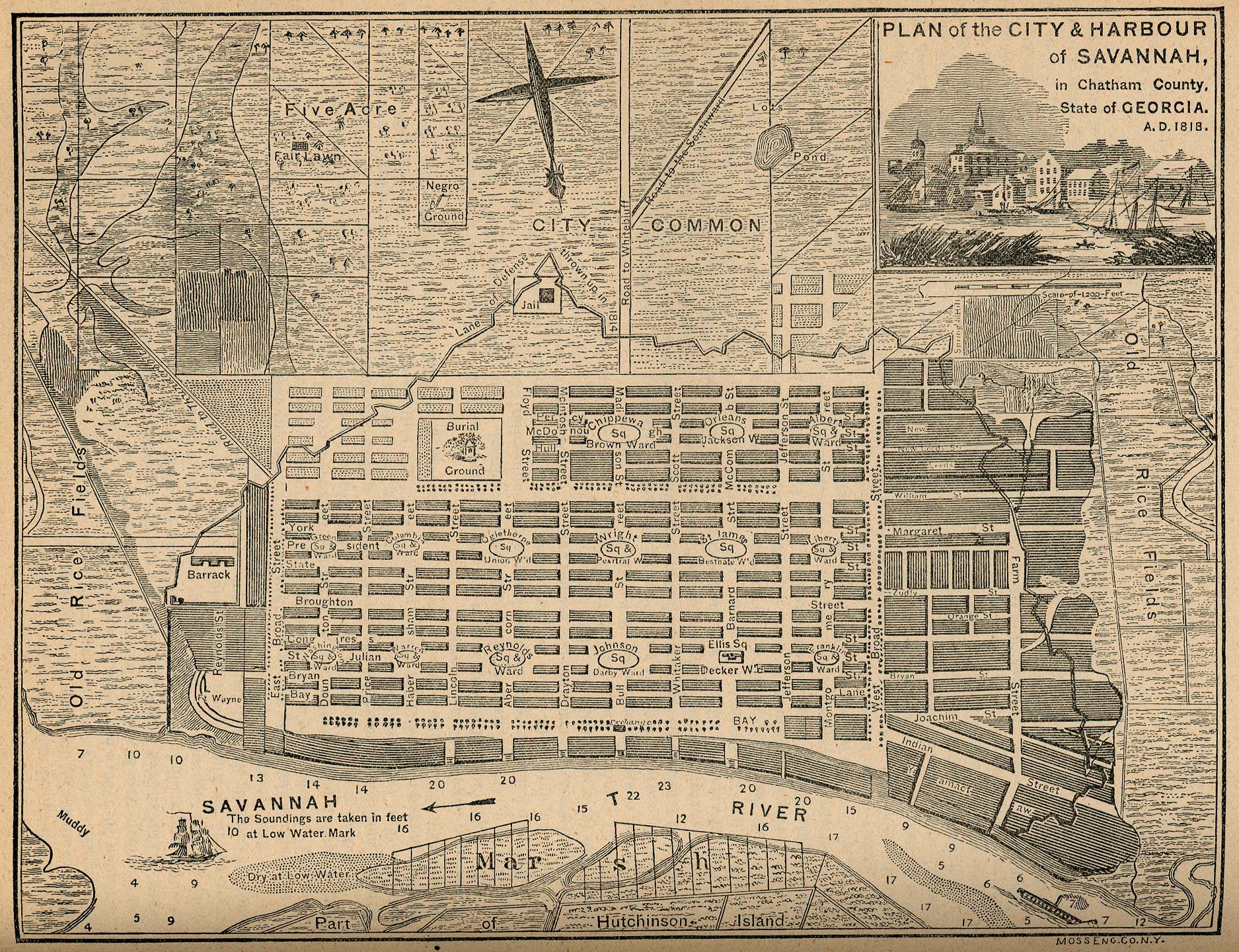
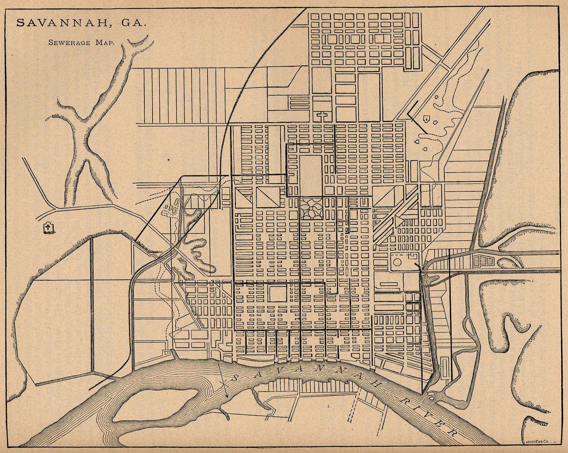
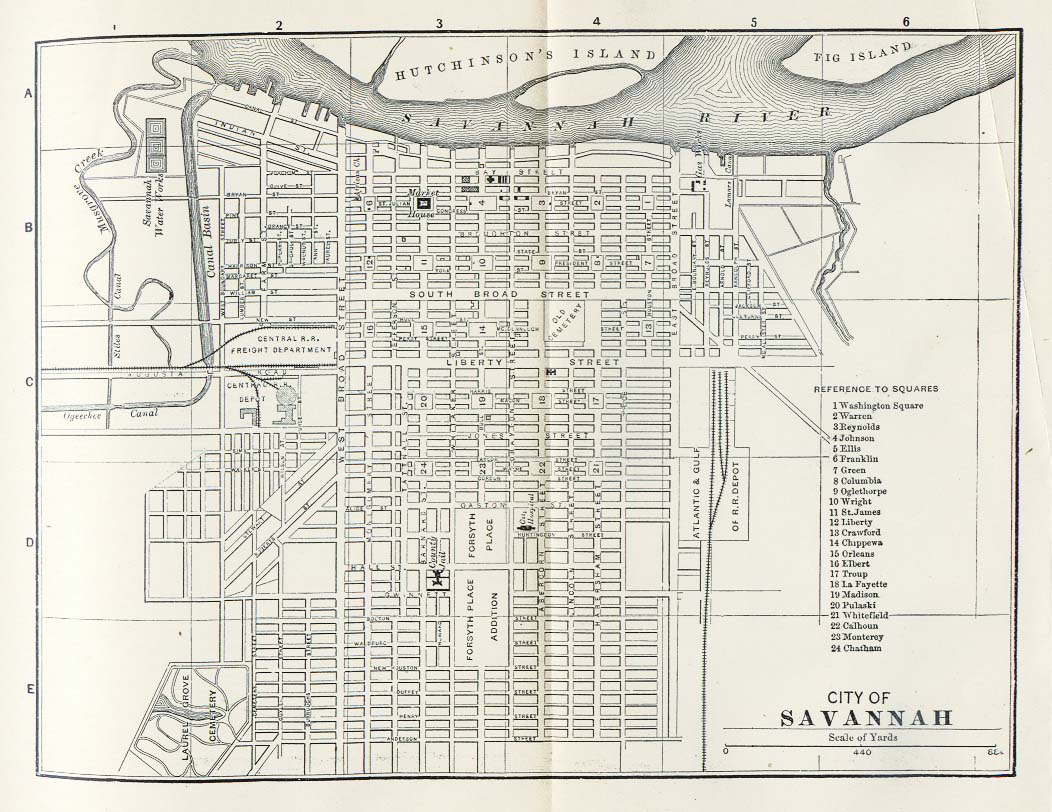
- Savannah, Georgia
- Other cities in Texas
- Panoramic plan of Abilene, 1883
- Panoramic plan of Bastrop, 1887
- Plan of Beaumont, 1850
- Panoramic plan of Belton, 1881
- Panoramic plan of Brenham, 1873
- Panoramic plan of Brenham, 1881
- Panoramic plan of Corpus Christi, 1887
- Panoramic plan of Cuero, 1881
- Panoramic plan of Dallas, 1872
- Panoramic plan of Denison, 1886, and another version
- Panoramic plan of Denton, 1883
- Panoramic plan of Eagle Pass, 1887
- Panoramic plan of El Paso, 1886
- Panoramic plan of Flatonia, 1881
- Plans of Fredericksburg, Indianola and New Braunfels, and map of Matagorda Bay, 1850
- Panoramic plan of Gainesville, 1883
- Panoramic plan of Gatesville, 1884
- Panoramic plan of Greenville, 1886, and another version
- Panoramic plan of Honey Grove, 1886, and another version
- Panoramic plan of Houston, 1873
- Panoramic plan of Jefferson, 1872
- Panoramic plan of La Grange, 1880
- Panoramic plan of McKinney, 1876
- Plan of New Braunfels, 1868
- Panoramic plan of New Braunfels, 1881
- Panoramic plan of Paris, 1885
- Panoramic plan of Schulenburg, 1881
- Plan of San Marcos, 1881
- Panoramic plan of Texarkana, 1888, and another version
- Panoramic plan of Victoria, 1873
- Panoramic plan of Waco, 1873
- Panoramic plan of Waco, 1886, and another version
- Other cities
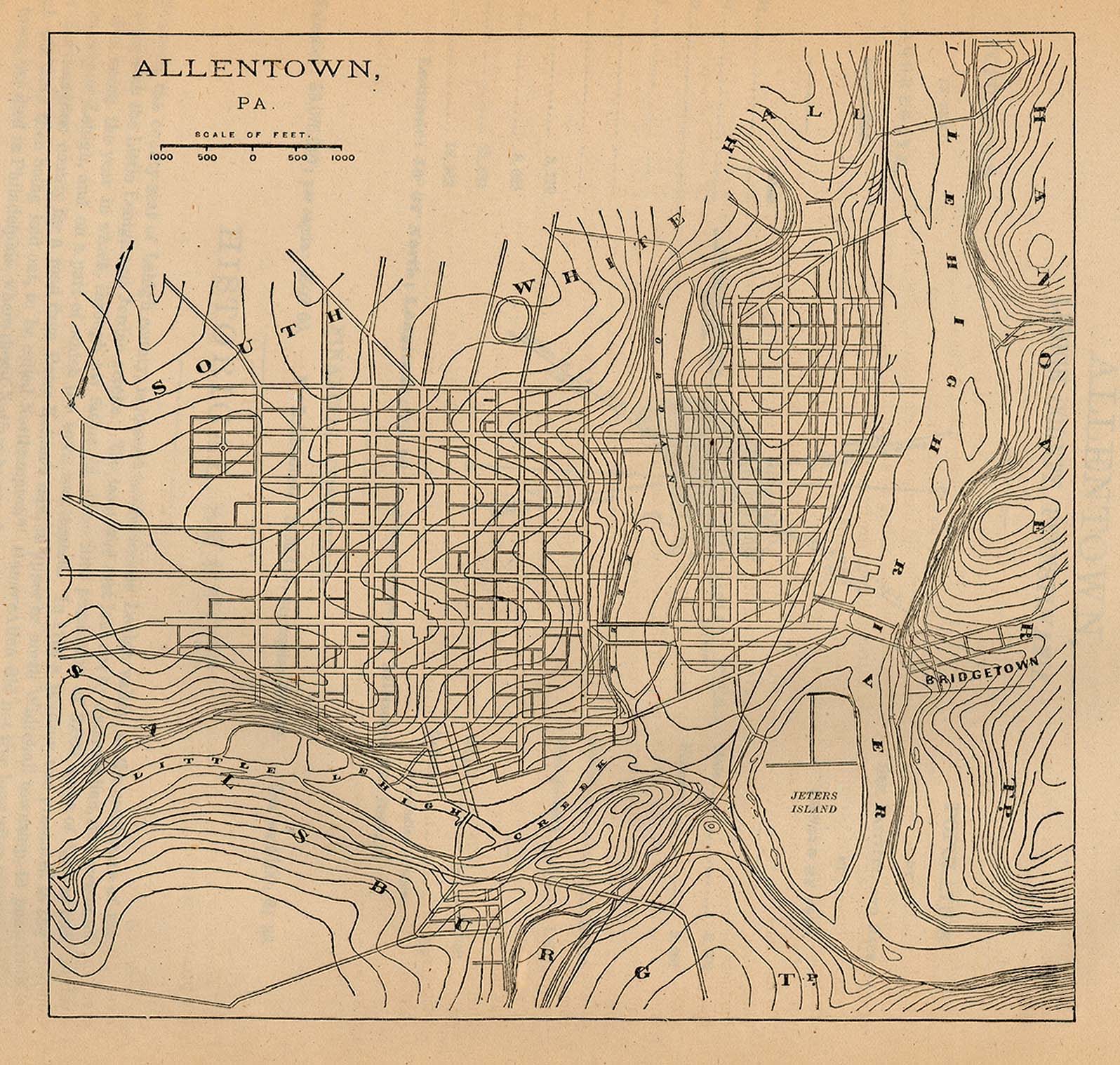
- Plan of Allentown, Pennsylvania, 1880
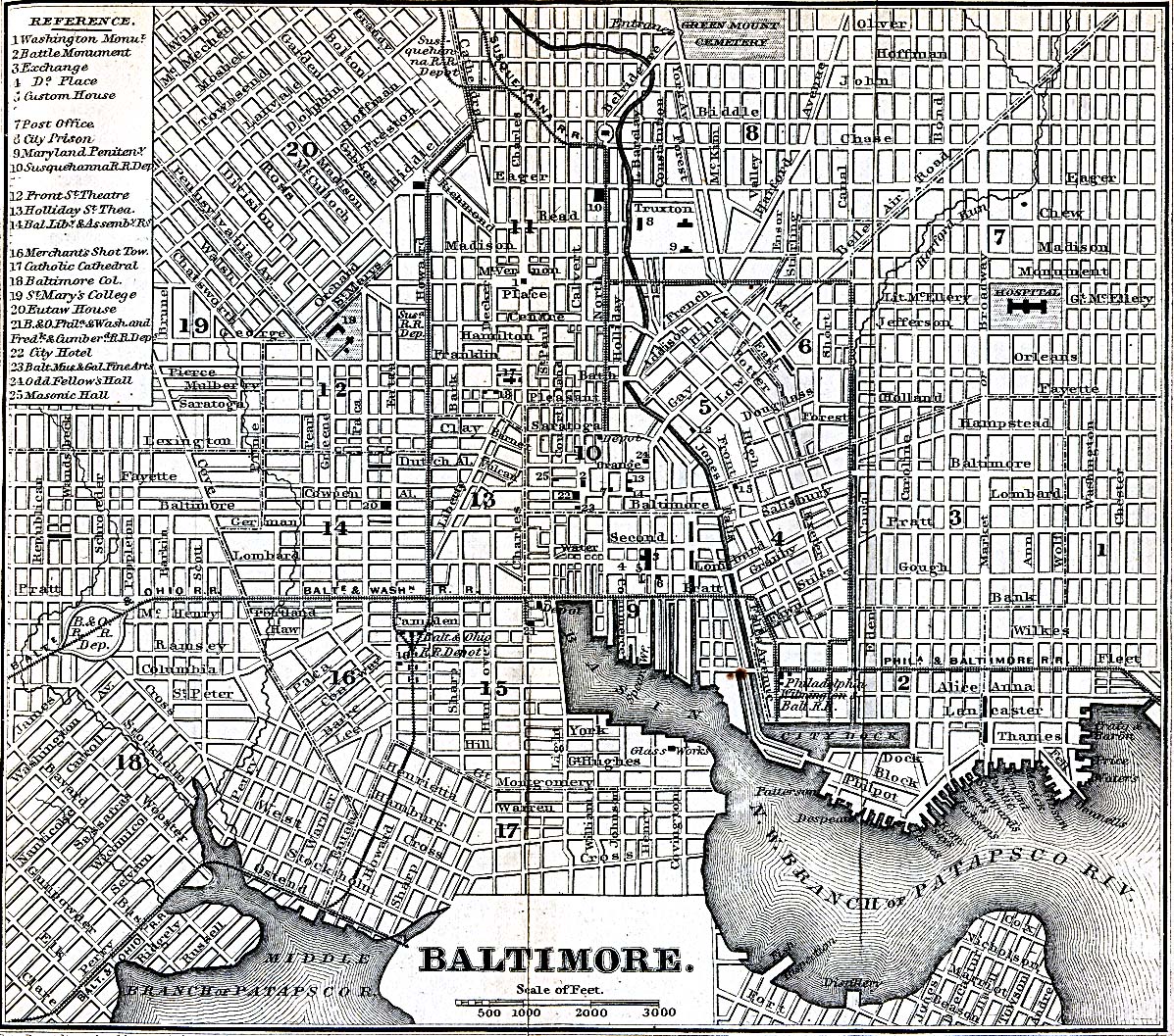
- Plan of Baltimore, 1869
- Plan of Buffalo, 1880, showing parks
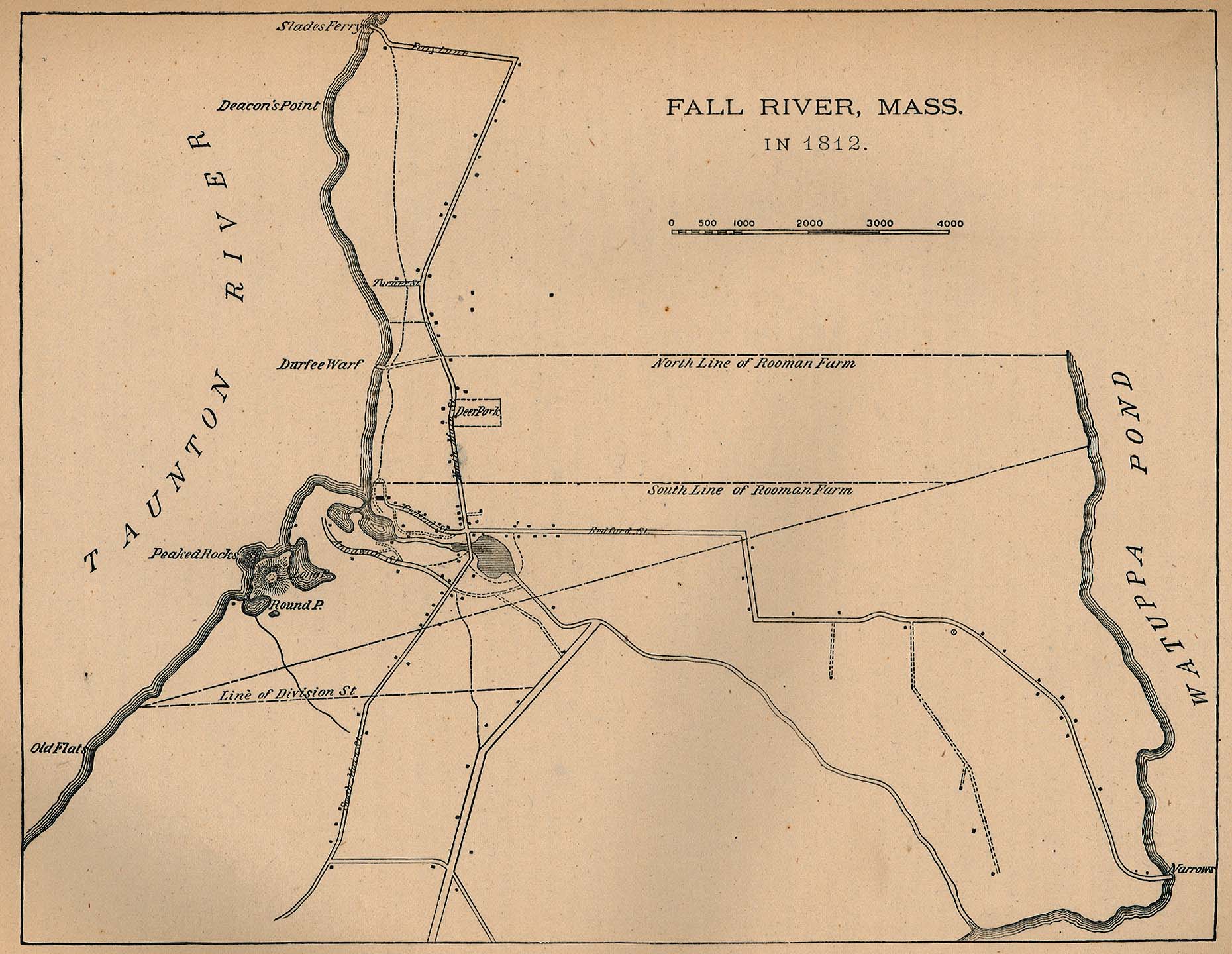
- Plan of Fall River, Massachusetts, 1812
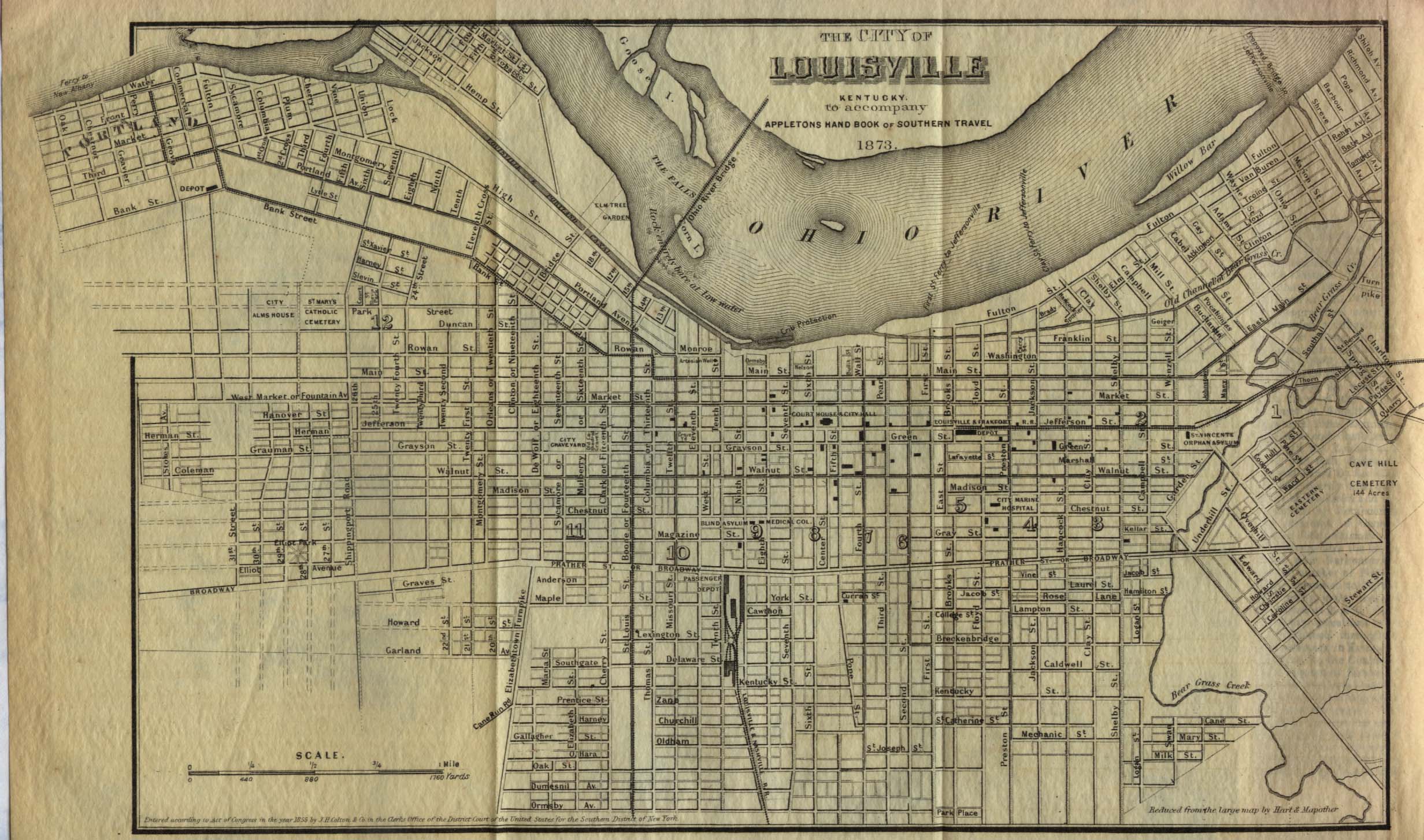
- Plan of Louisville, Kentucky, 1855
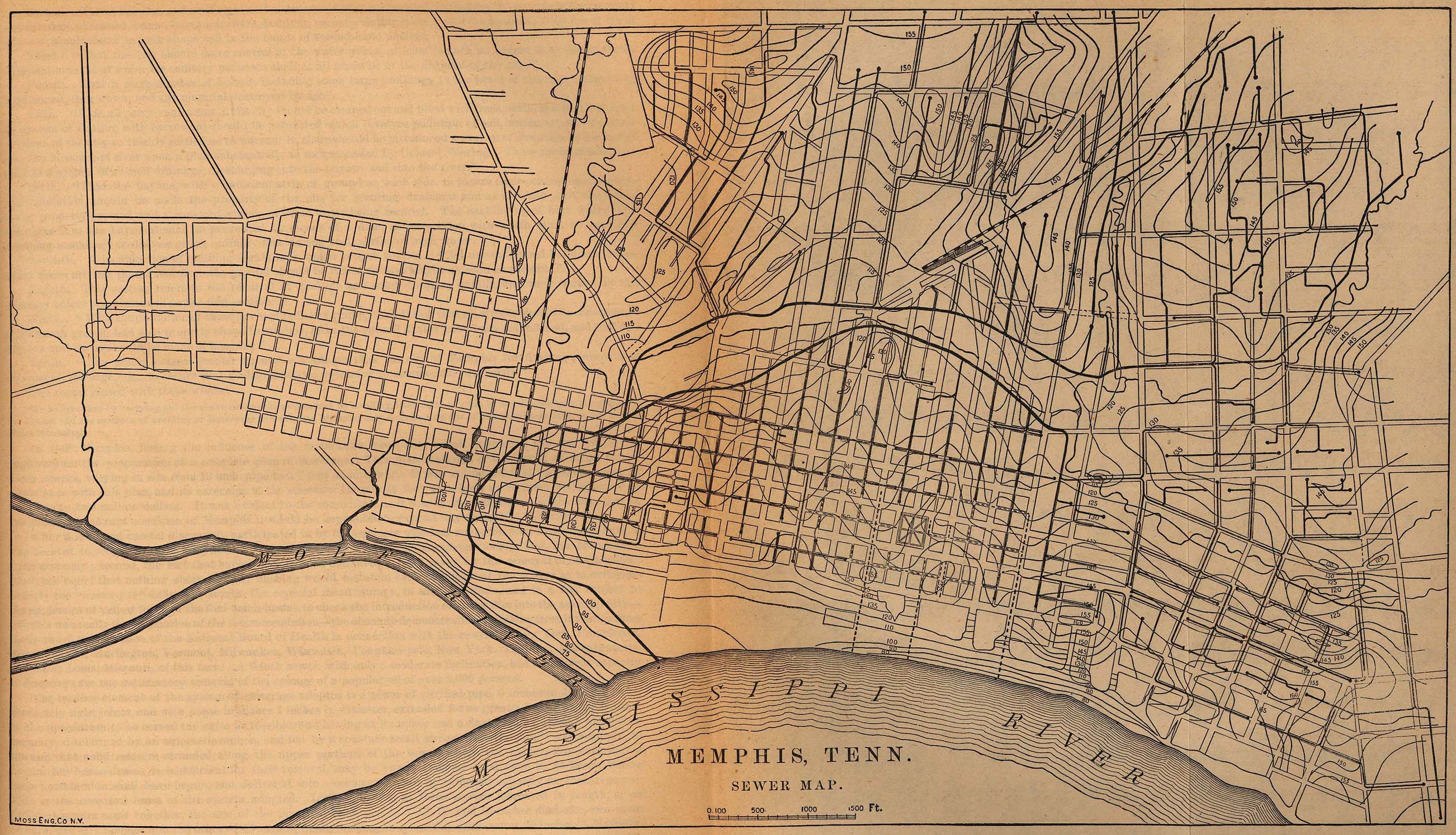
- Sewer plan of Memphis, 1880
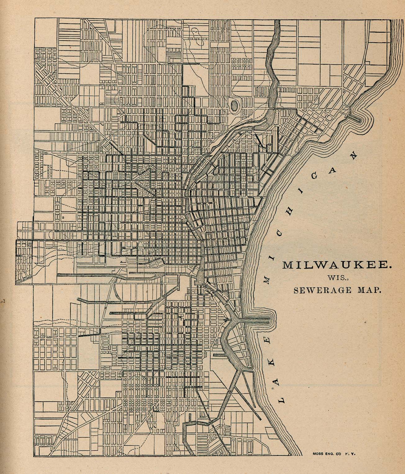
- Sewer plan of Milwaukee, 1880
- Plan of Mobile, 1815
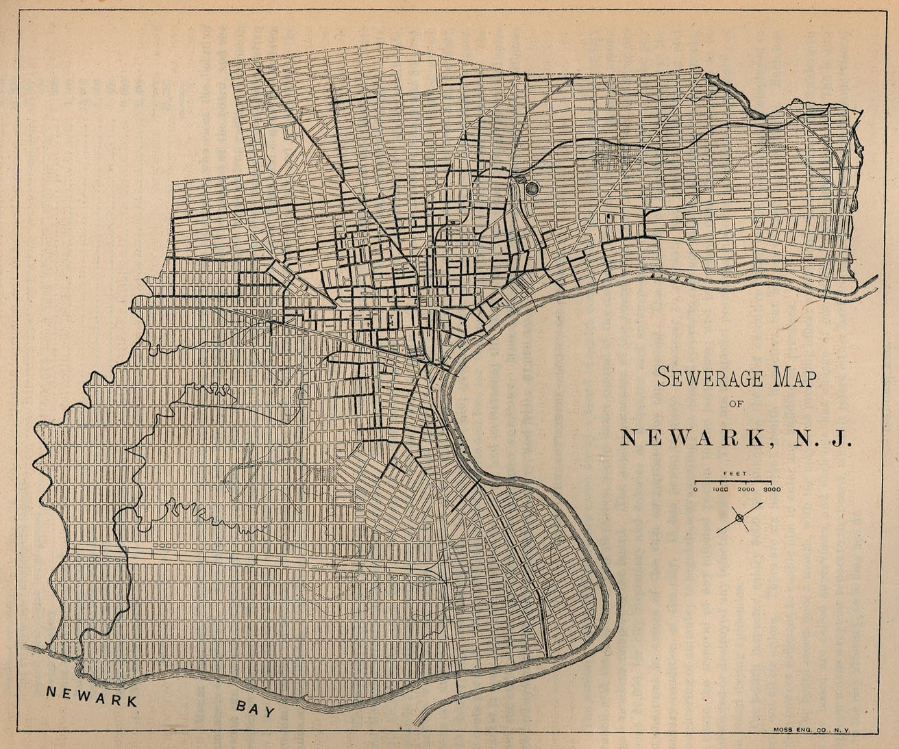
- Sewer plan of Newark, 1880
- Plan of New London, Connecticut, 1880
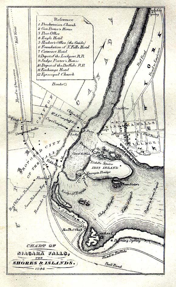
- Plan of Niagara Falls, 1844
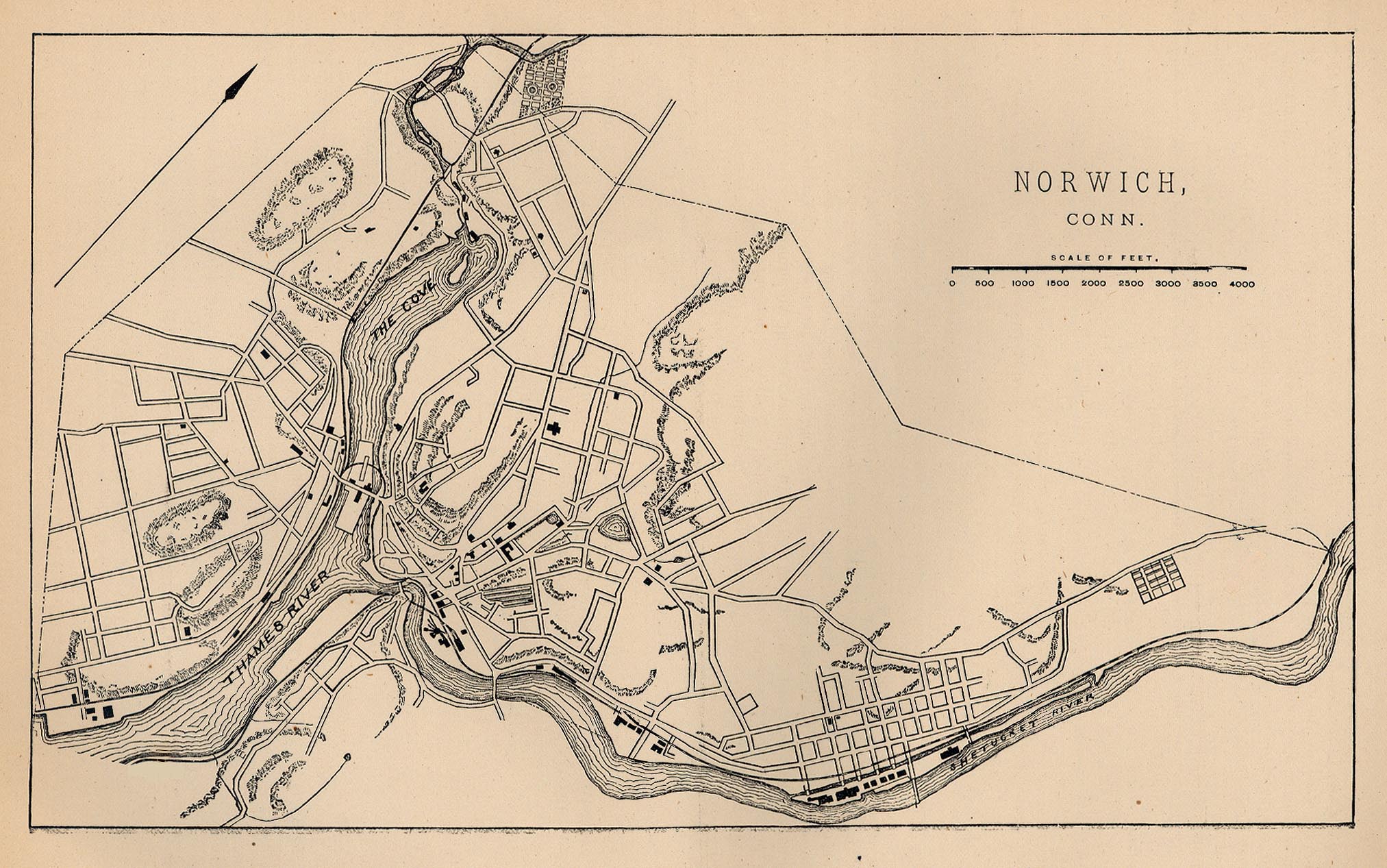
- Plan of Norwich, Connecticut, 1880
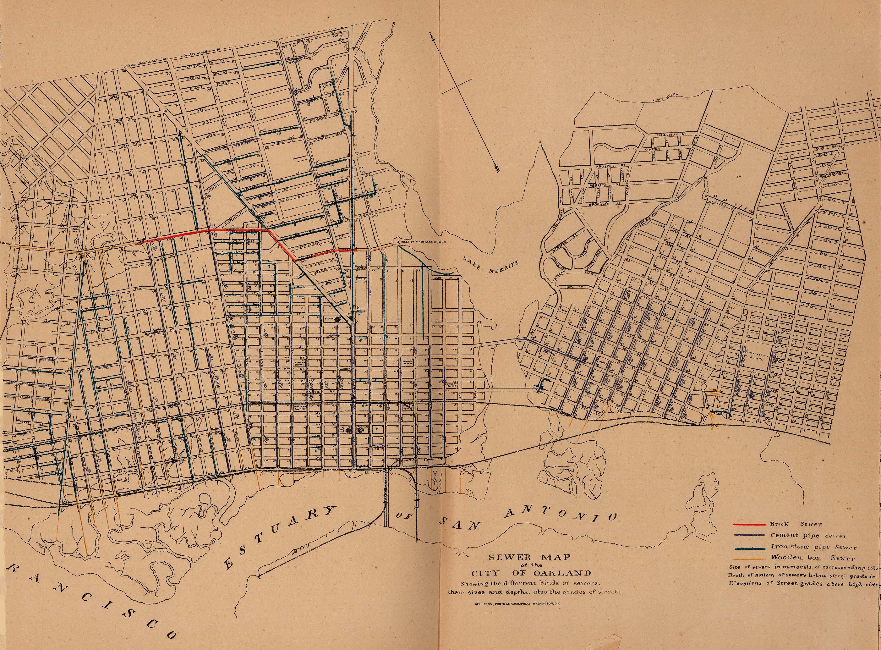
- Sewer plan of Oakland, California, 1880
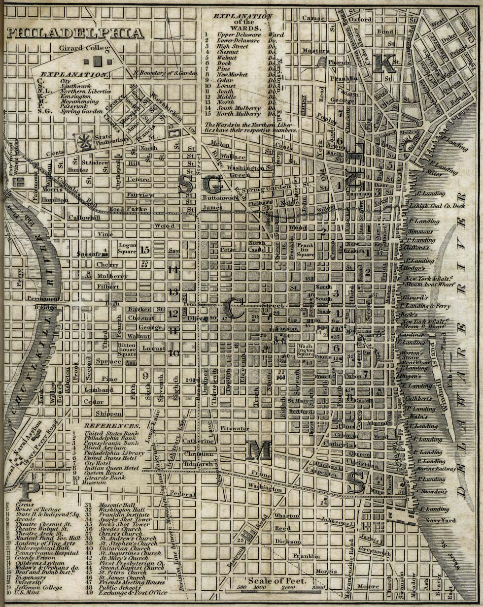
- Plan of Philadelphia, 1842
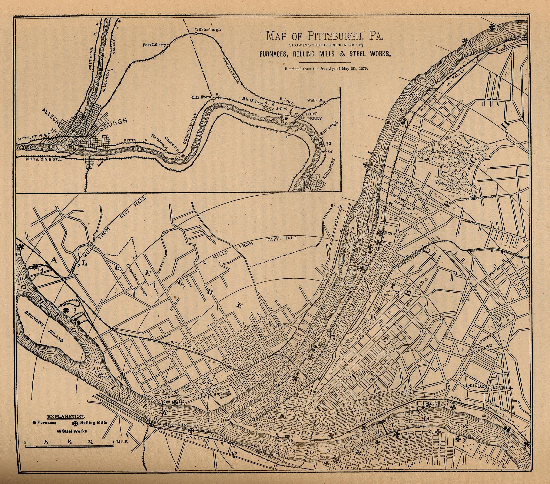
- Plan of Pittsburgh, 1879
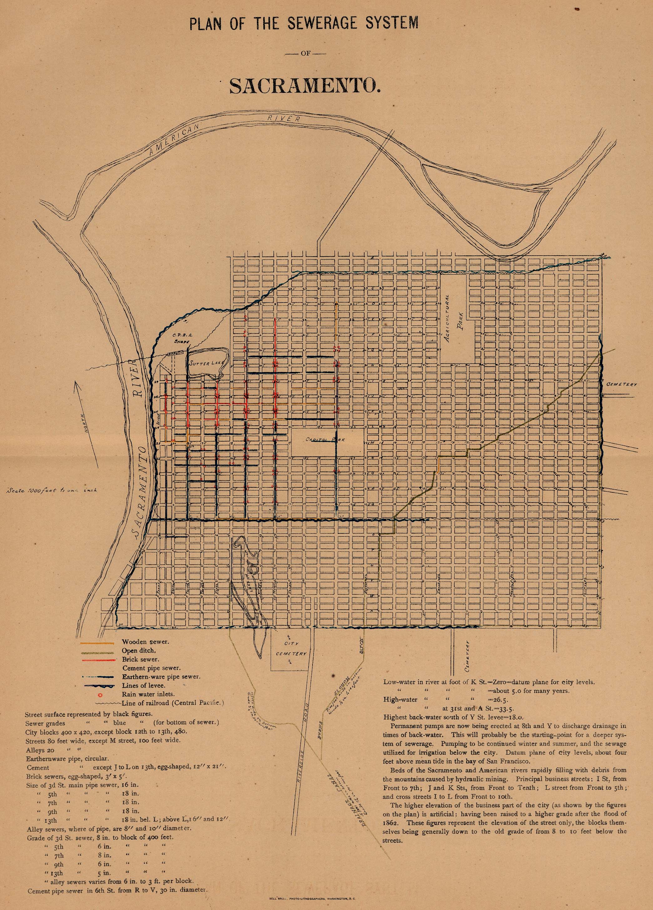
- Sewer plan of Sacramento, 1880
- Plan of St Louis, 1885
- Map of Utica, New York, and environs, 1830
- Texas
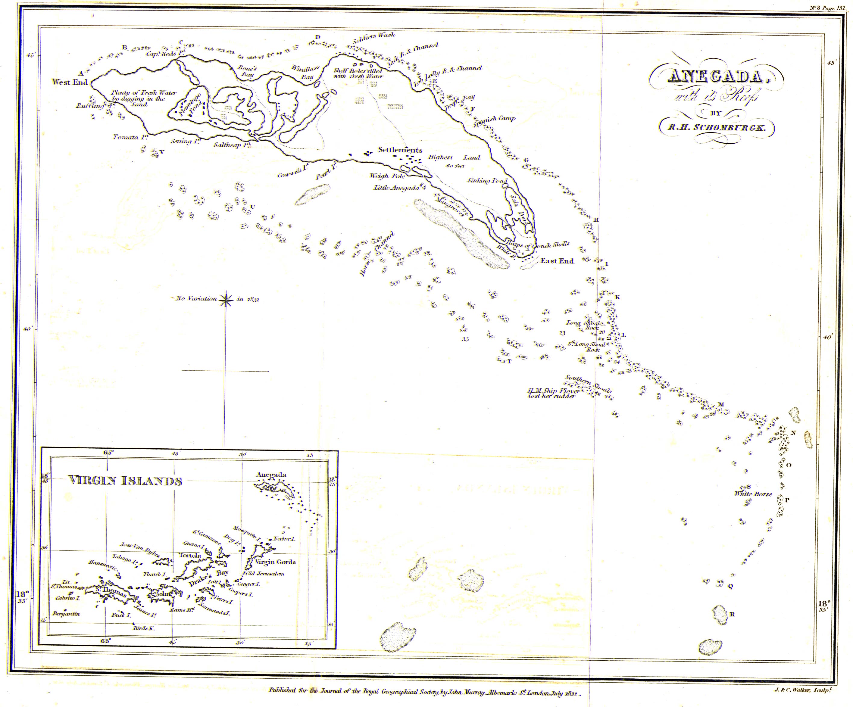
British Virgin Islands
Yemen
