-

The Palisades, or simply Palisades, is a neighborhood in Washington, D.C., along the Potomac River, running roughly from the edge of the Georgetown University campus (at Foxhall Road) to the D.C.-Maryland boundary (near Dalecarlia Treatment Plant). (Full article...) -

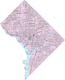
Map of Washington, D.C., with Hawthorne highlighted in red
Hawthorne is a neighborhood of 308 single family homes in the Northwest quadrant of Washington, D.C. According to neighborhood lore, the subdivision was named for the hawthorn trees once abundant in the area. The neighborhood borders Montgomery County, Maryland, and is bounded by Pinehurst Tributary to the south, Western Avenue to the northwest, and Rock Creek Park to the east. (Full article...) -
Brightwood is a neighborhood in the northwestern quadrant of Washington, D.C. Brightwood is part of Ward 4. (Full article...) -
Spring Valley is a largely residential neighborhood in Ward 3, Northwest Washington, D.C. As of July 2021, it was the most expensive neighborhood in the District, with homes selling at a median price of $1.465 million. (Full article...) -

Map of Washington, D.C., with Crestwood highlighted in maroon
Crestwood is an entirely residential neighborhood located in Northwest Washington, D.C., and bordered on three sides by Rock Creek Park. Heading north from the White House on 16th Street, Crestwood is among the first neighborhoods that features single-family homes with larger lawns. It has many mature trees, and it is not uncommon to see deer and other wildlife from the park crossing the streets there. (Full article...) -
Kent is a neighborhood in Northwest Washington, D.C. in the United States, bounded by Loughboro Road to the north, MacArthur Boulevard to the southwest, and Chain Bridge Road and Battery Kemble Park to the southeast. It is a suburban neighborhood, home to some of the most expensive homes in the city with an average home sales price in 2012 of $1.7 million ($2.26 million today). (Full article...) -

Mount Pleasant is a neighborhood in Washington, D.C., located in Northwest D.C. The neighborhood is primarily residential, with restaurants and stores centered along a commercial corridor on Mt. Pleasant Street. Mount Pleasant is known for its unique identity and multicultural landscape, home to diverse groups such as the punk rock, the Peace Corps and Hispanic Washingtonian communities. (Full article...) -
Foxhall, also known as Foxhall Village, is a neighborhood in northwestern Washington, D.C., bordered by Reservoir Road on the north side, Foxhall Road on the west, Glover-Archbold Park on the east, and P Street NW on the south (with some properties south of P Street). The first homes were constructed along Reservoir Road and Greenwich Park Way in the mid-1920s. By the end of December, 1927, some 150 homes had been erected, and the community given the name of Foxhall Village. (Full article...) -
Map of Washington, D.C., with Sursum Corda highlighted in red
Sursum Corda (Latin: "lift up your hearts") is a small neighborhood located in Washington, D.C., bounded by North Capitol Street on the east, K Street NW to the south, New Jersey Avenue NW to the west, and New York Avenue NW to the north. (Full article...) -

Shaw is a neighborhood of Washington, D.C., located in the Northwest quadrant. Shaw is a major entertainment and retail hub, and much of the neighborhood is designated as a historic district, including the smaller Blagden Alley-Naylor Court Historic District. Shaw and the U Street Corridor have historically have been the city's hub for African-American social, cultural, and economic life. (Full article...) -
Forest Hills is a residential neighborhood in the northwest quadrant of Washington, D.C., United States, bounded by Connecticut Avenue NW to the west, Rock Creek Park to the east, Chevy Chase to the north, and Tilden Street NW to the south. The neighborhood is frequently referred to as Van Ness because it is served by the Van Ness–UDC station on the Washington Metro's Red Line and is near the Van Ness campus of the University of the District of Columbia (UDC). (Full article...)


