| Place name
|
Place #
|
Street number
|
Street name
|
Suburb or town
|
Co-ordinates
|
Notes & former names
|
Photo
|
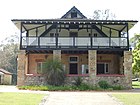
| Buckingham House |
2674 |
10F |
Neville Drive |
Wanneroo |
31°44′36″S 115°47′45″E / 31.743415°S 115.795834°E / -31.743415; 115.795834 (Buckingham House) |
Buckingham Homestead, Pioneer Activity Centre for School Groups |
|
| Cockman House |
2675 |
1230 |
Ocean Reef Road |
Wanneroo |
31°47′02″S 115°48′22″E / 31.783857°S 115.806176°E / -31.783857; 115.806176 (Cockman House) |
|
|
| Yanchep National Park Gloucester Lodge and Pool |
2677 |
3499 |
Wanneroo Road |
Yanchep |
31°32′35″S 115°41′15″E / 31.543048°S 115.687628°E / -31.543048; 115.687628 (Gloucester Lodge) |
Named after Prince Henry, Duke of Gloucester |

|
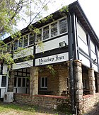
| Yanchep National Park Yanchep Inn |
2678 |
3499 |
Wanneroo Road |
Yanchep |
31°32′40″S 115°41′00″E / 31.544345°S 115.683244°E / -31.544345; 115.683244 (Yanchep Inn) |
|
|
| Yanchep National Park Tram Cottage |
2679 |
3499 |
Wanneroo Road |
Yanchep |
31°32′35″S 115°41′17″E / 31.543021°S 115.688003°E / -31.543021; 115.688003 (Tram Cottage) |
|

|
| Yanchep National Park McNess Guest House |
2680 |
3499 |
Wanneroo Road |
Yanchep |
31°32′48″S 115°41′02″E / 31.546570°S 115.683974°E / -31.546570; 115.683974 (McNess Guest House) |
|
|
| Yanchep National Park Ghost House Ruin, Chauffeur's Room and Garage |
2681 |
3499 |
Wanneroo Road |
Yanchep |
31°30′56″S 115°39′50″E / 31.515442°S 115.663791°E / -31.515442; 115.663791 (Ghost House Ruin, Chauffeur's Room and Garage) |
Shapcott's House (former) |
|
| Yanchep National Park Army Bunkers - Radar Installation |
2682 |
3499 |
Wanneroo Road |
Yanchep |
31°32′01″S 115°41′26″E / 31.5335°S 115.6906°E / -31.5335; 115.6906 (Army Bunkers) |
|

|
| Yanchep National Park Administration Building |
2683 |
3499 |
Wanneroo Road |
Yanchep |
31°32′50″S 115°41′04″E / 31.547152°S 115.684429°E / -31.547152; 115.684429 (Administration Building) |
|

|
| Yanchep National Park Recreation Hall Site |
2685 |
1 |
Indian Ocean Drive |
Yanchep |
31°32′39″S 115°40′28″E / 31.544037°S 115.674361°E / -31.544037; 115.674361 (Recreation Hall Site) |
|
|
| Yanchep National Park Precinct |
4151 |
3499 |
Wanneroo Road |
Yanchep |
|
McNess Recreation Area |

|
| Lime Kilns - Cooper's (12 & 12A) |
4558 |
Lot 693 |
Anchorage Drive |
Mindarie Keys |
31°41′07″S 115°42′14″E / 31.685159°S 115.703937°E / -31.685159; 115.703937 (Lime Kilns - Cooper's) |
Limestone quarry, Kiln 12, 12A (Cooper) |
|
| Perry's Paddock, Cottage & Stables |
9484 |
1170 |
Ocean Reef Road |
Wanneroo |
31°47′00″S 115°48′04″E / 31.783320°S 115.801019°E / -31.783320; 115.801019 (Perry's Paddock, Cottage & Stables) |
|

|
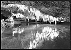
| Yanchep National Park Crystal Caves |
9529 |
3499 |
Wanneroo Road |
Yanchep |
31°32′51″S 115°41′33″E / 31.547543°S 115.692611°E / -31.547543; 115.692611 (Crystal Caves) |
|
|
| Yanchep National Park Avenue of Trees |
9531 |
|
Yanchep Road |
Yanchep |
31°33′08″S 115°41′17″E / 31.552141°S 115.687973°E / -31.552141; 115.687973 (Avenue of Trees) |
|
|
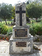
| Yanchep National Park Yanchep War Memorial |
14275 |
|
|
Yanchep National Park |
31°32′39″S 115°41′01″E / 31.544291°S 115.683652°E / -31.544291; 115.683652 (Yanchep War Memorial) |
|
|
| Yanchep National Park Generator Bunkers - Radar Installation |
14278 |
3499 |
Wanneroo Road |
Yanchep |
31°32′10″S 115°41′12″E / 31.535997°S 115.686713°E / -31.535997; 115.686713 (Generator Bunkers) |
|
|
| North West Stock Route (former) Stage 1 |
15873 |
|
|
Yanchep and Gingin |
|
Stock Route, Champion Bay Stock Route, Old North Road, Coastal Stock Route, Old North |
|
| Two Rocks Shopping Centre and Tavern |
16771 |
|
Sovereign Drive |
Two Rocks |
31°29′44″S 115°35′07″E / 31.495639°S 115.585155°E / -31.495639; 115.585155 (Two Rocks Shopping Centre and Tavern) |
Two Rocks Town Centre |
|
| Two Rocks Police Complex |
17395 |
|
Enterprise Avenue |
Two Rocks |
31°29′44″S 115°35′04″E / 31.495520°S 115.584534°E / -31.495520; 115.584534 (Two Rocks Police Complex) |
|
|
| Atlantis Marine Park (former) |
17523 |
10 |
Enterprise Avenue |
Two Rocks |
31°29′48″S 115°35′12″E / 31.496595°S 115.586730°E / -31.496595; 115.586730 (Atlantis Marine Park) |
|

|
| Olive Trees, Perry's Paddock |
17919 |
|
|
Wanneroo |
31°47′00″S 115°48′04″E / 31.783320°S 115.801019°E / -31.783320; 115.801019 (Perry's Paddock, Cottage & Stables) |
|
|
| King Neptune Sculpture |
17935 |
|
Enterprise Avenue |
Two Rocks |
31°29′47″S 115°35′11″E / 31.496389°S 115.586411°E / -31.496389; 115.586411 (King Neptune Sculpture) |
|

|
| School House - old |
17937 |
|
Perry's Paddock |
Woodvale |
31°47′00″S 115°48′04″E / 31.783320°S 115.801019°E / -31.783320; 115.801019 (Perry's Paddock, Cottage & Stables) |
|
|
| Sun City Land Sales Office (former) |
17939 |
Pt Lot 50 |
Sovereign Drive |
Two Rocks |
31°29′53″S 115°35′06″E / 31.498176°S 115.584908°E / -31.498176; 115.584908 (Sun City Land Sales Office (former)) |
|
|
| Two Rocks Limestone Retaining Wall |
17941 |
|
Pope Street & Enterprise Avenue |
Two Rocks |
31°29′47″S 115°35′04″E / 31.496352°S 115.584464°E / -31.496352; 115.584464 (Two Rocks Limestone Retaining Wall) |
|
|
| Two Rocks Marina |
17942 |
Lot 8976 |
Pope Street |
Two Rocks |
31°29′49″S 115°34′58″E / 31.496907°S 115.582682°E / -31.496907; 115.582682 (Two Rocks Marina) |
|
|
| Two Rocks Shopping Centre |
17943 |
10 & 20 |
Enterprise Avenue |
Two Rocks |
31°29′43″S 115°35′03″E / 31.495357°S 115.584270°E / -31.495357; 115.584270 (Two Rocks Shopping Centre) |
|
|
| Two Rocks Tavern |
17944 |
20 |
Enterprise Avenue |
Two Rocks |
31°29′46″S 115°35′05″E / 31.496157°S 115.584736°E / -31.496157; 115.584736 (Two Rocks Tavern) |
|
|
| Waugal Monoliths |
17948 |
10 |
Enterprise Avenue |
Two Rocks |
31°29′45″S 115°35′05″E / 31.495879°S 115.584764°E / -31.495879; 115.584764 (Waugal Monoliths) |
|
|
| Yanchep National Park Yanchep Golf Clubhouse |
17950 |
|
Lot 11544 |
Yanchep National Park |
31°32′31″S 115°40′59″E / 31.542010°S 115.683080°E / -31.542010; 115.683080 (Yanchep Golf Clubhouse) |
|

|
| Boongarra Government Well |
18095 |
|
State Forest off Wanneroo Road |
Wilbinga |
|
Boongarra Swamp, Boongarra Well |
|
| North West Stock Route (former) |
24914 |
|
|
Yanchep |
|
|
|
| Sun City Precinct, Two Rocks |
26470 |
|
|
Two Rocks |
31°29′45″S 115°35′08″E / 31.495868°S 115.585643°E / -31.495868; 115.585643 (Sun City Precinct, Two Rocks) |
|
|


