
Size of this JPG preview of this TIF file: 800 × 492 pixels. Other resolutions: 320 × 197 pixels | 640 × 394 pixels | 957 × 589 pixels.
Original file (957 × 589 pixels, file size: 666 KB, MIME type: image/tiff)
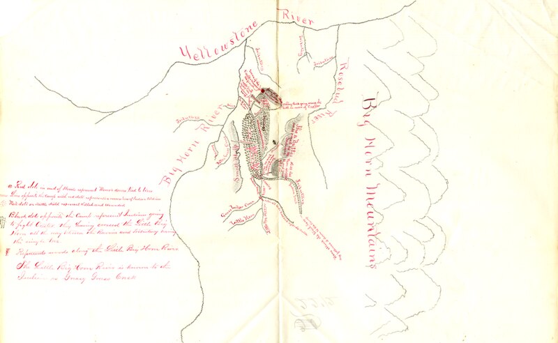
Army map, drawn based on interview with Kill Eagle, 1876. Original in RG393 Records of Continental Commands, Fort Yates, Letters Received. Scanned by Ephriam Dickson. Map in the public domain.
File history
Click on a date/time to view the file as it appeared at that time.
| Date/Time | Thumbnail | Dimensions | User | Comment | |
|---|---|---|---|---|---|
| current | 18:15, 20 December 2011 |  | 957 × 589 (666 KB) | Ephriam3 (talk | contribs) | Army map, drawn based on interview with Kill Eagle, 1876. Original in RG393 Records of Continental Commands, Fort Yates, Letters Received. Scanned by Ephriam Dickson. Map in the public domain. |
You cannot overwrite this file.
File usage
The following pages on the English Wikipedia use this file (pages on other projects are not listed):