Jo-Jo Eumerus (talk | contribs) Expanding article |
Jo-Jo Eumerus (talk | contribs) Expanding article |
||
| Line 22: | Line 22: | ||
In Bolivia, the [[Andes]] mountain chain splits up into two branches separated by a {{convert|3500|-|4000|m}} high plateau, the [[Altiplano]].{{sfn|Vuille|1999|p=1579}} Nevado Sajama lies in the Western Andes of Bolivia{{sfn|Vuille|1999|p=1579}} and in the western side of the Altiplano.<ref name="ReeseLiu2013" /> |
In Bolivia, the [[Andes]] mountain chain splits up into two branches separated by a {{convert|3500|-|4000|m}} high plateau, the [[Altiplano]].{{sfn|Vuille|1999|p=1579}} Nevado Sajama lies in the Western Andes of Bolivia{{sfn|Vuille|1999|p=1579}} and in the western side of the Altiplano.<ref name="ReeseLiu2013" /> |
||
Nevado Sajama rises about {{convert|2.2|km}} from the surrounding terrain to a height of {{convert|6542|m}},<ref name="GVP" /> making it the highest mountain of Bolivia.{{sfn|Vuille|1999|p=1580}} Two secondary summits {{convert|16506|ft|m|order=flip}} and {{convert|16932|ft|m|order=flip}} occur west and east-northeast from Sajama respectively; the former is named Cerro Huisalla<ref name="Map2" /> and the second is called Huayna Potosi.<ref name="Map1" /> The mountain has a conical shape and is capped by a [[summit crater]].<ref name="Ferrán1995" /> |
Nevado Sajama rises about {{convert|2.2|km}} from the surrounding terrain to a height of {{convert|6542|m}},<ref name="GVP" /> making it the highest mountain of Bolivia.{{sfn|Vuille|1999|p=1580}} Two secondary summits {{convert|16506|ft|m|order=flip}} and {{convert|16932|ft|m|order=flip}} occur west and east-northeast from Sajama respectively; the former is named Cerro Huisalla<ref name="Map2" /> and the second is called Huayna Potosi.<ref name="Map1" /> The mountain has a conical shape and is capped by a [[summit crater]].<ref name="Ferrán1995" /> The Patokho, Huaqui Jihuata and Phajokhoni valleys are located on the eastern flank.{{sfn|Smith|Lowell|Caffee|2009|p=362}} |
||
The terrain is characterized by a continuous [[ice]] cover in the central sector of the mountain, exposures of [[bedrock]], deposits and [[rock glacier]]s in some sites, [[alluvial fan]]s and [[scree]] in the periphery of Sajama and [[moraine]]s forming a girdle around the upper sector of Sajama.{{sfn|Smith|Lowell|Caffee|2009|p=361}} The ground moraines are the most prominent moraines on Sajama, and have varying colours depending on the source of their component rocks. Vegetation and small lakes occur in their proximity, while other parts are unvegetated. They mostly occur within glacial valleys, but some appear to have formed underneath small plateau ice caps on flatter terrain.{{sfn|Smith|Lowell|Caffee|2009|pp=363-365}} |
|||
A number of [[wetland]]s called ''[[bofedal]]es'' occur on the mountain.<ref name="Map1" /> Starting in the lake Laguna Huana Kkota on the northwestern foot of Sajama, the Tomarapi River flows first northeastward, then east, south and southeast around the northern and eastern flanks of the volcano; the Sicuyani River which originates on Sajama joins it there. The southern flanks give rise to the Huaythana River which flows directly south and then makes a sharp turn to the east. On the western side of the volcano originates the Sajama River which flows due south and increasingly turns southeast before joining the [[Lauca River]].<ref name="Map2" /> |
A number of [[wetland]]s called ''[[bofedal]]es'' occur on the mountain.<ref name="Map1" /> Starting in the lake Laguna Huana Kkota on the northwestern foot of Sajama, the Tomarapi River flows first northeastward, then east, south and southeast around the northern and eastern flanks of the volcano; the Sicuyani River which originates on Sajama joins it there. The southern flanks give rise to the Huaythana River which flows directly south and then makes a sharp turn to the east. On the western side of the volcano originates the Sajama River which flows due south and increasingly turns southeast before joining the [[Lauca River]].<ref name="Map2" /> |
||
| Line 28: | Line 30: | ||
== Geology == |
== Geology == |
||
Nevado Sajama is part of the [[Central Volcanic Zone]] of the Andes, where volcanism is triggered by the [[subduction]] of the [[Nazca Plate]] beneath the [[South America Plate]].<ref name="Galarza2004" /> |
Nevado Sajama is part of the [[Central Volcanic Zone]] of the Andes, where volcanism is triggered by the [[subduction]] of the [[Nazca Plate]] beneath the [[South America Plate]].<ref name="Galarza2004" /> Volcanoes in the region have ages ranging from [[Pleistocene]] to [[Miocene]].{{sfn|Smith|Lowell|Caffee|2009|p=361}} |
||
The mountain is a [[stratovolcano]] located atop several [[lava dome]]s. The stratovolcano consists of [[lava flow]]s and [[pyroclastic]] material which radiate away from the centre of the volcano.<ref name="Ferrán1995" /> Some [[parasitic vents]] occur southeast of Sajama;<ref name="GVP" /> the whole complex is a [[compound volcano]]. Two later volcanic units are known as the Colquen Wilqui lavas and the Jacha Khala [[tuff]].<ref name="Galarza2004" /> |
The mountain is a [[stratovolcano]] located atop several [[lava dome]]s. The stratovolcano consists of [[lava flow]]s and [[pyroclastic]] material which radiate away from the centre of the volcano.<ref name="Ferrán1995" /> Some [[parasitic vents]] occur southeast of Sajama;<ref name="GVP" /> the whole complex is a [[compound volcano]]. Two later volcanic units are known as the Colquen Wilqui lavas and the Jacha Khala [[tuff]].<ref name="Galarza2004" /> |
||
| Line 42: | Line 44: | ||
== Climate == |
== Climate == |
||
At Cosapa on the foot of Sajama, annual mean temperatures are about {{convert|7.3|C}}.{{sfn|Smith|Lowell|Caffee|2009|p=361}} |
|||
| ⚫ | Sajama is located between two climate regimes, a westerly one characterized by a dry climate and the [[Southeast Pacific High]] and an easterly one with a moister atmosphere. During the southern hemisphere summer, easterly winds carry moist air towards Sajama where solar [[insolation]] then triggers showers and [[thunderstorm]]s |
||
| ⚫ | Sajama is located between two climate regimes, a westerly one characterized by a dry climate and the [[Southeast Pacific High]] and an easterly one with a moister atmosphere. During the southern hemisphere summer, easterly winds carry moist air towards Sajama where solar [[insolation]] then triggers showers and [[thunderstorm]]s;{{sfn|Vuille|1999|p=1580}} the moisture ultimately originates in the [[Atlantic Ocean]].{{sfn|Smith|Lowell|Caffee|2009|p=361}} During winter, dry westerly winds prevail although cold air outbreaks from the [[westerlies]] belt sometimes trigger intense [[snowfall]]{{sfn|Vuille|1999|p=1581}} which is often underestimated by precipitation data.{{sfn|Vuille|1999|p=1582}} Overall, on the Altiplano precipitation diminishes from the northeast to the southwest.<ref name="ReeseLiu2013" /> |
||
Summer precipitation is typically reduced during [[El Nino]] years,{{sfn|Vuille|1999|p=1598}} but on Nevado Sajama there is little correlation.{{sfn|Vuille|1999|p=1599}} |
Summer precipitation is typically reduced during [[El Nino]] years,{{sfn|Vuille|1999|p=1598}} but on Nevado Sajama there is little correlation.{{sfn|Vuille|1999|p=1599}} |
||
| Line 56: | Line 60: | ||
== Glaciers == |
== Glaciers == |
||
Above {{convert|5600|m}}, Sajama is extensively [[glaciated]].<ref name="GVP" /> It is among the southernmost mountains in the region with significant glaciers; farther south the atmosphere is too dry to permit the development of glaciers.{{sfn|Smith|Lowell|Caffee|2009|p=361}} The history of glaciation on Sajama in general is poorly known,{{sfn|Smith|Lowell|Caffee|2009|p=362}} but it appears that the outermost glacial features originated during the late [[last glacial maximum]] and the intermediary features during the [[Middle Holocene]]{{sfn|Smith|Lowell|Caffee|2009|p=368}} which is usually considered to be a warm and dry period in the region.{{sfn|Smith|Lowell|Caffee|2009|p=371}} |
|||
Above {{convert|5600|m}}, Sajama is extensively [[glaciated]].<ref name="GVP" /> |
|||
Two [[ice core]]s were taken in 1997 from the summit area.<ref name="ReeseLiu2013" /> |
Two [[ice core]]s were taken in 1997 from the summit area.<ref name="ReeseLiu2013" /> |
||
[[Rock glacier]]s also occur above the zero degree isotherm above {{convert|4800|m}}, such as on lateral peaks.{{sfn|Smith|Lowell|Caffee|2009|p=365}} |
|||
== Human use == |
== Human use == |
||
| Line 89: | Line 95: | ||
=== Sources === |
=== Sources === |
||
{{refbegin}} |
{{refbegin}} |
||
* {{cite journal |last1=Smith |first1=Colby A. |last2=Lowell |first2=Thomas V. |last3=Caffee |first3=Marc W. |title=Lateglacial and Holocene cosmogenic surface exposure age glacial chronology and geomorphological evidence for the presence of cold-based glaciers at Nevado Sajama, Bolivia |journal=Journal of Quaternary Science |date=May 2009 |volume=24 |issue=4 |pages=360–372 |doi=10.1002/jqs.1239 |url=https://onlinelibrary.wiley.com/doi/abs/10.1002/jqs.1239 |ref=harv |language=en |issn=0267-8179}} |
|||
* {{cite journal |last1=Vuille |first1=M. |title=Atmospheric circulation over the Bolivian Altiplano during dry and wet periods and extreme phases of the Southern Oscillation |journal=International Journal of Climatology |date=30 November 1999 |volume=19 |issue=14 |pages=1579–1600 |doi=10.1002/(SICI)1097-0088(19991130)19:14<1579::AID-JOC441>3.0.CO;2-N |ref=harv}} |
* {{cite journal |last1=Vuille |first1=M. |title=Atmospheric circulation over the Bolivian Altiplano during dry and wet periods and extreme phases of the Southern Oscillation |journal=International Journal of Climatology |date=30 November 1999 |volume=19 |issue=14 |pages=1579–1600 |doi=10.1002/(SICI)1097-0088(19991130)19:14<1579::AID-JOC441>3.0.CO;2-N |ref=harv}} |
||
{{refend}} |
{{refend}} |
||
Revision as of 13:54, 28 October 2018
| Nevado Sajama | |
|---|---|
 Nevado Sajama | |
| Highest point | |
| Elevation | 6,542 m (21,463 ft) |
| Coordinates | 18°06′S 68°53′W / 18.1°S 68.88°W[1] |
Nevado Sajama is an extinct stratovolcano and the highest peak in Bolivia. The mountain is located in the Oruro Department, Sajama Province, Curahuara de Carangas Municipality, Sajama Canton.[2] It is situated in Sajama National Park in the southwest area of the country some 16–24 km (10-15 mi) from the border with Chile. The peak is an isolated cone, but is geologically complex, with lava domes of andesitic and rhyodactic composition overlain by an andesitic stratovolcano. The date of the most recent eruption is uncertain, although Holocene activity is assigned to the volcano by many. The treeline of Polylepis tarapacana on the volcano is as high as 5,200 m above sea level, one of the highest altitudes trees can be found growing anywhere in the world.
Joseph Prem made the first attempt to climb the mountain in 1927 by the northwest ridge but was stopped short at 6,200 m. After several more attempts, Prem along with Wilfrid Kuehm reached the top in August 1939 by a more difficult southeast ridge.
From the village of Sajama an acclimatised team can climb the mountain in two or three days if weather conditions are favorable. Currently the easiest of the routes is the SW ridge. This route is technically easy, require some minimal mountaineering equipment and does not present any particular difficulty except some snow slopes up to 45 degrees.
In August 2001, two teams of Sajama villagers and Bolivian mountain guides played a football match on top of Mount Sajama in an effort to show that altitude itself is not a limitation to physical strain.[3][4] Indeed, the objective was to protest against the FIFA decision to discontinue the use of La Paz as a location to hold international football matches, because of its very high elevation.
Geography and geomorphology
Nevado Sajama is located in the Sajama canton of the Oruro Department in Bolivia.[5] 20 metres (66 ft) away from the border with Chile. Cholcani volcano lies southeast of Sajama[1] and another neighbouring volcano, Pomerape, resembles Sajama in its appearance.[6] A road runs along the southeastern flank of the volcano, with additional roads completing a circle around Sajama. The town of Sajama lies on its western foot, with further villages at Caripe northeast and Lagunas southwest of the mountain; there are also a number of farms.[7]
In Bolivia, the Andes mountain chain splits up into two branches separated by a 3,500–4,000 metres (11,500–13,100 ft) high plateau, the Altiplano.[8] Nevado Sajama lies in the Western Andes of Bolivia[8] and in the western side of the Altiplano.[9]
Nevado Sajama rises about 2.2 kilometres (1.4 mi) from the surrounding terrain to a height of 6,542 metres (21,463 ft),[1] making it the highest mountain of Bolivia.[10] Two secondary summits 5,031 metres (16,506 ft) and 5,161 metres (16,932 ft) occur west and east-northeast from Sajama respectively; the former is named Cerro Huisalla[11] and the second is called Huayna Potosi.[12] The mountain has a conical shape and is capped by a summit crater.[6] The Patokho, Huaqui Jihuata and Phajokhoni valleys are located on the eastern flank.[13]
The terrain is characterized by a continuous ice cover in the central sector of the mountain, exposures of bedrock, deposits and rock glaciers in some sites, alluvial fans and scree in the periphery of Sajama and moraines forming a girdle around the upper sector of Sajama.[14] The ground moraines are the most prominent moraines on Sajama, and have varying colours depending on the source of their component rocks. Vegetation and small lakes occur in their proximity, while other parts are unvegetated. They mostly occur within glacial valleys, but some appear to have formed underneath small plateau ice caps on flatter terrain.[15]
A number of wetlands called bofedales occur on the mountain.[12] Starting in the lake Laguna Huana Kkota on the northwestern foot of Sajama, the Tomarapi River flows first northeastward, then east, south and southeast around the northern and eastern flanks of the volcano; the Sicuyani River which originates on Sajama joins it there. The southern flanks give rise to the Huaythana River which flows directly south and then makes a sharp turn to the east. On the western side of the volcano originates the Sajama River which flows due south and increasingly turns southeast before joining the Lauca River.[11]
Geology
Nevado Sajama is part of the Central Volcanic Zone of the Andes, where volcanism is triggered by the subduction of the Nazca Plate beneath the South America Plate.[5] Volcanoes in the region have ages ranging from Pleistocene to Miocene.[14]
The mountain is a stratovolcano located atop several lava domes. The stratovolcano consists of lava flows and pyroclastic material which radiate away from the centre of the volcano.[6] Some parasitic vents occur southeast of Sajama;[1] the whole complex is a compound volcano. Two later volcanic units are known as the Colquen Wilqui lavas and the Jacha Khala tuff.[5]
Argon-argon dating has yielded ages of 80,900 to 25,000 years ago for the Kkota Kkotani lavas, which are unrelated to the main Sajama volcano.[5] The date of the last eruption is not known, it may have occurred in the Pleistocene or Holocene.[1]
Three major geologic lineaments occur in the region, the north-northwesterly trending Sajama lineament, a west-southwesterly one aligned with high topographical features and a west-northwesterly one. The west-southwesterly one played an important role in the development of Sajama volcano.[5]
Composition
The volcano has erupted rocks ranging from andesite to rhyodacite, with the main stratovolcano formed by andesites[1] that contain hornblende and pyroxene.[6] The volcanic rocks erupted by Sajama define a potassium-rich calc-alkaline suite and formed through various processes, including assimilation of country rock, fractional crystallization and magma mixing (particularly in the Sayara lavas).[5]
Climate
At Cosapa on the foot of Sajama, annual mean temperatures are about 7.3 °C (45.1 °F).[14]
Sajama is located between two climate regimes, a westerly one characterized by a dry climate and the Southeast Pacific High and an easterly one with a moister atmosphere. During the southern hemisphere summer, easterly winds carry moist air towards Sajama where solar insolation then triggers showers and thunderstorms;[10] the moisture ultimately originates in the Atlantic Ocean.[14] During winter, dry westerly winds prevail although cold air outbreaks from the westerlies belt sometimes trigger intense snowfall[16] which is often underestimated by precipitation data.[17] Overall, on the Altiplano precipitation diminishes from the northeast to the southwest.[9]
Summer precipitation is typically reduced during El Nino years,[18] but on Nevado Sajama there is little correlation.[19]
Vegetation
While the vegetation of the surroundings of Sajama is considered to be a dry grassland known as puna, on the mountain itself there is some vertical gradation. Below 4,000 metres (13,000 ft) shrubs such as asteraceae, cactaceae, fabaceae and solanaceae dominate the vegetation. Between 4,000–4,800 metres (13,100–15,700 ft) the last three families become less important. Here especially during the wet season poaceae grasses become more important; finally above 4,800 metres (15,700 ft) frost-tolerant herbs such as Azorella and asteraceae, caryophyllaceae, malvaceae and poaceae make up most of the vegetation.[9]
In depressions or places where water occurs, peat bogs called bofedales develop. Taxa that occur here include apiaceae, cyperaceae, Azolla, Distichia and Plantago.[9]
Up to 5 kilometres (3.1 mi) elevation Polylepis tarapacana forms woodlands. The current woods are remnants; whether the decrease is caused by human impact or climate change is not clear.[9] Protecting these woodlands was the impetus for the 1939 creation of the Sajama National Park.[20]
Glaciers
Above 5,600 metres (18,400 ft), Sajama is extensively glaciated.[1] It is among the southernmost mountains in the region with significant glaciers; farther south the atmosphere is too dry to permit the development of glaciers.[14] The history of glaciation on Sajama in general is poorly known,[13] but it appears that the outermost glacial features originated during the late last glacial maximum and the intermediary features during the Middle Holocene[21] which is usually considered to be a warm and dry period in the region.[22]
Two ice cores were taken in 1997 from the summit area.[9]
Rock glaciers also occur above the zero degree isotherm above 4,800 metres (15,700 ft), such as on lateral peaks.[23]
Human use
The 50 Bolivian boliviano banknote launched in October 2018 shows Sajama on its backside.[24]
See also
- Asu Asuni
- Jach'a Kunturiri
- K'isi K'isini
- Llisa
- Pomerape
- Sajama Lines
- Waña Quta
- List of volcanoes in Bolivia
References
- ^ a b c d e f g "Nevado del Sajama". Global Volcanism Program. Smithsonian Institution.
- ^ Map of Curahuara de Carangas Municipality and population data Archived 2014-11-11 at the Wayback Machine
- ^ Enever, Andrew (7 August 2001). "Bolivian footballers reach new high". BBC News. Archived from the original on 21 October 2007.
{{cite news}}: Unknown parameter|deadurl=ignored (|url-status=suggested) (help) - ^
"L'Internaute website: Football at 6542 m". High Altitude Pathology Institute. Archived from the original on 8 October 2011.
{{cite web}}: Unknown parameter|deadurl=ignored (|url-status=suggested) (help) - ^ a b c d e f Galarza, Mauri, Iris Marcela (2004). "Geología y petrología del volcán Sajama: Provincia Sajama, departamento de Oruro" (in Spanish). La Paz: Higher University of San Andrés. Retrieved 27 October 2018.
{{cite web}}: CS1 maint: multiple names: authors list (link) - ^ a b c d Ferrán, O. González (1995). Volcanes de Chile (in Spanish). Instituto Geográfico Militar. p. 109. ISBN 9789562020541.
- ^ Hoffmann, Dirk (February 2007). "The Sajama National Park in Bolivia". Mountain Research and Development. 27 (1): 12. doi:10.1659/0276-4741(2007)27[11:TSNPIB]2.0.CO;2.
- ^ a b Vuille 1999, p. 1579.
- ^ a b c d e f Reese, C. A.; Liu, K. B.; Thompson, L. G. (2013). "An ice-core pollen record showing vegetation response to Late-glacial and Holocene climate changes at Nevado Sajama, Bolivia". Annals of Glaciology. 54 (63): 184. doi:10.3189/2013AoG63A375. ISSN 0260-3055.
- ^ a b Vuille 1999, p. 1580.
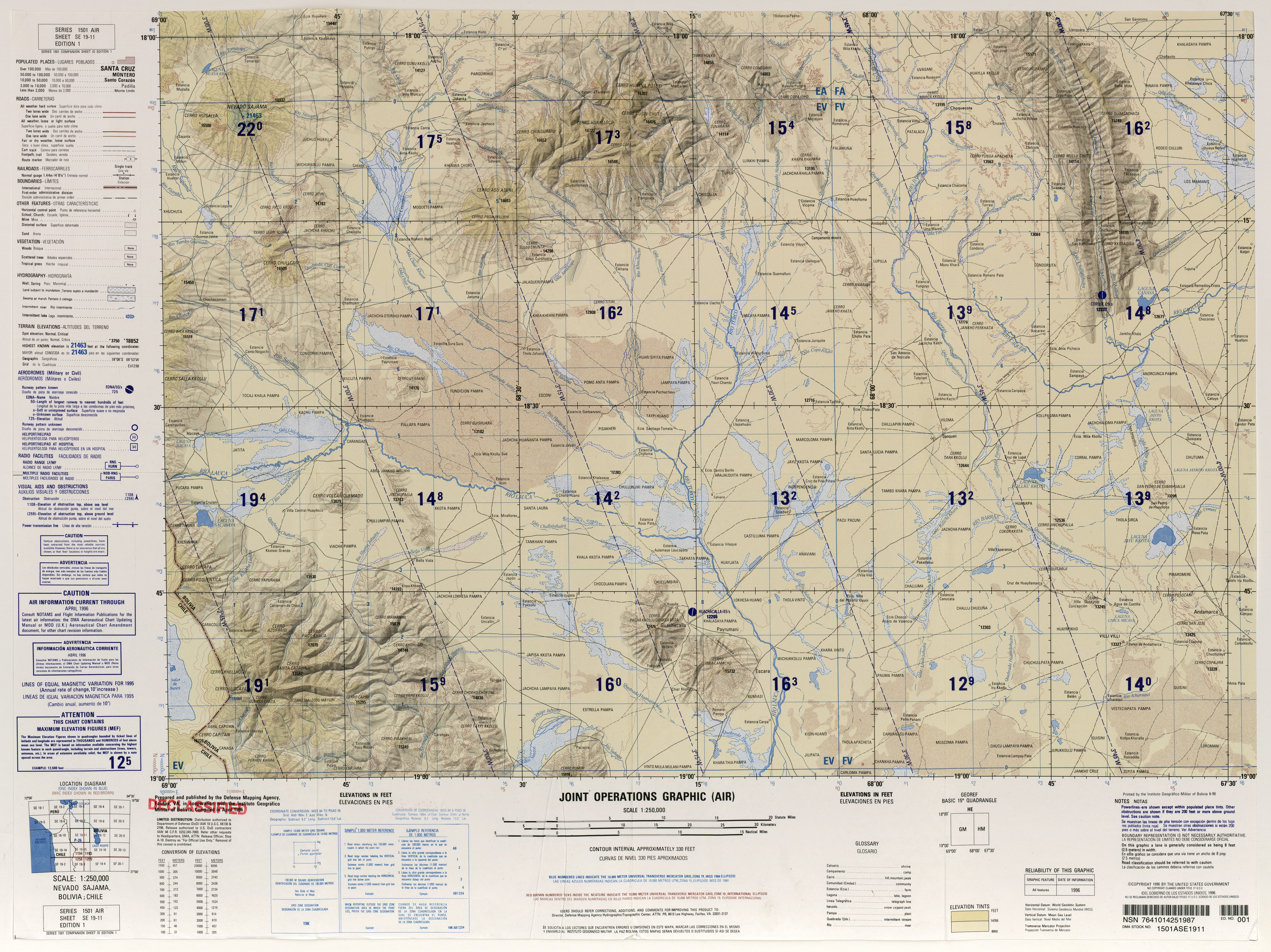
- ^ a b Defense Mapping Agency (1996). "Nevado Sajama, Bolivia; Chile" (Map). Latin America, Joint Operations Graphic (1 ed.). 1:250000.
- ^ a b "NEVADO SAJAMA, BOLIVIA 5839-IV H731 EDICION 1-IGM" (PDF). IGM Bolivia (in Spanish). Archived from the original (PDF) on 8 September 2017. Retrieved 27 October 2018.
- ^ a b Smith, Lowell & Caffee 2009, p. 362.
- ^ a b c d e Smith, Lowell & Caffee 2009, p. 361.
- ^ Smith, Lowell & Caffee 2009, pp. 363–365.
- ^ Vuille 1999, p. 1581.
- ^ Vuille 1999, p. 1582.
- ^ Vuille 1999, p. 1598.
- ^ Vuille 1999, p. 1599.
- ^ "ÁREAS PROTEGIDAS SUBNACIONALES EN BOLIVIA SITUACION ACTUAL 2012" (PDF). Dirección General de Biodiversidad y Áreas Protegidas (in Spanish). 2012. p. 10. Retrieved 28 October 2018.
- ^ Smith, Lowell & Caffee 2009, p. 368.
- ^ Smith, Lowell & Caffee 2009, p. 371.
- ^ Smith, Lowell & Caffee 2009, p. 365.
- ^ "El Banco Central de Bolivia lanza a la circulación el nuevo billete de Bs50" (in Spanish). Banco Central de Bolivia . 26 October 2018. Retrieved 27 October 2018.
Sources
- Smith, Colby A.; Lowell, Thomas V.; Caffee, Marc W. (May 2009). "Lateglacial and Holocene cosmogenic surface exposure age glacial chronology and geomorphological evidence for the presence of cold-based glaciers at Nevado Sajama, Bolivia". Journal of Quaternary Science. 24 (4): 360–372. doi:10.1002/jqs.1239. ISSN 0267-8179.
{{cite journal}}: Invalid|ref=harv(help) - Vuille, M. (30 November 1999). "Atmospheric circulation over the Bolivian Altiplano during dry and wet periods and extreme phases of the Southern Oscillation". International Journal of Climatology. 19 (14): 1579–1600. doi:10.1002/(SICI)1097-0088(19991130)19:14<1579::AID-JOC441>3.0.CO;2-N.
{{cite journal}}: Invalid|ref=harv(help)
Bibliography
- Biggar, John (2005). The Andes: A Guide for Climbers (3 ed.). Scotland: Andes Publishing. ISBN 0-9536087-2-7.
- Darack, Ed (2001). Wild Winds: Adventures in the Highest Andes. Cordee / DPP. ISBN 978-1884980817.