Marcin 303 (talk | contribs) No edit summary |
|||
| (305 intermediate revisions by more than 100 users not shown) | |||
| Line 1: | Line 1: | ||
{{Short description|Oblast (region) of Ukraine}} |
|||
{{Infobox Ukrainian oblast |
|||
{{Infobox settlement |
|||
| name = Kharkiv Oblast |
|||
<!-- See Template:Infobox settlement for additional fields and descriptions -->| name = Kharkiv Oblast |
|||
| Ukrainian_name = Харківська область |
|||
| native_name = Харківська область |
|||
| TransliteratedName = Kharkivs’ka oblast’ |
|||
| native_name_lang = uk<!-- ISO 639-2 code e.g. "fr" for French. --> |
|||
| image_flag = Flag of Kharkiv Oblast.svg |
|||
| official_name = Kharkivska oblast<ref>{{Cite book|last1=Syvak|first1=Nina|last2=Ponomarenko|first2=Valerii|last3=Khodzinska|first3=Olha|last4=Lakeichuk|first4=Iryna|date=2011|editor-last=Veklych|editor-first=Lesia|others=scientific consultant Iryna Rudenko; reviewed by Nataliia Kizilowa; translated by Olha Khodzinska|title=Toponymic Guidelines for Map and Other Editors for International Use|url=https://unstats.un.org/unsd/geoinfo/UNGEGN/docs/Toponymic%20guidelines%20PDF/Ukraine/Verstka.pdf|page=20|access-date=2020-10-06|website=[[United Nations Statistics Division]]|publisher=DerzhHeoKadastr and Kartographia|publication-place=Kyiv|isbn=978-966-475-839-7}}</ref> |
|||
| nickname = {{lang|uk|Харківщина (''Kharkivshchyna'')}} |
|||
| nickname = {{lang|uk|Харківщина}} ({{transliteration|uk|Kharkivshchyna}}), {{lang|uk|Слобожанщина}} ({{transliteration|uk|[[Sloboda Ukraine|Slobozhanshchyna]]}}) |
|||
| image_shield = |
|||
| |
| settlement_type = [[Oblasts of Ukraine|Oblast]] |
||
| image_skyline = Осенний пейзаж - panoramio (4).jpg |
|||
| latd = 49.59 |
|||
| |
| image_alt = |
||
| |
| image_caption = View of [[Kharkiv]] |
||
| |
| image_flag = Flag of Kharkiv Oblast.svg |
||
| flag_alt = Flag of Kharkiv Oblast |
|||
| governor = Mykhailo Dobkin<ref name=newgovukmrch182010>[http://www.interfax.com.ua/eng/main/34467 President appoints 14 regional governors], [[Interfax-Ukraine]] (March 18, 2010)</ref> |
|||
| |
| image_shield = COA of Kharkiv Oblast.svg |
||
| |
| shield_alt = Coat of arms of Kharkiv Oblast |
||
| |
| image_map = Kharkiv in Ukraine.svg |
||
| |
| mapsize = 275px |
||
| |
| map_alt = |
||
| |
| map_caption = |
||
| coordinates = {{coord|49.59|36.43|type:adm1st_region:UA|display=inline,title}} |
|||
| cities = 17 |
|||
| |
| coor_pinpoint = |
||
| coordinates_footnotes = |
|||
| villages = 1683 |
|||
| subdivision_type = [[List of sovereign states|Country]] |
|||
| area_rank = 4th |
|||
| |
| subdivision_name = {{UKR}} |
||
| parts_type = [[List of cities in Ukraine by population|Largest cities]] |
|||
| population_as_of = 2006 |
|||
| |
| parts_style = para |
||
| p1 = [[Kharkiv]], [[Lozova]], [[Izium]], [[Chuhuiv]], [[Pervomaiskyi]], [[Kupiansk]] |
|||
| population = 2808701 |
|||
| |
| established_title = |
||
| established_date = 27 February 1932 |
|||
| PostalCodePrefix = [[List of postal codes#U-Z]] |
|||
| |
| seat_type = [[Administrative centre|Administrative center]] |
||
| |
| seat = [[Kharkiv]] |
||
| |
| leader_title = [[Governor of Kharkiv Oblast|Governor]] |
||
| leader_name = [[Oleh Synyehubov]] |
|||
| website = [http://www.kharkivoda.gov.ua www.kharkivoda.gov.ua] |
|||
| leader_party = |
|||
| leader_title1 = [[Kharkiv Oblast Council|Oblast council]] |
|||
| leader_name1 = 120 seats |
|||
| leader_title2 = Chairperson |
|||
| leader_name2 = {{ill|Tetyana Yehorova-Lutsenko|uk|Єгорова-Луценко Тетяна Петрівна}} ([[Servant of the People]]) |
|||
| unit_pref = Metric<!-- or US or UK --> |
|||
| area_footnotes = |
|||
| area_total_km2 = 31415 |
|||
| area_land_km2 = |
|||
| area_water_km2 = |
|||
| area_water_percent = |
|||
| area_rank = [[List of Ukrainian oblasts and territories by area|Ranked 4th]] |
|||
| elevation_footnotes = |
|||
| elevation_m = |
|||
| population_footnotes = <ref name="ua2022estimate"/> |
|||
| population_total = {{decrease}} 2598961 |
|||
| population_rank = [[List of Ukrainian oblasts and territories by population|Ranked 3rd]] |
|||
| population_as_of = 2022 |
|||
| population_blank1_title = Annual growth |
|||
| population_blank1 = |
|||
| population_density_km2 = auto |
|||
| demographics_type1 = GDP |
|||
| demographics1_footnotes = <ref>{{Cite web|title=Валовии регіональнии продукт|url=https://ukrstat.gov.ua/druk/publicat/kat_u/2023/05/zb_vrp_2021.xlsx}}</ref> |
|||
| demographics1_title1 = Total |
|||
| demographics1_info1 = ₴ 320 billion<br />(€8.289 billion) |
|||
| demographics1_title2 = Per capita |
|||
| demographics1_info2 = ₴ 122,227<br />(€3,167) |
|||
| blank_name_sec1 = [[Raions of Ukraine|Raion]]s |
|||
| blank_info_sec1 = 7<ref name="247455LocalElections">{{in lang|uk}} [https://m.tyzhden.ua/publication/247455 Local elections. Kharkiv region: new block and "big change of shoes"], [[The Ukrainian Week]] (7 September 2020)</ref> |
|||
| blank1_name_sec1 = [[List of cities in Ukraine by subdivision#Kharkiv Oblast|Cities]] <small>(total)</small> |
|||
| blank1_info_sec1 = 17 |
|||
| blank2_name_sec1 = • [[City of regional significance (Ukraine)|Regional cities]] |
|||
| blank2_info_sec1 = 7 |
|||
| blank3_name_sec1 = [[List of urban-type settlements in Ukraine by subdivision#Kharkiv Oblast|{{nowrap|Urban-type settlements}}]] |
|||
| blank3_info_sec1 = 61 |
|||
| blank4_name_sec1 = Villages |
|||
| blank4_info_sec1 = 1,683 |
|||
| timezone1 = [[Eastern European Time|EET]] |
|||
| utc_offset1 = +2 |
|||
| timezone1_DST = [[Eastern European Summer Time|EEST]] |
|||
| utc_offset1_DST = +3 |
|||
| postal_code_type = [[Ukrainian postal codes|Postal code]] |
|||
| postal_code = 61-64 |
|||
| area_code_type = [[Area code#Ukraine|Area code]] |
|||
| area_code = [[Area code#Ukraine|+380-57]] |
|||
| iso_code = [[ISO 3166-2:UA|UA-63]] |
|||
| registration_plate_type = [[Vehicle registration plates of Ukraine|Vehicle registration]] |
|||
| registration_plate = AX |
|||
| blank_name_sec2 = [[FIPS 10-4]] |
|||
| blank_info_sec2 = [[List of FIPS region codes (S-U)#UP: Ukraine|UP07]] |
|||
| website = [http://www.kharkivoda.gov.ua www.kharkivoda.gov.ua] |
|||
| footnotes = |
|||
}} |
}} |
||
'''Kharkiv Oblast''' ({{lang-uk|Харківська область|Kharkivska oblast}}), also referred to as '''Kharkivshchyna''' ({{lang-uk|Харківщина}}), is an [[administrative divisions of Ukraine|oblast]] (province) in eastern [[Ukraine]]. |
|||
Kharkiv borders [[Luhansk Oblast]] to the east, [[Donetsk Oblast]] to the southeast, [[Dnipropetrovsk Oblast]] to the southwest, [[Poltava Oblast]] to the west, [[Sumy Oblast]] to the northwest and [[Russia]]'s [[Belgorod Oblast]] to the north. Its area is {{convert|31,400|km2}}, or 5.2% of the total territory of Ukraine. |
|||
The oblast is the third |
The oblast is the third-most populous of Ukraine, with a population of 2,598,961 in 2021, more than half (1.42 million) of whom live in the city of [[Kharkiv]], the oblast's [[administrative center]].<ref name="ua2022estimate">{{cite web |title=Чисельність наявного населення України на 1 січня 2021 / The current population of Ukraine on 1 January 2021 |url=http://database.ukrcensus.gov.ua/PXWEB2007/ukr/publ_new1/2021/zb_chuselnist%202021.pdf |publisher=[[State Statistics Service of Ukraine]] |language=uk, en |access-date=7 September 2022 |archive-date=6 April 2022 |archive-url=https://web.archive.org/web/20220406120543/http://database.ukrcensus.gov.ua/PXWEB2007/ukr/publ_new1/2021/zb_chuselnist%202021.pdf |url-status=dead }}</ref> |
||
== |
==Geography== |
||
The oblast borders [[Russia]] ([[Belgorod Oblast]]) to the north, [[Luhansk Oblast]] to the east, [[Donetsk Oblast]] to the southeast, [[Dnipropetrovsk Oblast]] to the southwest, [[Poltava Oblast]] to the west and [[Sumy Oblast]] to the northwest. |
|||
The northern and central parts are part of historic [[Sloboda Ukraine]], and the southern part is part of historic [[Zaporizhzhia (region)|Zaporizhzhia]]. |
|||
The territory of the Kharkiv oblast has been permanently inhabited since at least the late [[Paleolithic]] period (10,000–12,000 years ago) but archaeological evidence indicates a human ([[Neanderthal]]) presence as early as the Mousterian period some 80,000 years ago. |
|||
==History== |
|||
The territory was relatively sparsely inhabited until the 1630s, when large numbers of [[Ukrainians]] began to settle there before and during the [[Khmelnytsky Uprising]]. Most of the settlers were migrants from the [[Dnieper]] region, many of whom were fleeing fighting between [[Cossacks]], [[Poles]] and [[Tatars]]. They called the newly settled region the ''[[Sloboda Ukraine]]'' <!-- ("word sloboda means fortress, mostly made of wood") - not true. Fortress is Ostrog. Sloboda=Svoboda=Freedom --> or ''Slobozhanshchina'' (as the area is still sometimes called) and ruled it from the newly established fortress-city of [[Kharkiv]] (founded 1654). In 1654, the region was incorporated into [[Muscovy]] (and subsequently the [[Russian Empire]]) under the terms of the [[Treaty of Pereyaslav]]. |
|||
[[File:HolodomorKharkiv 1933 Wienerberger.jpg|thumb|left|Starved people on the street during the [[Holodomor]] in Kharkiv, 1933]] |
|||
During the [[Soviet administrative reform of 1923–1929]], in 1925, the [[Kharkov Governorate]] was abolished leaving its five [[Okruhas of the Ukrainian SSR|okruhas]]: Okhtyrka (originally Bohodukhiv), Izyum, Kupyansk, Sumy, and Kharkiv. Introduced in the Soviet Union in 1923, a similar subdivisions existed in Ukraine back in 1918. In 1930 all okruhas were also abolished with [[Raions of Ukraine|raions]] becoming the first level of subdivision of Ukraine until 1932. |
|||
The modern Kharkiv Oblast was established on 27 February 1932. In the summer of 1932, some parts of the oblast were included in the newly created [[Donetsk Oblast]] originally centered in [[Bakhmut|Artemivsk]] (later in [[Donetsk|Stalino]]). Then in the fall, some territories of the Kharkiv Oblast were used in the creation of [[Chernihiv Oblast]]. More territories became part of [[Poltava Oblast]] in fall of 1937 and [[Sumy Oblast]] in winter of 1939. |
|||
Over the next centuries, the area became heavily Russified. [[Kharkov Governorate]] (Russian: Ха́рьковская губе́рния) was established in 1797 as a governorate of the Russian Empire and disestablished in 1919. Kharkiv itself became one of the cultural and administrative centres of the Russian Empire in the mid-18th century, and served as the capital of the [[Ukrainian SSR]] from 1919 until 1934. |
|||
During the [[Holodomor]] the population of the Kharkiv Oblast together with Kyiv Oblast suffered the most. During [[World War II]], it was the site or large Soviet massacres of Poles ([[Piatykhatky, Kharkiv Oblast|Piatykhatky]]) and German massacres of Jews ([[Drobytsky Yar]]). The region saw major fighting during World War II in several [[Battle of Kharkov (disambiguation)|Battles of Kharkov]] between 1941 and 1943. |
|||
During the [[Russian Civil War|Civil War]], on June 25, 1919, the whiteguards created military [[Kharkiv Oblast (Armed Forces of South Russia)|Kharkiv Oblast]] of the [[Armed Forces of South Russia]] ([[:ru:Харьковская область (ВСЮР)|Харьковская область (ВСЮР)]]). On December 12, 1919 the Oblast was disestablished giving its place back to the Kharkov Governorate (1919–1923). |
|||
During the [[1991 Ukrainian independence referendum|1991 referendum]], 86.33% of votes in Kharkiv Oblast were in favor of the [[Declaration of Independence of Ukraine]]. A survey conducted in December 2014 by the Kyiv International Institute of Sociology found 4.2% of the oblast's population supported their region joining Russia, 71.5% did not support the idea, and the rest were undecided or did not respond.<ref name=DT150103>{{cite news |url= http://dt.ua/UKRAINE/lishe-3-ukrayinciv-hochut-priyednannya-yih-oblasti-do-rosiyi-160641_.html |script-title=uk:Лише 3% українців хочуть приєднання їх області до Росії |language= uk |trans-title= Only 3% of Ukrainians want their region to become part of Russia |work= [[Dzerkalo Tyzhnia]] |date= 3 January 2015 }}</ref> |
|||
The administrative unit of the Kharkov Governorate was initially preserved in early years of [[Ukrainian Soviet Socialist Republic|Soviet Ukraine]] (from 1922 a constituent republic of the [[Soviet Union|USSR]]) with some territorial changes. |
|||
Following the [[Euromaidan]], there was [[2014 pro-Russian unrest in Ukraine|pro-Russian unrest]] in the region, and central government buildings were taken over by separatists in a failed attempt to create a separatist 'Kharkov's People's Republic'.<ref name=osw>{{Cite web |last=Piechal |first=Tomasz |date=2015-06-09 |title=The Kharkiv oblast: a fragile stability |url=https://www.osw.waw.pl/en/publikacje/osw-commentary/2015-06-09/kharkiv-oblast-a-fragile-stability |access-date=2023-08-10 |website=OSW Centre for Eastern Studies |language=en}}</ref> The region also became a very popular destination for refugees from the [[Russian-occupied territories of Ukraine|Russian-occupied]] [[Donetsk Oblast|Donetsk]] and [[Luhansk Oblast]] regions.<ref name=osw/> |
|||
During the [[Soviet administrative reform of 1923–1929]], in 1925, the Kharkov Governorate was abolished and a part of it became subordinate to the capital (Kharkov) of the Ukrainian SSR until 1932. |
|||
During the [[2022 Russian invasion of Ukraine]], the Russian military launched a major [[military offensive]] in the region — the [[Eastern Ukraine campaign]] — which resulted in the [[Russian occupation of Kharkiv Oblast|occupation of parts of the oblast]]. By late August, about one third of the territory of Kharkiv Oblast was occupied including [[Izium]] and [[Kupiansk]]. In July 2022, the [[Donetsk People's Republic]] signed a memorandum to "liberate Kharkiv from Ukraine".<ref>{{cite web|title=Donetsk People's Republic signs first memorandum to "liberate Kharkiv from Ukraine"|date=July 2022|author=Joshua Manning|publisher=Euronews|url=https://euroweeklynews.com/2022/07/21/breaking-news-donetsk-peoples-republic-signs-first-memorandum-to-liberate-kharkiv-from-ukraine/}}</ref> |
|||
The modern Kharkiv oblast is a relatively recent creation, having been established on 27 February 1932. During the [[Holodomor]] the population of the Kharkiv Oblast together with Kiev Oblast suffered the most. The region saw major fighting during [[World War II]] in several [[Battle of Kharkov (disambiguation)|Battles of Kharkov]] between 1941 and 1943. |
|||
In early September 2022, the Ukrainian military commenced a [[2022 Ukrainian Kharkiv counteroffensive|counteroffensive]] in the region. Several settlements in the region were recaptured from Russian control.<ref name="theguardian.com">{{Cite web |date=2022-09-10 |title=Ukraine-Russia war: Russian forces 'taken by surprise' as Ukrainian counter-offensive advances 50km, says UK – live |url=https://www.theguardian.com/world/live/2022/sep/10/russia-ukraine-war-latest-updates-live-news-putin-zelenskiy |access-date=2022-09-10 |website=the Guardian |language=en}}</ref> By 10 September 2022, Ukraine had recaptured [[Kupiansk]] and [[Izium]].<ref name="theguardian.com"/> On 11 September, Russia had retreated from many of the settlements it previously occupied in the oblast <ref name="11sept">{{Cite web |last=Анисимова |first=Ольга |date=2022-09-11 |title=Минобороны РФ опубликовало карту фронта в Харьковской области |url=https://rus-bel.online/novosti/armiya/minoborony-rf-opublikovalo-kartu-fronta-v-harkovskoj-oblasti/ |access-date=2022-09-11 |website=RB Новости |language=ru-RU}}</ref> and the Russian Ministry of Defense announced a formal withdrawal of Russian forces from most of Kharkiv Oblast stating that an "operation to curtail and transfer troops" was underway."<ref name=meduza20220911>{{cite news |title=Russian defense ministry shows retreat from most of Kharkiv region |url=https://meduza.io/en/news/2022/09/11/russian-defense-ministry-shows-retreat-from-most-of-kharkiv-region |work=Meduza |date=11 September 2022 |access-date=11 September 2022 }}</ref><ref>[https://charter97.org/en/news/2022/9/11/515204/ Russian Defence Ministry Showed Map Of New Frontline In Kharkiv Region], Хартии'97, 11 September 2022.</ref> By 12 September 2022, as the Russian front lines in Kharkiv Oblast continued to collapse, Ukrainian forces had managed to push back to the northeastern border with Russia in some areas of the region.<ref>{{Cite web |title=Ukraine reclaims more territory, reports capturing many POWs |url=https://abcnews.go.com/International/wireStory/ukraine-initiative-claims-reached-russian-border-89736000 |access-date=2022-09-12 |website=ABC News |language=en}}</ref><ref>{{Cite web |last=Kaonga |first=Gerrard |date=2022-09-12 |title=Ukraine soldiers reach Russian border after driving enemy back, video shows |url=https://www.newsweek.com/ukraine-russia-retreat-russia-border-soldier-latest-update-conflict-1741910 |access-date=2022-09-12 |website=Newsweek |language=en}}</ref> By 3 October 2022, Russian forces had almost completely withdrawn from Kharkiv Oblast.<ref>{{cite news | url=https://euroweeklynews.com/2022/10/03/russian-controlled-settlements-liberated-kharkiv-ukraine/ | title=Five Russian-controlled settlements around Kharkiv reportedly liberated by Ukraine | newspaper=Euro Weekly News | date=3 October 2022 | last1=Roscoe | first1=Matthew }}</ref><ref>{{cite web | url=https://news.yahoo.com/ukrainian-armed-forces-liberate-village-131902374.html?guce_referrer=aHR0cHM6Ly93d3cuZ29vZ2xlLmNvLnVrLw&guce_referrer_sig=AQAAAK9guLazBDdKFs94jiLkLDQENiO2DQhWCp1GcyLi5gnbjIvM0d4skDfv7-cjtPegi52541TVd67NVzHC7K7FTWpmlS7t84S-1Z1yZr6xTfKWdx_HrcthPn8kALjpk6JXeK8YEtAOZ1LWhsJBxF05Fqze6bX1rkJIALlp3MWb3zWr | title=Ukrainian Armed Forces liberate village of Borova in Kharkiv Oblast | date=3 October 2022 }}</ref> As of 2023, fighting continues in the easternmost parts of the oblast in the [[Battle of the Svatove–Kreminna line]].<ref>{{Cite news |date=2023-02-28 |title=Ukraine's northeastern front could decide new battle lines |language=en |url=https://apnews.com/article/russia-ukraine-war-feb-28-fe78797198d506ced10b207e9db85350 |access-date=2023-08-10|first=Samya|last=Kullab}}</ref> In May 2024, Russia launched a [[2024 Kharkiv offensive|renewed offensive]] in Kharkiv Oblast. |
|||
==Points of interest== |
|||
The following sites were nominated for the [[Seven Wonders of Ukraine]]. |
|||
* [[Derzhprom]] Building |
|||
* [[Pokrov monastery (Kharkiv)]] |
|||
* [[Skovoroda museum]] |
|||
==Demographics== |
==Demographics== |
||
[[File:Kharkiv oblast detail map.png|thumb|Detailed map of Kharkiv Oblast]] |
|||
[[File:Успенський собор взимку, аерофото.jpg|thumb|[[Kharkiv]]]] |
|||
Its population in 2001 was 2,895,800 million (1,328,900 males (45.9%) and 1,566,900 females (54.1%)). |
|||
At the 2001 census, the ethnic groups within the Kharkiv Oblast were: |
|||
Its population (as of 2001) is 2,895,800 million (1328900 males (45,9%), 1566900 females (54,1%)). |
|||
* [[Ukrainians]] – 70.7% |
|||
As of the 2001 census, the ethnic groups within the Kharkiv Oblast are: |
|||
* [[Russians]] – 25.6% |
|||
* [[Belarusians]] – 0.5% |
|||
* [[Jews]] – 0.4% |
|||
* [[Armenians]] – 0.4% |
|||
* [[Azeris]] – 0.2% |
|||
* [[Georgians]] – 0.15% |
|||
* [[Tatars]] – 0.14% |
|||
* Others – 2.1% |
|||
Groups by native language: |
|||
* [[Ukrainians]] – 70.7%, |
|||
* [[Russians]] – 25.6%, |
|||
* [[Belorussians]] – 0.5% |
|||
* [[Jews]] – 0.4%, |
|||
* [[Armenians]] – 0.4%, |
|||
* [[Azeris]] – 0.2%, |
|||
* [[Georgians]] – 0.15%, |
|||
* [[Tatars]] – 0.14%, |
|||
* others – 2.1%,; |
|||
* [[Ukrainian language|Ukrainian]] – 53.8% |
|||
the groups by native language: |
|||
* [[Russian language|Russian]] – 44.3% |
|||
* Other languages – 1.9% |
|||
===Age structure=== |
|||
*[[Ukrainian language|Ukrainian]] 53.8%, |
|||
: ''0–14 years:'' 12.6% {{increase}} (male 177,464/female 167,321) |
|||
*[[Russian language|Russian]] 44.3%, |
|||
: ''15–64 years:'' 72.2% {{decrease}} (male 945,695/female 1,024,841) |
|||
*other languages 1.9%. |
|||
: ''65 years and over:'' 15.2% {{steady}} (male 135,737/female 277,725) (2013 official) |
|||
== |
===Median age=== |
||
: ''total:'' 40.5 years {{increase}} |
|||
The Kharkiv oblast has a primarily industrially based economy, including [[engineering]], [[metallurgy]], [[manufacturing]], production of chemicals and [[food processing]]. It also has an important [[agriculture|agricultural]] sector with 19,000 square kilometres of arable land (comprising 5.9% of the total arable lands of Ukraine). |
|||
: ''male:'' 36.9 years {{steady}} |
|||
: ''female:'' 44.1 years {{increase}} (2013 official) |
|||
=== Religion === |
|||
Also in Kharkiv is the Airplane plant for space controlling systems. It is a major center for all branches of engineering, from large-scale manufacture to microelectronics. Also situated in Kharkiv Oblast is a gas field, which is one of the biggest in Ukraine. |
|||
[[File:Blagoveschensky Cathedral - 01.jpg|thumb|[[Annunciation Cathedral, Kharkiv|Annunciation Orthodox Cathedral]] is one of the [[List of tallest Orthodox churches|tallest Orthodox churches]] in the world. It was completed on 2 October 1888.]] |
|||
In 2007, there were 700 religious associations in the Kharkiv Oblast, including: |
|||
* 265 – [[Ukrainian Orthodox Church (Moscow Patriarchate)]] |
|||
==Subdivisions== |
|||
* 116 – [[Baptists]] |
|||
[[File:Kharkiv oblast detail map.png|thumb|right|175px|Detailed map of Kharkiv Oblast.]] |
|||
* 83 – [[Jehovah's Witnesses]] |
|||
* 39 – [[Seventh-day Adventist Church|Seventh-day Adventists Church]] |
|||
* 34 – [[Protestantism in Ukraine|Christians of the Evangelical Faith]] |
|||
* 25 – [[Pentecostalism in Ukraine|Pentecostals]] |
|||
* 13 – [[Ukrainian Orthodox Church of the Kyivan Patriarchate]] (now [[Orthodox Church of Ukraine]]) |
|||
* 12 – [[Ukrainian Autocephalous Orthodox Church]] (now [[Orthodox Church of Ukraine]]) |
|||
* 9 – [[Judaism in Ukraine|Judaism]] |
|||
* 6 – [[Ukrainian Greek Catholic Church]] |
|||
* 6 – [[Roman Catholic Church in Ukraine|Roman Catholic Church]] |
|||
=== Cities and towns === |
|||
The Kharkiv Oblast is administratively subdivided into 27 [[raions]] ([[district]]s), as well as 7 cities ([[municipality|municipalities]]) which are directly subordinate to the oblast government: [[Chuhuiv]], [[Izium]], [[Kupiansk]], [[Liubotyn]], [[Lozova]], [[Pervomaiskyi]], and the administrative center of the oblast, [[Kharkiv]]. |
|||
Ranked by population, the oblast's 12 largest municipalities are: |
|||
{{Div col|colwidth=20em}} |
|||
{| border=0 cellspacing=0 cellpadding=2 style="text-align:left; border:1px solid #ddd; font-size:90%; " summary="Raions of the Kharkiv Oblast and their capital cities" |
|||
# [[File:Coat of arms of Kharkiv.svg|20px]] [[Kharkiv]] (1,421,125) |
|||
|+ style="background:#ddd; vertical-align:bottom; text-align:left; font-size:111%; font-weight:bold; padding:.5em 0;" | Raions of the Kharkiv Oblast |
|||
# [[File:Герб Лозової.svg|20px]] [[Lozova]] (53,126) |
|||
|- style="vertical-align:top;" |
|||
# [[File:Coat of Arms of Izium.svg|20px]] [[Izium]] (44,979) |
|||
! || style="text-align:left; font-weight:normal;" | In English |
|||
# [[File:Coat of Arms Chuhuiv.png|20px]] [[Chuhuiv]] (31,018) |
|||
! style="text-align:left; font-weight:normal;" | In Ukrainian |
|||
# [[File:1may har gerb.png|20px]] [[Pervomaiskyi]] (28,510) |
|||
! style="text-align:left; font-weight:normal;" | Administrative Center |
|||
# [[File:Kupyansk-herb.png|20px]] [[Kupiansk]] (26,627) |
|||
|- style="vertical-align:top;" |
|||
# [[File:Герб Балаклеи.png|20px]] [[Balakliia]] (26,334) |
|||
|- style="vertical-align:top; background:#f0f0f0; " |
|||
# [[File:Coat of Arms Merefa.jpg|20px]] [[Merefa]] (21,202) |
|||
| || [[Balakliyskyi Raion]] |
|||
# [[File:Lubotyn gerb.png|20px]] [[Liubotyn]] (20,001) |
|||
| Балаклійський район <br />''Balakliys'kyi raion'' |
|||
# [[File:Герб_Краснограда_(Small).png|20px]] [[Krasnohrad]] (19,674) |
|||
| [[Balakliia]] <br />''([[City]])'' |
|||
# [[File:Герб Волчанска.png|20px]] [[Vovchansk]] (17,459) |
|||
|- style="vertical-align:top;" |
|||
# [[File:Derhatschi Wappen.png|20px]] [[Derhachi]] (17,139) |
|||
| || [[Barvinkivskyi Raion]] |
|||
{{Div col end}} |
|||
| Барвінківський район <br />''Barvinkivs'kyi raion'' |
|||
{{clear}} |
|||
| [[Barvinkove]] <br />''([[City]])'' |
|||
|- style="vertical-align:top; background:#f0f0f0; " |
|||
==Administrative divisions== |
|||
| || [[Blyzniukivskyi Raion]] |
|||
{{main|Administrative divisions of Kharkiv Oblast}} |
|||
| Близнюківський район <br />''Blyzniukivs'kyi raion'' |
|||
[[File:Майдан Свободи у Харкові 2.jpg|thumb|Building of Kharkiv Regional Administration]] |
|||
| [[Blyzniuky]] <br />''([[Urban-type settlement]])'' |
|||
Kharkiv Oblast is administratively subdivided into seven [[raions]].<ref name="247455LocalElections"/> Prior to the 2020 administrative reform, there were 25 raions,<ref name="247455LocalElections"/> and also seven cities ([[municipality|municipalities]]) that were directly subordinate to the oblast government ([[Chuhuiv]], [[Izium]], [[Kupiansk]], [[Liubotyn]], [[Lozova]], [[Pervomaiskyi]], and the administrative center of the oblast, [[Kharkiv]]). |
|||
|- style="vertical-align:top;" |
|||
{{Further|List of villages in Kharkiv Oblast}} |
|||
| || [[Bohodukhivskyi Raion]] |
|||
[[File:Kharkiv Oblast 2020 subdivisions.jpg|thumb|320x320px|Map of Kharkiv Oblast.]] |
|||
| Богодухівський район <br />''Bohodukhivs'kyi raion'' |
|||
{| class="sortable wikitable" |
|||
| [[Bohodukhiv]] <br />''([[City]])'' |
|||
|- |
|||
|- style="vertical-align:top; background:#f0f0f0; " |
|||
! Name || Ukrainian name || Area <br />(km<sup>2</sup>) || Population<br />(2022)<ref name="UkrStat">{{cite web|url=http://kh.ukrstat.gov.ua/index.php/chyselnist-naselennia-shchomisiachna-informatsiia|website=UkrStat|title=Population Quantity|language=uk|access-date=7 January 2016}}</ref> || Admin. center |
|||
| || [[Borivskyi Raion]] |
|||
|- |
|||
| Борівський район <br />''Borivs'kyi raion'' |
|||
| [[Bohodukhiv Raion]] || Богодухівський район ||align="right"| 4508 ||align="right"| 122,287 || [[Bohodukhiv]] |
|||
| [[Borova (Kharkiv Oblast)|Borova]] <br />''([[Urban-type settlement]])'' |
|||
|- |
|||
|- style="vertical-align:top;" |
|||
| [[Chuhuiv Raion]] || Чугуївський район ||align="right"| 4804 ||align="right"| 194,177 || [[Chuhuiv]] |
|||
| || [[Chuhuivskyi Raion]] |
|||
|- |
|||
| Чугуївський район <br />''Chuhuivs'kyi raion'' |
|||
| [[Izium Raion]] || Ізюмський район ||align="right"| 5906 ||align="right"| 172,130 || [[Izium]] |
|||
| [[Chuhuiv]] <br />''([[City]])'' |
|||
|- |
|||
|- style="vertical-align:top; background:#f0f0f0;" |
|||
| [[Kharkiv Raion]] || Харківський район ||align="right"| 3222 ||align="right"| 1,727,573 || [[Kharkiv]] |
|||
| || [[Derhachivskyi Raion]] |
|||
|- |
|||
| Дергачівський район <br />''Derhachivs'kyi raion'' |
|||
| [[Krasnohrad Raion]] || Красноградський район ||align="right"| 4335 ||align="right"| 103,856 || [[Krasnohrad]] |
|||
| [[Derhachi]] <br />''([[City]])'' |
|||
|- |
|||
|- style="vertical-align:top;" |
|||
| [[Kupiansk Raion]] || Куп’янський район ||align="right"| 4612 ||align="right"| 130,111 || [[Kupiansk]] |
|||
| || [[Dvorichanskyi Raion]] |
|||
|- |
|||
| Дворічанський район <br />''Dvorichans'kyi raion'' |
|||
| [[Lozova Raion]] || Лозівський район ||align="right"| 4027 ||align="right"| 147,361 || [[Lozova]] |
|||
| [[Dvorichna]] <br />''([[Urban-type settlement]])'' |
|||
|- style="vertical-align:top; background:#f0f0f0;" |
|||
| || [[Iziumskyi Raion]] |
|||
| Ізюмський район <br />''Iziums'kyi raion'' |
|||
| [[Izyum]] <br />''([[City]])'' |
|||
|- style="vertical-align:top;" |
|||
| || [[Kehychivskyi Raion]] |
|||
| Кегичівський район <br />''Kehychivs'kyi raion'' |
|||
| [[Kehychivka]] <br />''([[Urban-type settlement]])'' |
|||
|- style="vertical-align:top; background:#f0f0f0;" |
|||
| || [[Kharkivskyi Raion, Kharkiv Oblast|Kharkivskyi Raion]] |
|||
| Харківський район <br />''Kharkivs'kyi raion'' |
|||
| [[Kharkiv]] <br />''([[City]])'' |
|||
|- style="vertical-align:top;" |
|||
| || [[Kolomatskyi Raion]] |
|||
| Коломацький район <br />''Kolomats'kyi raion'' |
|||
| [[Kolomak]] <br />''([[Urban-type settlement]])'' |
|||
|- style="vertical-align:top; background:#f0f0f0;" |
|||
| || [[Krasnohradskyi Raion]] |
|||
| Красноградський район <br />''Krasnohrads'kyi raion'' |
|||
| [[Krasnohrad]] <br />''([[City]])'' |
|||
|- style="vertical-align:top;" |
|||
| || [[Krasnokutskyi Raion]] |
|||
| Краснокутський район <br />''Krasnokuts'kyi raion'' |
|||
| [[Krasnokutsk]] <br />''([[Urban-type settlement]])'' |
|||
|- style="vertical-align:top; background:#f0f0f0;" |
|||
| || [[Kupyanskyi Raion]] |
|||
| Куп'янський район <br />''Kupyans'kyi raion'' |
|||
| [[Kupiansk]] <br />''([[City]])'' |
|||
|- style="vertical-align:top;" |
|||
| || [[Lozivskyi Raion]] |
|||
| Лозівський район <br />''Lozivs'kyi raion'' |
|||
| [[Lozova]] <br />''([[City]])'' |
|||
|- style="vertical-align:top; background:#f0f0f0;" |
|||
| || [[Novovodolazkyi Raion]] |
|||
| Нововодолазький район <br />''Novovodolaz'kyi raion'' |
|||
| [[Nova Vodolaha]] <br />''([[Urban-type settlement]])'' |
|||
|- style="vertical-align:top;" |
|||
| || [[Pechenizkyi Raion]] |
|||
| Печенізький район <br />''Pecheniz'kyi raion'' |
|||
| [[Pechenihy]] <br />''([[Urban-type settlement]])'' |
|||
|- style="vertical-align:top; background:#f0f0f0;" |
|||
| || [[Pervomaiskyi Raion]] |
|||
| Первомайський район <br />''Pervomais'kyi raion'' |
|||
| [[Pervomaiskyi]] <br />''([[City]])'' |
|||
|- style="vertical-align:top;" |
|||
| || [[Sakhnovshchynskyi Raion]] |
|||
| Сахновщинський район <br />''Sakhnovshchyns'kyi raion'' |
|||
| [[Sakhnovshchyna]] <br />''([[Urban-type settlement]])'' |
|||
|- style="vertical-align:top; background:#f0f0f0;" |
|||
| || [[Shevchenkivskyi Raion, Kharkiv Oblast|Shevchenkivskyi Raion]] |
|||
| Шевченківський район <br />''Shevchenkivs'kyi raion'' |
|||
| [[Shevchenkove]] <br />''([[Urban-type settlement]])'' |
|||
|- style="vertical-align:top;" |
|||
| || [[Valkivskyi Raion]] |
|||
| Валківський район <br />''Valkivs'kyi raion'' |
|||
| [[Valky]] <br />''([[City]])'' |
|||
|- style="vertical-align:top; background:#f0f0f0;" |
|||
| || [[Velykoburlutskyi Raion]] |
|||
| Великобурлуцький район <br />''Velykoburluts'kyi raion'' |
|||
| [[Velykyi Burluk]] <br />''([[Urban-type settlement]])'' |
|||
|- style="vertical-align:top;" |
|||
| || [[Vovchanskyi Raion]] |
|||
| Вовчанський район <br />''Vovchans'kyi raion'' |
|||
| [[Vovchansk]] <br />''([[City]])'' |
|||
|- style="vertical-align:top; background:#f0f0f0;" |
|||
| || [[Zachepylivskyi Raion]] |
|||
| Зачепилівський район <br />''Zachepylivs'kyi raion'' |
|||
| [[Zachepylivka]] <br />''([[Urban-type settlement]])'' |
|||
|- style="vertical-align:top;" |
|||
| || [[Zmiivskyi Raion]] |
|||
| Зміївський район <br />''Zmiyivs'kyi raion'' |
|||
| [[Zmiiv]] <br />''([[City]])'' |
|||
|- style="vertical-align:top; background:#f0f0f0;" |
|||
| || [[Zolochivskyi Raion]] |
|||
| Золочівський район <br />''Zolochivs'kyi raion'' |
|||
| [[Zolochiv, Kharkiv Oblast, Ukraine|Zolochiv]] <br />''([[Urban-type settlement]])'' |
|||
|} |
|} |
||
== Transport == |
|||
[[File:81-718.jpg|thumb|[[Kharkiv Metro]]]] |
|||
The Kharkiv Oblast has an undeveloped transport network, 60% of the total transportation falls on the part of the [[rail transport]]. At the end of 2020, the operational life of the salivary lines of the gas station on the territory of the Kharkiv region was 1520 km.<ref>{{Cite web |title=День залізничника |url=http://kh.ukrstat.gov.ua/download/press/2021/press_zaliznychnykW.pdf |publisher=Головне управління статистики у Харківській області}}</ref> |
|||
Kharkiv Salvage University serves 10 million passengers on the river, [[road transport]], sedation, buses - about 12 million. The largest salvage stations are [[Izium]], [[Kupiansk]], [[Liubotyn]], [[Lozova]]. |
|||
In the Kharkiv Oblast, in 2019, 31.4878 million passengers traveled through travel transport services, or 96.5% of the total in 2018.<ref>{{Cite web |last= |first= |date= |title=Підсумки роботи транспорту Харківської області у 2019 році |url=http://kh.ukrstat.gov.ua/download/express/2020/express_01_06.zip |accessdate= |website= |publisher=Головне управління статистики у Харківській області |language=}}</ref> |
|||
The most important highways that pass through the region: [[Kharkiv]]-[[Moscow]], Kharkiv-[[Simferopol]], Kharkiv-[[Rostov-on-Don]], Kharkiv-[[Poltava]]. The total length of highways in the past is more than 9.7 thousand km, of which 97.5% are on hard surfaces.<ref>{{Cite web |last= |first= |date= |title=Головне управління статистики у Харківській області |url=http://kh.ukrstat.gov.ua/download/press/Press_autoW.pdf |accessdate= |website= |publisher= |language=}}</ref> The length of the autoshlyakh of the sovereign venue in the Kharkiv Oblast is 2343.9 km, including 617.4 km - the MITERNINI, 108.2 km - National Monalni, 639.1 km - regions, 979.2 km - Teritorialne. On highways of national importance in the region there are 242 bridges with a total length of 1316.3 linear meters. m.<ref>{{Cite web |title=Перелік державних автомобільних доріг Харківської області |url=https://kh.ukravtodor.gov.ua/pro_sluzhbu/perelik_derzhavnykh_avtomobilnykh_dorih_kharkivskoi_oblasti.html |accessdate=2021-01-26 |website=kh.ukravtodor.gov.ua |language=uk}}</ref> |
|||
[[Kharkiv International Airport|Kharkiv airport]] serves domestic and international airlines, mainly engaged in passenger transportation.<ref>[http://www.kharkov.ua/region/region.htm Харківська область] {{in lang|ru}}</ref> |
|||
== Education == |
|||
[[File:Будинок проектів, Харків DJI 0046.jpg|thumb|[[National University of Kharkiv|V. N. Karazin Kharkiv National University]]]] |
|||
[[File:KharkovRadioInstituteWinter.jpg|thumb|[[Kharkiv National University of Radioelectronics]]]] |
|||
{{Main list|List of universities in Ukraine}} |
|||
In 2020, 104,900 people aged 15-70 worked in the education sector of the Kharkiv region, or 8.7% of the total number of people employed in the region's economy.<ref name=":6">{{Cite web |title=До Дня працівників освіти, Дня Вчителя |url=http://kh.ukrstat.gov.ua/download/press/2021/4Den_osvit_2021_site.pdf |publisher=Головне управління статистики Харківської області}}</ref> |
|||
At the end of 2020, there were 753 preschool education institutions in the region (11 more institutions compared to 2019), designed for 79.7 thousand places. The number of their pupils was 74,100 children (3,400 less than in 2019).<ref>{{Cite web |title=Заклади дошкільної освіти Харківської області у 2020 році |url=http://kh.ukrstat.gov.ua/download/press/2021/presЗДО_20-w.pdf |publisher=Головне управління статистики у Харківській області}}</ref> |
|||
At the beginning of the 2020/21 academic year, there were 734 institutions of general secondary education in Kharkiv region, 258,800 students studied in them and 22,700 teachers (including part-time teachers) worked in them. In 2020, 14,300 graduates received a certificate of complete general secondary education.<ref name=":7">{{Cite web |title=Заклади загальної середньої та професійної (професійно-технічної) освіти Харківської області у 2020 р. |url=http://kh.ukrstat.gov.ua/download/press/2021/pres_ЗСПО_20W.pdf |publisher=Головне управління статистики у Харківській області}}</ref> |
|||
At the end of 2020, there were 39 institutions of professional (vocational and technical) education in the region, in which 13,700 people studied. |
|||
At the beginning of the 2020/21 academic year, there were 55 institutions of higher education in the region, and 124,200 people studied in them. In 2020, higher education institutions of the region accepted 29,800 people to study, and graduated 44,000 specialists. Postgraduate students were trained by 55 institutions of higher education and scientific institutions, in which 3,400 postgraduate students received their education. 5.6 thousand people obtained professional preliminary education in 8 educational institutions. More than 19,000 scientific, scientific-pedagogical and pedagogical workers worked in institutions of higher and professional pre-higher education.<ref>{{Cite web |title=Заклади вищої та фахової передвищої освіти Харківської області у 2020 р. |url=http://kh.ukrstat.gov.ua/download/press/2021/pres_ЗВО_20-w.pdf |publisher=Головне управління статистики у Харківській області}}</ref> |
|||
==Nomenclature== |
==Nomenclature== |
||
Most of Ukraine's oblasts are named after their [[Capital (political)|capital]] cities, officially |
Most of Ukraine's oblasts are named after their [[Capital (political)|capital]] cities, officially called "oblast centers" ({{lang-uk|обласний центр}}, [[Romanization of Ukrainian|translit.]] ''oblasnyi tsentr''). The name of each oblast is a [[relative clause|relative]] [[adjective]], formed by adding a feminine [[suffix]] to the name of respective center city: ''Kharkiv'' is the center of the ''Kharkivs’ka oblast’'' (Kharkiv Oblast). Most oblasts are also sometimes referred to in a feminine noun form, following the convention of traditional regional place names, ending with the suffix "-shchyna", as is the case with the Kharkiv Oblast, ''Kharkivshchyna''. |
||
{{See also |Romanization of Ukrainian}} |
{{See also |Romanization of Ukrainian}} |
||
== |
==Economy== |
||
[[File:Frunzens'kyi District, Kharkiv, Kharkiv Oblast, Ukraine - panoramio (37).jpg|thumb|View of the [[Turboatom]] plant.]] |
|||
{{More footnotes|date=February 2008}} |
|||
The Kharkiv oblast has a primarily industrial economy, including [[engineering]], [[metallurgy]], [[manufacturing]], production of chemicals and [[food processing]]. It also has an important [[agriculture|agricultural]] sector with 19,000 square kilometres of arable land (comprising 5.9% of the total arable lands of Ukraine). Agricultural production grew substantially in 2015.<ref>{{in lang|ru}} [http://www.sq.com.ua/rus/news/vlast/13.02.2016/selskoe_hozyajstvo/ Agriculture in 2015: results] SQ News (13 February 2016)</ref> |
|||
Also in Kharkiv is the airplane plant for space controlling systems. It is a major center for all branches of engineering, from large-scale manufacture to microelectronics. Also situated in Kharkiv Oblast is a gas field, which is one of the biggest in Ukraine. |
|||
==Points of interest== |
|||
The following sites were nominated for the [[Seven Wonders of Ukraine]]. |
|||
* [[Derzhprom]] Building |
|||
* [[Pokrovskyi Monastery, Kharkiv|Pokrov monastery (Kharkiv)]] |
|||
* [[Skovoroda museum]] |
|||
==Sport== |
|||
[[File:Стадион ОСК Металлист (21299283693).jpg|thumb|[[Metalist Oblast Sports Complex|Metalist Stadium]]]] |
|||
It has a regional federation within Ukrainian [[Bandy]] and [[Rink bandy]] Federation.[https://web.archive.org/web/20140223045433/http://www.ukrbandy.org.ua/about_en.html] |
|||
== Notable people from Kharkiv Oblast == |
|||
* [[Hryhorii Skovoroda]] – Ukrainian philosopher (1722–1794) |
|||
* [[Ilya Repin]] – Russian realist painter (1844–1930) |
|||
* [[Élie Metchnikoff]] – Russian immunologist (1845–1916) |
|||
* [[Alexander Potebnja]] – Russian-Ukrainian philosopher, linguist and [[Pan-Slavism|panslavist]] activist |
|||
* [[George Shevelov]] – Ukrainian-American linguist (1908–2002) |
|||
* [[Dmytro Bahalii]] – Ukrainian historian |
|||
* [[Hryhorii Kvitka-Osnovianenko]] – Ukrainian writer, journalist, and playwright (1778–1843) |
|||
* [[Arkady Averchenko]] – Russian playwright and satirist |
|||
* [[Anton Makarenko]] – Soviet educator, social worker and writer |
|||
* [[Vasily Karazin]] – Ukrainian scientist |
|||
* [[Lyudmila Gurchenko]] – Soviet and Russian actress, singer (1935–2011) |
|||
== Gallery == |
|||
<gallery> |
|||
File:Вид окрестностей Харькова.jpg|[[Alexander Kiselyov (painter)|Alexander Kiselyov]] “View of the outskirts of Kharkov”, 1875 |
|||
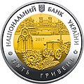
File:Харківська область аверс.jpg|The [[Jubilee coinage|jubilee coin]] of the [[National Bank of Ukraine|NBU]] is dedicated to the Kharkiv Oblast (obverse) |
|||
File:Харківська область реверс.jpg|The [[Jubilee coinage|jubilee coin]] of the [[National Bank of Ukraine|NBU]] is dedicated to the Kharkiv Oblast (reverse) |
|||
File:Stamp of Ukraine s396.jpg|Stamp for the anniversary of the Kharkiv Oblast, 2001 |
|||
File:Церква Вознесіння (Ізюм).JPG|Ascension Cathedral, [[Izium]] |
|||
File:Chimney and two hiperboloide cooling towers on Kharkov-CN.jpg|View of [[Kharkiv TEC-5]], [[Pisochyn]] |
|||
File:Donec near Mokhnach.jpg|View of [[Seversky Donets]] |
|||
</gallery> |
|||
==References== |
|||
{{reflist}} |
{{reflist}} |
||
==External links== |
==External links== |
||
* [http://www.ukrainebiz.com/Articles/KharkivFacts.htm Kharkiv Oblast Facts & Figures] |
* [http://www.ukrainebiz.com/Articles/KharkivFacts.htm Kharkiv Oblast Facts & Figures] |
||
* [http://kts.8m.com/statisti.htm Kharkiv Oblast statistics] |
* [https://web.archive.org/web/20060619114620/http://kts.8m.com/statisti.htm Kharkiv Oblast statistics] |
||
* [http://uamaps.com/ukraine-map/kharkovskaya/ Maps of Kharkiv oblast Cities, Towns and Villages] |
* [http://uamaps.com/ukraine-map/kharkovskaya/ Maps of Kharkiv oblast Cities, Towns and Villages] |
||
* [http://www.gorod.kharkov.ua/secart3123.html About Kharkiv Oblast] |
* [http://www.gorod.kharkov.ua/secart3123.html About Kharkiv Oblast] |
||
* [http://www.catalogue.biz.ua/eng/guides/guide_index/1/21/ Post codes directory of Kharkiv Oblast] |
* [https://web.archive.org/web/20080612200845/http://www.catalogue.biz.ua/eng/guides/guide_index/1/21/ Post codes directory of Kharkiv Oblast] |
||
{{Kharkiv Oblast}} |
{{Kharkiv Oblast}} |
||
{{Administrative divisions of Ukraine}} |
{{Administrative divisions of Ukraine}} |
||
{{Authority control}} |
|||
[[Category:Kharkiv Oblast| ]] |
[[Category:Kharkiv Oblast| ]] |
||
[[Category:Oblasts of Ukraine]] |
[[Category:Oblasts of Ukraine]] |
||
[[Category:States and territories established in 1932]] |
[[Category:States and territories established in 1932]] |
||
[[Category:1932 establishments in Ukraine]] |
|||
[[zh-min-nan:Xarkiv séng]] |
|||
[[be:Харкаўская вобласць]] |
|||
[[be-x-old:Харкаўская вобласьць]] |
|||
[[bg:Харковска област]] |
|||
[[ca:Província de Khàrkiv]] |
|||
[[cs:Charkovská oblast]] |
|||
[[de:Oblast Charkiw]] |
|||
[[et:Harkivi oblast]] |
|||
[[es:Óblast de Járkov]] |
|||
[[eo:Ĥarkiva provinco]] |
|||
[[eu:Kharkiveko oblasta]] |
|||
[[fa:استان خارکف]] |
|||
[[fr:Oblast de Kharkiv]] |
|||
[[ko:하르키우 주]] |
|||
[[hr:Harkivska oblast]] |
|||
[[id:Oblast Kharkiv]] |
|||
[[os:Харьковы облæст]] |
|||
[[it:Oblast' di Charkiv]] |
|||
[[ka:ხარკოვის ოლქი]] |
|||
[[lv:Harkovas apgabals]] |
|||
[[lt:Charkovo sritis]] |
|||
[[hu:Harkivi terület]] |
|||
[[mr:खार्कीव्ह ओब्लास्त]] |
|||
[[xmf:ხარკოვიშ ოლქი]] |
|||
[[nl:Oblast Charkov]] |
|||
[[ja:ハルキウ州]] |
|||
[[no:Kharkiv oblast]] |
|||
[[nn:Kharkiv oblast]] |
|||
[[pnb:خارکیف اوبلاست]] |
|||
[[pl:Obwód charkowski]] |
|||
[[pt:Oblast de Kharkiv]] |
|||
[[crh:Harkiv vilâyeti]] |
|||
[[ro:Regiunea Harkov]] |
|||
[[rue:Харківска область]] |
|||
[[ru:Харьковская область]] |
|||
[[sco:Kharkiv Oblast]] |
|||
[[sk:Charkovská oblasť]] |
|||
[[szl:Charkowski uobwůd]] |
|||
[[sr:Харковска област]] |
|||
[[sh:Harkivska oblast]] |
|||
[[fi:Harkovan alue]] |
|||
[[sv:Charkiv oblast]] |
|||
[[tr:Harkiv Oblastı]] |
|||
[[uk:Харківська область]] |
|||
[[vi:Kharkiv (tỉnh)]] |
|||
[[war:Kharkiv Oblast]] |
|||
[[zh:哈爾科夫州]] |
|||
Revision as of 10:19, 21 May 2024
Kharkiv Oblast
Харківська область | |
|---|---|
| Kharkivska oblast[1] | |
 View of Kharkiv | |
| Nickname(s): | |
 | |
| Coordinates: 49°35′N 36°26′E / 49.59°N 36.43°E | |
| Country | |
| Administrative center | Kharkiv |
| Largest cities | Kharkiv, Lozova, Izium, Chuhuiv, Pervomaiskyi, Kupiansk |
| Government | |
| • Governor | Oleh Synyehubov |
| • Oblast council | 120 seats |
| • Chairperson | Tetyana Yehorova-Lutsenko (Servant of the People) |
| Area | |
| • Total | 31,415 km2 (12,129 sq mi) |
| • Rank | Ranked 4th |
| Population (2022)[2] | |
| • Total | |
| • Rank | Ranked 3rd |
| GDP | |
| • Total | ₴ 320 billion (€8.289 billion) |
| • Per capita | ₴ 122,227 (€3,167) |
| Time zone | UTC+2 (EET) |
| • Summer (DST) | UTC+3 (EEST) |
| Postal code | 61-64 |
| Area code | +380-57 |
| ISO 3166 code | UA-63 |
| Vehicle registration | AX |
| Raions | 7[4] |
| Cities (total) | 17 |
| • Regional cities | 7 |
| Urban-type settlements | 61 |
| Villages | 1,683 |
| FIPS 10-4 | UP07 |
| Website | www.kharkivoda.gov.ua |


Kharkiv Oblast (Ukrainian: Харківська область, romanized: Kharkivska oblast), also referred to as Kharkivshchyna (Ukrainian: Харківщина), is an oblast (province) in eastern Ukraine.
Kharkiv borders Luhansk Oblast to the east, Donetsk Oblast to the southeast, Dnipropetrovsk Oblast to the southwest, Poltava Oblast to the west, Sumy Oblast to the northwest and Russia's Belgorod Oblast to the north. Its area is 31,400 square kilometres (12,100 sq mi), or 5.2% of the total territory of Ukraine.
The oblast is the third-most populous of Ukraine, with a population of 2,598,961 in 2021, more than half (1.42 million) of whom live in the city of Kharkiv, the oblast's administrative center.[2]
Geography
The oblast borders Russia (Belgorod Oblast) to the north, Luhansk Oblast to the east, Donetsk Oblast to the southeast, Dnipropetrovsk Oblast to the southwest, Poltava Oblast to the west and Sumy Oblast to the northwest.
The northern and central parts are part of historic Sloboda Ukraine, and the southern part is part of historic Zaporizhzhia.
History

During the Soviet administrative reform of 1923–1929, in 1925, the Kharkov Governorate was abolished leaving its five okruhas: Okhtyrka (originally Bohodukhiv), Izyum, Kupyansk, Sumy, and Kharkiv. Introduced in the Soviet Union in 1923, a similar subdivisions existed in Ukraine back in 1918. In 1930 all okruhas were also abolished with raions becoming the first level of subdivision of Ukraine until 1932.
The modern Kharkiv Oblast was established on 27 February 1932. In the summer of 1932, some parts of the oblast were included in the newly created Donetsk Oblast originally centered in Artemivsk (later in Stalino). Then in the fall, some territories of the Kharkiv Oblast were used in the creation of Chernihiv Oblast. More territories became part of Poltava Oblast in fall of 1937 and Sumy Oblast in winter of 1939.
During the Holodomor the population of the Kharkiv Oblast together with Kyiv Oblast suffered the most. During World War II, it was the site or large Soviet massacres of Poles (Piatykhatky) and German massacres of Jews (Drobytsky Yar). The region saw major fighting during World War II in several Battles of Kharkov between 1941 and 1943.
During the 1991 referendum, 86.33% of votes in Kharkiv Oblast were in favor of the Declaration of Independence of Ukraine. A survey conducted in December 2014 by the Kyiv International Institute of Sociology found 4.2% of the oblast's population supported their region joining Russia, 71.5% did not support the idea, and the rest were undecided or did not respond.[5]
Following the Euromaidan, there was pro-Russian unrest in the region, and central government buildings were taken over by separatists in a failed attempt to create a separatist 'Kharkov's People's Republic'.[6] The region also became a very popular destination for refugees from the Russian-occupied Donetsk and Luhansk Oblast regions.[6]
During the 2022 Russian invasion of Ukraine, the Russian military launched a major military offensive in the region — the Eastern Ukraine campaign — which resulted in the occupation of parts of the oblast. By late August, about one third of the territory of Kharkiv Oblast was occupied including Izium and Kupiansk. In July 2022, the Donetsk People's Republic signed a memorandum to "liberate Kharkiv from Ukraine".[7]
In early September 2022, the Ukrainian military commenced a counteroffensive in the region. Several settlements in the region were recaptured from Russian control.[8] By 10 September 2022, Ukraine had recaptured Kupiansk and Izium.[8] On 11 September, Russia had retreated from many of the settlements it previously occupied in the oblast [9] and the Russian Ministry of Defense announced a formal withdrawal of Russian forces from most of Kharkiv Oblast stating that an "operation to curtail and transfer troops" was underway."[10][11] By 12 September 2022, as the Russian front lines in Kharkiv Oblast continued to collapse, Ukrainian forces had managed to push back to the northeastern border with Russia in some areas of the region.[12][13] By 3 October 2022, Russian forces had almost completely withdrawn from Kharkiv Oblast.[14][15] As of 2023, fighting continues in the easternmost parts of the oblast in the Battle of the Svatove–Kreminna line.[16] In May 2024, Russia launched a renewed offensive in Kharkiv Oblast.
Demographics


Its population in 2001 was 2,895,800 million (1,328,900 males (45.9%) and 1,566,900 females (54.1%)).
At the 2001 census, the ethnic groups within the Kharkiv Oblast were:
- Ukrainians – 70.7%
- Russians – 25.6%
- Belarusians – 0.5%
- Jews – 0.4%
- Armenians – 0.4%
- Azeris – 0.2%
- Georgians – 0.15%
- Tatars – 0.14%
- Others – 2.1%
Groups by native language:
Age structure
- 0–14 years: 12.6%
 (male 177,464/female 167,321)
 - 15–64 years: 72.2%
 (male 945,695/female 1,024,841)
 - 65 years and over: 15.2%
 (male 135,737/female 277,725) (2013 official)
Median age
- total: 40.5 years
- male: 36.9 years
- female: 44.1 years (2013 official)
Religion

In 2007, there were 700 religious associations in the Kharkiv Oblast, including:
- 265 – Ukrainian Orthodox Church (Moscow Patriarchate)
- 116 – Baptists
- 83 – Jehovah's Witnesses
- 39 – Seventh-day Adventists Church
- 34 – Christians of the Evangelical Faith
- 25 – Pentecostals
- 13 – Ukrainian Orthodox Church of the Kyivan Patriarchate (now Orthodox Church of Ukraine)
- 12 – Ukrainian Autocephalous Orthodox Church (now Orthodox Church of Ukraine)
- 9 – Judaism
- 6 – Ukrainian Greek Catholic Church
- 6 – Roman Catholic Church
Cities and towns
Ranked by population, the oblast's 12 largest municipalities are:
Administrative divisions

Kharkiv Oblast is administratively subdivided into seven raions.[4] Prior to the 2020 administrative reform, there were 25 raions,[4] and also seven cities (municipalities) that were directly subordinate to the oblast government (Chuhuiv, Izium, Kupiansk, Liubotyn, Lozova, Pervomaiskyi, and the administrative center of the oblast, Kharkiv).

| Name | Ukrainian name | Area (km2) |
Population (2022)[17] |
Admin. center |
|---|---|---|---|---|
| Bohodukhiv Raion | Богодухівський район | 4508 | 122,287 | Bohodukhiv |
| Chuhuiv Raion | Чугуївський район | 4804 | 194,177 | Chuhuiv |
| Izium Raion | Ізюмський район | 5906 | 172,130 | Izium |
| Kharkiv Raion | Харківський район | 3222 | 1,727,573 | Kharkiv |
| Krasnohrad Raion | Красноградський район | 4335 | 103,856 | Krasnohrad |
| Kupiansk Raion | Куп’янський район | 4612 | 130,111 | Kupiansk |
| Lozova Raion | Лозівський район | 4027 | 147,361 | Lozova |
Transport

The Kharkiv Oblast has an undeveloped transport network, 60% of the total transportation falls on the part of the rail transport. At the end of 2020, the operational life of the salivary lines of the gas station on the territory of the Kharkiv region was 1520 km.[18]
Kharkiv Salvage University serves 10 million passengers on the river, road transport, sedation, buses - about 12 million. The largest salvage stations are Izium, Kupiansk, Liubotyn, Lozova.
In the Kharkiv Oblast, in 2019, 31.4878 million passengers traveled through travel transport services, or 96.5% of the total in 2018.[19]
The most important highways that pass through the region: Kharkiv-Moscow, Kharkiv-Simferopol, Kharkiv-Rostov-on-Don, Kharkiv-Poltava. The total length of highways in the past is more than 9.7 thousand km, of which 97.5% are on hard surfaces.[20] The length of the autoshlyakh of the sovereign venue in the Kharkiv Oblast is 2343.9 km, including 617.4 km - the MITERNINI, 108.2 km - National Monalni, 639.1 km - regions, 979.2 km - Teritorialne. On highways of national importance in the region there are 242 bridges with a total length of 1316.3 linear meters. m.[21]
Kharkiv airport serves domestic and international airlines, mainly engaged in passenger transportation.[22]
Education


In 2020, 104,900 people aged 15-70 worked in the education sector of the Kharkiv region, or 8.7% of the total number of people employed in the region's economy.[23]
At the end of 2020, there were 753 preschool education institutions in the region (11 more institutions compared to 2019), designed for 79.7 thousand places. The number of their pupils was 74,100 children (3,400 less than in 2019).[24]
At the beginning of the 2020/21 academic year, there were 734 institutions of general secondary education in Kharkiv region, 258,800 students studied in them and 22,700 teachers (including part-time teachers) worked in them. In 2020, 14,300 graduates received a certificate of complete general secondary education.[25]
At the end of 2020, there were 39 institutions of professional (vocational and technical) education in the region, in which 13,700 people studied.
At the beginning of the 2020/21 academic year, there were 55 institutions of higher education in the region, and 124,200 people studied in them. In 2020, higher education institutions of the region accepted 29,800 people to study, and graduated 44,000 specialists. Postgraduate students were trained by 55 institutions of higher education and scientific institutions, in which 3,400 postgraduate students received their education. 5.6 thousand people obtained professional preliminary education in 8 educational institutions. More than 19,000 scientific, scientific-pedagogical and pedagogical workers worked in institutions of higher and professional pre-higher education.[26]
Nomenclature
Most of Ukraine's oblasts are named after their capital cities, officially called "oblast centers" (Ukrainian: обласний центр, translit. oblasnyi tsentr). The name of each oblast is a relative adjective, formed by adding a feminine suffix to the name of respective center city: Kharkiv is the center of the Kharkivs’ka oblast’ (Kharkiv Oblast). Most oblasts are also sometimes referred to in a feminine noun form, following the convention of traditional regional place names, ending with the suffix "-shchyna", as is the case with the Kharkiv Oblast, Kharkivshchyna.
Economy

The Kharkiv oblast has a primarily industrial economy, including engineering, metallurgy, manufacturing, production of chemicals and food processing. It also has an important agricultural sector with 19,000 square kilometres of arable land (comprising 5.9% of the total arable lands of Ukraine). Agricultural production grew substantially in 2015.[27]
Also in Kharkiv is the airplane plant for space controlling systems. It is a major center for all branches of engineering, from large-scale manufacture to microelectronics. Also situated in Kharkiv Oblast is a gas field, which is one of the biggest in Ukraine.
Points of interest
The following sites were nominated for the Seven Wonders of Ukraine.
Sport

It has a regional federation within Ukrainian Bandy and Rink bandy Federation.[1]
Notable people from Kharkiv Oblast
- Hryhorii Skovoroda – Ukrainian philosopher (1722–1794)
- Ilya Repin – Russian realist painter (1844–1930)
- Élie Metchnikoff – Russian immunologist (1845–1916)
- Alexander Potebnja – Russian-Ukrainian philosopher, linguist and panslavist activist
- George Shevelov – Ukrainian-American linguist (1908–2002)
- Dmytro Bahalii – Ukrainian historian
- Hryhorii Kvitka-Osnovianenko – Ukrainian writer, journalist, and playwright (1778–1843)
- Arkady Averchenko – Russian playwright and satirist
- Anton Makarenko – Soviet educator, social worker and writer
- Vasily Karazin – Ukrainian scientist
- Lyudmila Gurchenko – Soviet and Russian actress, singer (1935–2011)
Gallery
-
 Alexander Kiselyov “View of the outskirts of Kharkov”, 1875
 -
 The jubilee coin of the NBU is dedicated to the Kharkiv Oblast (obverse)
 -
 The jubilee coin of the NBU is dedicated to the Kharkiv Oblast (reverse)
 -
 Stamp for the anniversary of the Kharkiv Oblast, 2001
 -
 Ascension Cathedral, Izium
 -
 View of Kharkiv TEC-5, Pisochyn
 -
 View of Seversky Donets


References
- ^ Syvak, Nina; Ponomarenko, Valerii; Khodzinska, Olha; Lakeichuk, Iryna (2011). Veklych, Lesia (ed.). Toponymic Guidelines for Map and Other Editors for International Use (PDF). scientific consultant Iryna Rudenko; reviewed by Nataliia Kizilowa; translated by Olha Khodzinska. Kyiv: DerzhHeoKadastr and Kartographia. p. 20. ISBN 978-966-475-839-7. Retrieved 2020-10-06.
{{cite book}}:|website=ignored (help) - ^ a b "Чисельність наявного населення України на 1 січня 2021 / The current population of Ukraine on 1 January 2021" (PDF) (in Ukrainian and English). State Statistics Service of Ukraine. Archived from the original (PDF) on 6 April 2022. Retrieved 7 September 2022.
- ^ "Валовии регіональнии продукт".
- ^ a b c (in Ukrainian) Local elections. Kharkiv region: new block and "big change of shoes", The Ukrainian Week (7 September 2020)
- ^ Лише 3% українців хочуть приєднання їх області до Росії [Only 3% of Ukrainians want their region to become part of Russia]. Dzerkalo Tyzhnia (in Ukrainian). 3 January 2015.
- ^ a b Piechal, Tomasz (2015-06-09). "The Kharkiv oblast: a fragile stability". OSW Centre for Eastern Studies. Retrieved 2023-08-10.
- ^ Joshua Manning (July 2022). "Donetsk People's Republic signs first memorandum to "liberate Kharkiv from Ukraine"". Euronews.
- ^ a b "Ukraine-Russia war: Russian forces 'taken by surprise' as Ukrainian counter-offensive advances 50km, says UK – live". the Guardian. 2022-09-10. Retrieved 2022-09-10.
- ^ Анисимова, Ольга (2022-09-11). "Минобороны РФ опубликовало карту фронта в Харьковской области". RB Новости (in Russian). Retrieved 2022-09-11.
- ^ "Russian defense ministry shows retreat from most of Kharkiv region". Meduza. 11 September 2022. Retrieved 11 September 2022.
- ^ Russian Defence Ministry Showed Map Of New Frontline In Kharkiv Region, Хартии'97, 11 September 2022.
- ^ "Ukraine reclaims more territory, reports capturing many POWs". ABC News. Retrieved 2022-09-12.
- ^ Kaonga, Gerrard (2022-09-12). "Ukraine soldiers reach Russian border after driving enemy back, video shows". Newsweek. Retrieved 2022-09-12.
- ^ Roscoe, Matthew (3 October 2022). "Five Russian-controlled settlements around Kharkiv reportedly liberated by Ukraine". Euro Weekly News.
- ^ "Ukrainian Armed Forces liberate village of Borova in Kharkiv Oblast". 3 October 2022.
- ^ Kullab, Samya (2023-02-28). "Ukraine's northeastern front could decide new battle lines". Retrieved 2023-08-10.
- ^ "Population Quantity". UkrStat (in Ukrainian). Retrieved 7 January 2016.
- ^ "День залізничника" (PDF). Головне управління статистики у Харківській області.
- ^ "Підсумки роботи транспорту Харківської області у 2019 році". Головне управління статистики у Харківській області.
- ^ "Головне управління статистики у Харківській області" (PDF).
- ^ "Перелік державних автомобільних доріг Харківської області". kh.ukravtodor.gov.ua (in Ukrainian). Retrieved 2021-01-26.
- ^ Харківська область (in Russian)
- ^ "До Дня працівників освіти, Дня Вчителя" (PDF). Головне управління статистики Харківської області.
- ^ "Заклади дошкільної освіти Харківської області у 2020 році" (PDF). Головне управління статистики у Харківській області.
- ^ "Заклади загальної середньої та професійної (професійно-технічної) освіти Харківської області у 2020 р." (PDF). Головне управління статистики у Харківській області.
- ^ "Заклади вищої та фахової передвищої освіти Харківської області у 2020 р." (PDF). Головне управління статистики у Харківській області.
- ^ (in Russian) Agriculture in 2015: results SQ News (13 February 2016)
External links
- Kharkiv Oblast Facts & Figures
- Kharkiv Oblast statistics
- Maps of Kharkiv oblast Cities, Towns and Villages
- About Kharkiv Oblast
- Post codes directory of Kharkiv Oblast
| National | |
|---|---|
| Geographic | |
| Other | |