m typo: pupulation -> population |
216.165.12.158 (talk) Just because Igdir is famous for it's Azerbaijani prostitutes, we do not need to include the Azeri spelling of the town. especially since it is not utilized and is same as turkish(see link I added) |
||
| Line 47: | Line 47: | ||
}} |
}} |
||
'''Iğdır''' ({{Lang-tr|Iğdır}}, {{Lang-hy|Իգդիր |
'''Iğdır''' ({{Lang-tr|Iğdır}}, {{Lang-hy|Իգդիր}}) is the capital city of '''[[Iğdır Province]]''' in [[East Anatolia Region, Turkey|Eastern Anatolia Region]], [[Turkey]], close to the border with [[Armenia]], [[Azerbaijan]] and [[Iran]]. Turkey's highest mountain, the Biblical [[Mount Ararat]] (Ağrı Dağı) is in Iğdır, but much of the land is a wide plain far below the mountain. Iğdır is where Noah is said to have thrived following the flood. The Armenian border is marked by the [[Aras River]]. |
||
==Etymology== |
==Etymology== |
||
| Line 160: | Line 160: | ||
==Demographics== |
==Demographics== |
||
{{Further|[[Demographics of Turkey]]}} |
{{Further|[[Demographics of Turkey]]}} |
||
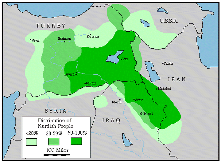
Today, Iğdır has a mixed population of [[Kurdish people|Kurds]] (who form the majority<ref>[http://www.globalsecurity.org/military/world/war/images/dist-kurdish.gif Distribution of Kurdish People] — [[GlobalSecurity.org]]</ref>), [[Turkish people|Turks]], and [[Azerbaijani people| |
Today, Iğdır has a mixed population of [[Kurdish people|Kurds]] (who form the majority<ref>[http://www.globalsecurity.org/military/world/war/images/dist-kurdish.gif Distribution of Kurdish People] — [[GlobalSecurity.org]]</ref>), [[Turkish people|Turks]], and a "teeming number" of [[Azerbaijani people|Azerbaijani]] prostitutes.<ref>[http://www.iwpr.net/?p=art&s=j&o=340488&apc_state=henjart349777 About teeming number of Azerbaijani prostitutes in Igdir]</ref><ref>{{tr icon}} [http://webarsiv.hurriyet.com.tr/2002/08/05/162199.asp Hürriyet<!-- Bot generated title -->]</ref> The spring festival [[nevruz]] which is native to Iran is widely celebrated in Iğdır. |
||
[[Image:Ağrı Dağı'ndan Iğdır Şehri.jpg|thumb|right|250px|Iğdır City from [[Mount Ararat]]]] |
[[Image:Ağrı Dağı'ndan Iğdır Şehri.jpg|thumb|right|250px|Iğdır City from [[Mount Ararat]]]] |
||
{| class="wikitable" width=200 |
{| class="wikitable" width=200 |
||
Revision as of 20:32, 22 February 2009
Iğdır | |
|---|---|
 Location of Iğdır | |
| Country | |
| Region | Eastern Anatolia Region |
| Province | Iğdır |
| Government | |
| Area | |
| • City | 1,479 km2 (571 sq mi) |
| Elevation | 850 m (2,790 ft) |
| Population (2007)TÜİK | |
| • City | 119,432 |
| • Urban | 75,927 |
| Time zone | UTC+2 (EET) |
| • Summer (DST) | UTC+3 (EEST) |
| Postal code | 76000 |
| Area code | 0476 |
| Licence plate | 76 XX XXX |
| Website | Iğdır Municipality |
Iğdır (Turkish: Iğdır, Armenian: Իգդիր) is the capital city of Iğdır Province in Eastern Anatolia Region, Turkey, close to the border with Armenia, Azerbaijan and Iran. Turkey's highest mountain, the Biblical Mount Ararat (Ağrı Dağı) is in Iğdır, but much of the land is a wide plain far below the mountain. Iğdır is where Noah is said to have thrived following the flood. The Armenian border is marked by the Aras River.
Etymology
The area is came from "Iğdır Bey" being oldest son of "Cengiz Alp" who was one of six sons of Oghuz Han belonging to internal Oghuz three arrows branch considered to be the 21st of the 24 Oghuz branches.[1] They spread throughout Anatolia and there are towns and villages named Iğdır in Malatya and other parts of Turkey today.[2]
Geography
The city of Iğdır sits on a plain at a lower altitude than most of Turkey's eastern provinces. This allows agricultural production including apples, tomatoes, cucumbers, peaches, pears, sugar beet, watermelons and melons. However, the most famous produces of Iğdır are cotton and apricots.
Climate
Iğdır has a relatively moderate Continental climate. The climate is the warmest in this part of Turkey.
| Ortalama Veriler | |||||||||||||
|---|---|---|---|---|---|---|---|---|---|---|---|---|---|
| Months | Jan | Feb | Mar | Apr | May | Jun | Jul | Aug | Sep | Oct | Nov | Dec | |
| Average high °C | 2,6 | 5,6 | 12,8 | 20,1 | 24,3 | 29,4 | 33,7 | 34,4 | 29,1 | 21,2 | 12,6 | 4,9 | |
| Average low °C | -7,3 | -4,9 | 0,1 | 6,5 | 10,5 | 14,3 | 18,3 | 17,7 | 12,2 | 6,1 | 0,2 | -4,2 | |
| Average sunny day | 2,7 | 4,1 | 5,4 | 6,1 | 7,5 | 9,6 | 10,1 | 9,9 | 8,5 | 6,3 | 4,3 | 2,4 | |
| Average rainy day | 5,8 | 6,5 | 7,6 | 11,2 | 15,0 | 10,6 | 5,5 | 4,1 | 4,0 | 8,3 | 6,9 | 6,2 | |
| kaynak: www.meteor.gov.tr | |||||||||||||
Architecture
On the peninsula within a military zone stands Sürmeli castle, a medieval citadel whose surviving walls dating from 1224. The Armenian "Caravanserai of Zor" [3]is another historical structure near Iğdır.
Genocide Monument and Museum

The Genocide Monument has been started for construction on 1 August 1997 and its inauguration has been conducted on 5 October 1999. It has been founded on a 1,3 hectar area. Its height from ground is 43,5 meters. At present time, it is highest Monument of Turkey. Its bottom part is museum with 350 square meters area ad its upper part is monument consisting of 5 swords. Granite of Monument's swords has been brought from China and other materials such as marble, granite, stone ceramics have been brought from other regions of Turkey. It forms a picture with Mount Ararat in the background. In Museum, documents, certificates, photographs and other materials remaining from Armenian terror who had lived in the Region between 1915-1918 years and taken out from collective, mass cementers, are being exhibited.[4]
Culture

Iğdır's culture is a subculture of the larger Culture of Turkey. The city's in the south of Caucasus position is central to many annual festivals.[5]
The agricultural production has caused the town to be livelier and wealthier than its neighbours in the generally impoverished eastern Turkey. There are many cafes and resaturants. The best-known dish is an oily meat stew called bozbaş.[6]
Media
Iğdır has 18 local daily and weekly newspapers.[7] The most prominent of these is Yeşil Iğdır which is published since 1 September 1955.
Economy
The city of Iğdır is located between Kars and Ağrı, and also neighbours with three countries; Armenia, Azerbaijan and Iran. Despite the fact that it has three strategically important neighbours, the border gates are held close, therefore this situation diminishes economic possibilities.
Almost seventy-four percent of Mount Ararat's area, the highest mountain of Turkey, stands in Iğdır's borders. But the investments for developing tourism in Mt. Ararat is paid to the Ağrı Municipality.
Demographics
Today, Iğdır has a mixed population of Kurds (who form the majority[8]), Turks, and a "teeming number" of Azerbaijani prostitutes.[9][10] The spring festival nevruz which is native to Iran is widely celebrated in Iğdır.

| Iğdır Centrum Population | |||
|---|---|---|---|
| 2007 | 75.927 | ||
| 2000 | 59.880 | ||
| 1997 | 44.334 | ||
| 1990 | 35.858 | ||
| 1985 | 29.460 | ||
| 1980 | 24.352 | ||
| 1975 | 29.542 | ||
| 1970 | 21.420 | ||
Famous people
- Avetis Aharonyan, chairman of the Democratic Republic of Armenia
- Drastamat Kanayan, an Armenian politician and general
- Servet Çetin, a Turkish-Azeri soccer player
- Şahin Yakut, a Turkish kickboxer and MMA Fighter
Sister cities
References
- ^ :: Iğdır Belediyesi ::
- ^ igdir köyü
- ^ "Caravansarai of Zor" www.virtualani.org/zor/
- ^ "Introduction of Iğdır", Iğdır Municipality Publishing, 2003
- ^ "Introduction of Iğdır", Iğdır Municipality Publishing, 2003
- ^ "Sürmeli Çukurda Iğdır", Ziya Zakir Acar, 2002
- ^ Her Yönüyle Iğdır", Ziya Zakir Acar, 2004
- ^ Distribution of Kurdish People — GlobalSecurity.org
- ^ About teeming number of Azerbaijani prostitutes in Igdir
- ^ Template:Tr icon Hürriyet
External links
- Official website of the Iğdır Municipality
- Template:Tr icon Official website of the Iğdır Province
- Template:Tr icon Iğdır's News website

