AaronzAccount (talk | contribs) |
SDstreetcars (talk | contribs) |
||
| Line 89: | Line 89: | ||
===20th century=== |
===20th century=== |
||
The citizens of Chula Vista voted to incorporate on October 17, 1911. The State approved in November.<ref name="CVH"/> |
|||
| ⚫ | |||
In the 1910s, Chula Vista became one of the many San Diego neighborhoods connected by [[San Diego Class 1 Streetcars|the Class 1 streetcars]] and an extensive San Diego public transit system that was spurred by the [[Panama-California Exposition]] of 1915 and built by [[John D. Spreckels]]. These streetcars went on to serve briefly as a connection to the U.S.-Mexico Border and became a fixture of this neighborhood until their retirement in 1939. Only three of these streetcars exist today -- surviving only by virtue of being transformed into homes -- and remain ideal candidates for restoration as a historic streetcar line on any of their previous routes.<ref>[http://sandiegohistoricstreetcars.org/ The Home of the San Diego Historic Class 1Streetcars]</ref> |
|||
| ⚫ | In 1916, the [[Hercules Inc.|Hercules Powder Company]] opened a 30-acre bayfront site, now known as Gunpowder point, which produced substances used to make [[cordite]], which was used extensively by the [[British military]] during [[World War I]].<ref name="Perspective" /> Although the Great Depression affected Chula Vista significantly, agriculture still provided considerable income for the residents. In 1931, the lemon orchards produced $1 million in revenue and the celery fields contributed $600,000.<ref name="CVH"/> |
||
The relocation of [[Rohr Aircraft Corporation]] to Chula Vista in early 1941, just months before the attack on Pearl Harbor, changed Chula Vista. The land never returned to being orchard groves again. The population of post-World War II Chula Vista tripled from 5,000 residents in 1940 to more than 16,000 in 1950.<ref name="CVH"/> After the war, many of the factory workers and thousands of servicemen stayed in the area resulting in the huge growth in population. The last of the citrus groves and produce fields disappeared as Chula Vista became one of the largest communities in San Diego County.<ref name="CVH"/> |
The relocation of [[Rohr Aircraft Corporation]] to Chula Vista in early 1941, just months before the attack on Pearl Harbor, changed Chula Vista. The land never returned to being orchard groves again. The population of post-World War II Chula Vista tripled from 5,000 residents in 1940 to more than 16,000 in 1950.<ref name="CVH"/> After the war, many of the factory workers and thousands of servicemen stayed in the area resulting in the huge growth in population. The last of the citrus groves and produce fields disappeared as Chula Vista became one of the largest communities in San Diego County.<ref name="CVH"/> |
||
Revision as of 23:42, 27 April 2011
Chula Vista | |
|---|---|
| City of Chula Vista | |
 Images from top, left to right: Chula Vista Bayfront, Cricket Wireless Amphitheater, HMS Surprise, Third Avenue in Downtown | |
 Flag  Seal | |
| Nickname(s): | |
 Location of Chula Vista within San Diego County, California | |
| Country | |
| State | |
| County | San Diego |
| Government | |
| • Type | Council-Manager |
| • City Council | Mayor Cheryl Cox Rudy Ramirez Patricia Aguilar Pamela Bensoussan Steve Castaneda |
| • City Manager | Jim Sandoval |
| Area | |
| • City | 51.2 sq mi (132.7 km2) |
| • Land | 48.9 sq mi (126.6 km2) |
| • Water | 2.4 sq mi (6.1 km2) |
| Elevation | 69 ft (21 m) |
| Population (2010 Census)[5] | |
| • City | 243,916 |
| • Density | 3,551/sq mi (1,370.9/km2) |
| • Metro | San Diego–Tijuana: 5,105,768 |
| Time zone | UTC-8 (PST) |
| • Summer (DST) | UTC-7 (PDT) |
| ZIP codes | 91909, 91910, 91911, 91912, 91913, 91914, 91915, 91921 |
| Area code | 619 |
| FIPS code | 06-13392 |
| GNIS feature ID | 1660481 |
| Website | http://www.chulavistaca.gov/ |
Chula Vista (Template:Pron-en; Spanish: Beautiful View) is so named because of its scenic location between the San Diego Bay and coastal mountain foothills. It is the second largest city in the San Diego metropolitan area, 7th largest city in Southern California as well as the 14-largest city in the U.S. State of California. Located just 7 miles (11 km) from downtown San Diego and 7 miles (11 km) from the Mexican border in the South Bay region of the metropolitan area, the city is at the center of one of the richest economic and culturally diverse zones in the United States. Chula Vista is also the third largest city in San Diego–Tijuana and exerts strong influence on the nearby surrounding communities.[neutrality is disputed][citation needed]
Founded in the early 19th century, fast rates of growth are presently observed in the city. As the second largest city in San Diego County, Chula Vista has quickly become a destination popular to many tourists. Located in the city is one of Americas few year-round United States Olympic Training centers. Popular tourist destinations include Cricket Wireless Amphitheater, Knott's Soak City USA, the Chula Vista marina, the Chula Vista Nature Center as well as golf courses and the region’s newest lifestyle center.
History
Early history
Prehistoric evidence, of both land and aquatic origin, date Chula Vista's history to millions of years back. In the year 3000 B.C. people speaking the Yuman (Quechan) language began movement into the region from the Lower Colorado River Valley and southwestern Arizona portions of the Sonoran desert. Later the Kumeyaay tribe came to populate the land, on which the city sits today, who lived in the area for hundreds of years.[6]
In the year 1542, a fleet of three Spanish Empire ships, commanded by Juan Rodríguez Cabrillo, sailed into San Diego Harbor. Early explorations by Spanish conquistadors, such as these, led to Spanish claims of the land. The historic land on which Chula Vista sits became part of the 1795 land grant known as Rancho del Rey or The King's Ranch. The land eventually was renamed Rancho del la Nation.[6]
During the Mexican-American War, California was claimed by the United States, regardless of the California independence movement that had briefly swept the state. Though California was now under the jurisdiction of the United States, land grants were allowed to continue in the form of private property.[6]
The San Diego Land and Town Company developed lands of the Rancho de la Nación for new settlement. The town began as a five thousand acre development, with the first house being erected in 1887; by 1889, ten houses had been completed.[7] Chula Vista can be roughly translated in Spanish as "beautiful view."[6]
The 1888 completion of the Sweetwater Dam allowed for irrigation of Chula Vista farming lands. Chula Vista eventually became the largest lemon-growing center in the world for a period of time.[6]
20th century
The citizens of Chula Vista voted to incorporate on October 17, 1911. The State approved in November.[6]
In the 1910s, Chula Vista became one of the many San Diego neighborhoods connected by the Class 1 streetcars and an extensive San Diego public transit system that was spurred by the Panama-California Exposition of 1915 and built by John D. Spreckels. These streetcars went on to serve briefly as a connection to the U.S.-Mexico Border and became a fixture of this neighborhood until their retirement in 1939. Only three of these streetcars exist today -- surviving only by virtue of being transformed into homes -- and remain ideal candidates for restoration as a historic streetcar line on any of their previous routes.[8]
In 1916, the Hercules Powder Company opened a 30-acre bayfront site, now known as Gunpowder point, which produced substances used to make cordite, which was used extensively by the British military during World War I.[9] Although the Great Depression affected Chula Vista significantly, agriculture still provided considerable income for the residents. In 1931, the lemon orchards produced $1 million in revenue and the celery fields contributed $600,000.[6]
The relocation of Rohr Aircraft Corporation to Chula Vista in early 1941, just months before the attack on Pearl Harbor, changed Chula Vista. The land never returned to being orchard groves again. The population of post-World War II Chula Vista tripled from 5,000 residents in 1940 to more than 16,000 in 1950.[6] After the war, many of the factory workers and thousands of servicemen stayed in the area resulting in the huge growth in population. The last of the citrus groves and produce fields disappeared as Chula Vista became one of the largest communities in San Diego County.[6]
In January 1986, Chula Vista annexed the unincorporated community of Montgomery which had previously rejected annexation in 1979 and 1982. At the time of the annexation the community was virtually surrounded by its larger neighbor.[10] Over the next few decades, Chula Vista continued to expand eastward. Plans called for a variety of housing developments such as Eastlake, Rancho del Rey and Otay Ranch neighborhoods.[9]
Camp Otay/Weber

During World War One and Two The army maintained a base on what is now the corner of Main Street and Albany Avenue. It initially served as a border post during World War One, and was reestablished in December 1942. It was home to the 140th Infantry Regiment, 35th Infantry Division. The base was closed in February 1944, and the division went on to see combat in the European theater. All traces of the post have since been removed.[11]
21st century
In 2003, Chula Vista had 200,000 residents and was the second largest city in San Diego County.[12]
Chula Vista is growing at a fast pace,[9] with major developments taking place in the Otay Valley near the U.S. Olympic Training Center and Otay Lake Reservoir. Thousands of new homes have been built in the Otay Ranch, Lomas Verdes, Rancho Del Rey, Eastlake and Otay Mesa Areas.[13] The South Bay Expressway, a toll-road extension of state route 125, opened November 19, 2007, connecting freeways 805 and 905 with State Route 54.
On May 30, 2006 officials from Chula Vista and the San Diego Chargers met to potentially discuss building a new stadium that would serve as the home for the team. Yet, in June 2009 the Chargers removed Chula Vista as a possible location for a new stadium.[14] In 2009, Chula Vista - along with nine other second tier metropolitan area cities such as Hialeah and Southern California's Santa Ana - was ranked as one of the most boring cities in America by Forbes Magazine;[15] citing the large population but rare mentions of the city in national media. A current development plan in Chula Vista is to develop the bayfront.
Geography

Owning up to its Spanish name origins - beautiful view - Chula Vista is located in the South Bay region of San Diego County, between the foothills of the Jamul and San Ysidro Mountains (including Lower Otay Reservoir) and San Diego Bay on its east and west extremes, and the Sweetwater River and Otay River at its north and south extremes.[16] In South Bay Chula Vista has a large footprint, and aside from South San Diego, it is the largest geographic entity in the region.[citation needed]
Ecological preserves
Chula Vista has within its city limits the Sweetwater Marsh unit of the San Diego Bay NWR.[17] It also maintains several city maintained open space areas.[18]
Climate
Chula Vista has a Mediterranean climate which it shares with San Diego County.[19]
| Climate data for Chula Vista, California | |||||||||||||
|---|---|---|---|---|---|---|---|---|---|---|---|---|---|
| Month | Jan | Feb | Mar | Apr | May | Jun | Jul | Aug | Sep | Oct | Nov | Dec | Year |
| Mean daily maximum °F (°C) | 69 (21) |
68 (20) |
68 (20) |
68 (20) |
70 (21) |
73 (23) |
76 (24) |
78 (26) |
78 (26) |
76 (24) |
72 (22) |
69 (21) |
72.4 (22.4) |
| Mean daily minimum °F (°C) | 46 (8) |
48 (9) |
50 (10) |
53 (12) |
57 (14) |
60 (16) |
64 (18) |
65 (18) |
64 (18) |
58 (14) |
50 (10) |
46 (8) |
55 (13) |
| Average precipitation inches (mm) | 2.01 (51) |
2.01 (51) |
2.09 (53) |
0.71 (18) |
0.16 (4.1) |
0.08 (2.0) |
0.04 (1.0) |
0.08 (2.0) |
0.02 (0.51) |
0.39 (9.9) |
1.1 (28) |
1.18 (30) |
10.0 (250) |
| Source: U.S. Climate Data[20] | |||||||||||||
Government

Local government
According to the city’s most recent Comprehensive Annual Financial Report, the city’s various funds had $322.9 million in Revenues, $287.5 million in expenditures, $1,232.7 million in total assets, $258.6 million in total liabilities, and $181.0 million in cash and investments.[21]
Presently the City Council is led by Mayor Cheryl Cox. It has four other city councilmembers: Rudy Ramirez, Patricia Aguilar, Pamela Bensoussan, and Steve Castaneda.[22]
Politics
In the state legislature Chula Vista is located in the 40th Senate District, represented by Democrat Juan Vargas, and in the 78th and 79th Assembly District, represented by Democrats Martin Block and Ben Hueso respectively. Federally, Chula Vista is located in California's 51st congressional district, which has a Cook PVI of D +7[23] and is represented by Democrat Bob Filner.
As of March 2011, out of the city's total population, 99,248 are registered to vote, reduced from 103,985 in 2009. The three largest registered parties in the city are the Democratic Party with 42,456, Republican Party with 29,446, and Decline to State with 23,620.[24]
Demographics
| Year | Population (pop.) |
Change in pop. (raw) |
Change in pop. (%) |
|---|---|---|---|
| 2010 | 243,916[5] | +70,360 | +40.5% |
| 2000 | 173,556[25] | +38,393 | +28.4% |
| 1990 | 135,163[26] | +51,236 | +61.0% |
| 1980 | 83,927[27] | +16,026 | +23.6% |
| 1970 | 67,901[27] | +25,867 | +61.5% |
| 1960 | 42,034[9] | +26,107 | +163.9% |
| 1950 | 15,927[28] | +10,789 | +209.9% |
| 1940 | 5,138[9] | +1, 269 | +32.7% |
| 1930 | 3,869[9] | +2,151 | +125.2% |
| 1920 | 1,718[9] | +1,068 | +164.3% |
| 1910 | 650[9] | - | - |
According to the 2010 census, the population is 243,916,[5] growing 40.6 percent between 2000 and 2010,[29] making it the second-largest city in San Diego County, the 14th-largest in the state of California,.[29] As of 2009, based on estimates by the Census Bureau at the time, Chula Vista was the 90th largest in the United States.[30] The racial make up of the city, based on the 2010 census, is 53.7% White, 20.1% Other, 14.3% Asian, 5.8% of two or more races, 4.5% African American, 0.7% Native American, and 0.5% Pacific Islander. Hispanic or Latino of any race were 58.2% of the population. Of all these individuals 27.9% were under the age of 18.[31]
Within the city there were, as of the 2010 census, 79,416 housing units, of which 95% were occupied.;[31] this was greater than the estimate provided by SANDAG issued in August 2010, which listed 78,244 housing units, of which 91.6% were occupied.[32] According to this estimate the median income for a household in the city was 53,400USD when adjusted for inflation (1999 dollars), and 74,881USD when not adjusted in January 2009. When adjusted for inflation, 25% of households had incomes lower than 30,000USD, and 5% of households had incomes equal to or greater than 150,000USD.[32]
In 2000, the city's population was 173,556. The racial make up of the city during the 2000 census was 55.1% White, 22.1% Other, 11% Asian, 5.8% of two or more races, 4.6% African American, 0.8% Native American, and 0.6% Pacific Islander. Hispanic or Latino of any race were 49.6%. Of these individuals, 28.7% were under the age of 18.[25][33]
In 1990, the city's population was 135,163. The racial make up of the city during the 1990 census was 67.7% White, 18.1% Other, 8.2% Asian, 4.5% African American, 0.6% Pacific Islander, and 0.6% Native American. Hispanic or Latino of any race were 37.2%. Of these individuals, 26% were under the age of 18.[26]
In 1980, the city's population was 83,927.[27] The racial make up of the city during the 1980 census was 83.1% White, 7.9% "Race, n.e.c.", 6.1% Asian and Pacific Islander, 2.1% African American, and 0.7% Native American. Persons of "Spanish Origin" made up 46.6% of the population.[34]
Economy
Chula Vista maintains a business atmosphere that encourages growth and development.[35] In the city, the small business sector amounts for the majority of Chula Vista's business populous.[35] This small business community is attributed to the city's growth and serves as a stable base for its economic engine.[35]

Tourism
Tourism serves as an economic engine for Chula Vista. The city has numerous dining, shopping, and cinema experiences.[36] As with many California cities, Chula Vista features many golf courses.[37] Some of the city's notable attractions included the Chula Vista Nature Center, Otay Valley Regional Park, Cricket Wireless Amphitheatre, OnStage Playhouse, Knott's Soak City USA, the Chula Vista Marina, and the U.S. Olympic Training Center.[38] The Nature Center is home to interactive exhibits describing geologic and historic aspects of the Sweetwater Marsh and San Diego Bay. The Center has exhibits on sharks, rays, waterbirds, birds of prey, insects, and flora.[38] Otay Valley Regional Park is located partially within Chula Vista, where it covers the area of a natural river valley.
The marina at Chula Vista is located in South Bay including multiple marinas and being home to the Chula Vista Yacht Club. Sports fishing and whale watching charters operate the regional bay area. The Olympic Training Center assists current and future Olympic athletes in archery, rowing, kayaking, soccer, softball, field hockey, tennis, track and field, and cycling.[38]
Top employers
In 2008 the city conducted a Comprehensive Annual Financial Report;[39] the results revealed the top employers in the city for 2008 to be:
| # | Employer | # of Employees |
|---|---|---|
| 1 | Sweetwater Union High School District | 4,435 |
| 2 | Chula Vista Elementary School District | 2,753 |
| 3 | Southwestern College | 2,400 |
| 4 | Goodrich Aerostructures | 1,903 |
| 5 | Sharp Chula Vista Medical Center | 1,799 |
| 6 | Scripps Mercy Hospital Chula Vista | 1,079 |
| 7 | City of Chula Vista | 980 |
| 8 | Wal-Mart | 950 |
| 9 | United Parcel Service | 627 |
| 10 | Target | 604 |
Culture

Chula Vista is home to OnStage Playhouse the only live theater in South Bay, San Diego. Other points of interest and events include the Chula Vista Nature Center,[40] the J Street Harbor,[41] the Third Avenue Village,[42] the Olympic Training Center,[43] and Knott's Soak City. Downtown Chula Vista hosts a number of cultural events, including the famous Lemon Festival, Starlight Parade, and Chula Vista Rose Festival.
Cricket Wireless Amphitheatre is a performing arts theatre that was the areas first major concert music facility. OnStage theater stages high quality productions;[38] serving as a large contributor to the cultural arts setting in Chula Vista. Knott's Soak City is a large waterpark representative of Chula Vista providing for both tourists and residents.
Media
Chula Vista is serverd by The Star-News (Chula Vista) and The San Diego Union-Tribune.
Transportation
Major freeways & highways
Chula Vista is served by multiple Interstates and California State Routes. Interstate 5 begins to the south of the city and runs through its western edge. Interstate 5 connects Chula Vista to North County and beyond to Greater Los Angeles and Northern California. Interstate 805 serves as a bypass to Interstate 5, linking to the latter interstate in Sorrento Valley. Interstate 905 runs from the Otay Mesa Port of Entry and is one of three auxiliary three-digit Interstate to meet an international border. State Route 54 and State Route 125 serve as highways to East County cities via north and northeastern corridors.
Education

The Sweetwater Union High School District, headquartered in Chula Vista serves as the primary secondary school district.[44]
Chula Vista is home to one of the four private collegees in San Diego County and is host to Southwestern College; a community college founded in 1961, that serves approximately 19,000 students annually. Over half a million students have attended Southwestern College since its creation.
Notable natives and residents
Sister cities
Chula Vista has two sister cities, as designated by Sister Cities International.[45]
| City | Country | Year |
|---|---|---|
| Cebu City | ||
| Odawara |
Gallery
-
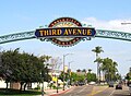 Third Avenue in Downtown Chula Vista
 -
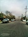 Ada Street in Chula Vista
 -
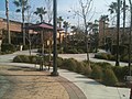 Otay Ranch Town Center Mall
 -
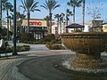 Otay Ranch Town Center Mall
 -
 President Eisenhower visits Country Club
 -
 Postcard of the Sweetwater Dam
 -
 Proctor Valley in Chula Vista
 -
 A neighborhood in eastern Chula Vista


References
- ^ "Welcome to Chula Vista, CA - City of Allure". chulavistacentennial.com. Retrieved 15 January 2011.
- ^ Bianca Bruno (6 October 2010). "Growing up in "Chula-juana"". The Vista. Retrieved 23 January 2011.
- ^ Anne-Marie O'Connor (11 September 2002). "Cross-Border Lifestyle Requires Patience". Los Angeles Times. Retrieved 27 March 2011.
- ^ Tom Greeley (15 April 1985). "S.D. County's Cities Defy The Negatives, Accent The Positives". Los Angeles Times. Retrieved 27 March 2011.
- ^ a b c Karen Kucher (8 March 2011). "The faces of San Diego's changing demographics". San Diego Union Tribune. Retrieved 9 March 2011.
- ^ a b c d e f g h i "Brief History of Chula Vista". City of Cula Vista. City of Cula Vista. Retrieved 27 October 2010.
- ^ Nancy Ray (26 May 1986). "Chula Vista, County's 2nd Largest City, Has Problem With Image". Los Angeles Times. Retrieved 19 March 2011.
- ^ The Home of the San Diego Historic Class 1Streetcars
- ^ a b c d e f g h "Chula Vista in Perspective, Chapter 3" (PDF). Chula Vista General Plan. City of Chula Vista. 13 December 2005. Retrieved 9 March 2011.
- ^ Keith A. Owens (3 January 1986). "Montgomery Merging With City : Chula Vista Annexation Is Cause to Celebrate". Los Angeles Times. Retrieved 19 March 2011.
- ^ Los Angeles District, Corps of Engineers. "Camp Otay". California State Military Museum. California State Military Department. Retrieved 21 April 2011.
- ^ "Spotlight" (PDF). Office of the City Manager. City of Chula Vista. 2003. Retrieved 19 March 2011.
- ^ "Horses Stampede Through Chula Vista Streets". KGTV. 24 March 2010. Retrieved 19 March 2011.
- ^ "Chula Vista Out As Possible Chargers Stadium Site". 10News.com. Internet Broadcasting Systems, Inc. 24 June 2009. Retrieved 13 August 2009.
{{cite news}}: Cite has empty unknown parameter:|coauthors=(help) - ^ "America's Most Boring Cities". Forbes. Retrieved 2009-01-05.
- ^ "City of Chula Vista Drainage Basins" (PDF). Geographic Information System. City of Chula Vista. 20 June 2009. Retrieved 19 March 2011.
- ^ "Sweetwater Marsh". U.S. Fish and Wildlife Service. United States Department of the Interior. 9 July 2010. Retrieved 19 March 2011.
- ^ "Open Space". Public Works Operations. City of Chula Vista. Retrieved 19 March 2011.
- ^ "Mediterranean Climate". County Television Network. County of San Diego. Retrieved 19 March 2011.
- ^ "Monthly averages for Chula Vista, California". Retrieved Feb 28 2009.
{{cite web}}: Check date values in:|accessdate=(help) - ^ City of Chula Vista CAFR Retrieved 2009-08-07
- ^ "Chula Vista City Government". Office of Mayor & City Council. City of Chula Vista. Retrieved 19 March 2011.
- ^ "Will Gerrymandered Districts Stem the Wave of Voter Unrest?". Campaign Legal Center Blog. Retrieved 2008-02-10.
- ^ "Report of Registration - State Reporting Districts" (PDF). Registrar of Voters. County of San Diego. 8 March 2011. Retrieved 11 March 2011.
- ^ a b "Chula Vista (city), California". State & County QuickFacts. U.S. Census Bureau. 8 July 20009. Retrieved 9 March 2011.
{{cite web}}: Check date values in:|date=(help) - ^ a b "Detailed Tables". 1990 Census of Population and Housing. U.S. Bureau of the Census. Retrieved 9March 2011.
{{cite web}}: Check date values in:|accessdate=(help) - ^ a b c "Number of Inhabitants, California" (PDF). 1980 Census of Population. U.S. Bureau of the Census. March 1982. Retrieved 9 March 2011.
- ^ Katz, Bruce (2003). Redefining urban and suburban America: evidence from Census 2000. Washington, D.C.: Brookings Institution Press. p. 106. ISBN 9780815748595. Retrieved 9 March 2011.
{{cite book}}: More than one of|pages=and|page=specified (help); Unknown parameter|coauthors=ignored (|author=suggested) (help) - ^ a b [2010.census.gov/news/xls/cb11cn68_ca_2010redistr.xls "The Most Populous Counties and Incorporated Places in 2010 in California: 2000 and 2010"]. 2010 census. United States Census Bureau. Retrieved 9 March 2011.
{{cite web}}: Check|url=value (help) - ^ "Table 1: Annual Estimates of the Population for Incorporated Places Over 100,000, Ranked by July 1, 2009 Population: April 1, 2000 to July 1, 2009" (CSV). 2009 Population Estimates. U.S. Census Bureau, Population Division. 22 June 2010. Retrieved 9 March 2011.
- ^ a b Ryan McNeil; Layne Smith; Daniel Lathrop. "Census 2010, Special Reports". The Press-Enterprise. Retrieved 9 March 2011.
- ^ a b "Population and housing estimates (2010), City of Chula Vista" (PDF). SANDAG. August 2010. Retrieved 9 March 2011.
- ^ "DP-1. Profile of General Demographic Characteristics: 2000". Census 2000. U.S. Census Bureau. Retrieved 9 March 2011.
- ^ "General Social and Economic Characteristics" (PDF). 1980 Census of Population. U.S. Bureau of the Census. July 1983. Retrieved 9 March 2011.
- ^ a b c "City of Chula Vista: Small Business". City of Chula Vista. Retrieved March 26, 2011.
- ^ "Shopping in Chula Vista". City of Chula Vista. Retrieved March 26, 2011.
- ^ "Golf Courses in Chula Vista". City of Chula Vista. Retrieved March 26, 2011.
- ^ a b c d "Chula Vista Attractions". City of Chula Vista. Retrieved March 26, 2011.
- ^ "City of Chula Vista, California Comprehensive Annual Financial Report, for the Year ended June 30, 2009" (PDF). Retrieved Retrieved 2010-09-26.
{{cite web}}: Check date values in:|accessdate=(help) - ^ "Nature Center". Community Services. City of Chula Vista. Retrieved 9 November 2009.
- ^ "Chula Vista Launch Ramp". SD Boating.com. Retrieved 9 November 2009.
- ^ "Third Avenue Village". Third Avenue Village Association. Retrieved 7 November 2009.
- ^ "Chula Vista Olympic Training Ctr". United States Olympic Committee. Retrieved 9 November 2009.
- ^ "Sweetwater Union High School District". SUHSD. Retrieved March 30, 2010.
- ^ "SCI: Sister City Directory". Sister Cities International. Retrieved March 26, 2011.
External links
- Chula Vista Public Library website
- Official City of Chula Vista website
- Chula Vista Schools Location and Phone Directory


