Notorious4life (talk | contribs) No edit summary |
|||
| Line 34: | Line 34: | ||
File:Monroe-IHM.jpg|<center>[[Sisters, Servants of the Immaculate Heart of Mary|Sisters, Servants of the IHM]] |
File:Monroe-IHM.jpg|<center>[[Sisters, Servants of the Immaculate Heart of Mary|Sisters, Servants of the IHM]] |
||
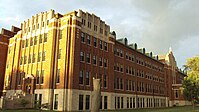
File:NormanTowers.jpg|<center>[[Hall of the Divine Child]] |
File:NormanTowers.jpg|<center>[[Hall of the Divine Child]] |
||
File:TurtleIslandLakeErie.jpg|<center>[[Turtle Island (Lake Erie)]] |
:File:TurtleIslandLakeErie.jpg <!--Non-Free file removed by DASHBot-->|<center>[[Turtle Island (Lake Erie)]] |
||
</gallery> |
</gallery> |
||
Revision as of 00:03, 22 March 2010

The following page is a gallery of all the images that I have uploaded on Wikipedia. As of 30 May 2024, I have uploaded 127 images that are still used and supported by Wikipedia. Roughly half of the images are ones that I have taken myself with my own camera. The camera that I use is a Sony Cybershot DSC-S950 10.1 MP [1]. It's not the greatest camera, but it does its job. The size of each image is 3,648 × 2,736 pixels, but I have recently began converting images to a 16:9 widescreen resolution of 3,648 × 2,052 pixels, which is something I do manually with Paint Shop Pro 7.0. A few self-taken images (the images from Mackinac Island) were taken with an equal Kodak digital camera that I no longer have access to using. Another image, the one of the Old Mill Museum was taken with a 7.0 MP Sansung camera that regrettable broke within four months of purchasing it. My Sony camera doesn't take images to the quality that would warrant featured picture status, but I have no intentions of promoted any of my images to such. My self-taken images are free for any use, as uploading them onto Wikipedia releases them into public domain. Some of my images have been converted to Wikimedia Commons (a process I let Wikipedia:Bots do), where they are able to be found on other sites and internet searches.
Aside from self-taken images, a large number of my uploads are maps, in which I have edited existing maps (and given credit) to describe a specific geographic location. The township maps relating to Roscommon County, Michigan were self drawn maps. Some maps and other images are those that were taken by government officials. As such, government images hold special copyright status and are able to be used in free media. Therefore, I didn't create all of the following images in this gallery. Because of the numerous copyright issues with uploading images, I would estimate that I have had an equal number of uploaded images removed from Wikipedia over the past five years, because in my earlier days on Wikipedia, I was unsure as to what internet images were acceptable and able to be used freely. I haven't uploaded an image found on the internet in many years unless it was one without any copyright restrictions (such as government or historical images).

I am a strong believer in that every single article should have an image to show the subject, although I realize it might be impossible for most subjects where an image simply doesn't exist. I have thousands of images on my computer, but that doesn't mean I'm going to try to wedge every single one of them into some article. I especially hate images (from others) that are low quality, low resolution, or wedged into an article for no reason. I would never create an article that didn't have an image. Of course, I've driven to as many locations within close proximity to take pictures to include in an article. That's why most of my self-taken images are in Monroe County, Michigan, where I live and regularly travel to many locations within to work.
Monroe County, Michigan
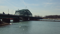
Since I live in Monroe County, it is very easy for me to take pictures wherever I go. The first section consists of general pictures from around the county. These include municipality photos, as well as The Mall of Monroe and several other buildings. I still need pictures from many of the municipalities in the county, but there are some places in the county that are pretty far away. For example, it would take me 30 minutes to drive to Milan and 40 minutes to drive to Whiteford Township. Also, some of the townships, such as London and Raisinville are sparsely populated and have no population centers or communities. It would be hard to get a comprehensive picture to represent the township, but I'll figure it out eventually. The "Hub of the Highways" picture only exists to provide a source to the fact that Dundee carries that nickname. It is the only image from my Sony camera that wasn't previously edited before uploading. Therefore, it is the only image where my camera's metadata can be viewed. Obviously, I didn't take the Turtle Island image myself.
-

-
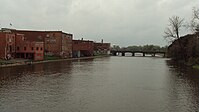
The River Raisin in Monroe, Michigan -

-

-

Monroe Bank & Trust headquarters -

-

-

-

-
-
-
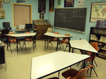
Monroe County ISD classroom -
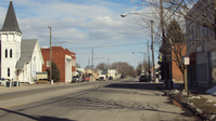
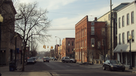
Dundee, Michigan
-

-
-

-


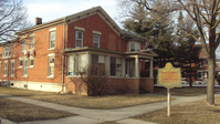
National Register of Historic Places
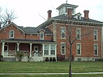
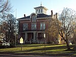
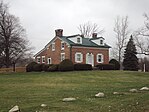
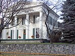
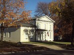
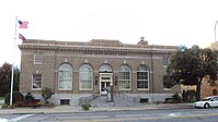
This section includes all pictures relating to the National Register of Historic Places listings in Monroe County, Michigan. There are 14 NRHP listings in the county, and I've taken the pictures for all of them except the Detroit River Light, which is inaccessible. For as old as Monroe County is, I'm surprised there are only 14 listings. But, I'm also glad, because all the pictures and 13 of the articles are mine. (I've barely touched the Detroit River Light article.) I have many more images relating to the county's listing, but these are the best ones. That's why I uploaded them, and if I take a better picture of the same location, then I'll replace the image. Some of them could use some better images.
-

-
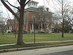
Childhood home of J. Sterling Morton -

-

-
-

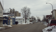
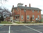
Monroe MS in the Old Village -
-
-
-

-
-
-
Old Mill Museum
-
-

-
-

-
-

-

-

-
-

-

-

-


Monroe County Community College
The following section consists of images of Monroe County Community College. I attended school there from 2001–2004, and while those three years represent a low point in my life, I created the article and uploaded all the images. The images are of the nine buildings belonging to MCCC. I think the main reason I decided to upload these images is because the MCCC article is short and fairly weak. I needed to expand the article somehow. All the pictures came out well, except for maybe the Whitman Center picture. That building is very far off-campus, and I happened to be in that area during the middle of a terrible snowstorm.


Sandy Creek
Just like with the Monroe County Community College article, these images were added to the Sandy Creek article for the purpose of expanding it. Created on 26 March 2005, Sandy Creek was my first article, and it sat in a miserable condition for over four years before I went back to expand and improve it. The article still needs a lot of work to comply with article standards, but it's not on the top of my priorities list.


Other Michigan locales
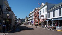
Unfortunately, I don't get out as much as I'd like, so the number of images I have outside of Monroe County is pretty low. I have hundreds of pictures of Detroit and Mackinac Island, but there's no need for me to shoehorn those images into articles that already have an abundance of pictures. I also have a pile of Roscommon County, Michigan images, because my family vacations there frequently. But, those images are just leisure pictures that don't really have a place in any article. The Mackinac-related pictures were those taken with a different Kodak camera. For reasons unknown, the Devil's Kitchen image is credited to someone else, while it acknowledges me as the original user who uploaded the image. Also, I found the Delray, Detroit image on a site with no copyright restrictions. So, I was able to use the image, where I tagged it as being my own work for image free-use purposes, but I never took that image.
-

-

-

-
-

-

-

Grassy Island (GOV image) -

Marquette Park (panorama) -

Marquette Park (panorama) -

-


Maps and other location images
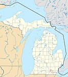
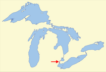
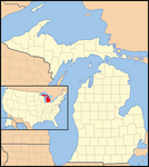
Michigan geography maps
For most geographic articles, I don't have to create my own map, because I can use a general location map and overlap the pog marker for the location. But, in some cases, I did have to create my own map. Of course, none of the maps are drawn from scratch, but as maps, they're free to modify. The two climate maps are actually for an article that I've never quite finished and published, and a few of the maps are no longer used by my own choice.
-
Course of the River Raisin -

Annual precipitation in MI (GOV image) -
Annual snowfall in MI (GOV image)
Annual snowfall in MI (GOV image) -
Grosse Ile (island)
-

-

-
-

Grassy Island location in Detroit River -
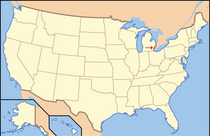
Detroit River location in the U.S. -
Touched-up map of Michigan (defunct) -
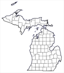
Blank Michigan county map (defunct) -

-

-
Detroit River aerial (defunct)
Detroit River aerial (defunct) -

The former M-130 -
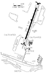
Custer Airport (GOV image) -

Map of Sandy Creek


Roscommon County, Michigan
If it were up to me, every county article in the country should include maps like the following to illustrate the location of townships. Currently in Michigan, only Wayne, Monroe, and Roscommon have township boundary maps included in their respective articles. The reason is because the maps are very hard to make and must be drawn from scratch by referencing this document from the Census. Roscommon County was easy to make, because the county is square and so are all the townships. I was able to easily draw the county on my own. Other counties are far more complex and above the amount of work I feel like doing.


Other
These are the only non-Michigan maps I created. It started when I created the Seal River article as the only Canadian Heritage Rivers System to not have an article. I originally wanted to fill in my created {{Canadian Heritage Rivers System}}, which I created to plug into the Detroit River article.


Historical images
Historical images are great to use, because there's no real copyright restrictions on images first published in the U.S. before 1923. It's still a free-use gray area, and I've only uploaded images I knew were available for free distribution. My only concern is the Monroe 1959 image since it's still fairly newer. I've always believed that there should be no such thing as a copyright restriction on any generic image one takes with a camera, even if that image appears in a copyrighted publication. Of course, there should be restrictions if someone tries to make money or publish a photo taken by someone else, but the images I have below are for non-commercial purposes.
-
Old Village Historic District (1959)
-
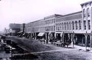
Front Street in Monroe (1880) -
Old Village Historic District (c. 1900)
Old Village Historic District (c. 1900) -
-

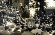
Custer Equestrian Monument (1910) -
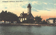
Mamajuda Island Lighthouse (1910) -

Grassy Island Lighthouse (c. 1915) -
Arch McCarthy (1902)
Arch McCarthy (1902) -
Turtle Island (Lake Erie)


Logos
For these images, I was unable to show the image on my user page, according to Wikipedia:Non-free content criteria (Policy #9), which states, "Non-free content is allowed only in articles." Since I didn't create these logos, I found them on their respective owner's website, and they constitute as a {{non-free logo}}. If I showed the image, a robot would come through and remove it from this page. But, I can provide a link to the image, which is what I have done here. 12 of these logos are for schools in Monroe County, and one is for Monroe Bank & Trust. These logos are used for the sole purpose of illustrating the organization.
- File:MonroeBank&Trust.png — Monroe Bank & Trust
- File:MCISDlogo.png — Monroe County Intermediate School District
- File:MCCCLogo.png — Monroe County Community College
- File:DundeeVikingHead.png — Dundee Community Schools
- File:DundeeSchoolsLogo.png — Dundee Community Schools
- File:IdaPublicSchoolsLogo.png — Ida Public Schools
- File:MasonConsolidatedSchoolsLogo.png — Mason Consolidated Schools
- File:WhitefordSchoolsMI.png — Whiteford Agricultural Schools
- File:SummerfieldSchoolsMI.png — Summerfield Schools
- File:BedfordPSLogoMI.png — Bedford Public Schools
- File:AirportCommunitySchoolsLogo.png — Airport Community Schools
- File:JeffersonSchoolsMI.png — Jefferson Schools
- File:MPSlogo.png — Monroe Public Schools
Map templates
The following images are used specifically on templates that I've created for articles. These are used for maps of the county, and I think that are very good aides in the article to illustrate the location of municipalities and other notable features within the county. The templates for Monroe County and Roscommon County are the only ones I know of in existence. I never finished the one for Wayne County, and the image for that prospective template is erroneous anyway. Brownstown Charter Township, which is segmented, is actually two different colors. I had the template deleted for good, but the image is still up for some reason, even though I requested its deletion.
For the two working templates, the only problems occur when someone is trying to view the templates using Internet Explorer instead of Mozilla Firefox. I don't know how the templates are rendered in other browsers, but I don't know anyone who uses the inept Explorer. In Explorer, some of the things in the templates are jumbled for no reason whatsoever, but in Firefox, the templates are perfect. I'm not going to change the templates (or anything else in Wikipedia) to accommodate those who use Explorer.
-

-

Wayne County template (never completed) -


Miscellaneous images
These are two self-created images that were created for my user page. The picture of myself was once used on my user page, but I don't actually use it anymore. The №tǒŖïøŭş4lĭfė♫♪ image is just a banner used on the top of my current page. It is an image that represents the signature I used to sign talk pages.
-

Image logo used my user page -
Self image (no longer used)
Self image (no longer used)

Non-free miscellaneous images
These are images that don't fall under any of the above categories. For these images, I was unable to show the image on my user page, according to Wikipedia:Non-free content criteria (Policy #9), which states, "Non-free content is allowed only in articles." Since I didn't create these images, I found them on their respective owner's website, and they constitute as a {{non-free logo}}. If I showed the image, a robot would come through and remove it from this page. But, I can provide a link to the image, which is what I have done here. The two images of Rich Rowland constitute as non-free images since the images are scanned from one of his baseball cards. I'm technically not even credited with uploading File:RichRowland1994Topps.png since Bot came through and re-sized it to comply with non-free standards, and the Bot is credited as the uploader now. Because of that, I wonder how many of my original non-free images are still floating around Wikipedia. Of all the earlier images I uploaded (improperly), File:MeatMK.jpg, uploaded on 29 July 2005, is the oldest of my images.
- File:RichRowland1994ToppsPicture.png — Rich Rowland
- File:RichRowland1994Topps.png — Rich Rowland
- File:SBSPseason2.jpg — SpongeBob SquarePants (season 2)
- File:MKSM5.JPG — Mortal Kombat: Shaolin Monks
- File:MeatMK.jpg — List of Mortal Kombat characters#Meat