No higher resolution available.
South_BC-NW_USA-relief_ShuswapHighland.png (708 × 600 pixels, file size: 963 KB, MIME type: image/png)
| Description |
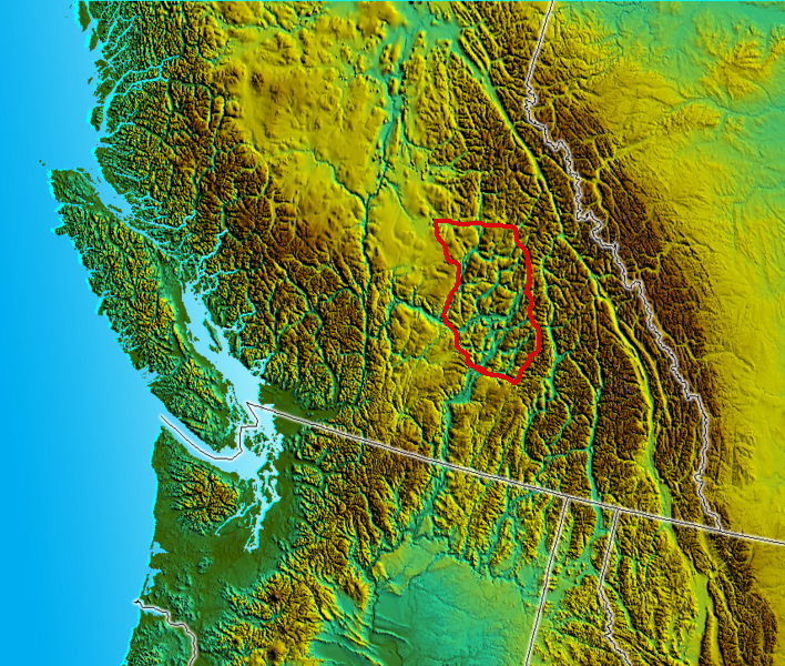
English: This file is adapted from File:South_BC-NW_USA-relief.png] which is already in Wikimedia Commons. I trimmed it to a certain region and added the red line, which indicates the approximate boundary of the region known as the w:Shuswap Highland. |
| Date | |
| Source | Own work |
| Author | Skookum1 (talk) (Uploads) |
Summary
This file is adapted from South_BC-NW_USA-relief.png which is already in Wikimedia Commons. I trimmed it to a certain region and added the red line, which indicates the approximate boundary of the region known as the w:Shuswap Highland.
Licensing
| I, the copyright holder of this work, release this work into the public domain. This applies worldwide. In some countries this may not be legally possible; if so: I grant anyone the right to use this work for any purpose, without any conditions, unless such conditions are required by law. |
File history
Click on a date/time to view the file as it appeared at that time.
| Date/Time | Thumbnail | Dimensions | User | Comment | |
|---|---|---|---|---|---|
| current | 07:59, 3 February 2007 | | 708 × 600 (963 KB) | Skookum1 | This file is adapted from 708px-South_BC-NW_USA-relief.png which is already in Wikimedia Commons. I trimmed it to a certain region and added the red line, which indicates the approximate boundary of the region known as the Shuswap Highland. |
File usage
The following pages on the English Wikipedia use this file (pages on other projects are not listed):
Global file usage
The following other wikis use this file:
- Usage on de.wikipedia.org