
Size of this JPG preview of this PDF file: 463 × 599 pixels. Other resolutions: 185 × 240 pixels | 371 × 480 pixels | 593 × 768 pixels | 1,275 × 1,650 pixels.
Original file (1,275 × 1,650 pixels, file size: 1.23 MB, MIME type: application/pdf)
Summary
| Description |
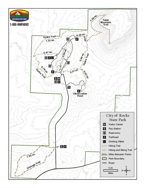
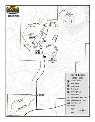
This is a simple map of the City of Rocks State Park in New Mexico. The map includes the trails in the park as well as the man made features. |
|---|---|
| Source | |
| Date | |
| Author |
Energy, Minerals and Natural Resources Department |
| Permission (Reusing this file) |
See below.
|
Licensing
File history
Click on a date/time to view the file as it appeared at that time.
| Date/Time | Thumbnail | Dimensions | User | Comment | |
|---|---|---|---|---|---|
| current | 02:29, 8 March 2024 |  | 1,275 × 1,650 (1.23 MB) | BR00110110486 (talk | contribs) | Uploading a public-domain item using File Upload Wizard |
You cannot overwrite this file.
File usage
The following pages on the English Wikipedia use this file (pages on other projects are not listed):