Size of this preview: 799 × 315 pixels. Other resolutions: 320 × 126 pixels | 640 × 252 pixels | 1,024 × 404 pixels | 1,280 × 505 pixels | 3,550 × 1,400 pixels.
Original file (3,550 × 1,400 pixels, file size: 1.18 MB, MIME type: image/jpeg)
|
This is a photo of a place or building that is listed on the California Historical Landmark listing in the United States. Its reference number is 334.
|
|
This is an image of a place or building that is listed on the National Register of Historic Places in the United States of America. Its reference number is 71000131. |
Summary
| Description |
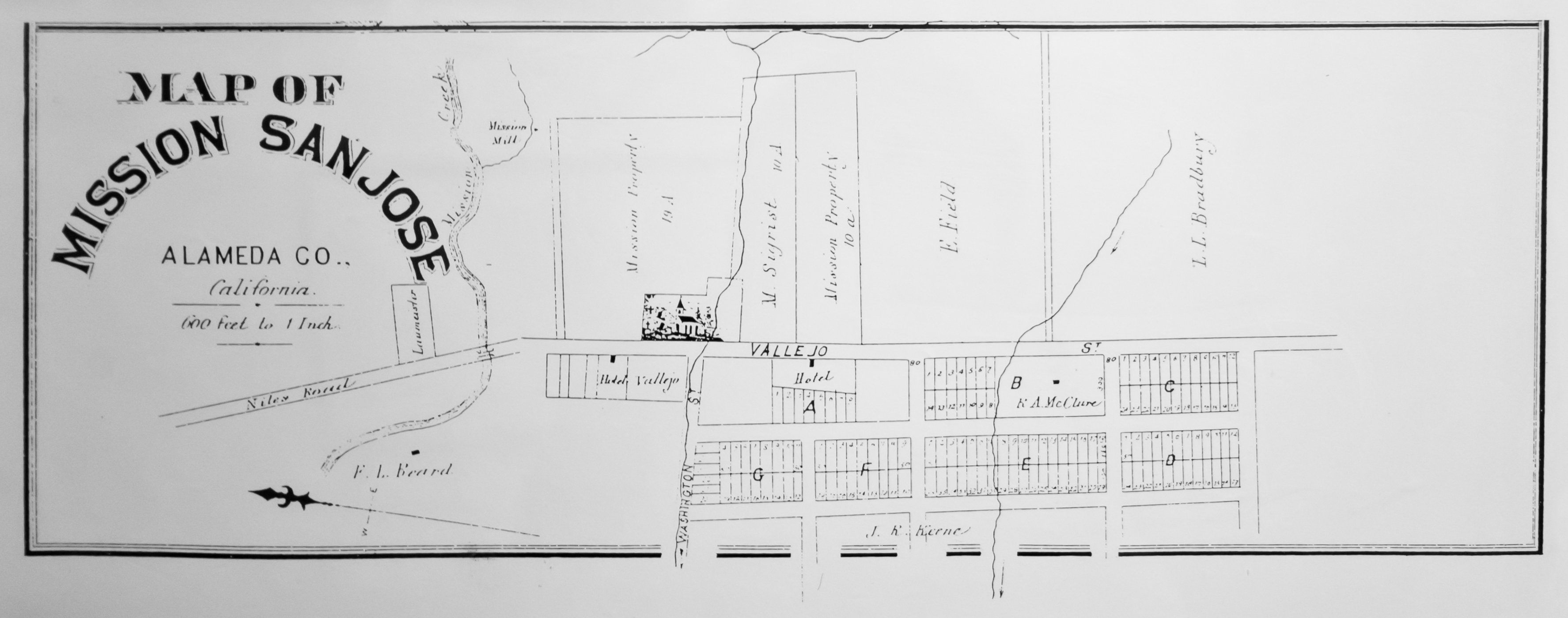
English: According to the exhibit caption: "Official and Historical Atlas Map of Alameda County, California, Thompson & West, Oakland, California, 1878, page 124." |
| Date | (photo 2011-04-23) |
| Source | Mission San Jose Museum |
| Author | Thompson & West (photo by King of Hearts) |
| Object location | | View this and other nearby images on: OpenStreetMap |
|---|
Licensing
This media file is in the public domain in the United States. This applies to U.S. works where the copyright has expired, often because its first publication occurred prior to January 1, 1929, and if not then due to lack of notice or renewal. See this page for further explanation.
|
 | |
 |
This image might not be in the public domain outside of the United States; this especially applies in the countries and areas that do not apply the rule of the shorter term for US works, such as Canada, Mainland China (not Hong Kong or Macao), Germany, Mexico, and Switzerland. The creator and year of publication are essential information and must be provided. See Wikipedia:Public domain and Wikipedia:Copyrights for more details.
|
File history
Click on a date/time to view the file as it appeared at that time.
| Date/Time | Thumbnail | Dimensions | User | Comment | |
|---|---|---|---|---|---|
| current | 05:35, 2 May 2011 | 3,550 × 1,400 (1.18 MB) | King of Hearts | grayscale, metadata | |
| 05:22, 2 May 2011 | 3,550 × 1,400 (1.25 MB) | King of Hearts | {{Information |Description ={{en|1=According to the exhibit caption: "''Official and Historical Atlas Map of Alameda County, California'', Thompson & West, Oakland, California, 1878, page 124."}} |Source =Mission San Jose |
File usage
The following pages on the English Wikipedia use this file (pages on other projects are not listed):